Cambodia is one of the most recognizable countries in mainland Southeast Asia, located between Thailand and Vietnam and bordering Laos to the north. Because of its position in the region, Cambodia frequently appears in travel guides, classroom materials, regional comparison projects, and presentation slides covering Southeast Asia. A clear map often explains the country’s layout far more effectively than text alone, especially when users need to identify provincial boundaries, major locations, or neighboring countries.
This printable Cambodia map collection was created for users who need more than a simple country outline. Whether you are preparing a geography lesson, building a travel presentation, creating blog graphics, or designing an infographic, having multiple map styles available makes the process easier. The collection includes three versions: a color administrative map, a black and white labeled map, and a blank outline map for editing.
All maps were prepared at A3 size with a resolution of 4961 × 3508 pixels and organized into a downloadable archive. During the design process, special attention was given to provincial boundaries because Cambodia contains a relatively large number of administrative divisions compared with several neighboring countries. Labels were reviewed at larger print sizes to ensure readability, and Phnom Penh was highlighted with a red star for easier identification.
For users looking for a printable map, a classroom reference, an editable graphic resource, or a presentation-ready visual aid, each version serves a different purpose. The sections below explain which map style may work best for your project.
Table of Contents
What’s Included in the Collection?
The downloadable package contains:
- Color administrative map
- Black and white labeled map
- Blank outline map
- A3 printable layout
- High-resolution image files
- Provincial names displayed in both Korean and English
- Phnom Penh marked for quick visual reference
Because the maps focus on geographic layout and administrative divisions rather than terrain, they work especially well for educational materials, presentations, travel planning documents, and regional comparison graphics.
Color Administrative Version
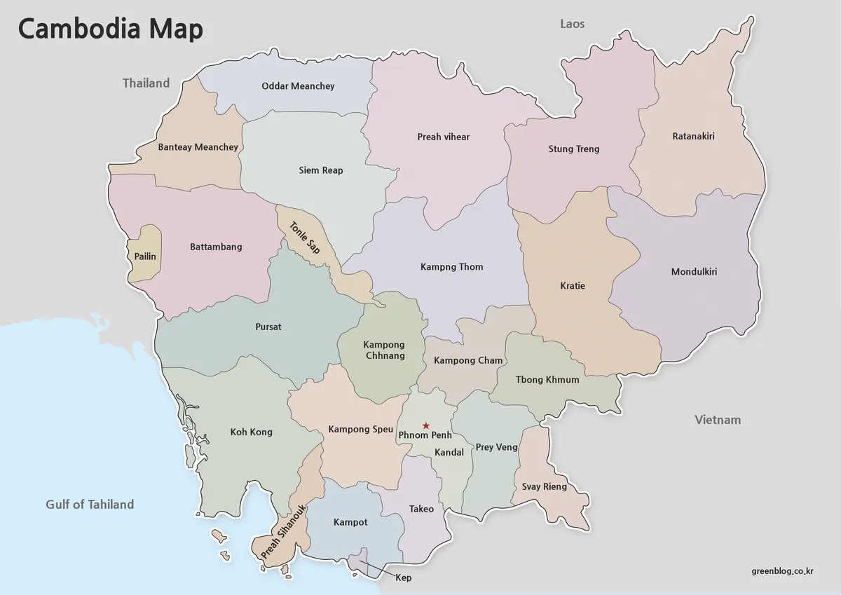
The color map is intended for situations where provincial boundaries need to stand out immediately. Each administrative region is displayed using contrasting colors, making it easier to distinguish neighboring provinces when viewed on screens, presentation slides, or websites.
One thing that became clear during preparation was the number of provincial divisions that needed to be organized visually without creating clutter. Extra care was taken to maintain clear separation between adjacent regions while keeping labels readable at larger sizes.
Phnom Penh is highlighted using a red star, making the capital city easy to locate even when viewing the map from a distance. For blog posts, educational presentations, travel articles, and infographic projects, this version generally provides the strongest visual impact.
Printable Cambodia Map for Classroom and Study Use
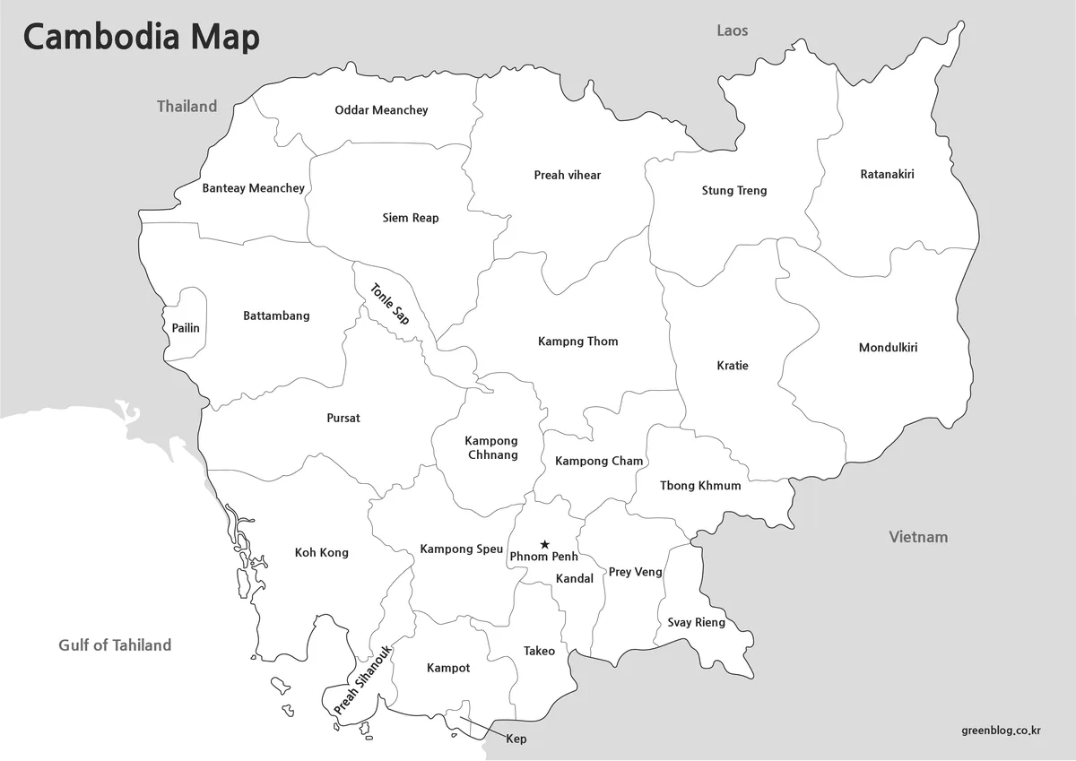
Not every project requires color. The black and white version removes color fills while preserving administrative boundaries and labels, creating a cleaner appearance for printed materials.
This format works particularly well for:
- Classroom worksheets
- Geography assignments
- Printed handouts
- Study guides
- Regional comparison exercises
The layout was reviewed specifically for black and white printing so that boundaries remain distinguishable without relying on color differences. Users who plan to write notes directly on the map may find this version more practical than the color edition.
Blank Outline Map for Editing
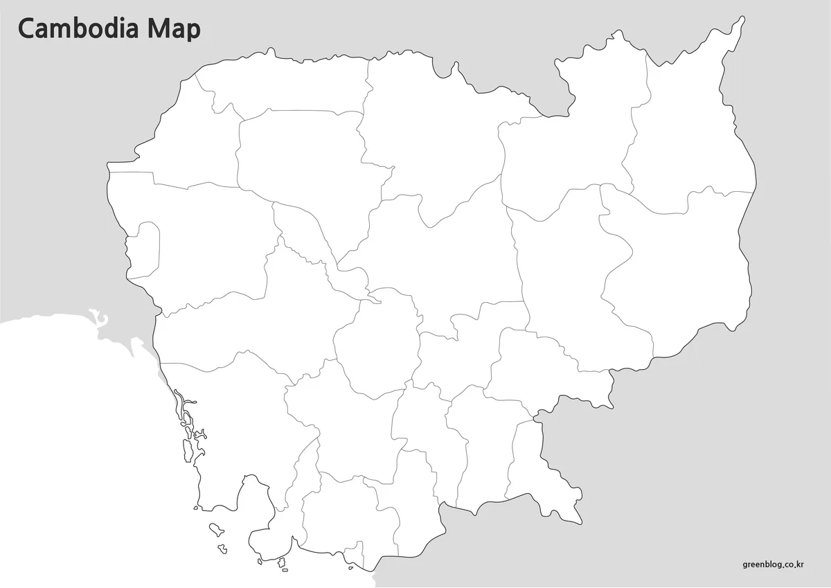
The outline version removes labels, symbols, and color fills, leaving only the boundary structure of Cambodia.
Graphic designers, educators, and content creators often need a blank map that can be customized with their own information. Regional statistics, travel routes, business locations, educational annotations, and infographic elements can be added without first removing existing map features.
Boundary lines were checked to ensure they remain continuous, reducing the amount of cleanup typically required when importing the map into graphic editing software. The simplified layout also provides a cleaner workspace for Photoshop and Illustrator projects.
Why a Cambodia Map Is Useful
Cambodia’s location between Thailand, Vietnam, and Laos makes it a common reference point in Southeast Asia studies and travel content. A map helps users quickly understand the country’s position within the region while also providing a clear view of provincial organization.
Common use cases include:
- Travel presentations
- Southeast Asia regional studies
- Classroom geography lessons
- Educational worksheets
- Blog graphics
- Infographic projects
- Printable reference materials
- Graphic editing projects
Because the collection includes both labeled and blank formats, users can choose the version that best matches their specific project requirements.
Frequently Asked Questions
Can I print the maps in A3 size?
Yes. The collection was prepared using an A3 layout and reviewed for readability at larger print sizes.
Which version is best for presentations?
The color administrative map is usually the easiest to read on presentation slides and large screens.
Is there a version for editing?
Yes. The outline map was created specifically for editing, annotation, and custom design projects.
How is Phnom Penh shown on the map?
The capital city is marked with a red star to make it easy to locate quickly.
Cambodia Map Download
Choose the map version that fits your project. Color, black and white, and outline editions are included for printing, presentations, and editing work.
- File Format: ZIP Archive
- Image Size: 4961 × 3508
- Color Mode: CMYK
- Intended Usage: Printing · Education · Presentation · Graphic Editing
Additional Resources
- Open Development Cambodia – Provides access to Cambodia-related geographic datasets and mapping resources that may be useful for educational and regional reference projects.
Related Maps
- Printable Iraq Map Download in A3 Size (Color, B&W, Outline)
- India Maps Download Collection (3 Maps for Regional Reference)
- China Maps Download Collection – 4 Regional Map Types
- Philippines Maps Collection Download (3 Printable Maps)
Green Map creates custom-edited map images using open geographic data sources such as geoBoundaries, Natural Earth, OpenStreetMap, and government open data.
These maps are edited visual materials, not raw data files, and are provided for education, documents, presentations, and graphic reference.