
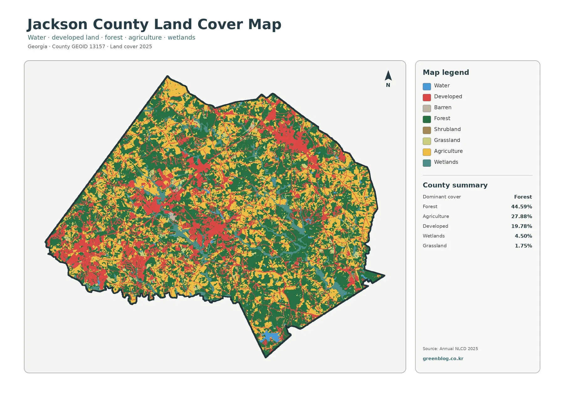
Jackson County Georgia Land Cover Map and JPG Set – Forest, Farmland & Developed Corridors
Jackson County in northeast Georgia has a land-cover pattern that is neither simply rural nor continuously built up. The 2025 […]
Jackson County in northeast Georgia has a land-cover pattern that is neither simply rural nor continuously built up. The 2025 […]
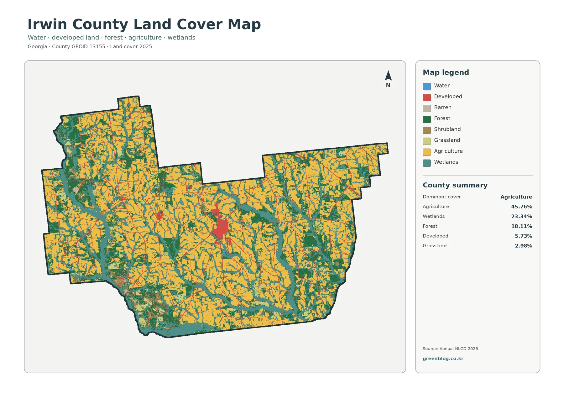
Irwin County is a strongly agricultural landscape in south Georgia, but the 2025 surface pattern is more varied than a
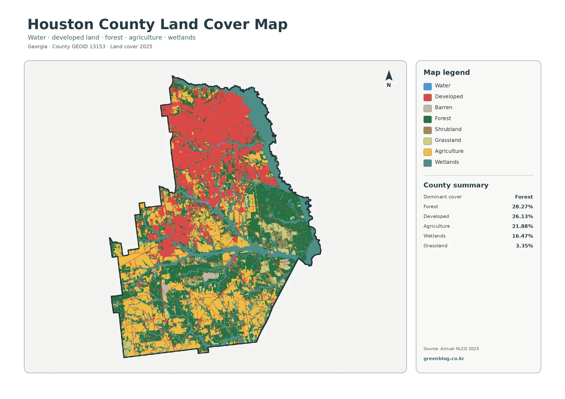
Houston County has one of the clearer urban-to-rural contrasts in central Georgia: a broad developed area fills much of the
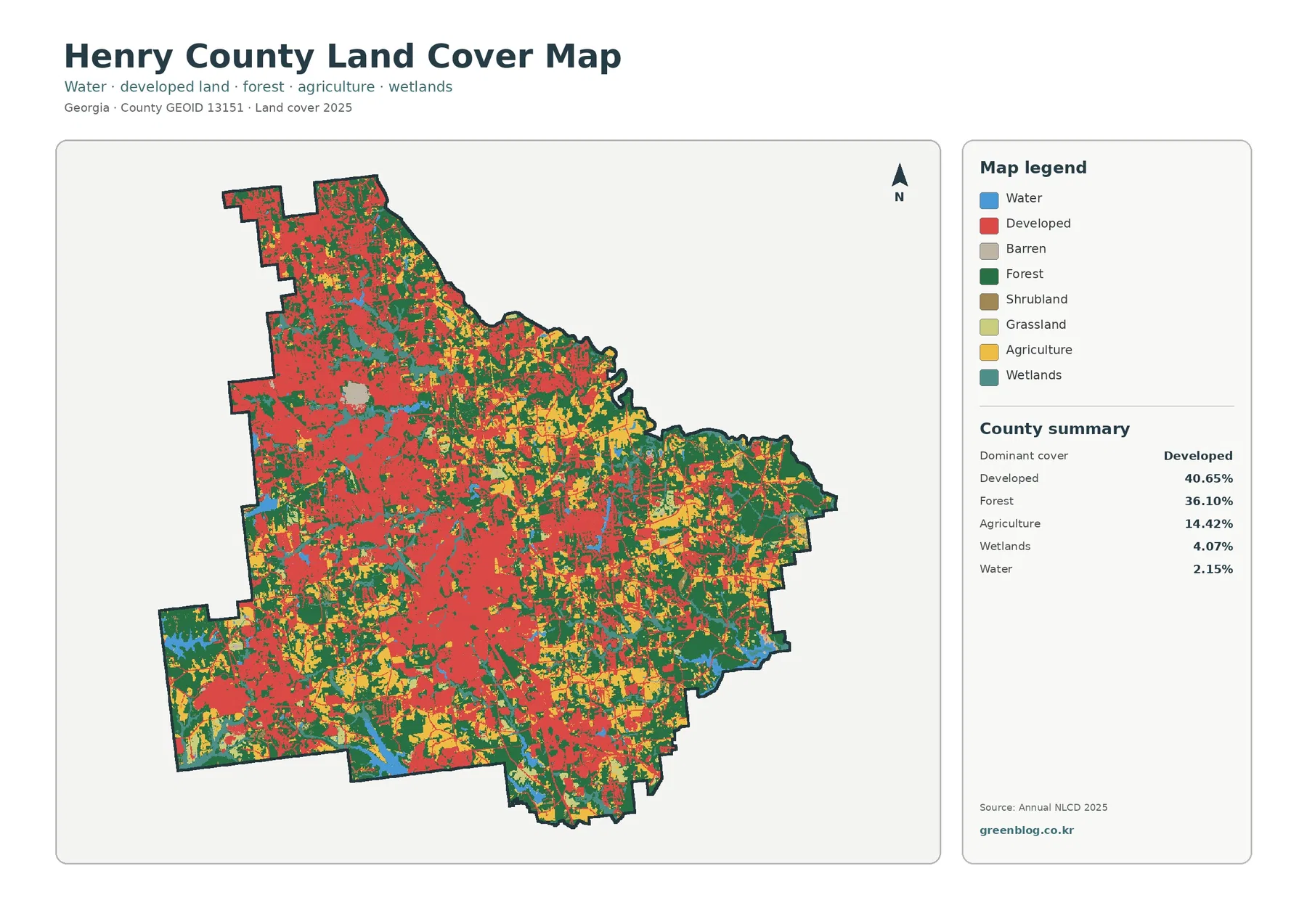
Henry County sits in the fast-changing part of Georgia southeast of Atlanta, and its 2025 surface pattern is split between
Henry County Georgia Land Cover Map: Where the Developed West Meets a Forested East Read More »
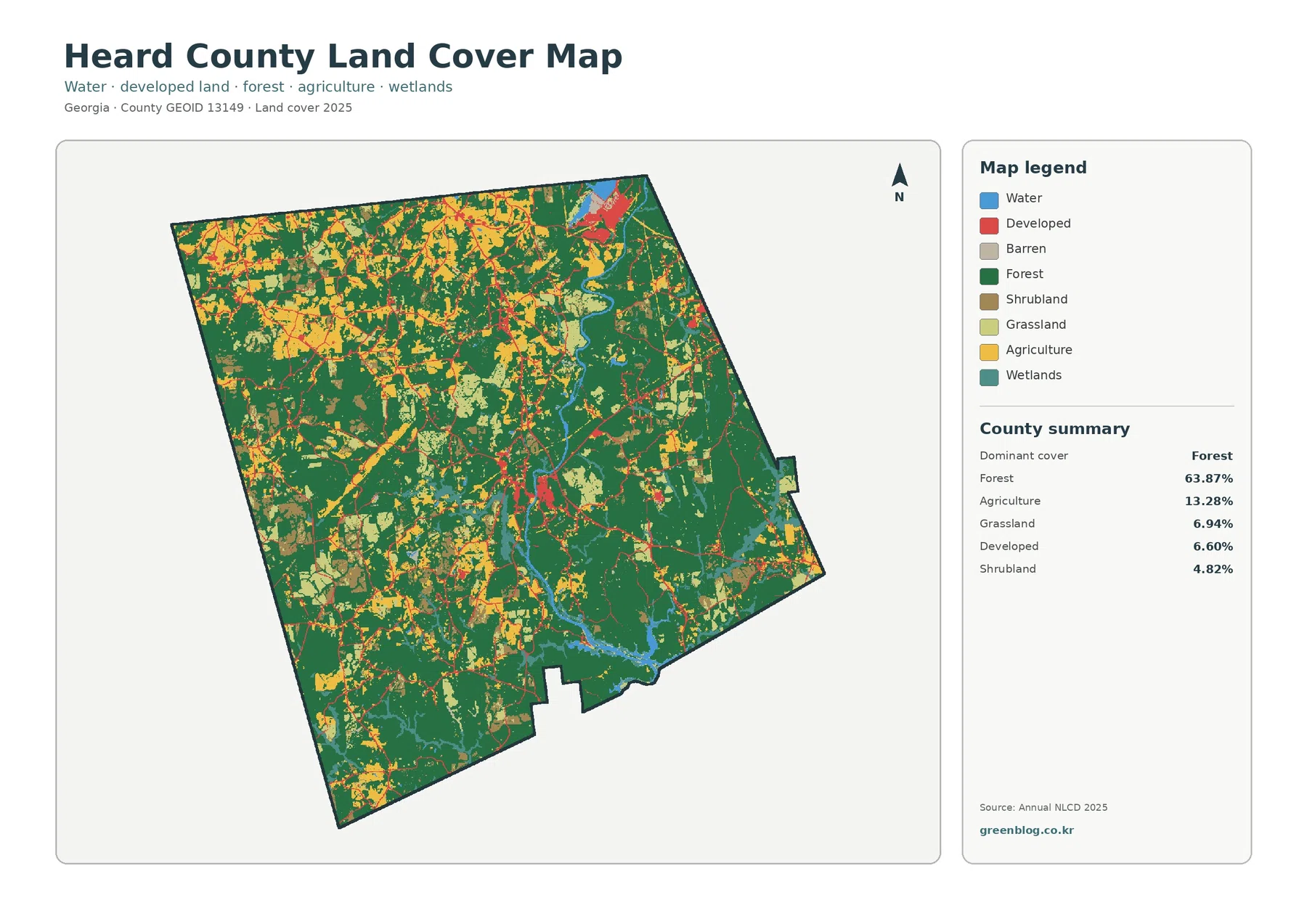
Heard County in west-central Georgia is predominantly wooded in the 2025 land-cover data. Forest covers 63.87% of the county, while
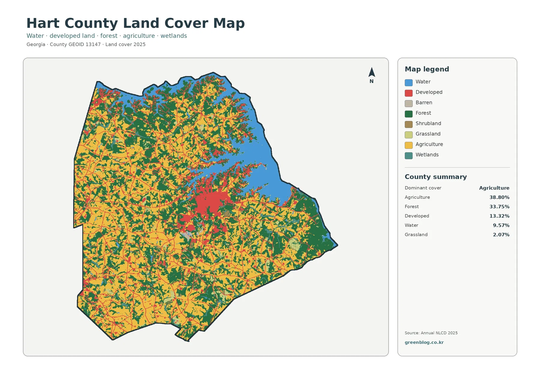
Hart County is unusual among many of the recent Georgia county maps because agriculture, not forest, is the largest 2025
Hart County Georgia Land Cover Map — 38.80% Agriculture Beside Lake Hartwell Read More »
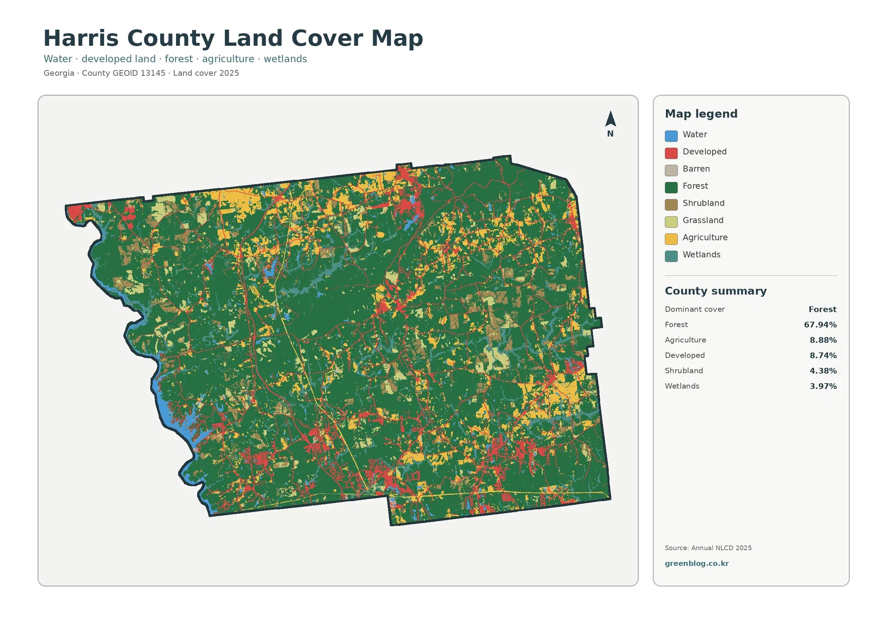
Harris County in west-central Georgia is predominantly forested, with 67.94% forest cover in the supplied 2025 summary. Water along the
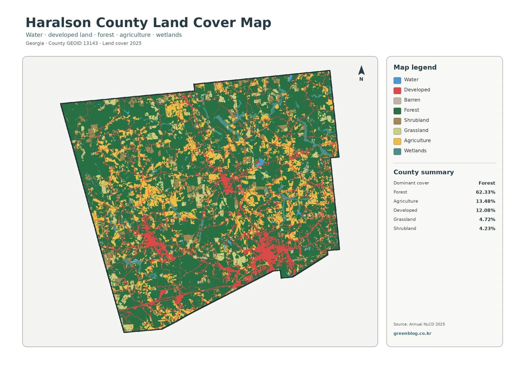
Haralson County in northwest Georgia is mostly forested on the 2025 land-cover map, but its developed land does not form
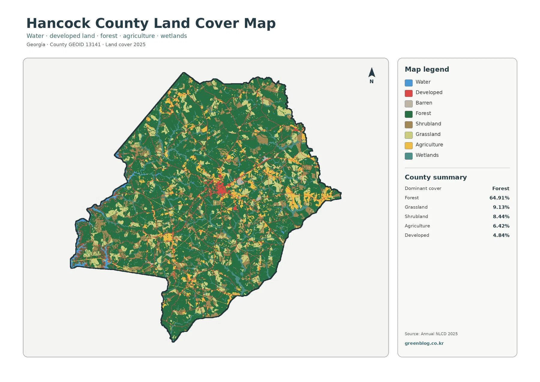
Hancock County, Georgia is a land-cover map where woodland dominates at first glance. The 2025 summary places forest at 64.91%,