
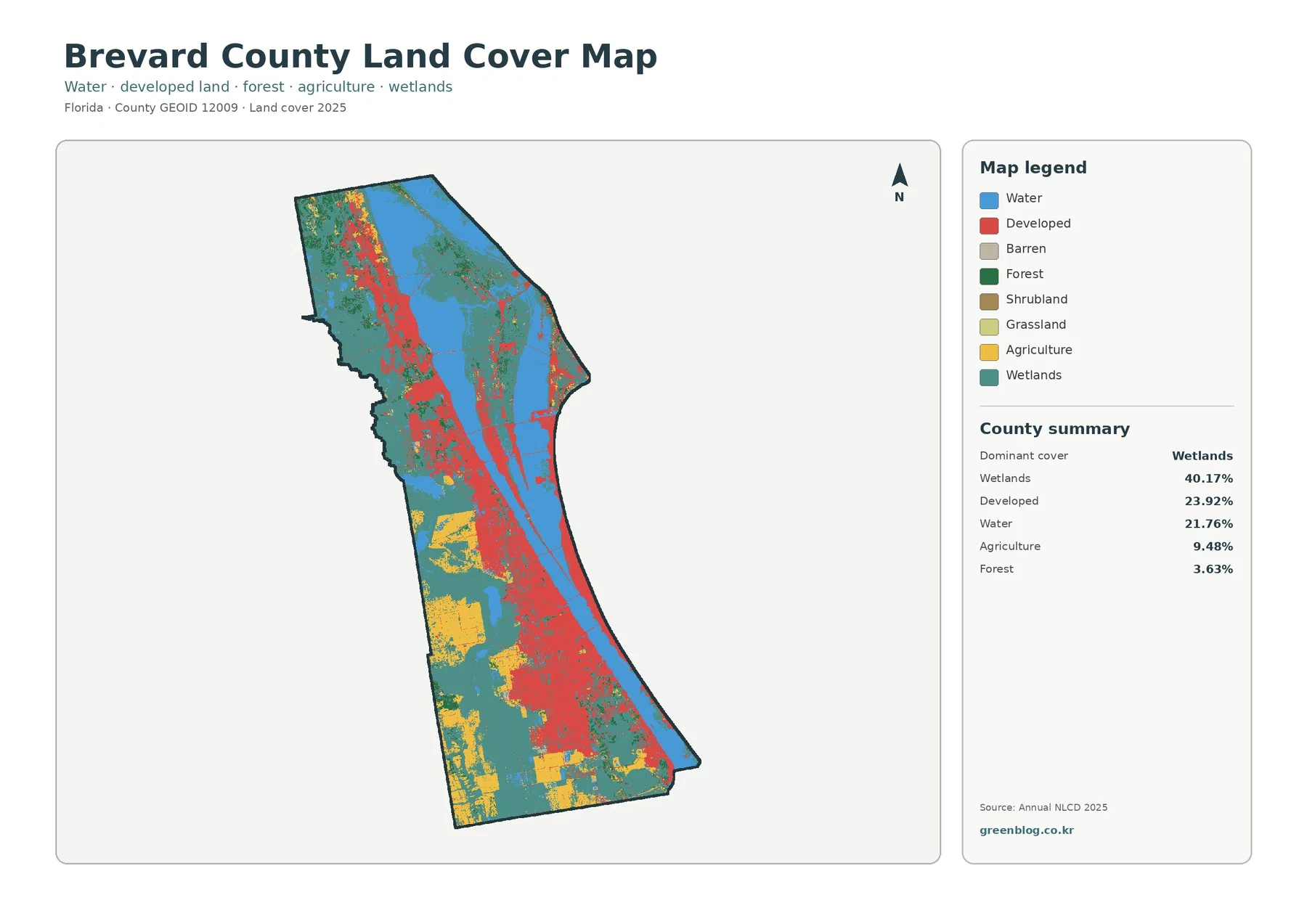
Brevard County Florida Land Cover Map — Lagoon Water, Coastal Development, and Extensive Wetlands
Brevard County’s maps are dominated by water and wetlands, but the county also contains one of Florida’s longest urbanized coastal […]
Brevard County’s maps are dominated by water and wetlands, but the county also contains one of Florida’s longest urbanized coastal […]
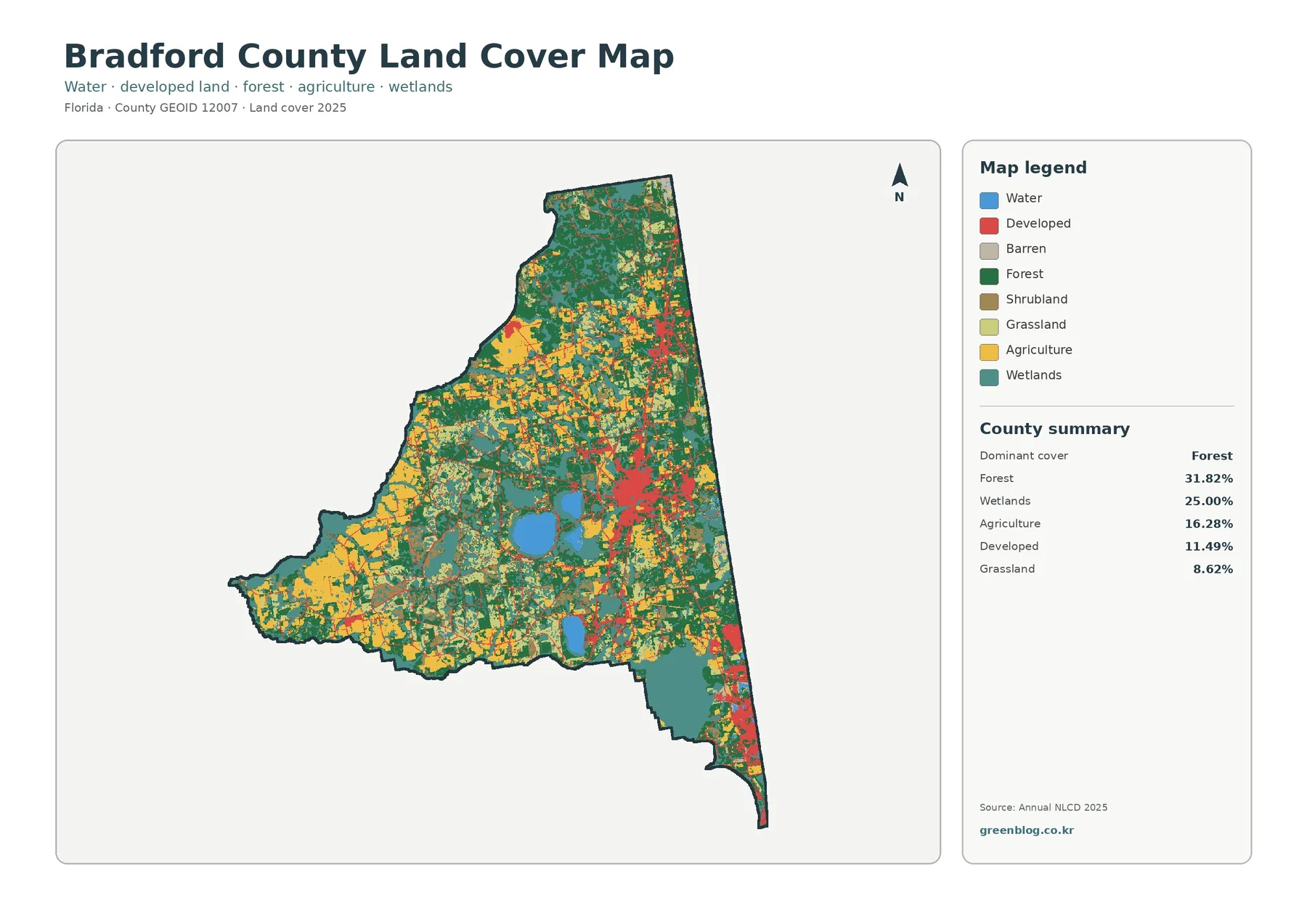
Bradford County’s 2025 land-cover pattern is a patchwork rather than a landscape dominated by one surface. Forest is the largest
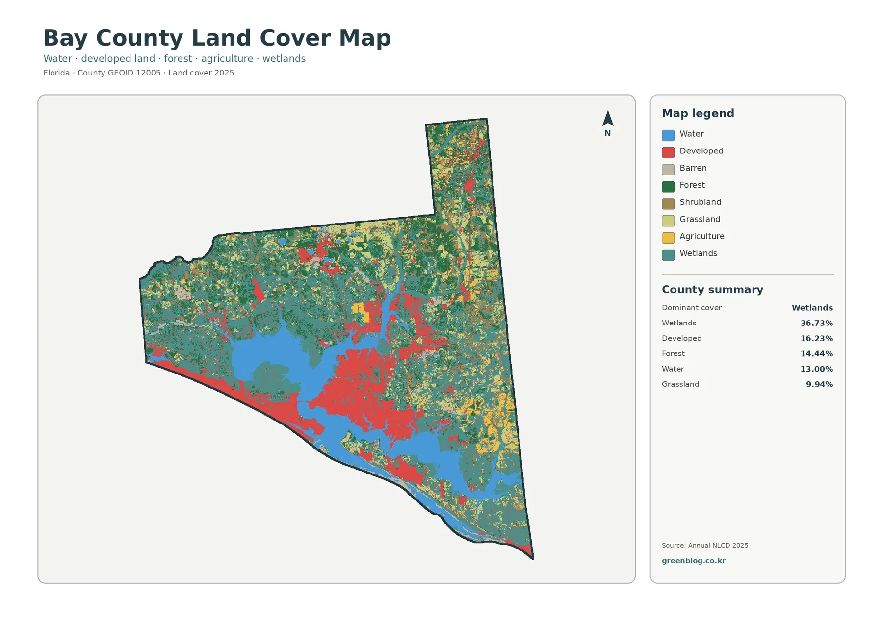
Water and wetlands shape Bay County’s 2025 land-cover pattern more strongly than any single urban feature. Wetlands are the largest
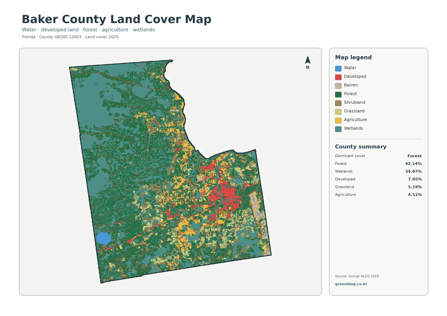
Baker County’s 2025 land-cover pattern is dominated by two classes: forest at 42.14% and wetlands at 34.97%. Together they account
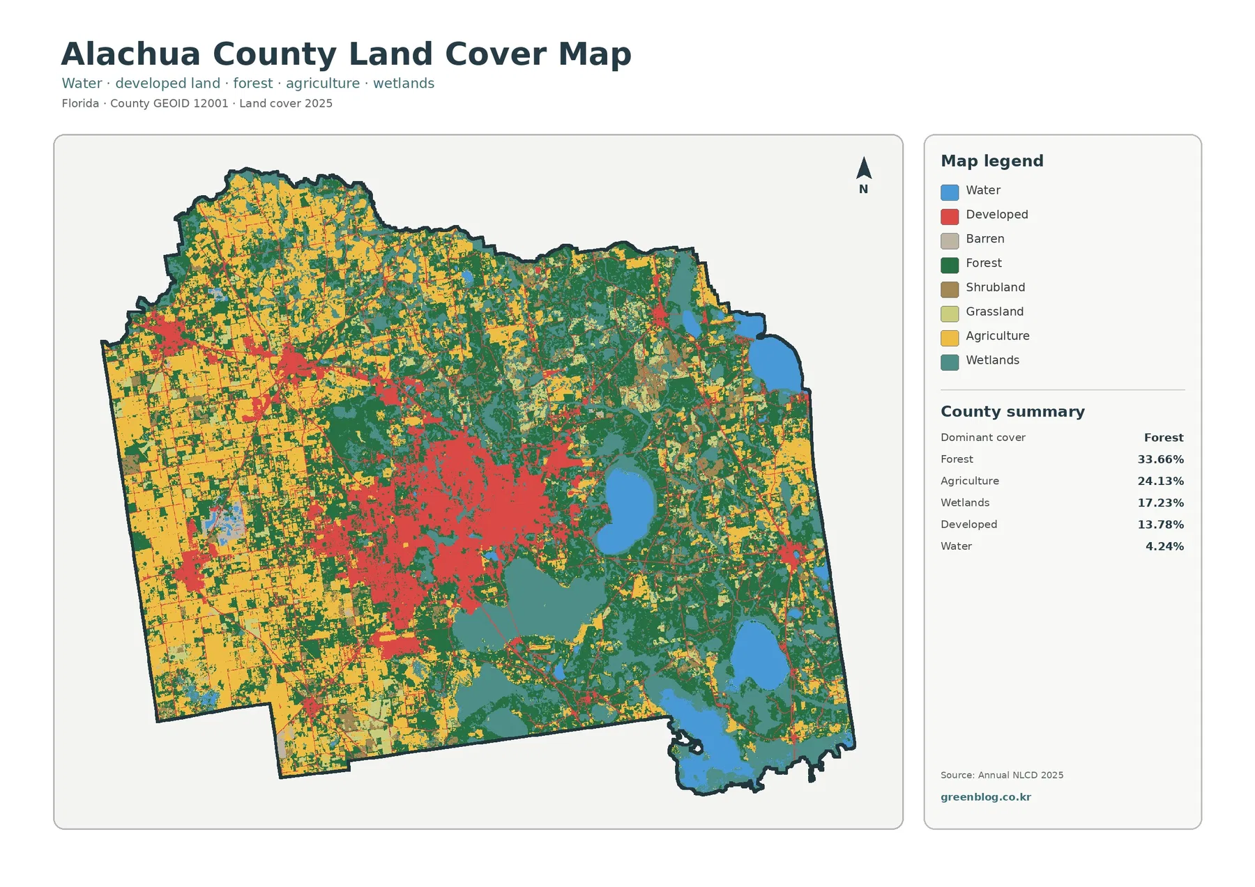
Alachua County’s 2025 land-cover pattern is unusually varied for a single county. Forest is the largest class at 33.66%, followed
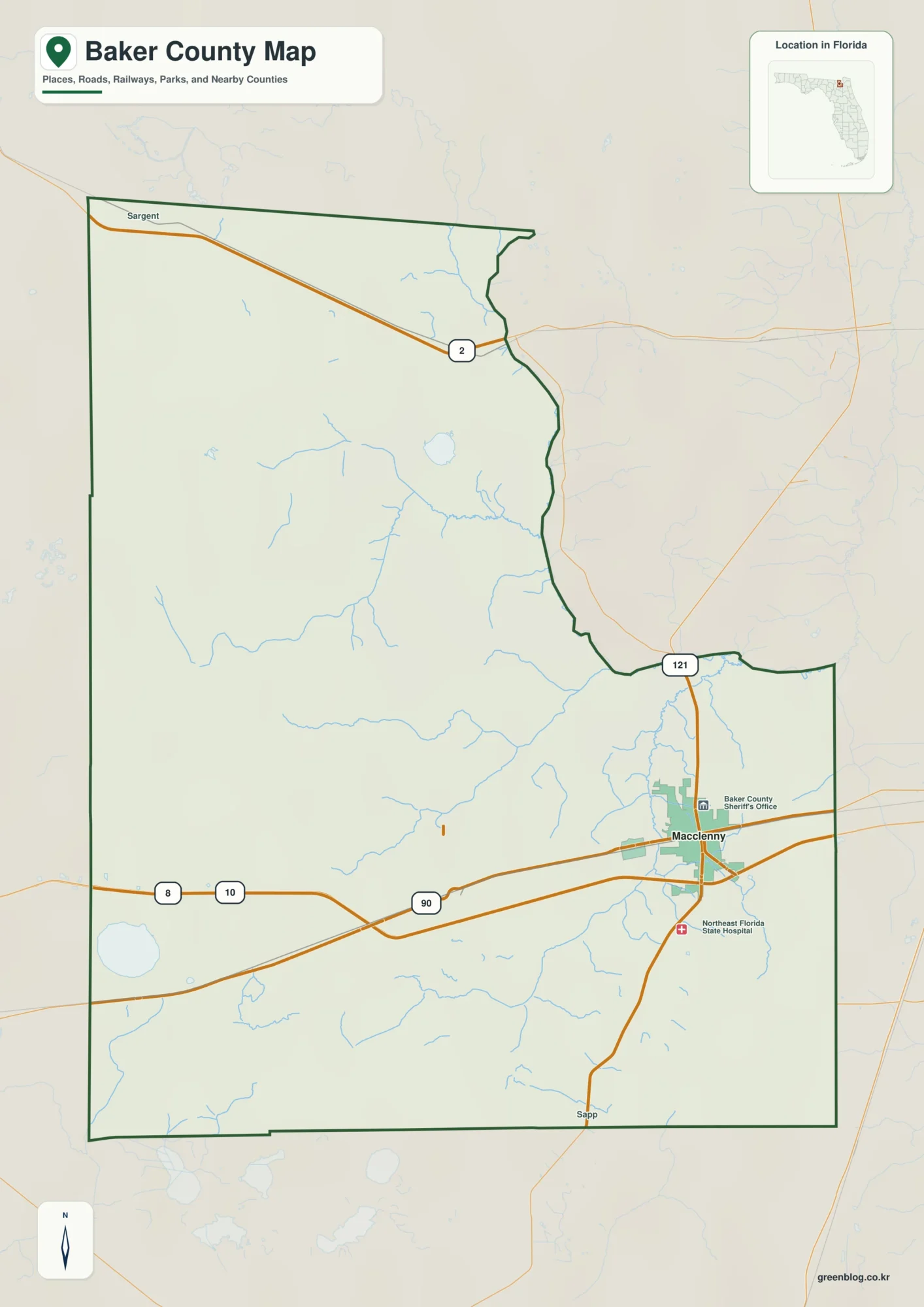
The Baker County Florida map makes the most sense when its compact eastern communities are contrasted with the much larger
Baker County Florida map | Macclenny, Olustee, and Osceola National Forest Read More »
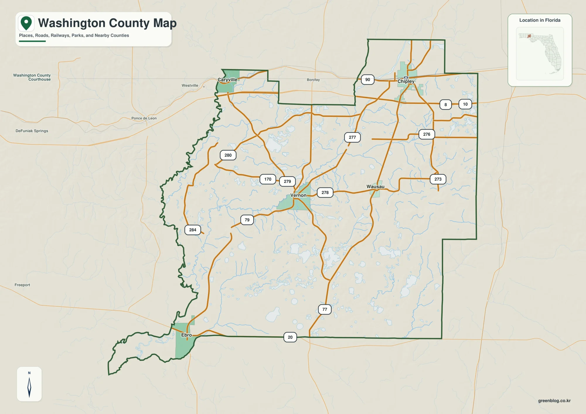
Washington County Florida map — The county changes from the I-10 and U.S. 90 corridor around Chipley and Caryville to
Washington County Florida map | Chipley, Vernon, and the Choctawhatchee River Read More »
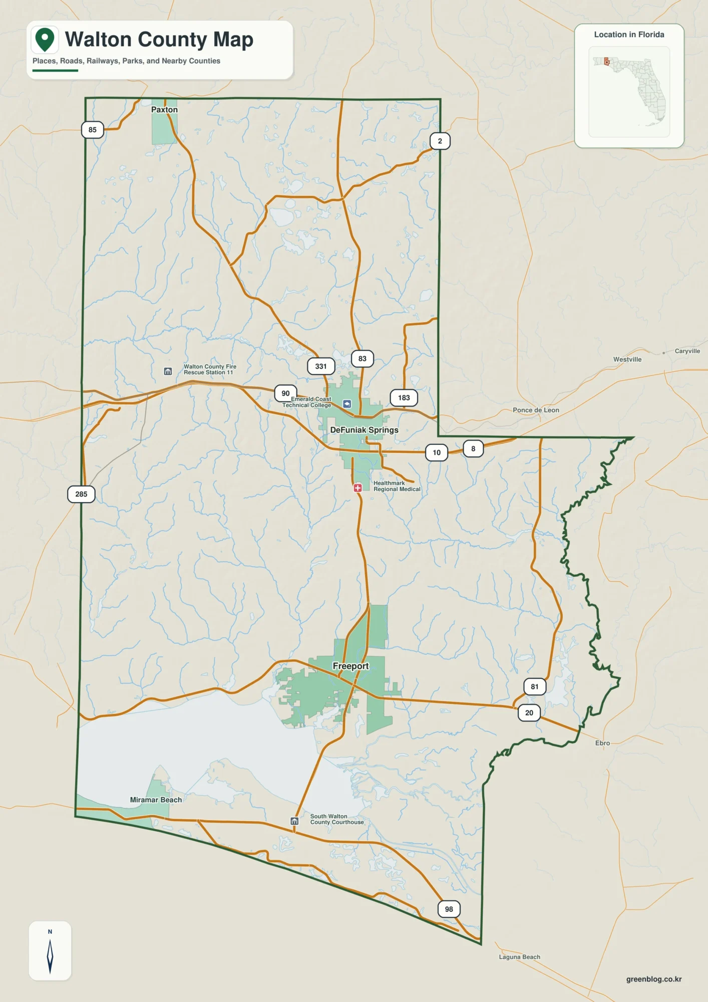
Walton County Florida map — Read the county as a long north-south corridor from Paxton at the Alabama line through
Walton County Florida map | DeFuniak Springs, South Walton, and Choctawhatchee Bay Read More »
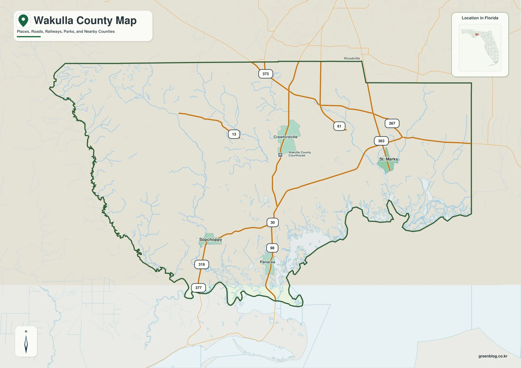
Wakulla County Florida map — Follow the county from Crawfordville on the Tallahassee corridor to the St. Marks estuary, the
Wakulla County Florida map | Crawfordville, St. Marks, and Wakulla Springs Read More »