
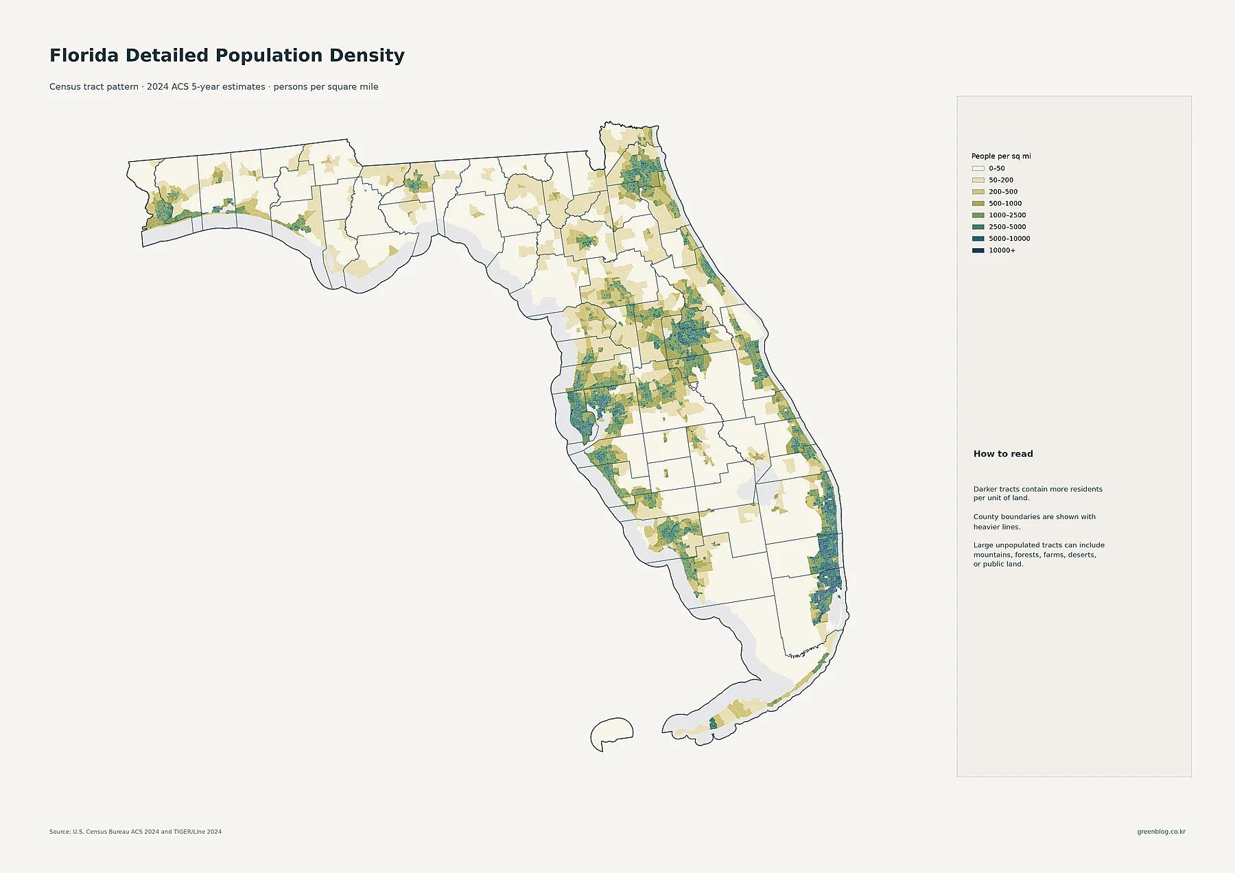
Florida Population Density: Coastal Metro Clusters and Fast Growth in Osceola and St. Johns
Florida’s population is concentrated in several large metropolitan belts rather than spread evenly across the peninsula and panhandle. On the […]
Florida’s population is concentrated in several large metropolitan belts rather than spread evenly across the peninsula and panhandle. On the […]
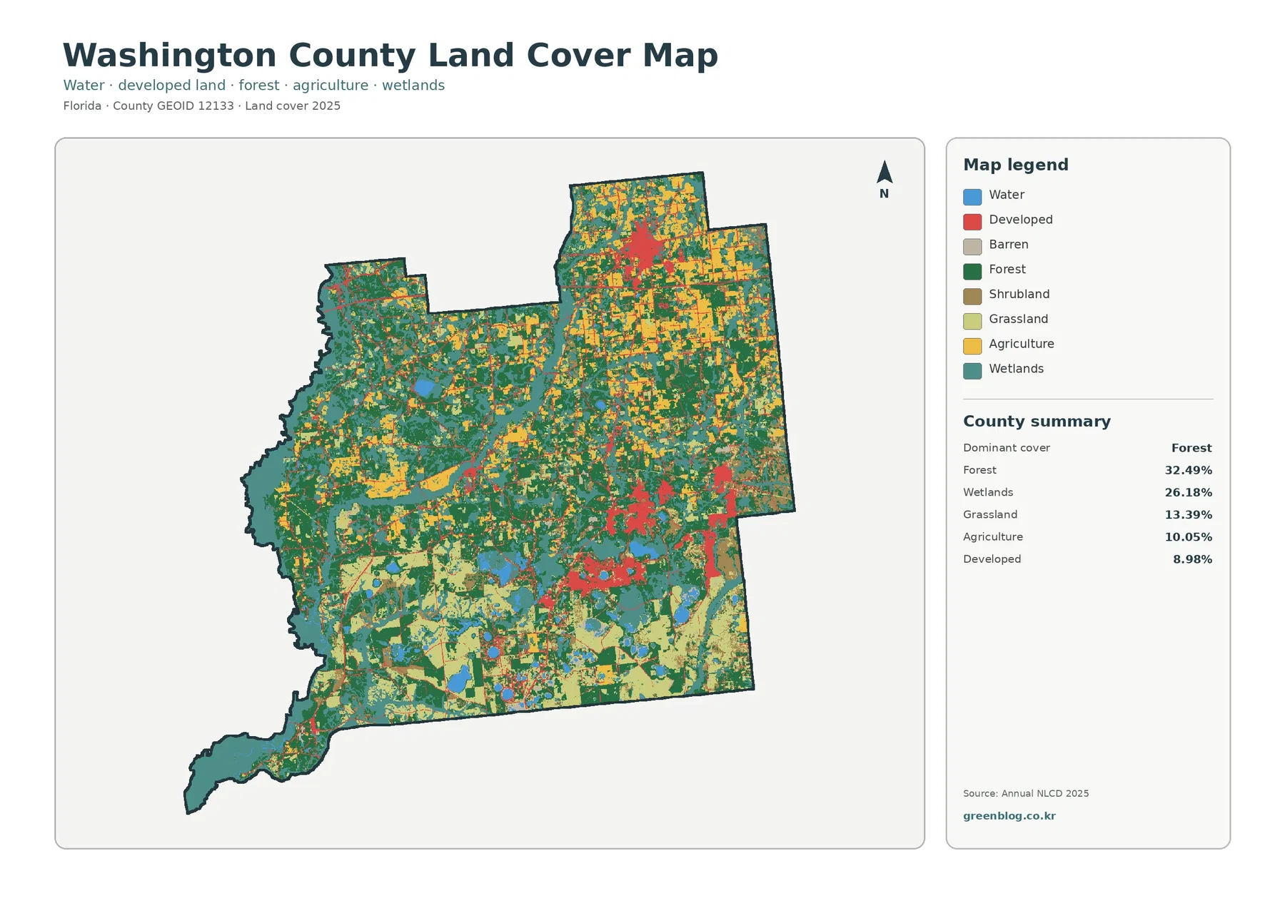
The Washington County Florida Land Cover Map shows a county where forest and wetlands are the two largest classes, but
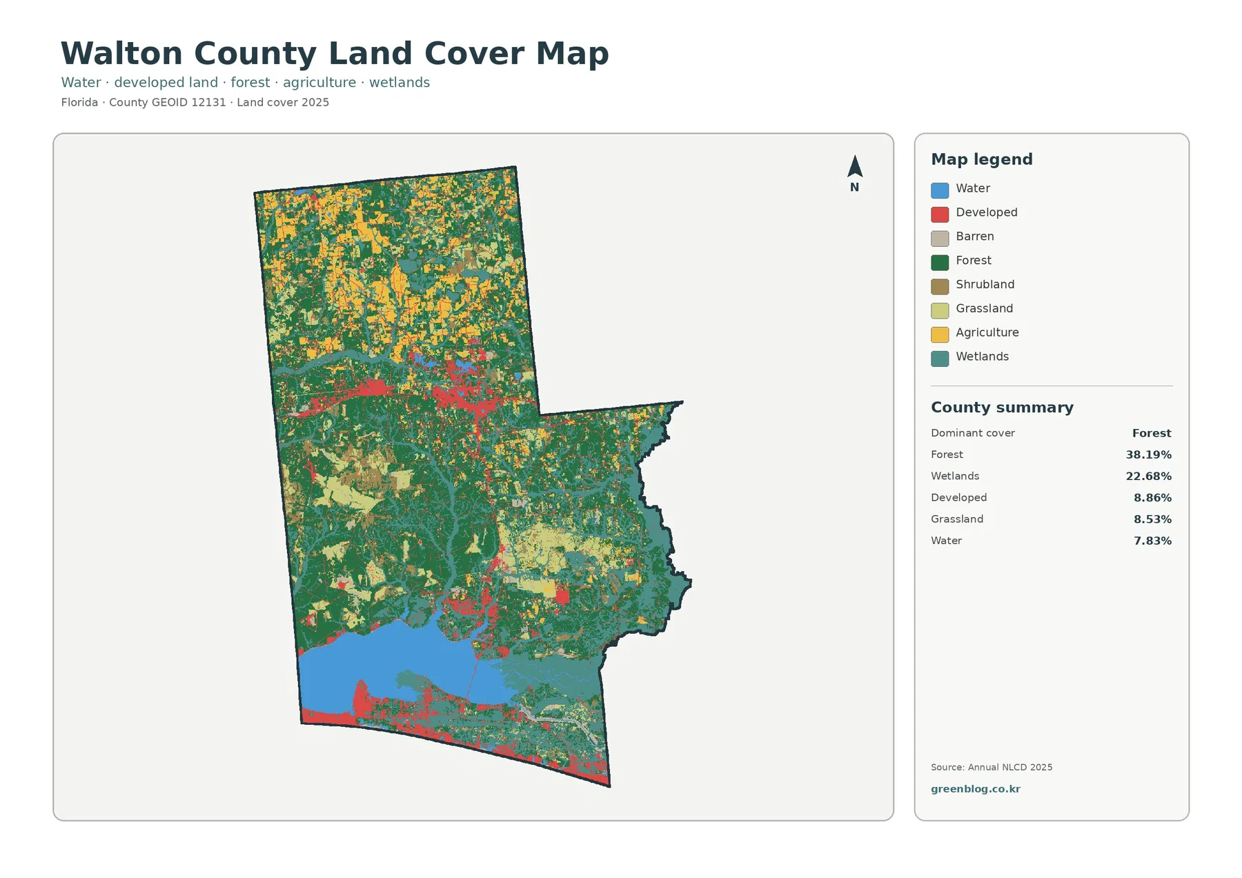
The Walton County Florida Land Cover Map shows a county with several distinct landscapes rather than one uniform surface. Forest
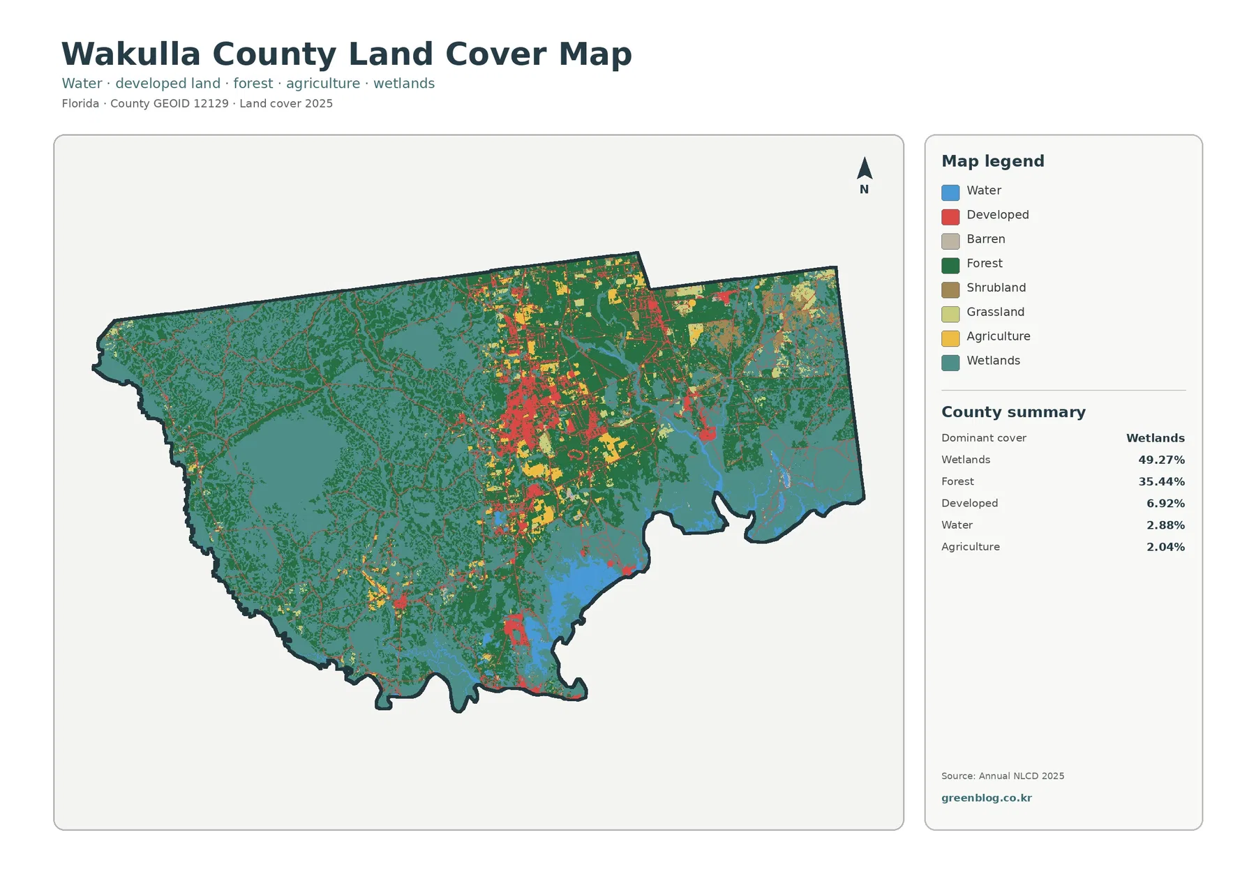
The Wakulla County Florida Land Cover Map is dominated by wet and wooded surfaces. Wetlands account for 49.27% of the
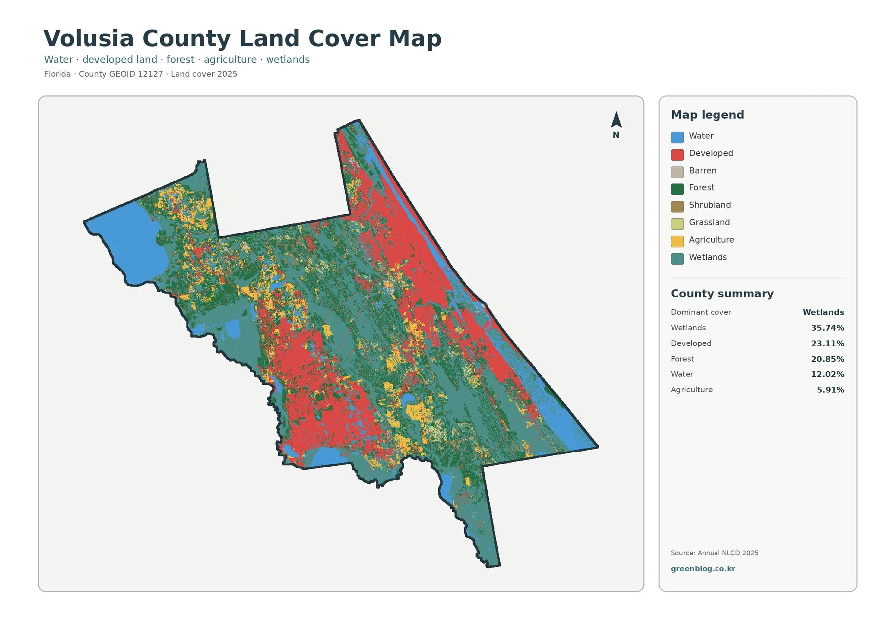
The Volusia County Florida Land Cover Map is shaped by a combination of extensive wetlands and major developed areas rather
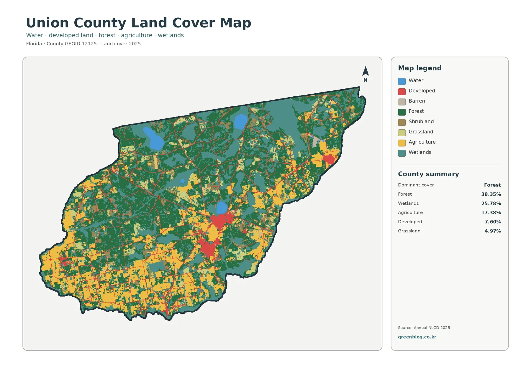
The Union County Florida Land Cover Map is led by forest, but the county is not uniformly wooded. Forest accounts
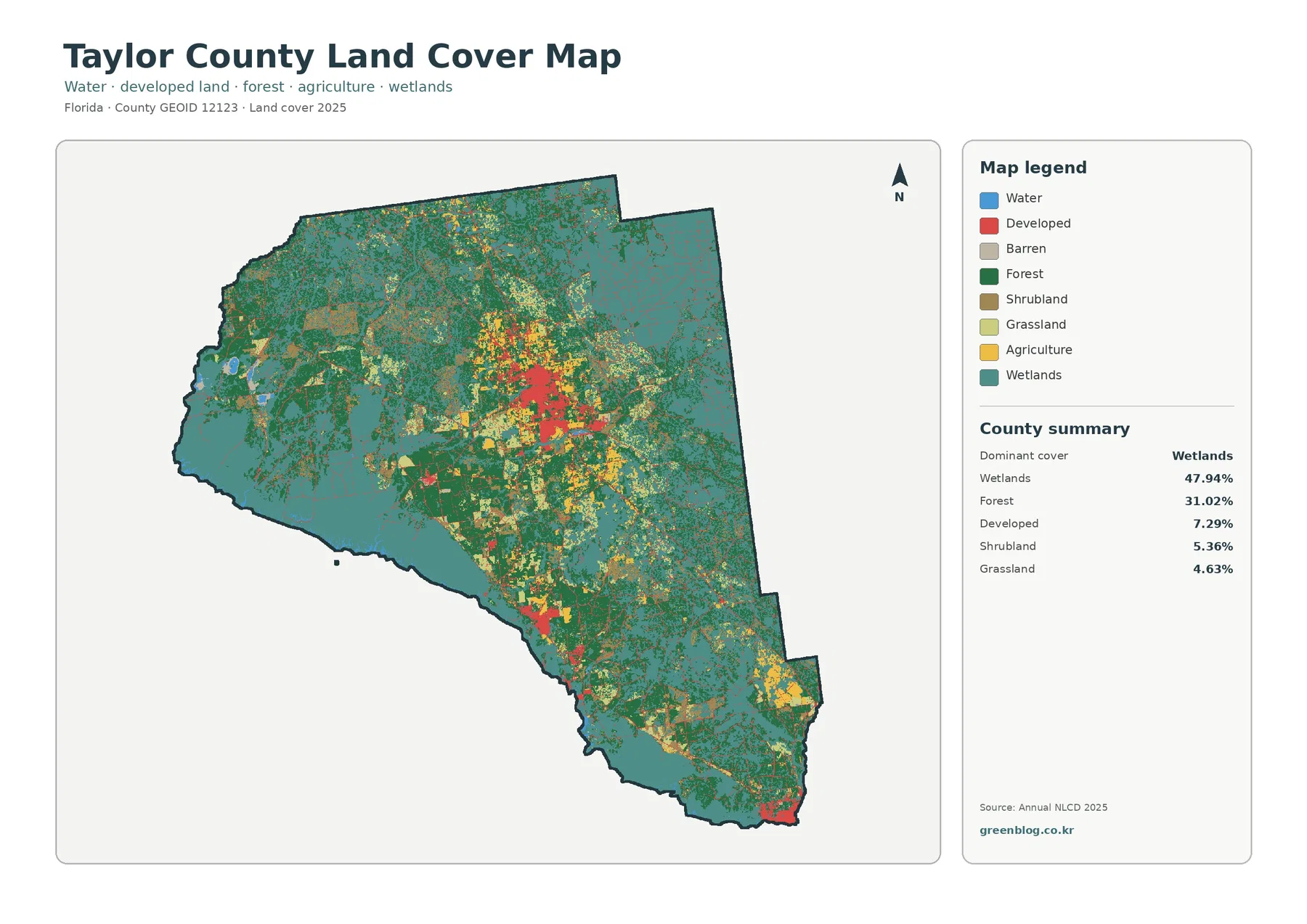
The Taylor County Florida Land Cover Map is defined first by wetlands and then by forest. Wetlands account for 47.94%
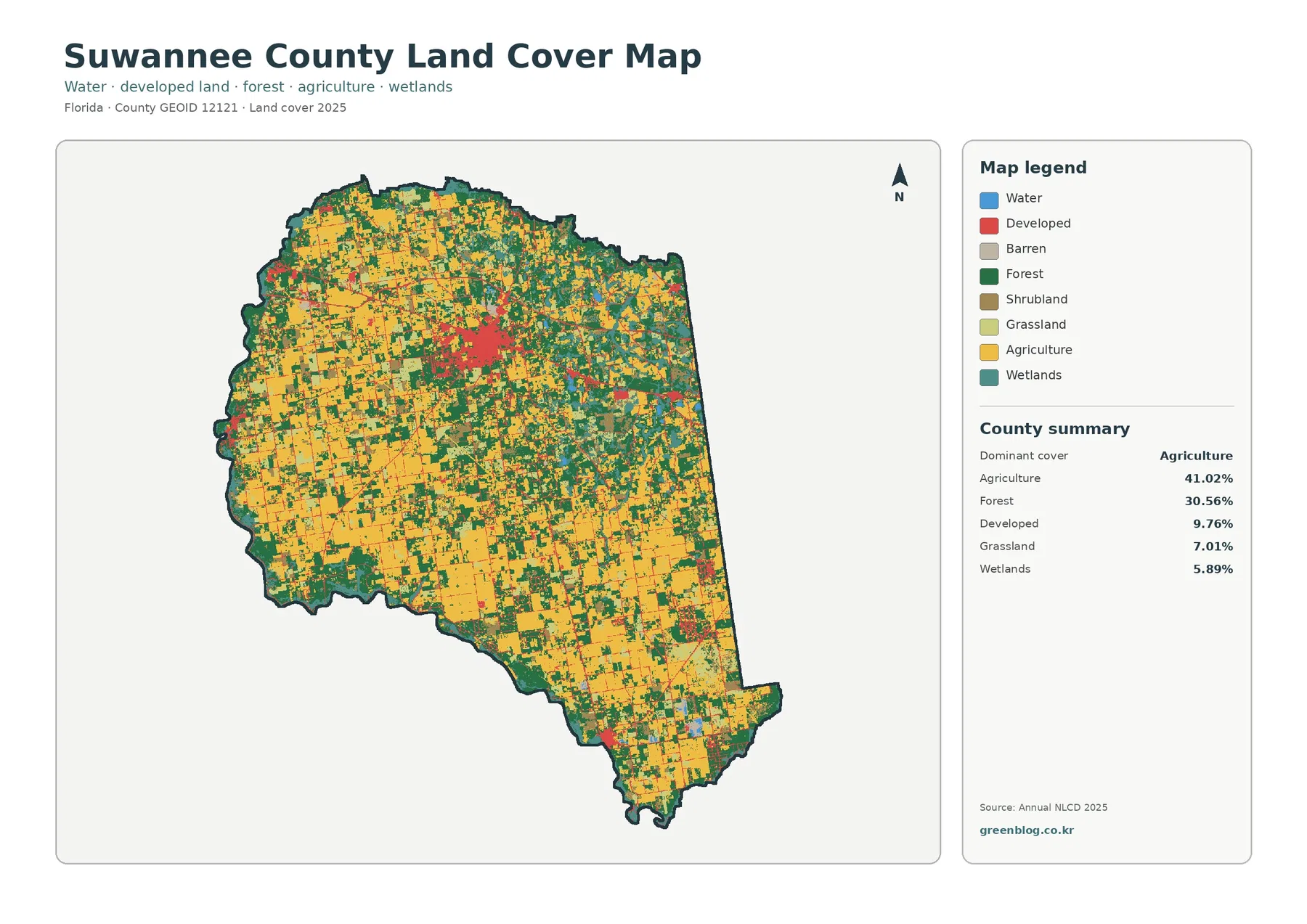
The Suwannee County Florida Land Cover Map is dominated by two broad surface types rather than one overwhelming class. Agriculture
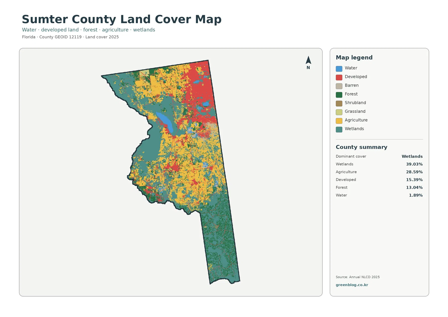
The Sumter County Florida Land Cover Map is dominated by wetlands and agriculture, with a distinctly different developed concentration in