
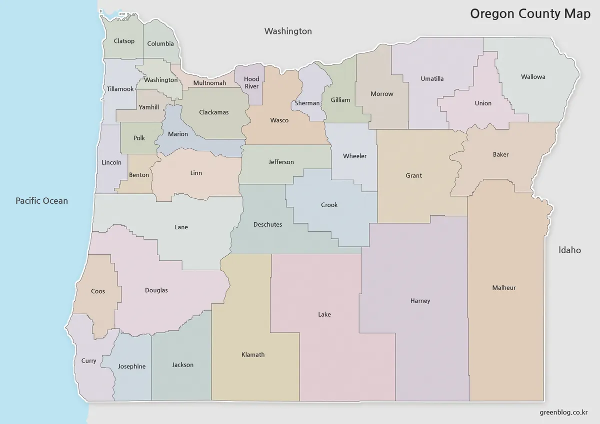
Oregon Map Files for Printing: Three County-Level Views
An Oregon Map becomes much easier to read when the state’s 36 counties are shown as separate shapes rather than […]
Oregon Map Files for Printing: Three County-Level Views Read More »
An Oregon Map becomes much easier to read when the state’s 36 counties are shown as separate shapes rather than […]
Oregon Map Files for Printing: Three County-Level Views Read More »
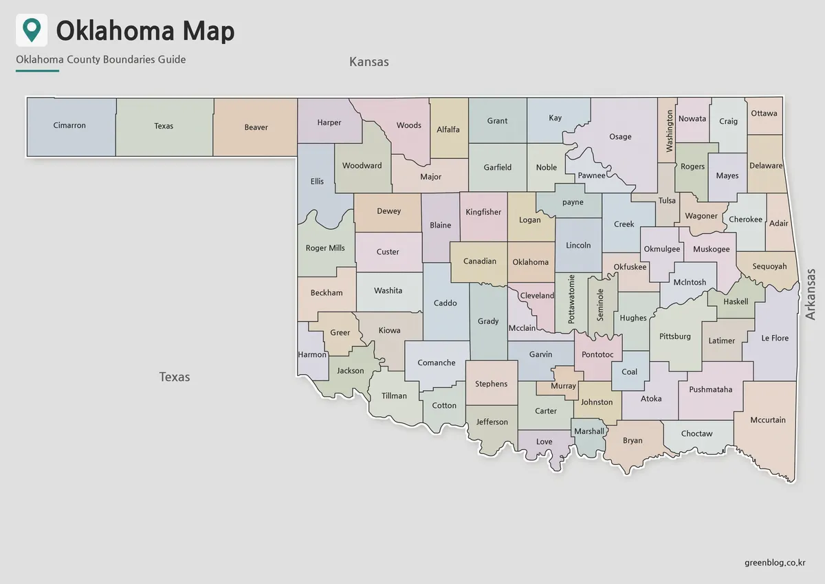
An Oklahoma Map has to accommodate two very different visual forms: a long, narrow panhandle in the west and a
Oklahoma Map from the Three-County Panhandle to McCurtain Read More »
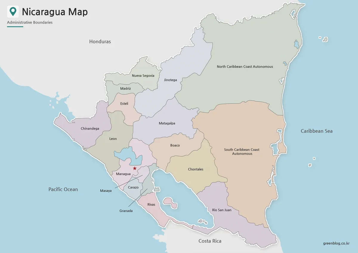
A Nicaragua Map becomes easier to understand when the narrow Pacific-side departments, the two large interior lakes, and the expansive
Two Lakes, Two Coasts, and 17 Areas on a Nicaragua Map Read More »
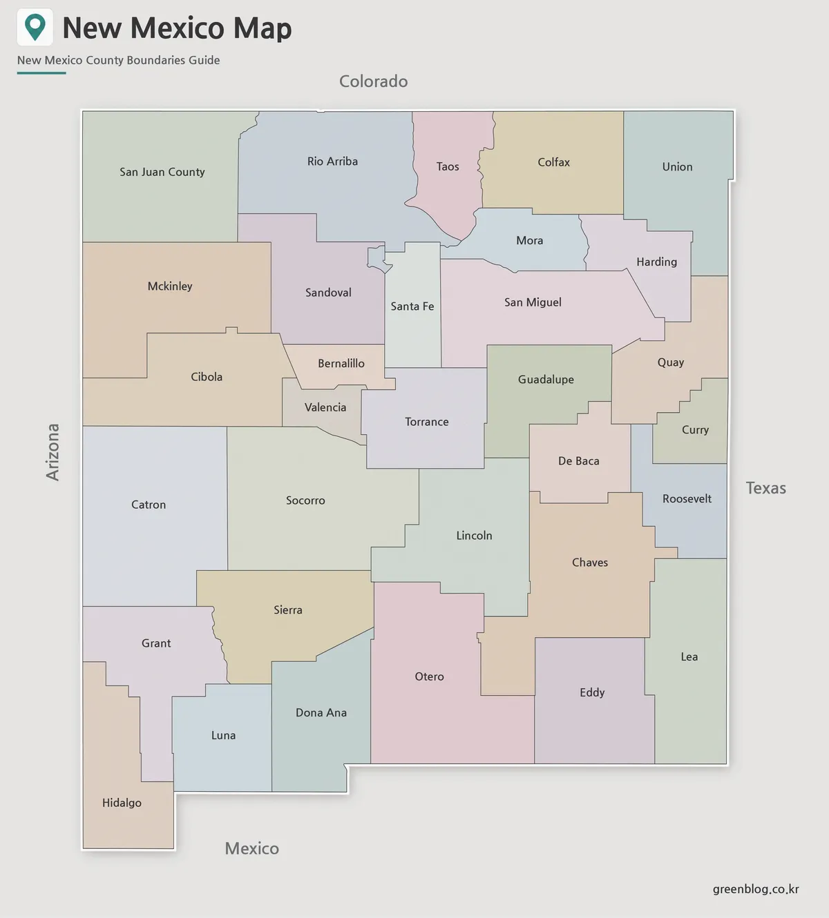
A Printable New Mexico map is useful when you need more than a simple location image of the American Southwest.
Printable New Mexico Map – Color, Black and White, and Outline Versions Read More »
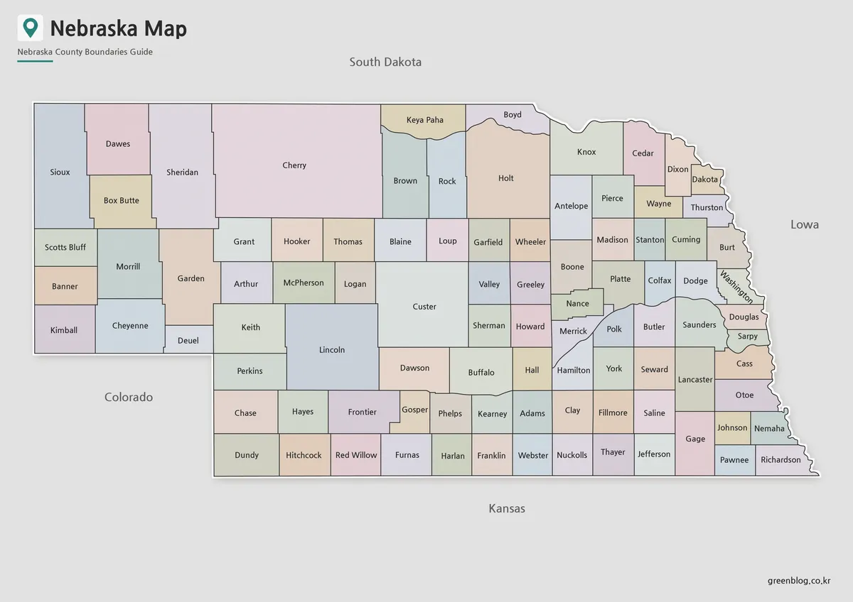
This Nebraska Map shows why the state cannot be reduced to a simple rectangle. A long western Panhandle extends toward
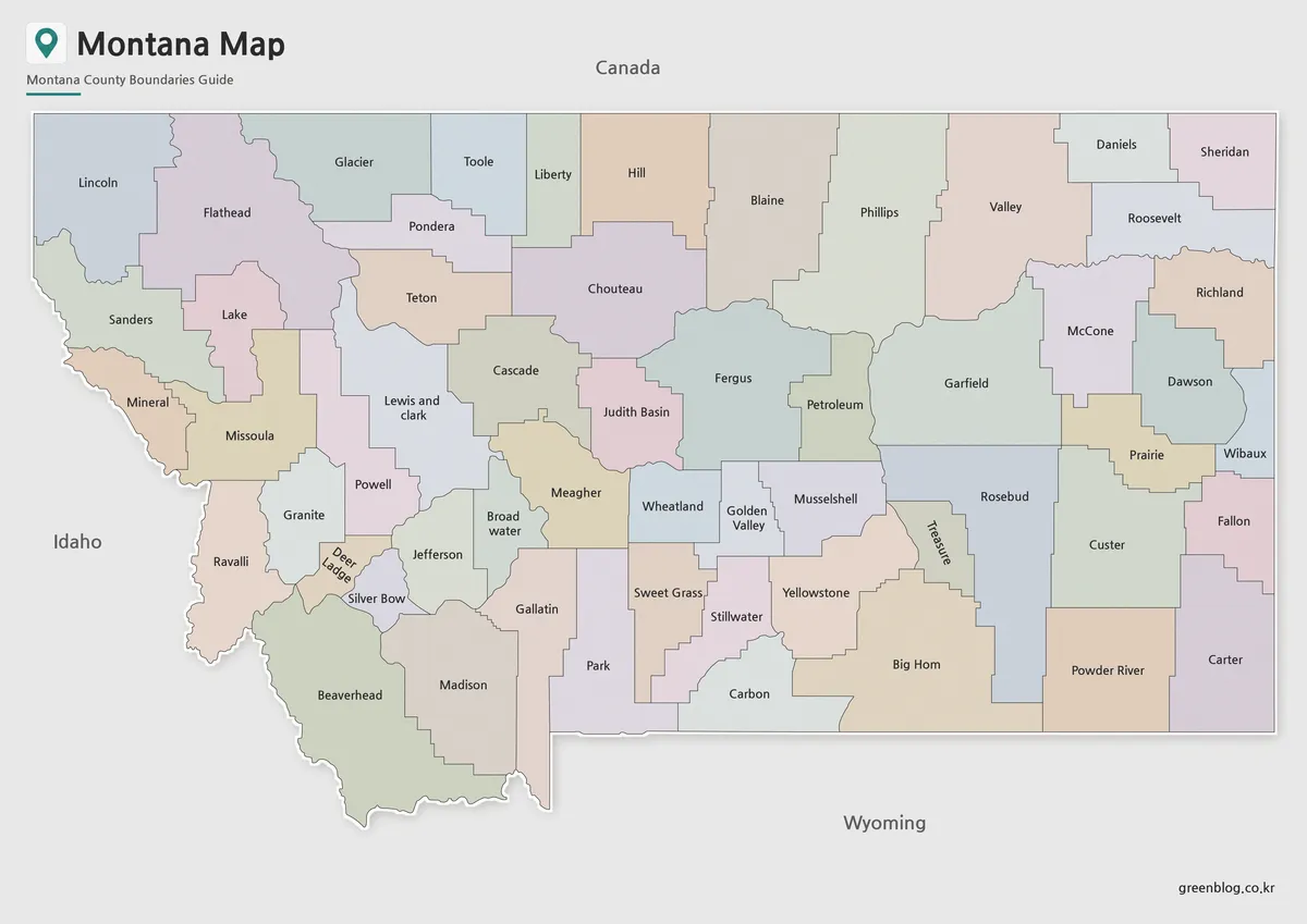
A Montana State Map must stretch across a broad east–west frame while keeping 56 county shapes readable. Montana reaches from
Montana State Map: 56 Counties from Lincoln to Wibaux Read More »
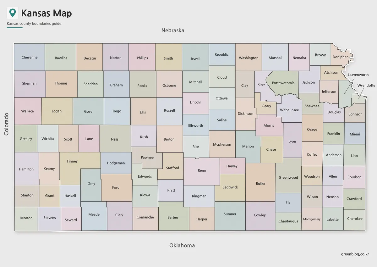
A Kansas Map becomes much more informative when the state’s broad rectangular frame is divided into all 105 counties. Western
Kansas Map Across the Western Grid and Northeast Border Read More »
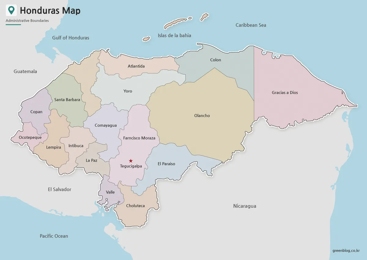
A Honduras Map has to explain a country that opens broadly toward the Caribbean Sea yet also reaches the Gulf
Honduras Map Across 18 Departments and Two Coasts Read More »
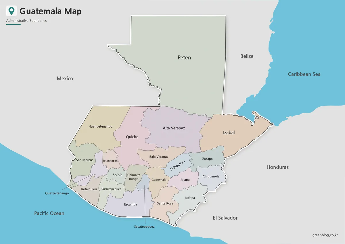
A Guatemala Map has to connect a very large northern department with a denser band of smaller departments stretching toward
From Petén to the Pacific: Reading a Guatemala Map Read More »