
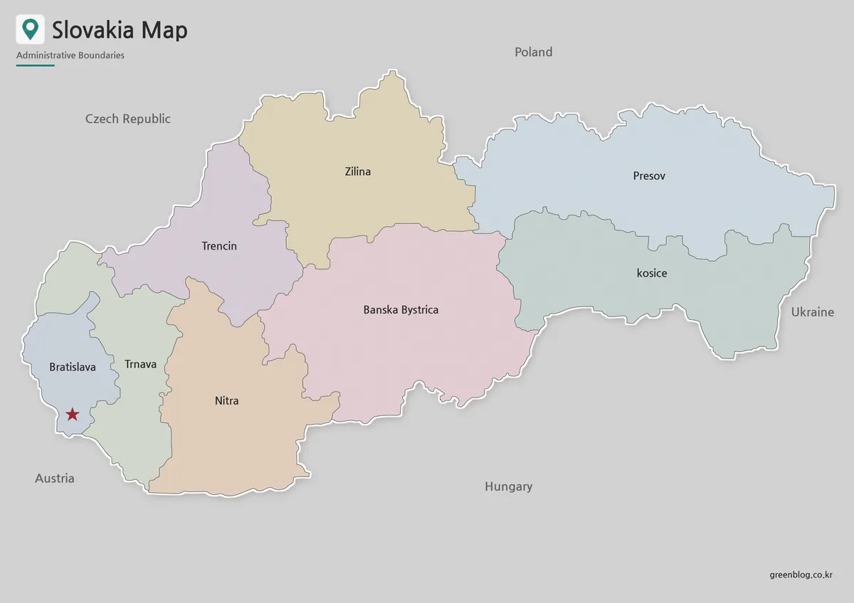
Eight Regions from Bratislava to Košice on a Slovakia Map
A Slovakia Map is especially revealing when read from Bratislava at the narrow western end to the broader regions around
Eight Regions from Bratislava to Košice on a Slovakia Map Read More »
A Slovakia Map is especially revealing when read from Bratislava at the narrow western end to the broader regions around
Eight Regions from Bratislava to Košice on a Slovakia Map Read More »
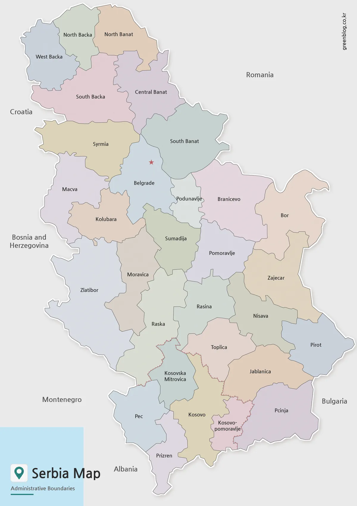
A Serbia Map becomes much easier to read when its district framework is separated into three visual zones: the seven
Serbia Map Explained: 29 Districts, Belgrade, and Kosovo Context Read More »
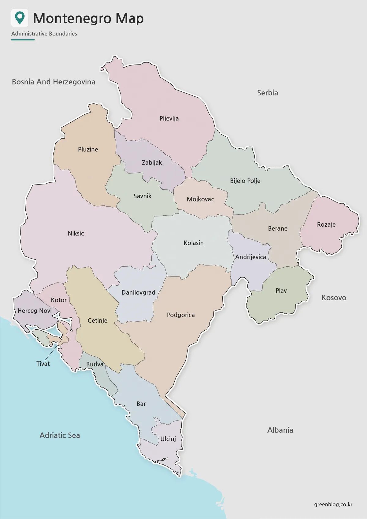
A Montenegro Map has to fit a narrow Adriatic coast, the deeply indented Bay of Kotor, a broad central interior,
Why Montenegro Map Labels Need a Portrait Layout Read More »
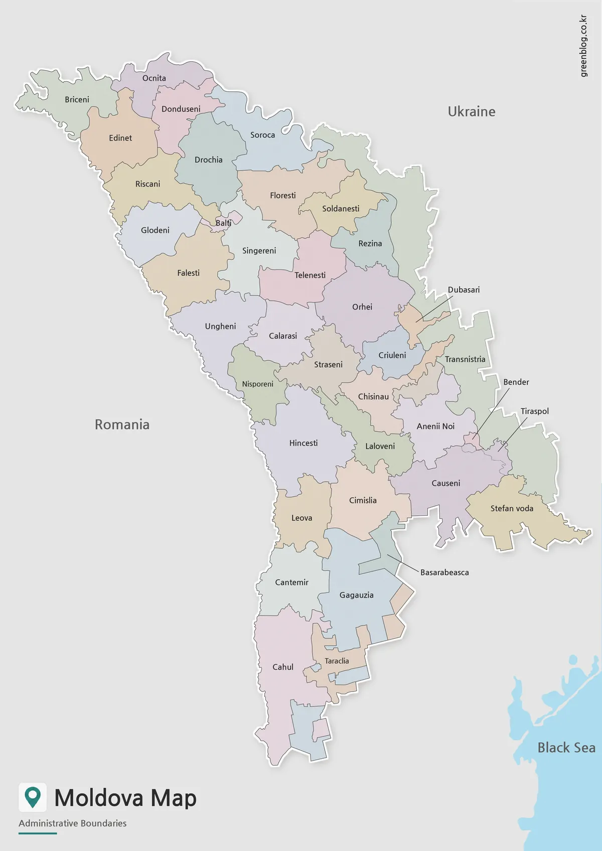
A Moldova Map has to make sense of a long, narrow country squeezed between Romania and Ukraine while leaving enough
Between Romania and Ukraine: A Moldova Map in Three Views Read More »
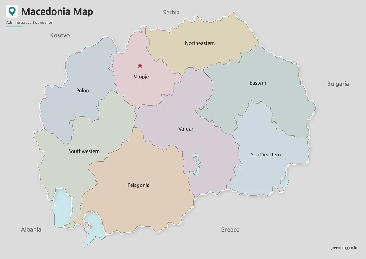
A North Macedonia Map becomes much easier to read when its eight statistical regions are treated as the main subject
Eight Statistical Regions on a North Macedonia Map Read More »
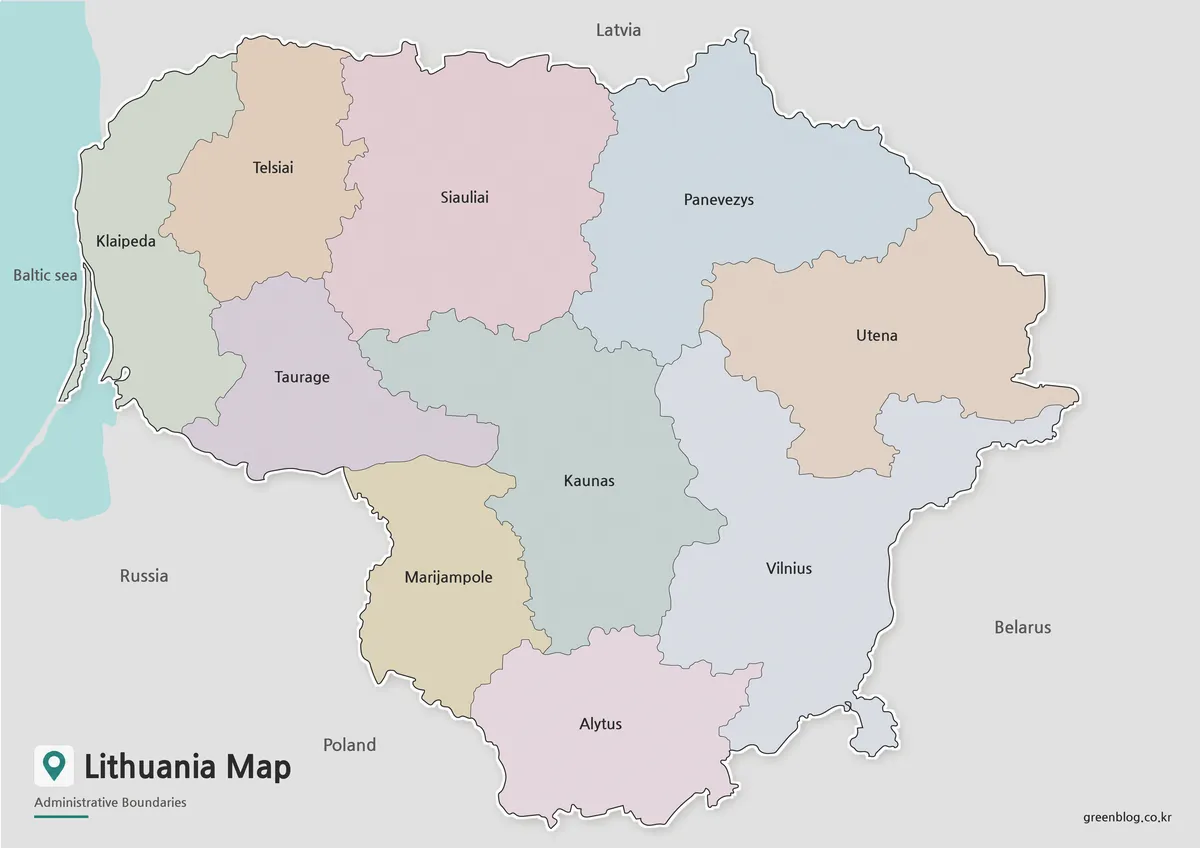
A Lithuania Map becomes much more informative when it shows the country’s short Baltic coast, ten county-level areas, and four
What Ten County Shapes Reveal on a Lithuania Map Read More »
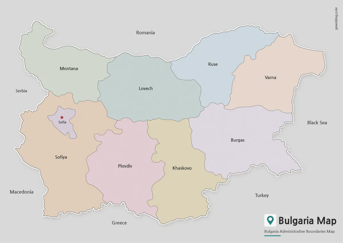
A Bulgaria Map in this collection divides the country into nine broad labeled areas rather than displaying all 28 present-day
Nine Broad Divisions and Sofia in a Bulgaria Map Read More »
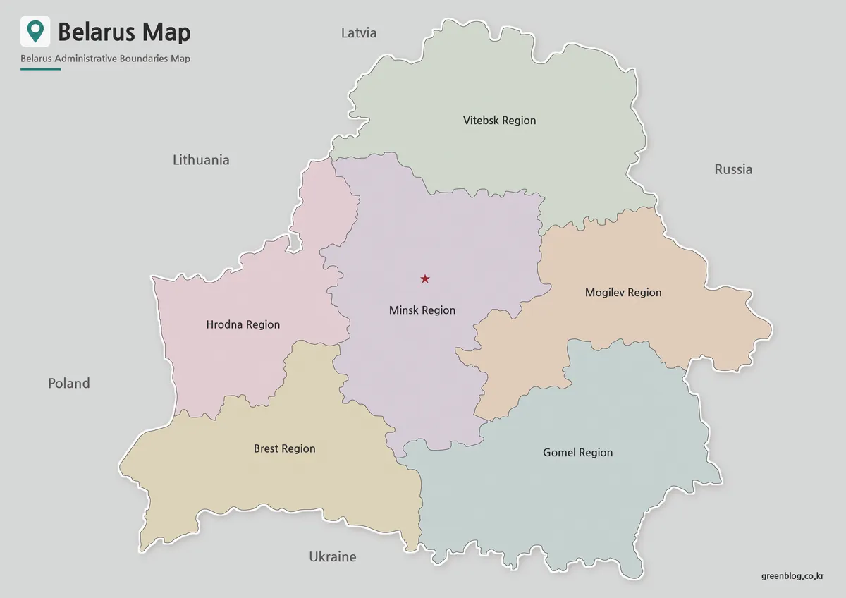
A Belarus Map makes the country’s position between the Baltic region, Central Europe, Russia, and Ukraine much easier to read
Belarus Map Files for Reading Six Regions and Minsk Read More »
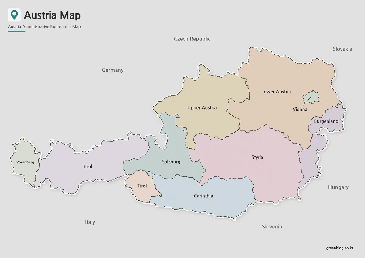
An Austria Map has to explain more than a long east–west country shape. It also needs to show Vienna as
Nine Federal States and a Vienna Enclave on an Austria Map Read More »