
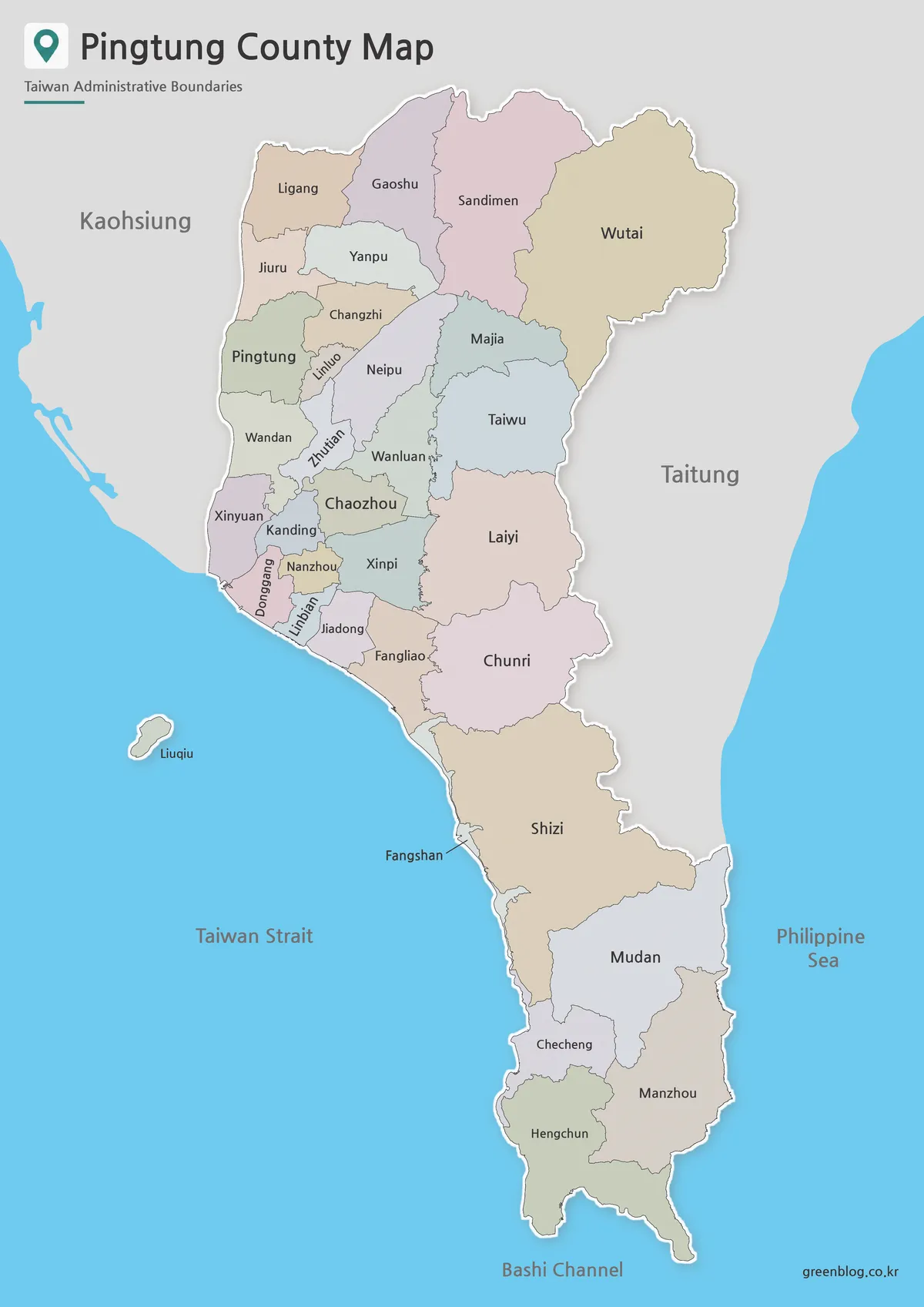
Pingtung County Map, Read from the Plains to the Peninsula
A Pingtung County map reveals a part of Taiwan whose shape is difficult to grasp on a national map. The
Pingtung County Map, Read from the Plains to the Peninsula Read More »
A Pingtung County map reveals a part of Taiwan whose shape is difficult to grasp on a national map. The
Pingtung County Map, Read from the Plains to the Peninsula Read More »
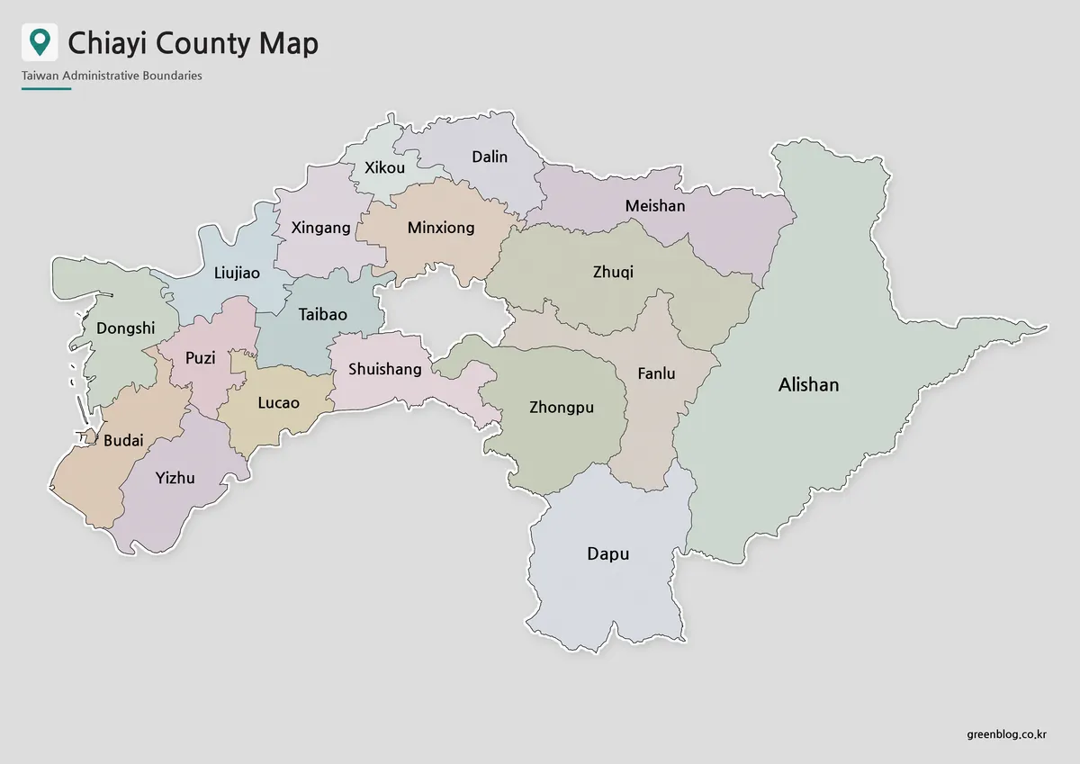
A Chiayi County Map has an unusual visual center: a gray gap where Chiayi City sits as a separate jurisdiction.
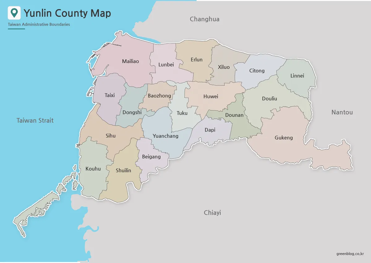
A Yunlin County map has to explain two patterns at once: a long western coast facing the Taiwan Strait and
Between the Strait and Gukeng: A Yunlin County Map Guide Read More »
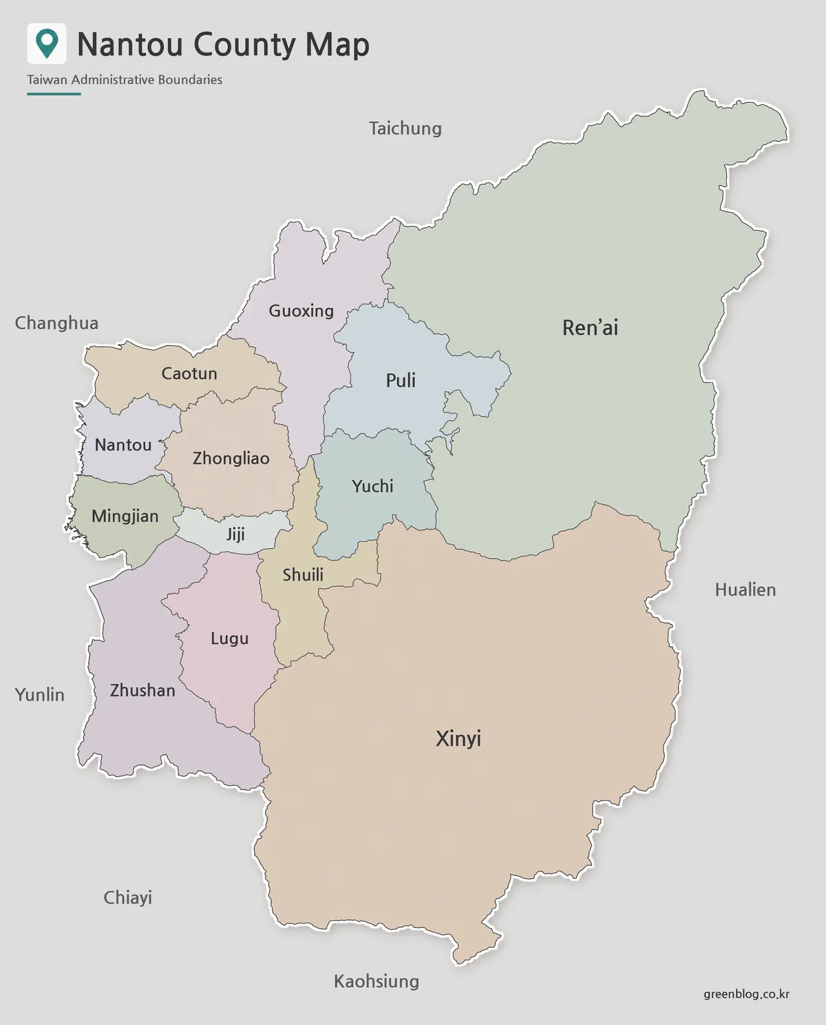
A Nantou County Map immediately shows why this inland part of central Taiwan cannot be understood as a set of
Why Ren’ai and Xinyi Dominate the Nantou County Map Read More »
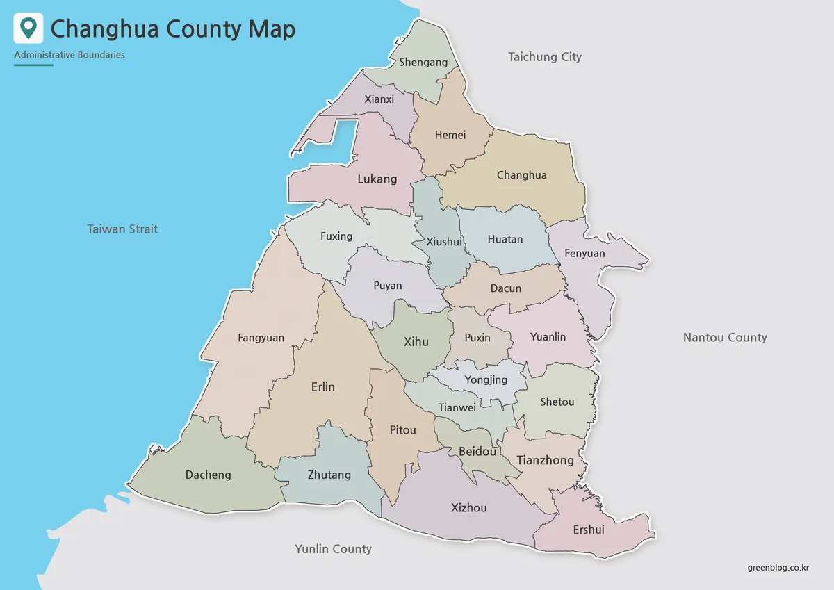
This Changhua County Map fits 26 administrative districts into a long north–south shape on Taiwan’s central-western coast. Shengang forms the
Reading Changhua County Map Labels from Shengang to Ershui Read More »
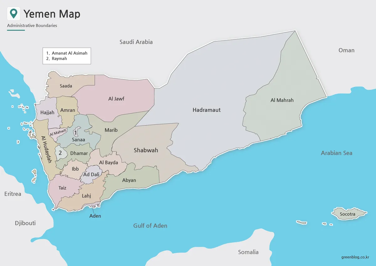
This Yemen map shows why a single page must handle two very different scales: tightly packed western governorates and much
Yemen Map Scale: Compact Western Governorates, Broad East Read More »
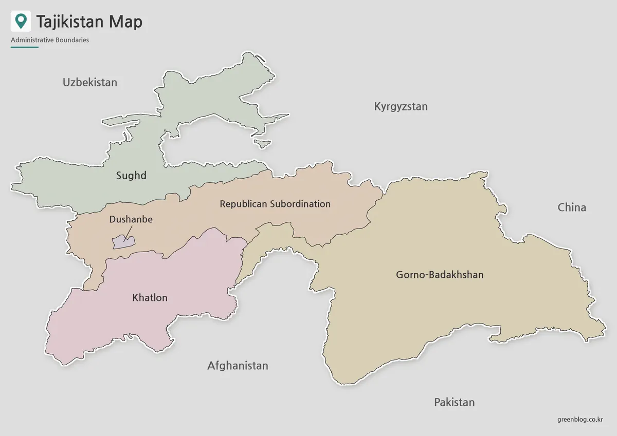
A Tajikistan Map has to distinguish administrative structure from a border outline. The supplied images show five top-level territorial categories:
Five Territorial Units and a 2025 Border Note on a Tajikistan Map Read More »
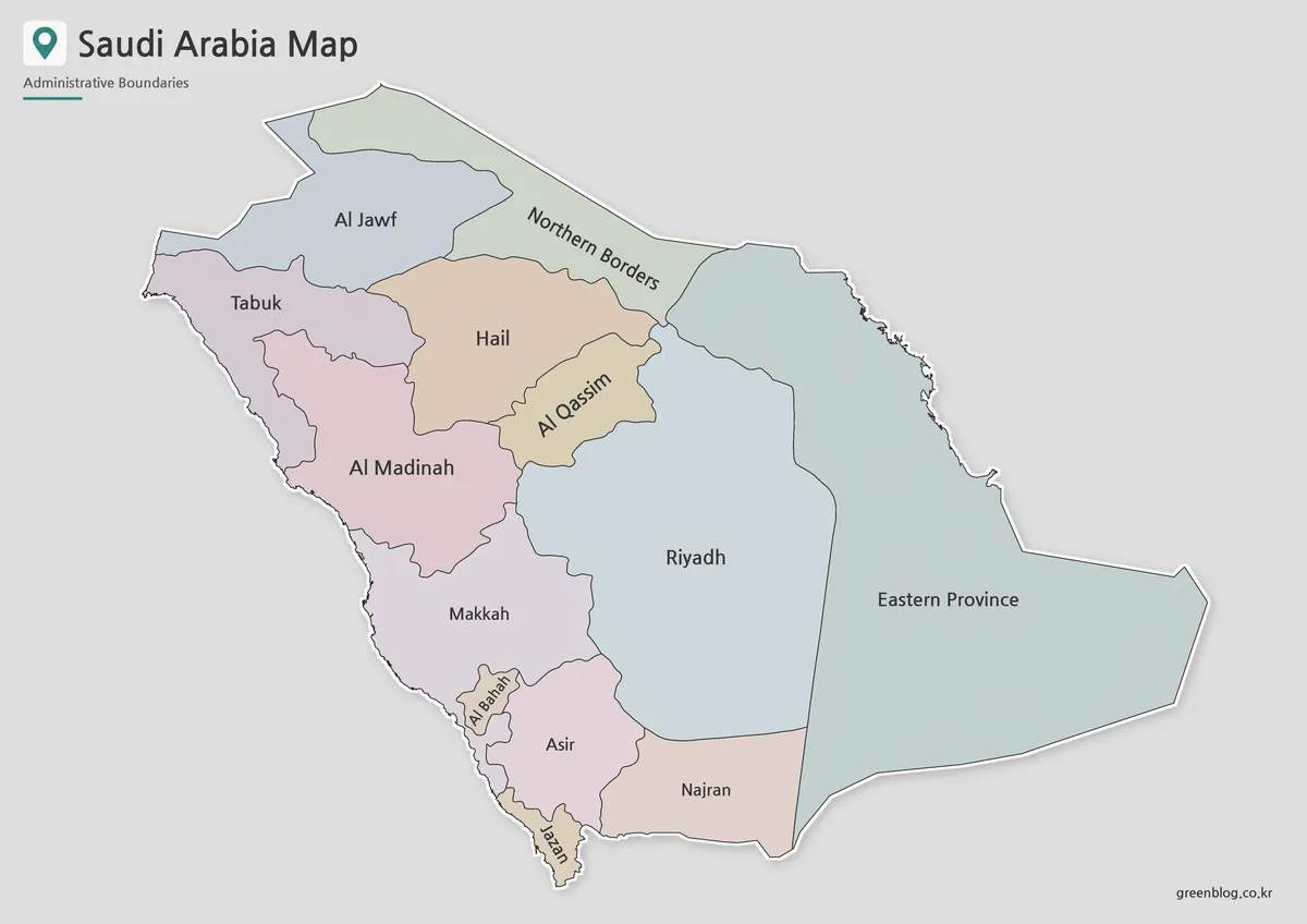
A Saudi Arabia Map has to balance some of the Arabian Peninsula’s largest administrative areas with a tight chain of
Large Interior, Narrow Southwest: A Saudi Arabia Map Read More »
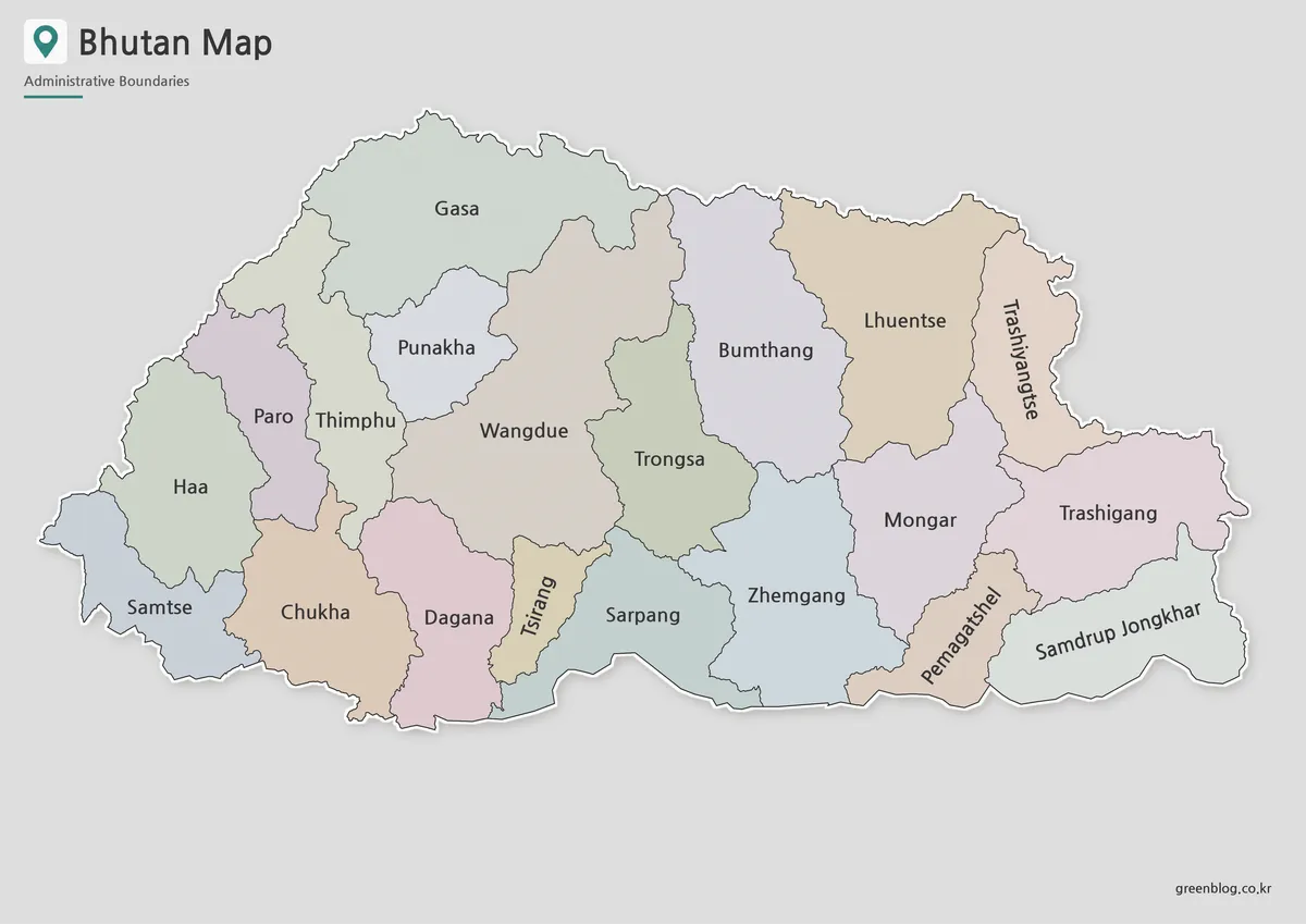
A Bhutan map is useful when you need more than a simple location image of the country. Bhutan sits in
Bhutan Map in High Resolution for Presentations and Worksheets Read More »