
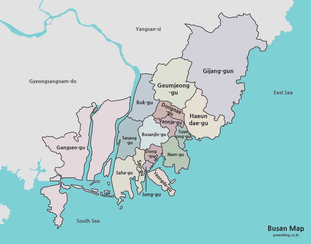
Fifteen Gu, One Gun, and a Coastal Busan Map
This Busan Map collection presents the city as a chain of 15 gu and one gun arranged around a deeply
This Busan Map collection presents the city as a chain of 15 gu and one gun arranged around a deeply
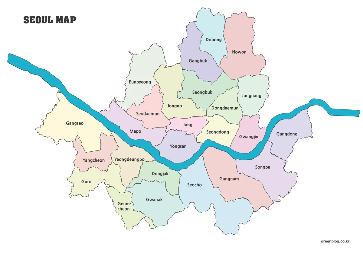
A Seoul Map becomes much easier to read when the Han River is treated as the city’s main visual axis.
Seoul Map Across the Han River: 25 Districts for Print and Study Read More »
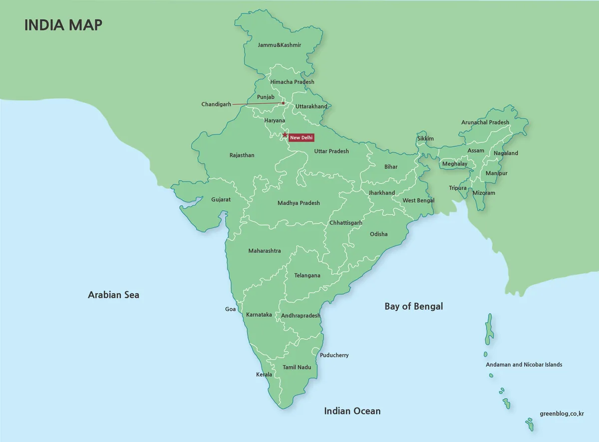
An India Map must fit several very different spatial patterns into one readable frame: the broad north, the tapering southern
A 2014–2019 India Map Set for Regional Study and Printing Read More »
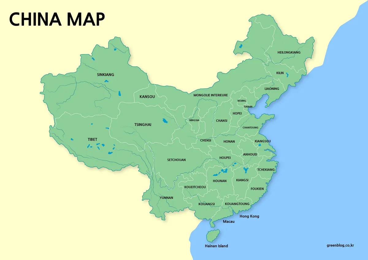
A China Map can resemble a current reference while using older names. These four maps share province-level boundaries, but their
China Map Labels Explained: Historical Spellings and Four Layouts Read More »
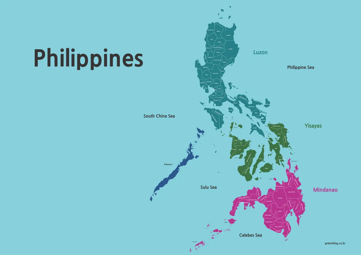
A Philippines Map must organize a widely scattered archipelago without losing the relationship among Luzon, the central Visayan islands, Mindanao,
Across Luzon, Visayas, and Mindanao: A Philippines Map Set Read More »

A South Korea Map can show the republic alone or place it within the full Korean Peninsula, and this collection
South Korea Map with Provincial Labels and Two Peninsula Views Read More »
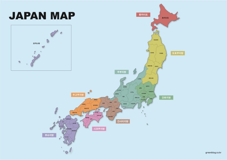
A Japan Map must balance geographic distance with readable detail. The main island chain forms a long northeast-to-southwest arc, while
One Archipelago, Three Working Views: A Japan Map Set Read More »