
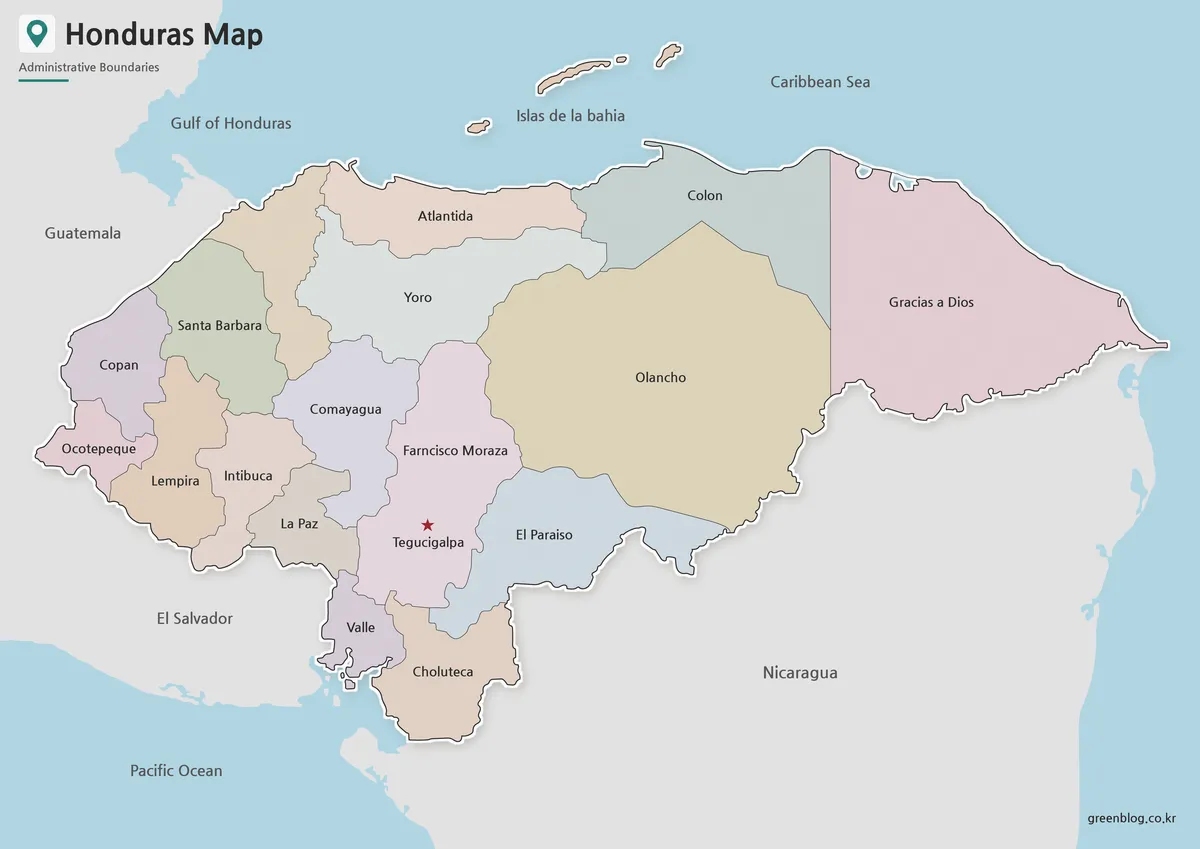
Honduras Map Across 18 Departments and Two Coasts
A Honduras Map has to explain a country that opens broadly toward the Caribbean Sea yet also reaches the Gulf
Honduras Map Across 18 Departments and Two Coasts Read More »
A Honduras Map has to explain a country that opens broadly toward the Caribbean Sea yet also reaches the Gulf
Honduras Map Across 18 Departments and Two Coasts Read More »
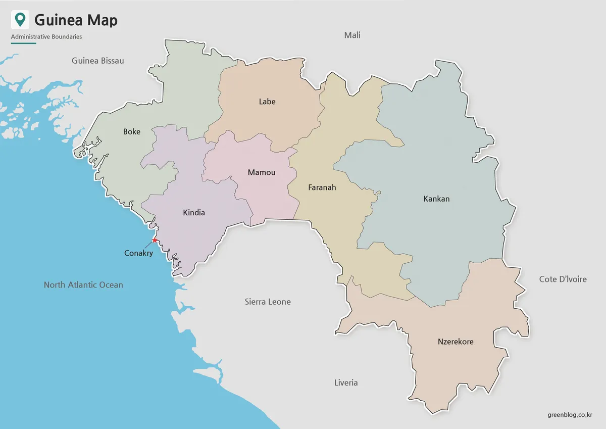
A Guinea Map reveals a country whose shape begins on the North Atlantic coast and reaches far inland across West
Guinea Map from Conakry to Kankan: Regional Files for A3 Use Read More »
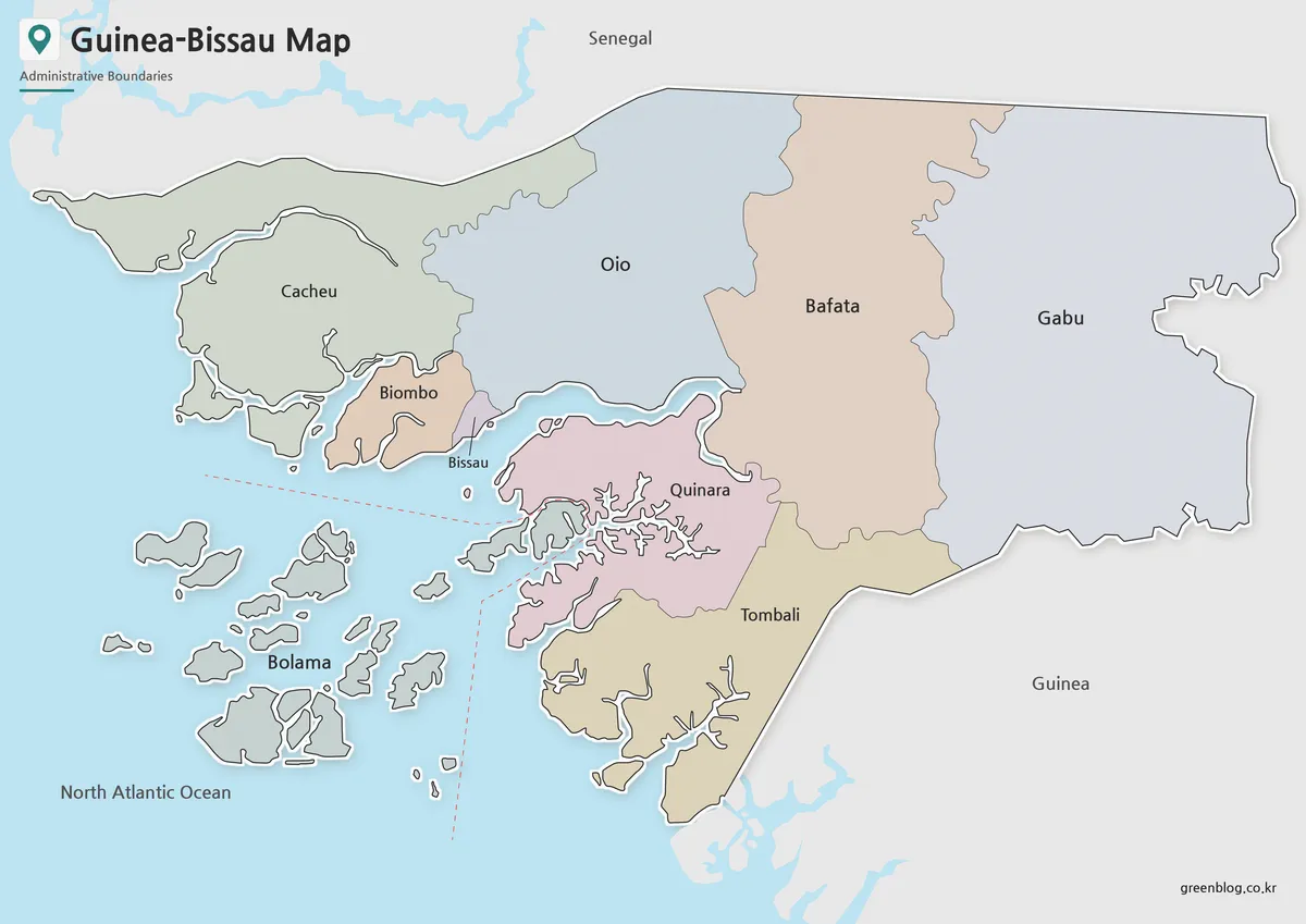
A Guinea-Bissau Map has to explain a country whose western edge is broken into estuaries, tidal channels, peninsulas, and offshore
Guinea-Bissau Map Across Estuaries, Regions, and Islands Read More »
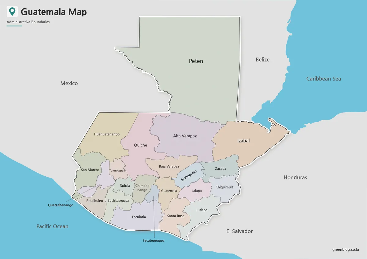
A Guatemala Map has to connect a very large northern department with a denser band of smaller departments stretching toward
From Petén to the Pacific: Reading a Guatemala Map Read More »
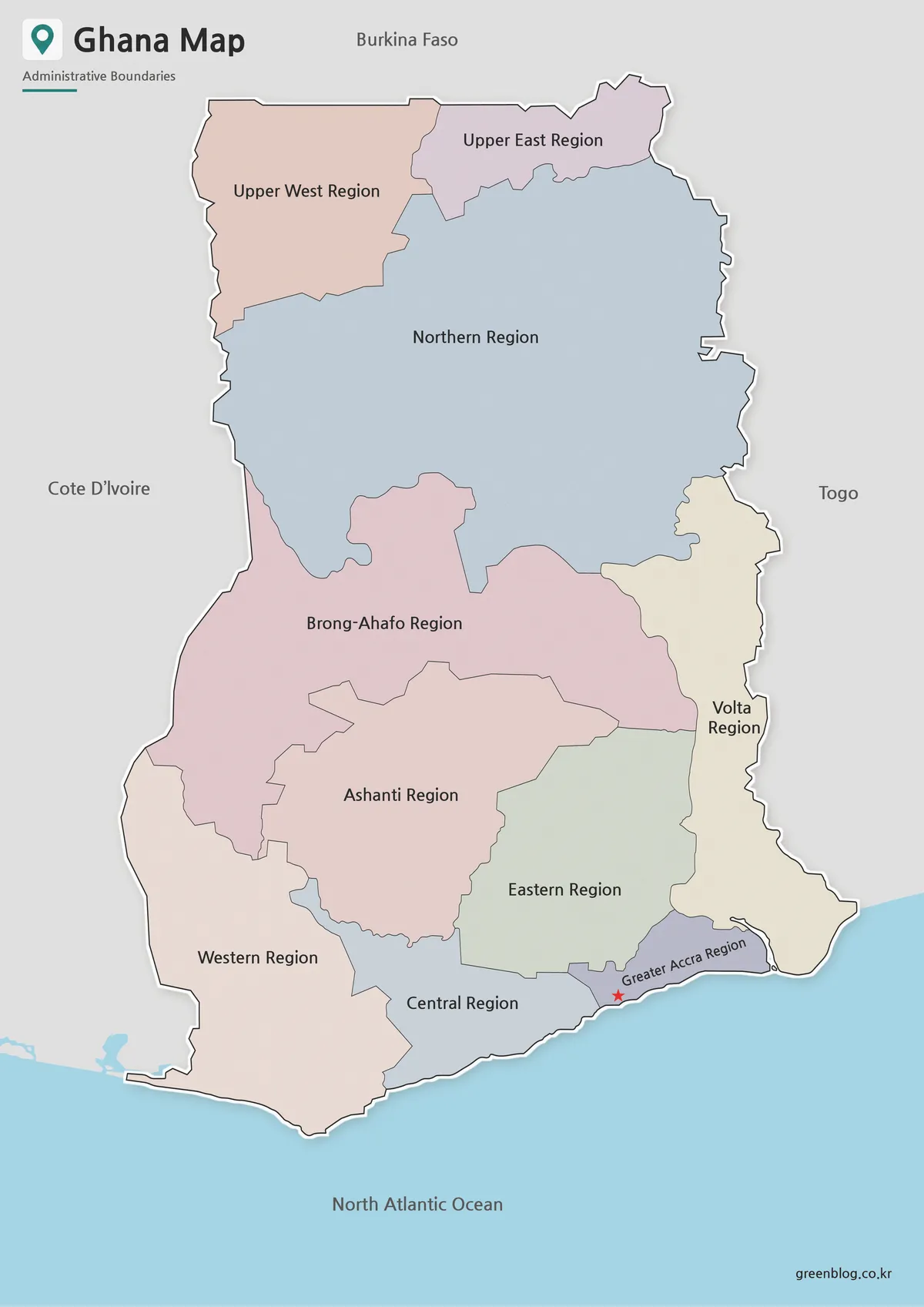
A Ghana Map in this collection shows the country’s former ten-region arrangement, not the 16-region system used today. The clue
Ghana Map with the Former Ten Regions and Lake Volta Read More »
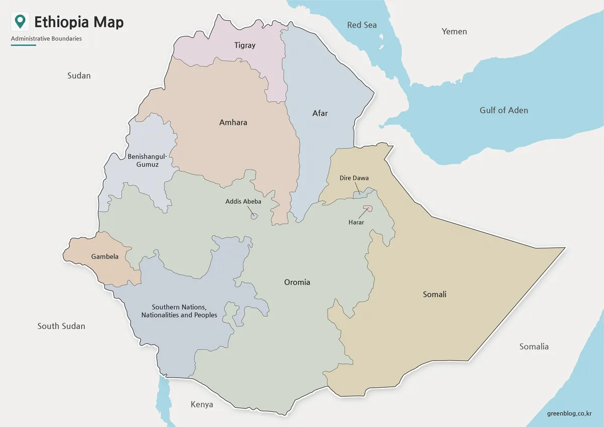
An Ethiopia Map needs a date note when its internal lines reflect an earlier administrative system. The three supplied images
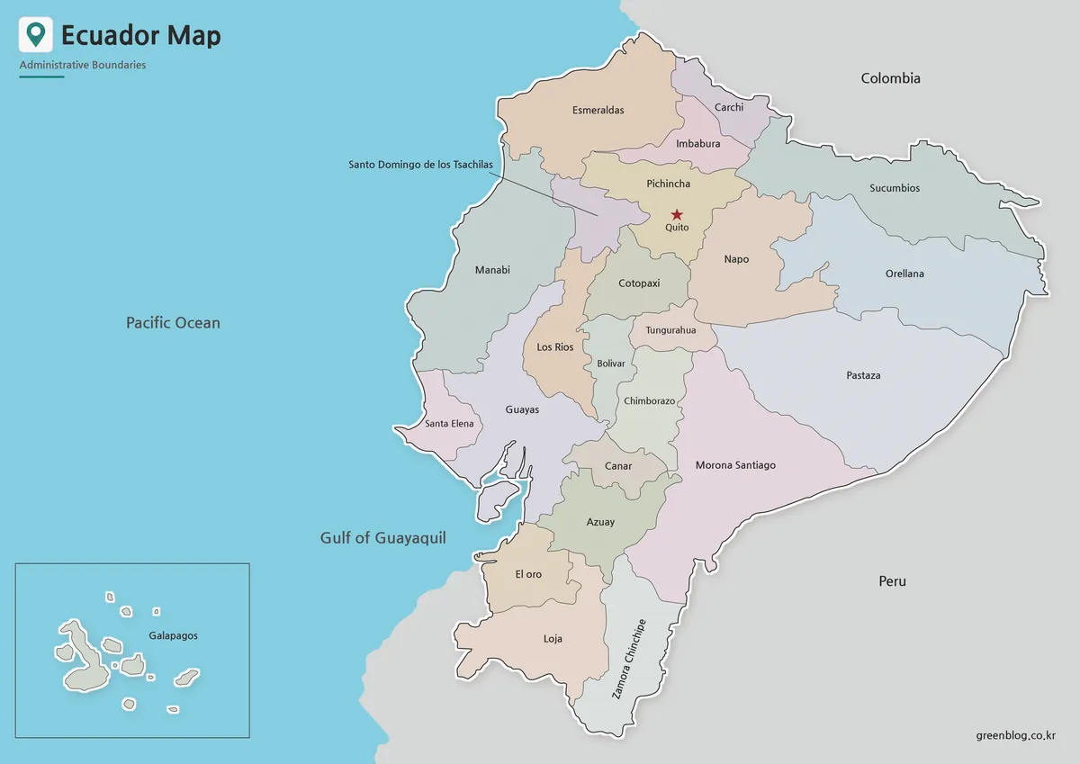
An Ecuador Map has to explain two geographic stories at once: a compact mainland on South America’s Pacific coast and
Ecuador Map of the Mainland, Quito, and Galápagos Read More »
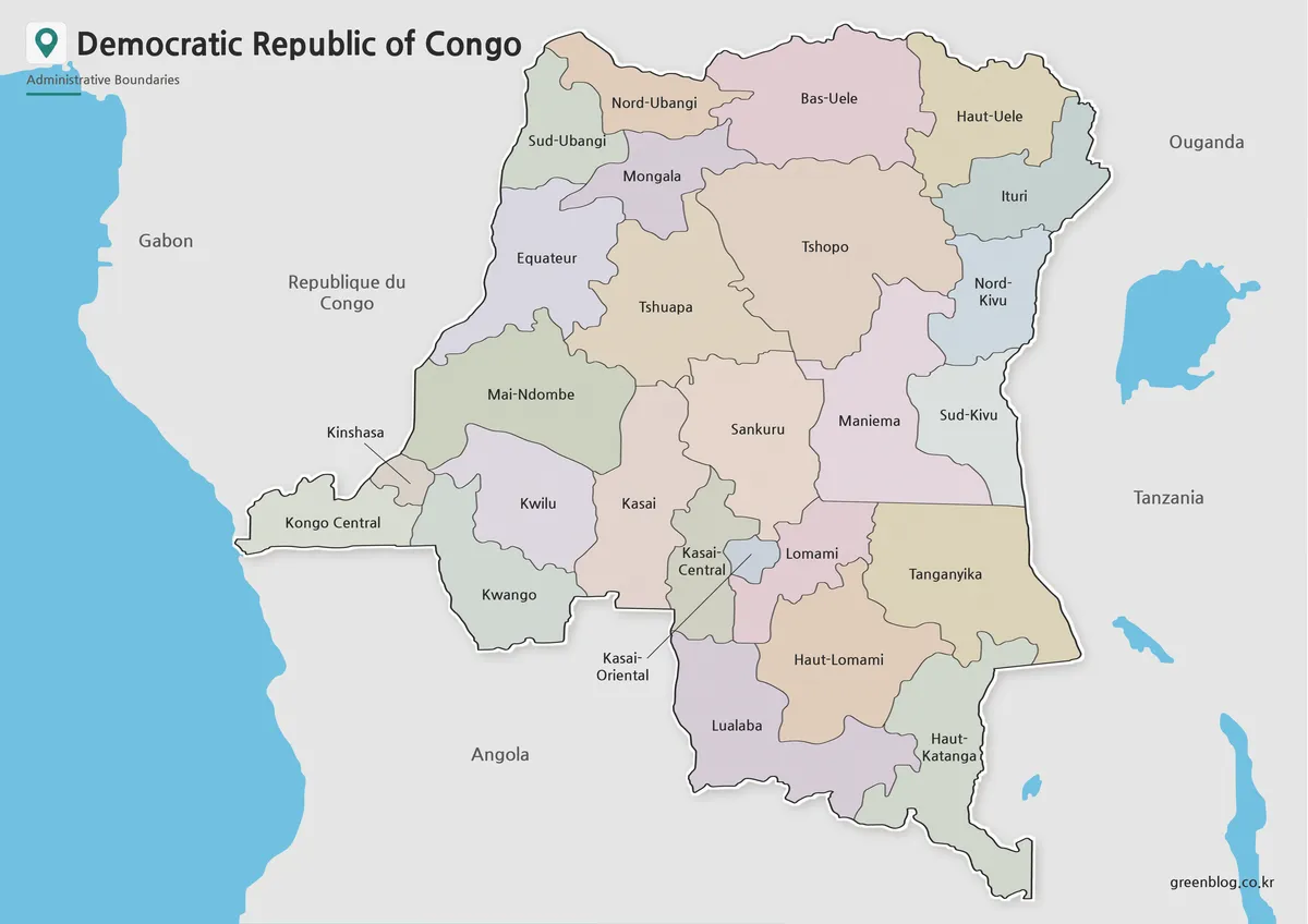
A Democratic Republic of the Congo Map has to make a very large Central African country readable while preserving one
Reading 26 Provinces on a Democratic Republic of the Congo Map Read More »
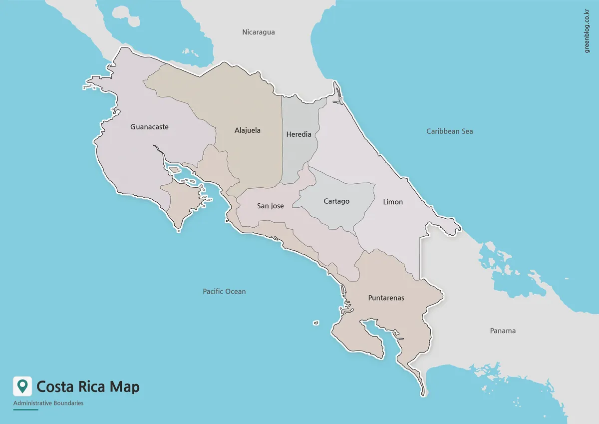
Costa Rica sits on the Central American isthmus between Nicaragua and Panama, with the Pacific Ocean on one side of
Costa Rica Map Download – Printable Province Maps in Color, B&W and Outline Read More »