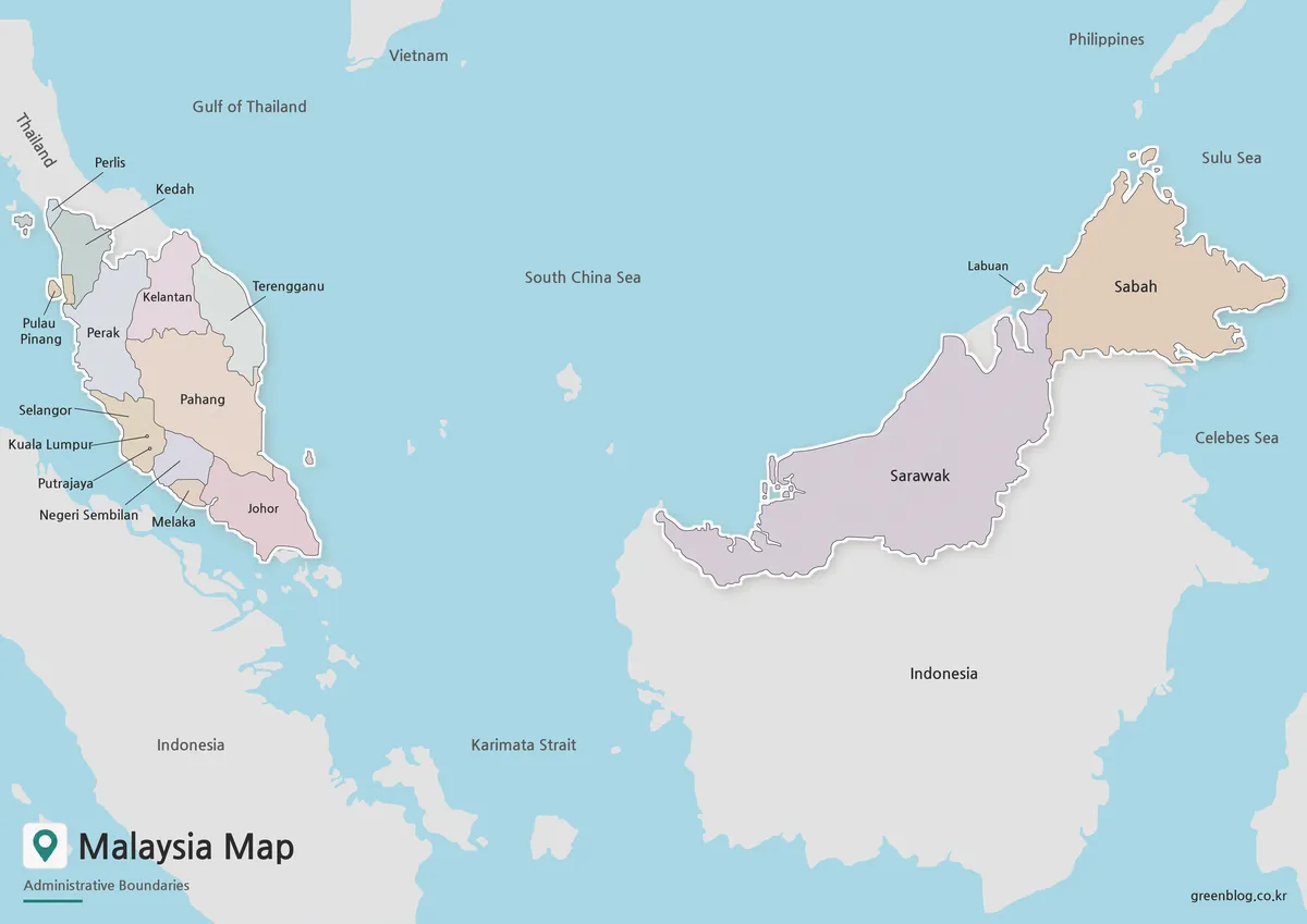
Malaysia Map Between Peninsula and Borneo
A Malaysia Map must connect two main land areas separated by the South China Sea. Peninsular Malaysia extends south from […]
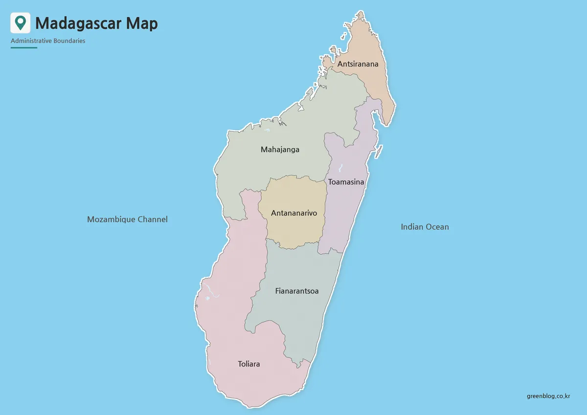
A Madagascar Map needs a tall composition because the island extends much farther north to south than east to west.
Madagascar Map from Antsiranana to Toliara in Four Views Read More »
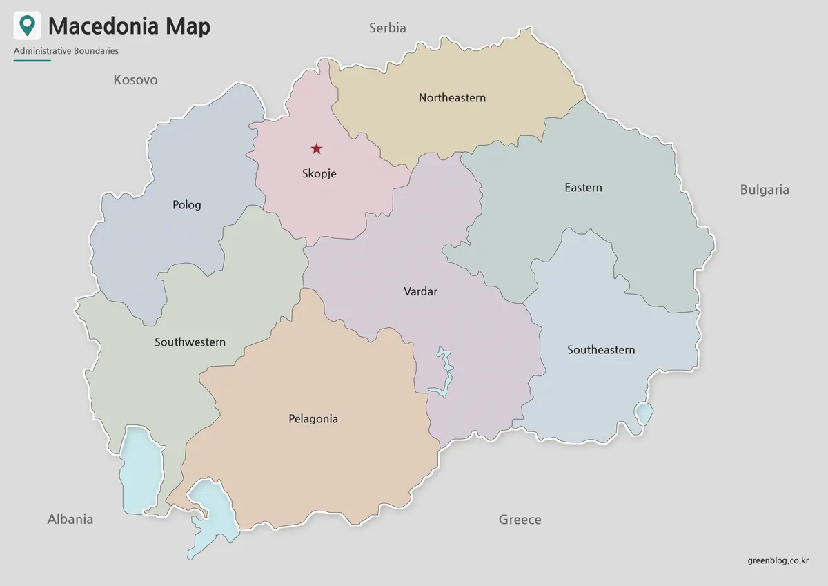
A North Macedonia Map becomes much easier to read when its eight statistical regions are treated as the main subject
Eight Statistical Regions on a North Macedonia Map Read More »
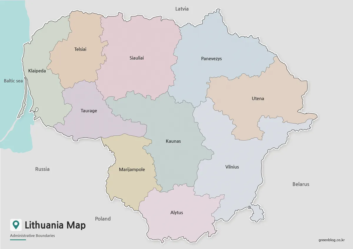
A Lithuania Map becomes much more informative when it shows the country’s short Baltic coast, ten county-level areas, and four
What Ten County Shapes Reveal on a Lithuania Map Read More »
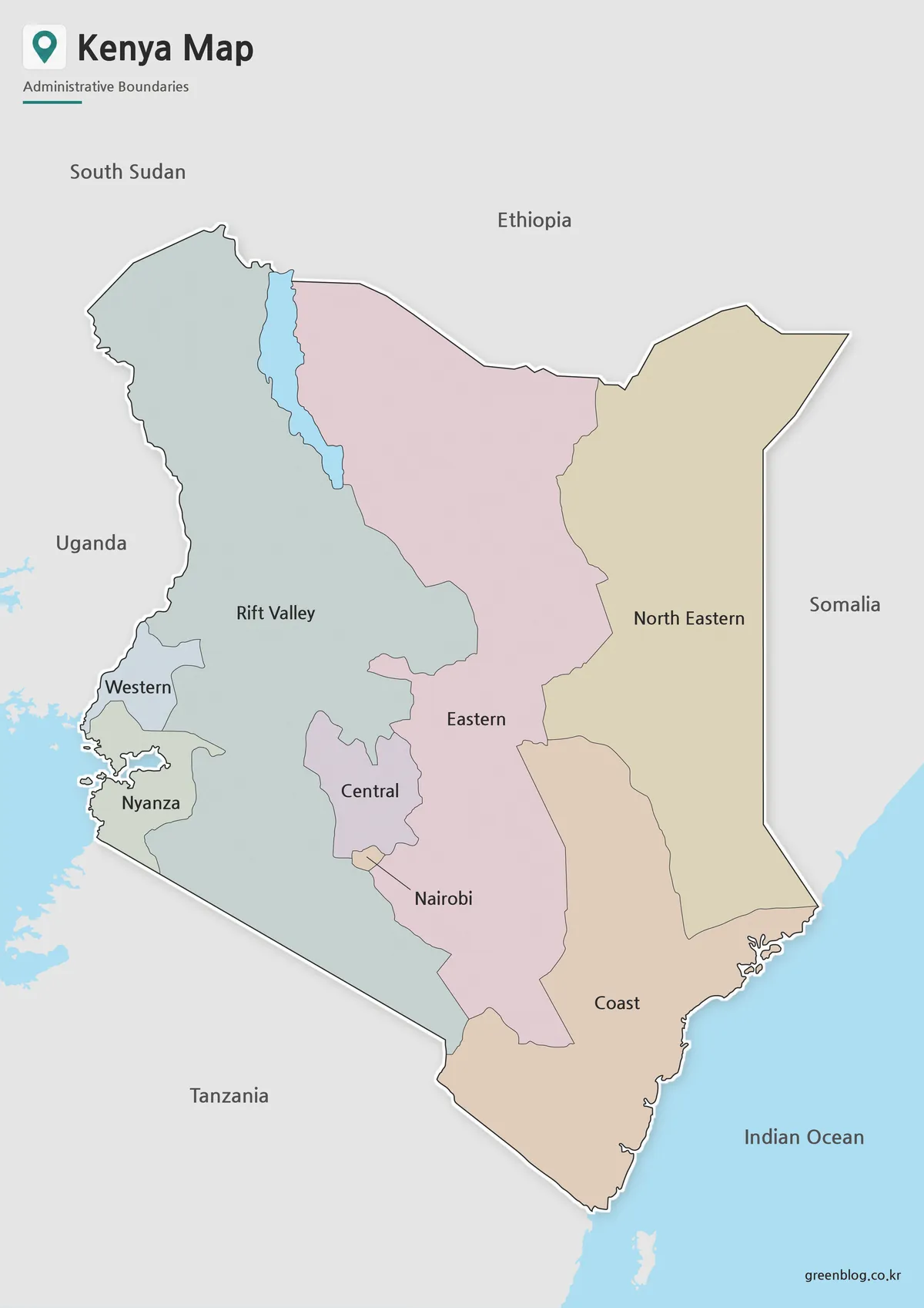
This Kenya Map shows the eight provinces used before the country’s present 47-county system. Central, Coast, Eastern, Nairobi, North Eastern,
Why This Kenya Map Has Eight Regions Instead of 47 Counties Read More »
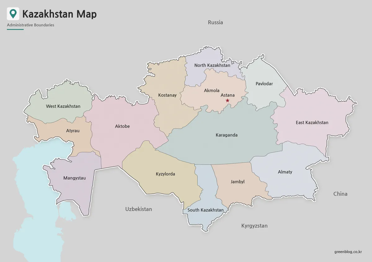
A Kazakhstan Map has to make an exceptionally wide country readable without shrinking its regional labels into the background. Kazakhstan
Reading a Kazakhstan Map: Regional Labels, Print, and Outline Use Read More »
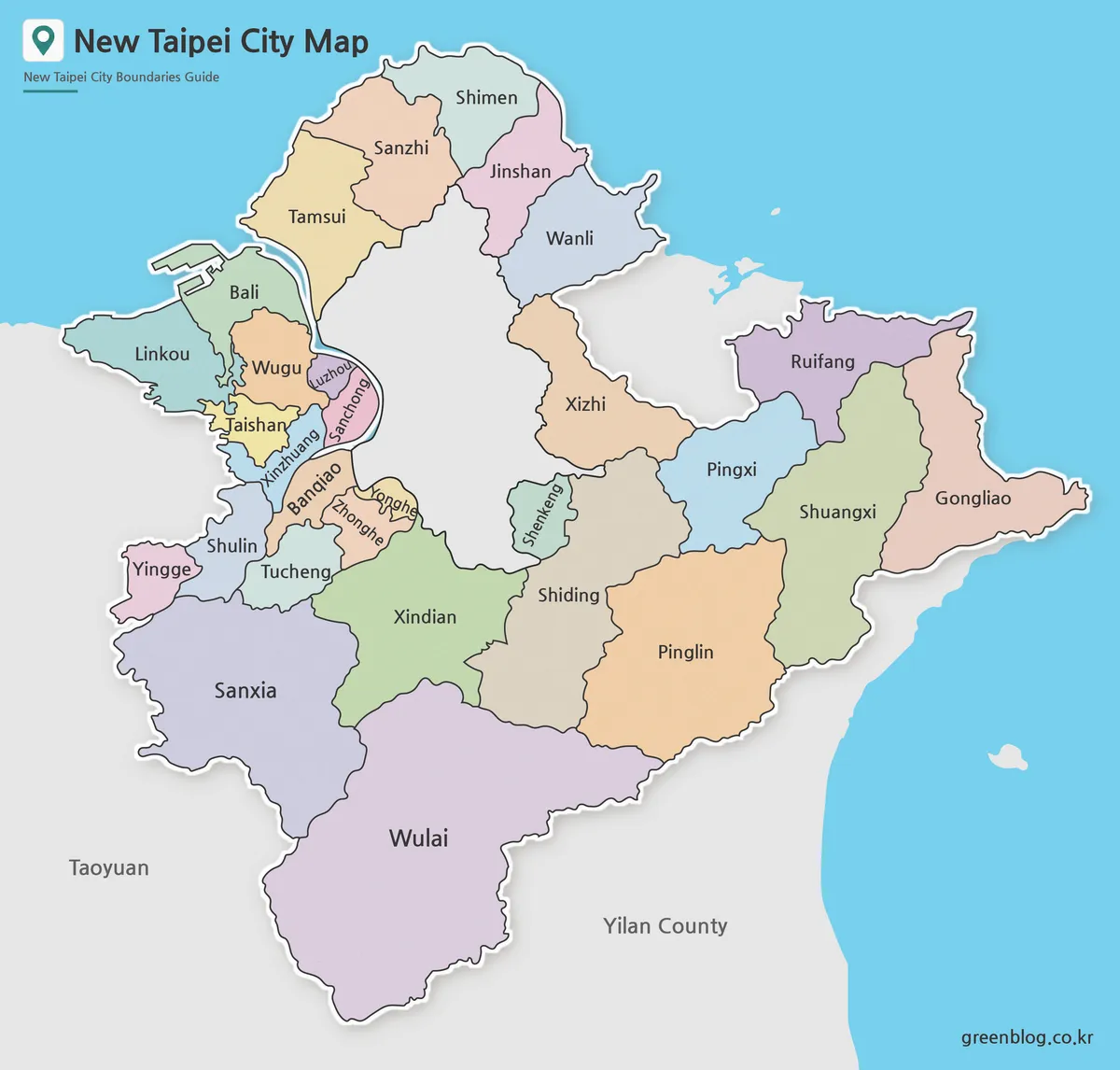
A Printable New Taipei City Map is useful when you need more than a simple location reference in northern Taiwan.
New Taipei City Map Download with District Boundarie Read More »
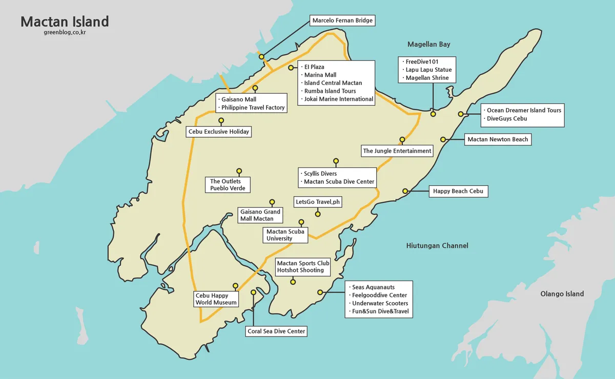
A Mactan Island Map is most useful when it separates three ideas that visitors often combine: the island itself, nearby
Across Bridges and Channels: Reading a Mactan Island Map Read More »
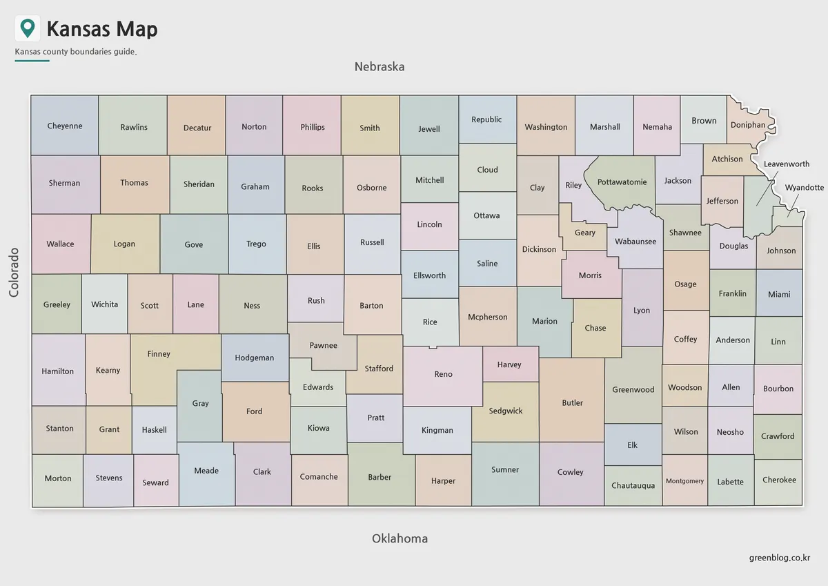
A Kansas Map becomes much more informative when the state’s broad rectangular frame is divided into all 105 counties. Western
Kansas Map Across the Western Grid and Northeast Border Read More »