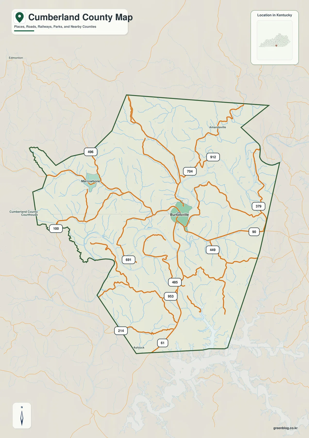
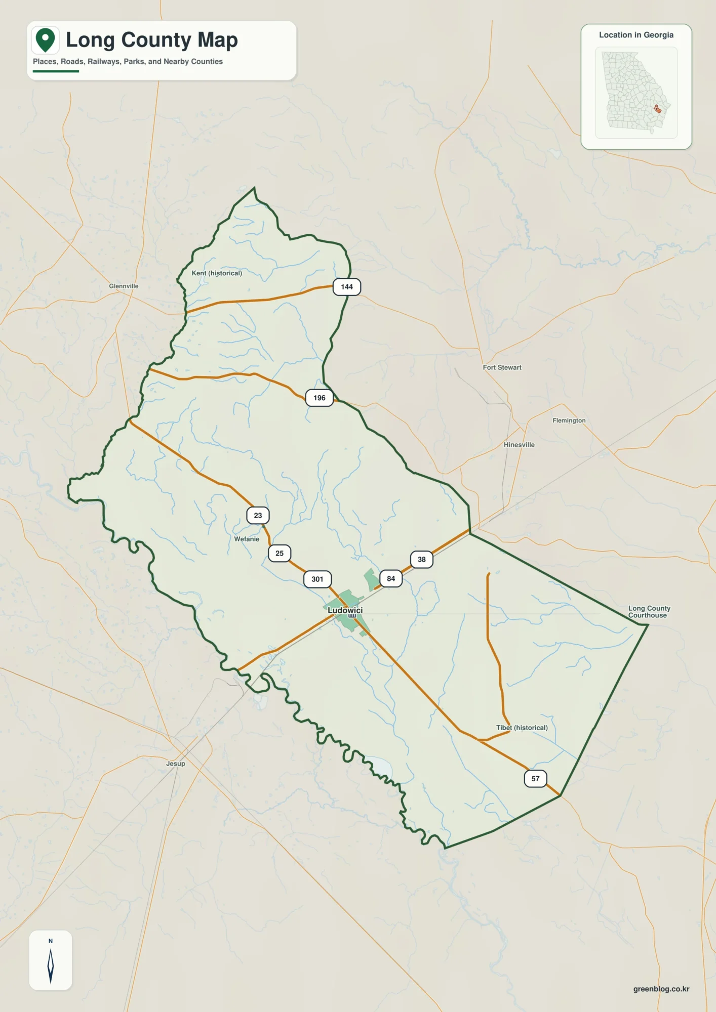
Casey County sits in south-central Kentucky, where Liberty provides the clearest reference point for roads, communities, and nearby waterways. U.S. 127 runs through Liberty from south to north, while KY 70 crosses the county through the same area. Once Liberty is located, smaller places such as Butchertown, Windsor, and Bass are easier to place within the county. High-resolution map files are available for download in the section below.
This page separates the county into four useful map views: roads and boundaries, the location of Liberty, waterways, and elevation. The high-resolution A3-size JPG originals are also available together in one ZIP file, so the maps can be printed, enlarged, or reused in classroom and regional-reference materials without relying on the smaller WebP images shown in the article.
Table of Contents
Liberty at the meeting point of U.S. 127 and KY 70
The county map makes Liberty the most practical starting point. U.S. 127 enters from the south, passes through town, and continues north, while KY 70 approaches from the west and crosses the same central area before continuing east. That crossing gives readers an immediate way to orient the rest of Casey County without having to study every local route at once.
North of Liberty, KY 49 and KY 78 lead toward the Butchertown area. South of town, U.S. 127 and KY 206 remain important, and farther south the map shows KY 80 and KY 910 near Windsor. Bass appears near the western side of the county along the KY 70 direction. These place names are useful because they spread the reader’s attention beyond Liberty while still tying back to a familiar central junction.
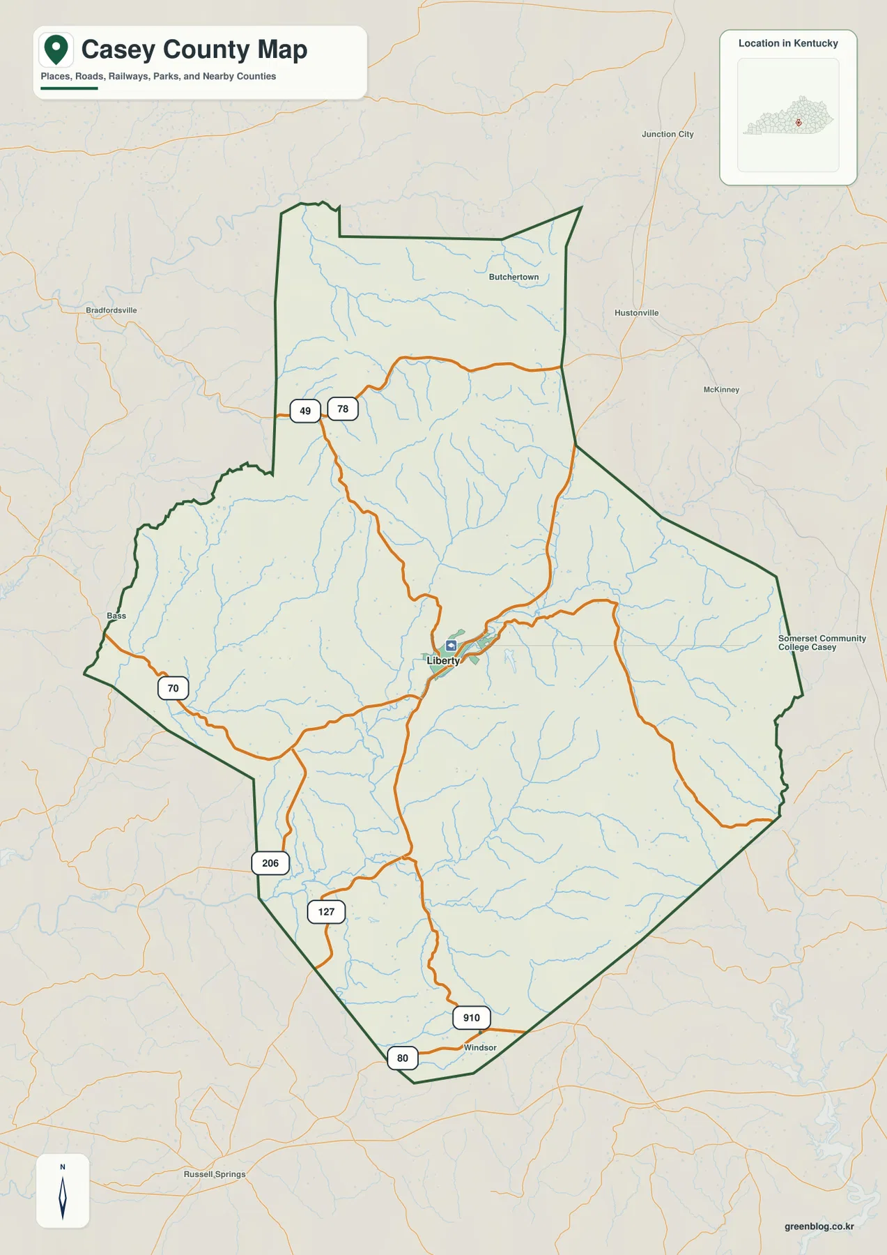
Many local roads curve rather than forming a regular grid. That shape is easier to understand after looking at the water and elevation maps: Casey County is crossed by numerous narrow valleys, and roads often follow the lower ground between ridges. The road map is therefore useful not only for finding route numbers but also for seeing how travel corridors fit the county’s uneven terrain.
The boundary line and neighboring counties provide additional context for regional planning or classroom use. This overview is not intended to replace live navigation, but it is more readable than a turn-by-turn map when the goal is to explain where Liberty sits, which routes cross the county, and how the surrounding communities relate to those routes.
A city view centered on Liberty
The city map is intentionally simple. Liberty is the primary city reference shown in the county, so there is no network of city-to-city connector distances to compare here. That makes this version useful for a title slide, a quick county profile, or any situation where the reader needs to see Liberty’s position without the visual weight of all the road labels.
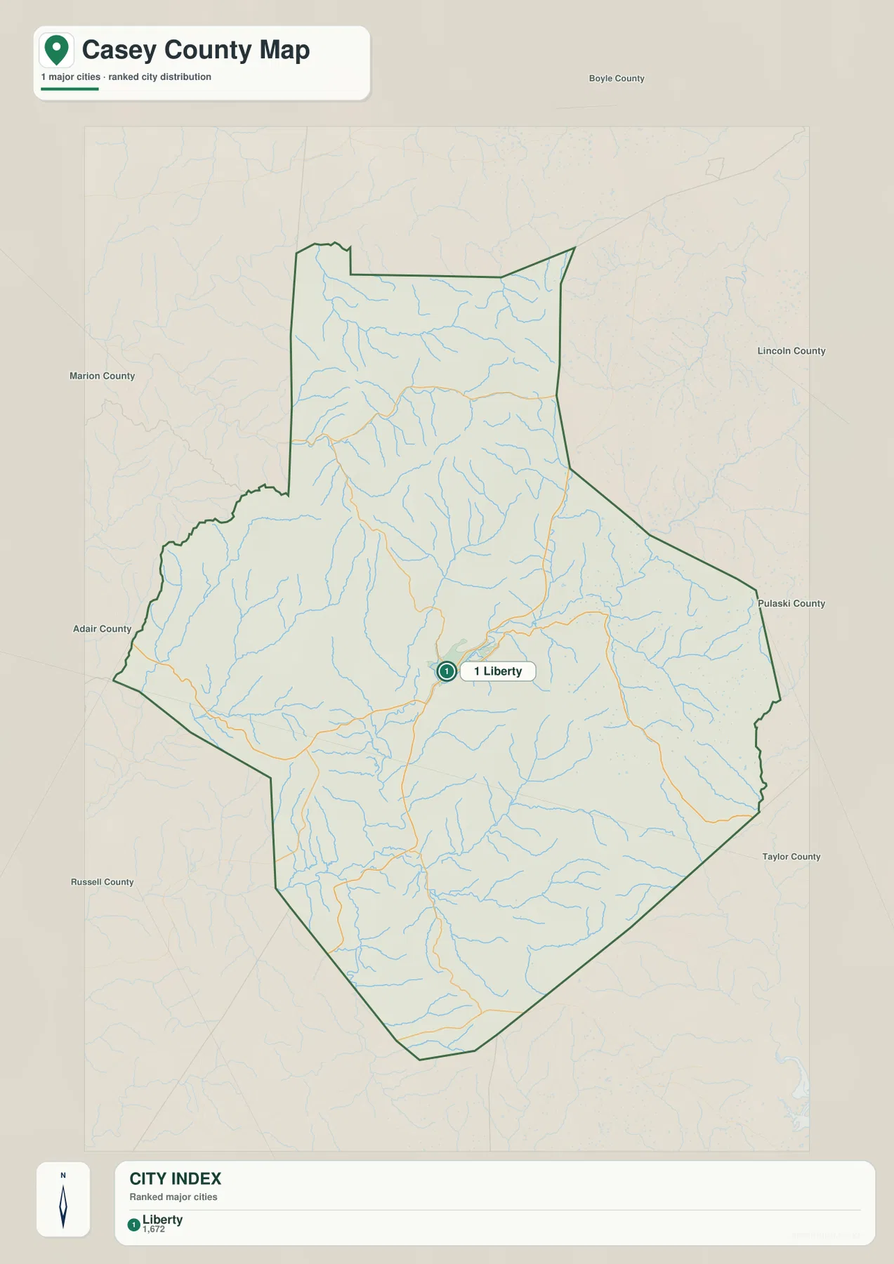
Liberty’s near-central position makes it easy to describe the rest of the county in relation to town. Butchertown lies to the north, Windsor to the south, and Bass toward the west. For more detailed travel context, the county map adds U.S. 127, KY 70, and the surrounding state routes, while the city map remains a cleaner choice for simple orientation.
This simplified view should not be treated as a complete settlement inventory or a driving map. It is a visual index that answers one basic question well: where is Liberty within Casey County? Once that reference point is established, the more detailed road, water, and elevation maps provide the rest of the geographic picture.
Green River, Lake Liberty, and a web of tributary valleys
Green River is the dominant named waterway on the map and provides a natural reference through the central and southwestern part of the county. The Kentucky Department of Fish and Wildlife Resources describes the upper Green River in this part of Kentucky, giving useful context for the river shown on the county map. Smaller streams feed into the larger drainage from many short valleys.
Casey Creek and Dry Creek are prominent on the western side, while Blowing Creek approaches the Green River corridor nearer the center. Carpenter Creek, Indian Creek, and Knob Lick Creek occupy separate valleys farther east. Additional forks and smaller tributaries appear in both the northern and southern parts of the county, reinforcing the impression of a landscape divided by many narrow hollows rather than one broad flat basin.
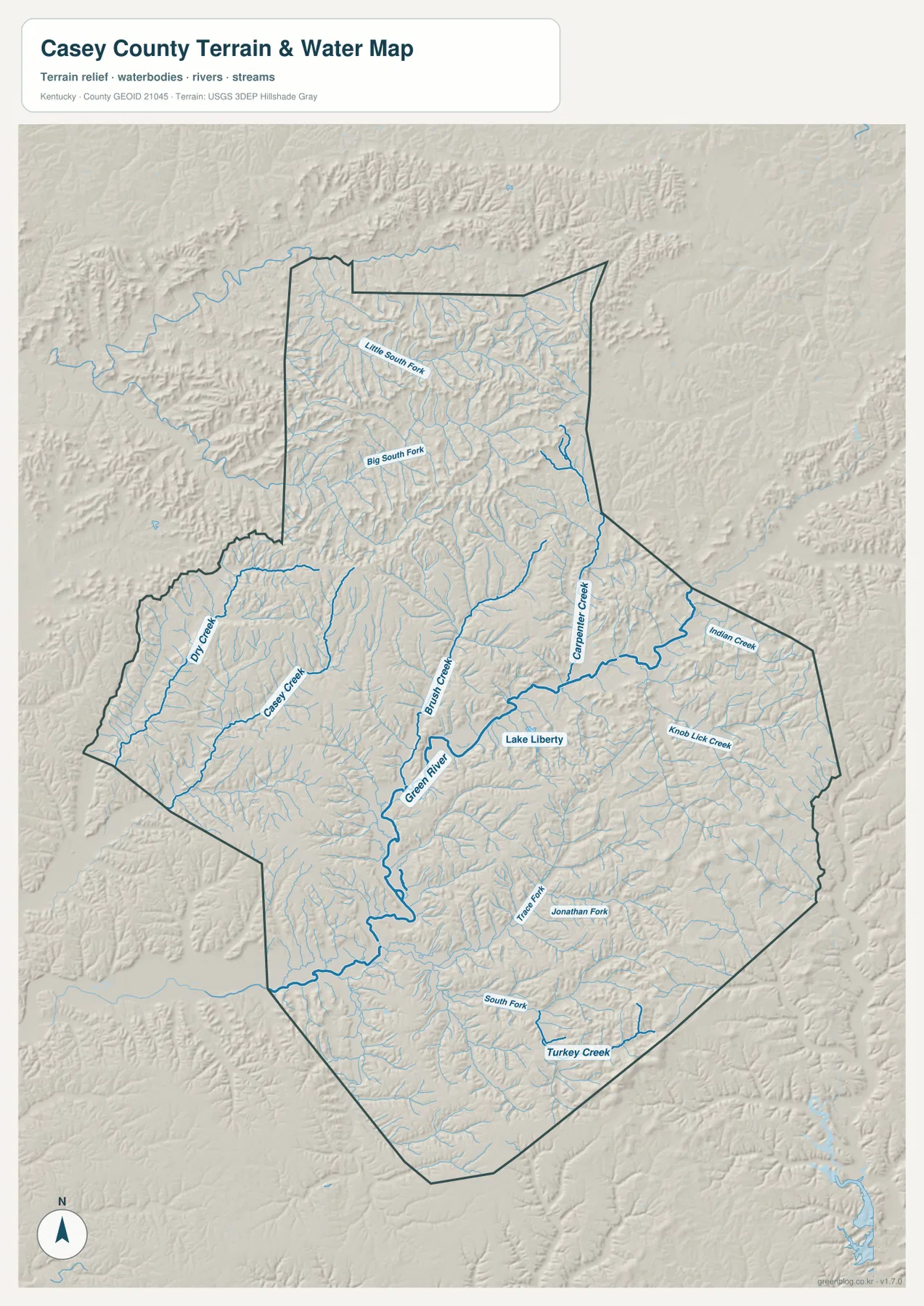
Lake Liberty appears close to Liberty and gives the central part of the county another recognizable water feature. The Liberty Tourism & Convention Commission provides local information about the lake and recreation around the city. On the countywide water map the lake is small compared with the river system, but its proximity to Liberty makes it a convenient landmark for local orientation.
The water map is a reference for the relative location of rivers, creeks, and lakes. It is not a flood map, navigation chart, current water-level report, or property-boundary product. Anyone planning fishing, paddling, or other water activity should use current state and local guidance; this map is best used to see which named streams occupy the county’s valleys.
From 217-meter valleys to 541-meter ridge tops
The elevation map ranges from about 217 to 541 meters, with a countywide mean near 311 meters. The lowest green tones follow the Green River and many tributary valleys through the center and southwest. Liberty sits close to this lower terrain, and the Casey Creek and Dry Creek corridors create additional low areas on the western side.
Higher ground becomes more common toward the north and northeast, and elevated ridges also line parts of the eastern side. Casey County is not defined by one single mountain peak. Instead, repeated ridge tops stand above a branching network of narrow valleys, creating a strong texture across the elevation map. The difference between the lower river corridors and the higher ridge country is visible even at a quick glance.
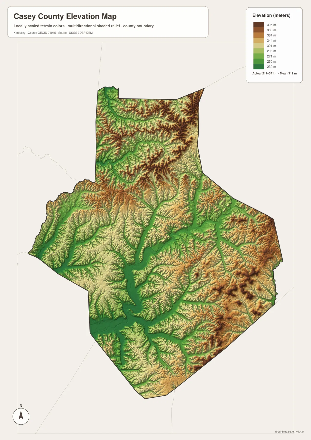
Comparing the elevation map with the road map helps explain why many minor roads bend through the countryside. U.S. 127 and KY 70 meet in a relatively low central area near Liberty, while smaller routes often follow valleys around higher ground. The water map adds another layer to that comparison because many named streams occupy the same low corridors visible on the elevation map.
This is a generalized county-scale elevation surface, not a survey product. It should not be used to determine the exact elevation of a parcel, design a road, calculate site drainage, or make construction decisions. The USGS 3D Elevation Program is the appropriate starting point for more detailed elevation data.
Choosing the right Casey County map for the task
Start with the county map when roads, boundaries, and place names need to be seen together. It is the most useful view for following U.S. 127 and KY 70 through Liberty and then tracing routes toward Butchertown, Windsor, Bass, and the county edges. The city map is better when Liberty’s position is the only point that needs to be communicated.
Use the water map when the subject is Green River, Lake Liberty, or named creeks such as Casey Creek and Carpenter Creek. Add the elevation map when the discussion shifts to valleys and ridges. The strongest terrain contrast is between lower central and southwestern corridors and higher ground in the north and east, so pairing the water and elevation views is especially helpful for explaining how streams fit the landscape.
For classroom work, printed reference sheets, or broad trip planning, two maps often communicate more clearly than one overloaded map. A road view can establish location, while a water or elevation view provides the natural setting. These county maps should not replace live navigation, legal boundary records, flood information, or engineering-grade datasets when those details matter.
Frequently Asked Questions
Which map is best for locating Liberty and the main highways?
Use the county map. It places Liberty at the meeting point of U.S. 127 and KY 70 and also shows KY 49, KY 78, KY 206, KY 80, and KY 910. If you only need Liberty’s position within the county, the city map provides a cleaner, simpler view.
Where should I look for Green River, Lake Liberty, and the named creeks?
The water map is the best choice. It shows Green River, Lake Liberty, Casey Creek, Dry Creek, Blowing Creek, Carpenter Creek, Indian Creek, Knob Lick Creek, and other tributaries. Pair it with the county map when you also need nearby roads and community names.
What is the main feature of the 217–541 m elevation map?
The clearest contrast is between the lower Green River and tributary valleys in the center and southwest and the higher ridge country in the north and east. The countywide mean is about 311 meters. The surface is for regional comparison rather than parcel-level surveying or engineering.
Map File Information
The original Casey County maps used on this page are bundled as high-resolution JPG files. They are larger than the WebP previews and are suitable for printing, enlargement, and offline reference.
- Included Files: county map, city map, water map, elevation map
- File Type: JPG
Related Maps
Sources and References
Administrative context for Liberty and Casey County is available from Kentucky.gov local information. The upper Green River is described by the Kentucky Department of Fish and Wildlife Resources, while Lake Liberty and local visitor information are available from the Liberty Tourism & Convention Commission. Boundary reference data come from U.S. Census Bureau TIGER/Line, waterways from USGS National Hydrography, and elevation from the USGS 3D Elevation Program.
Green Map creates custom-edited map images using open geographic data sources such as geoBoundaries, Natural Earth, OpenStreetMap, and government open data. These maps are edited visual materials, not raw data files, and are provided for education, documents, presentations, and graphic reference.