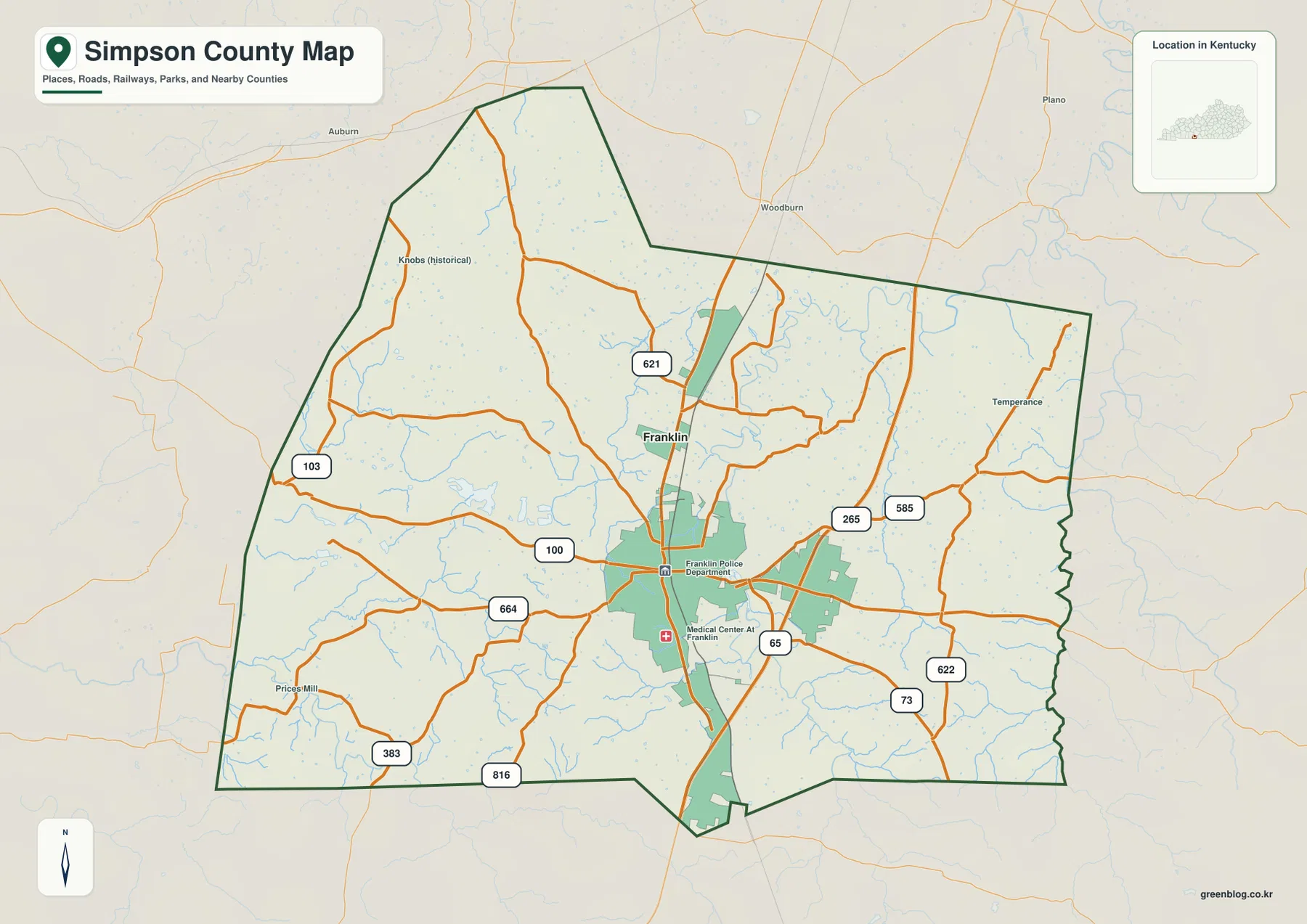
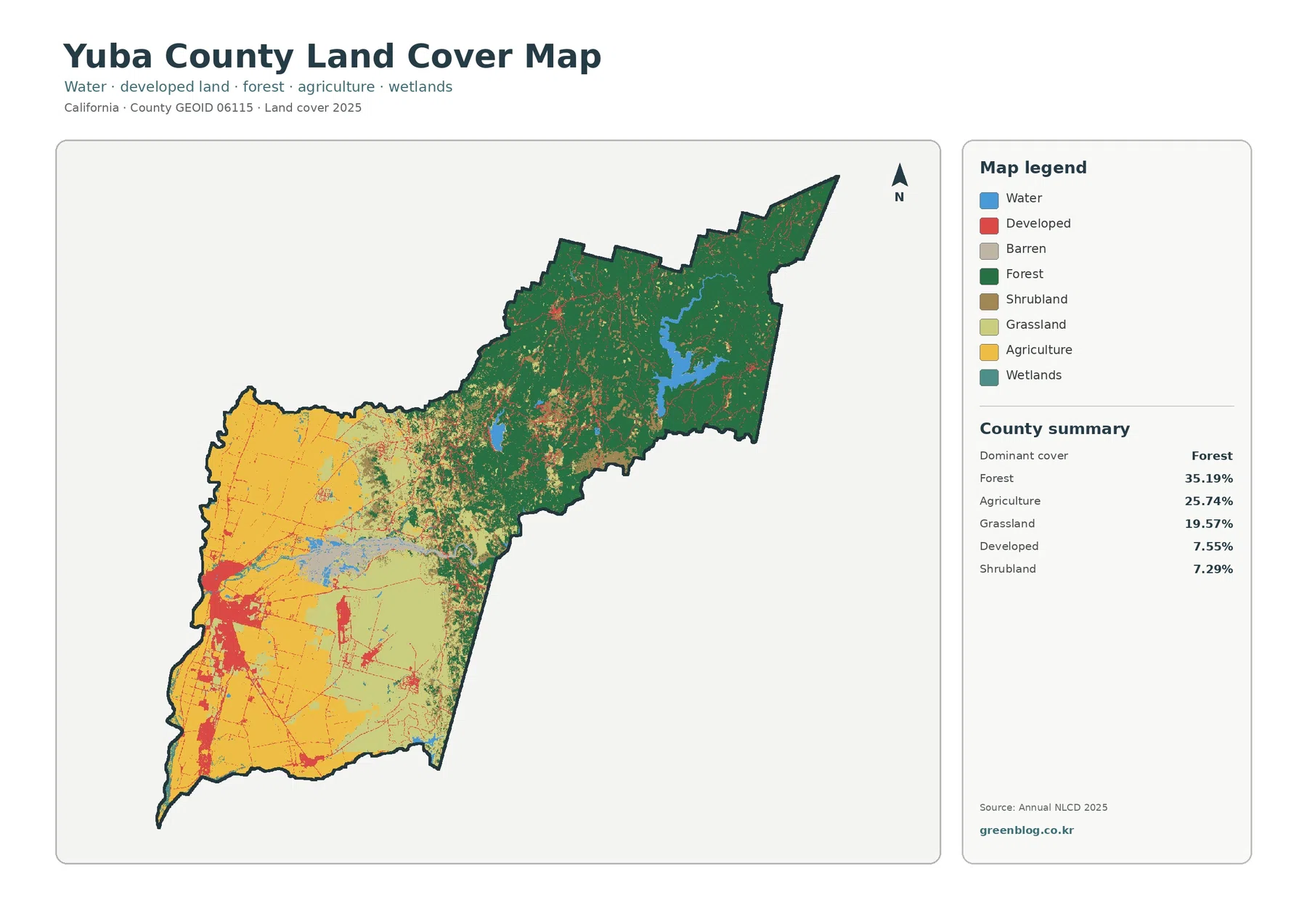
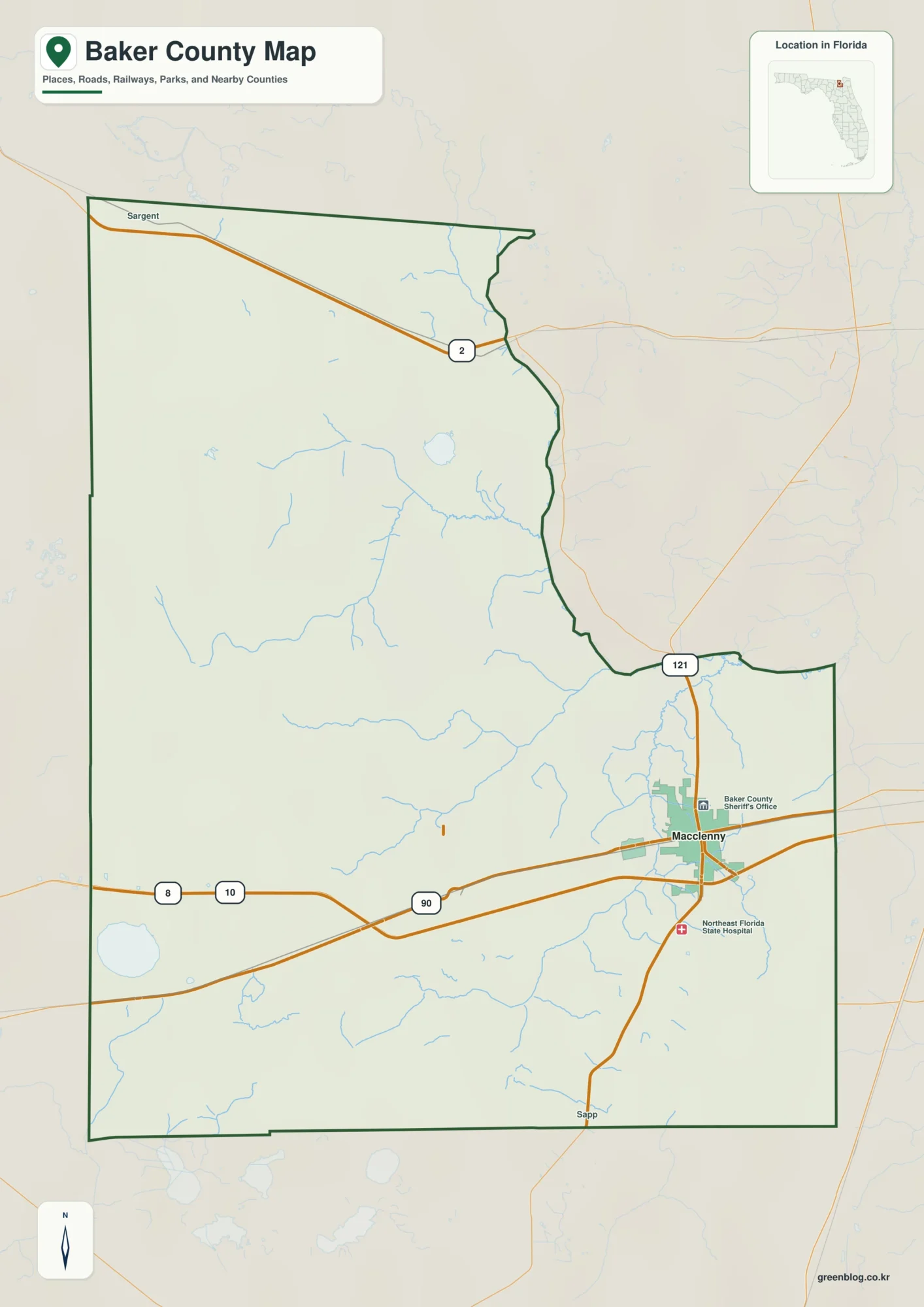
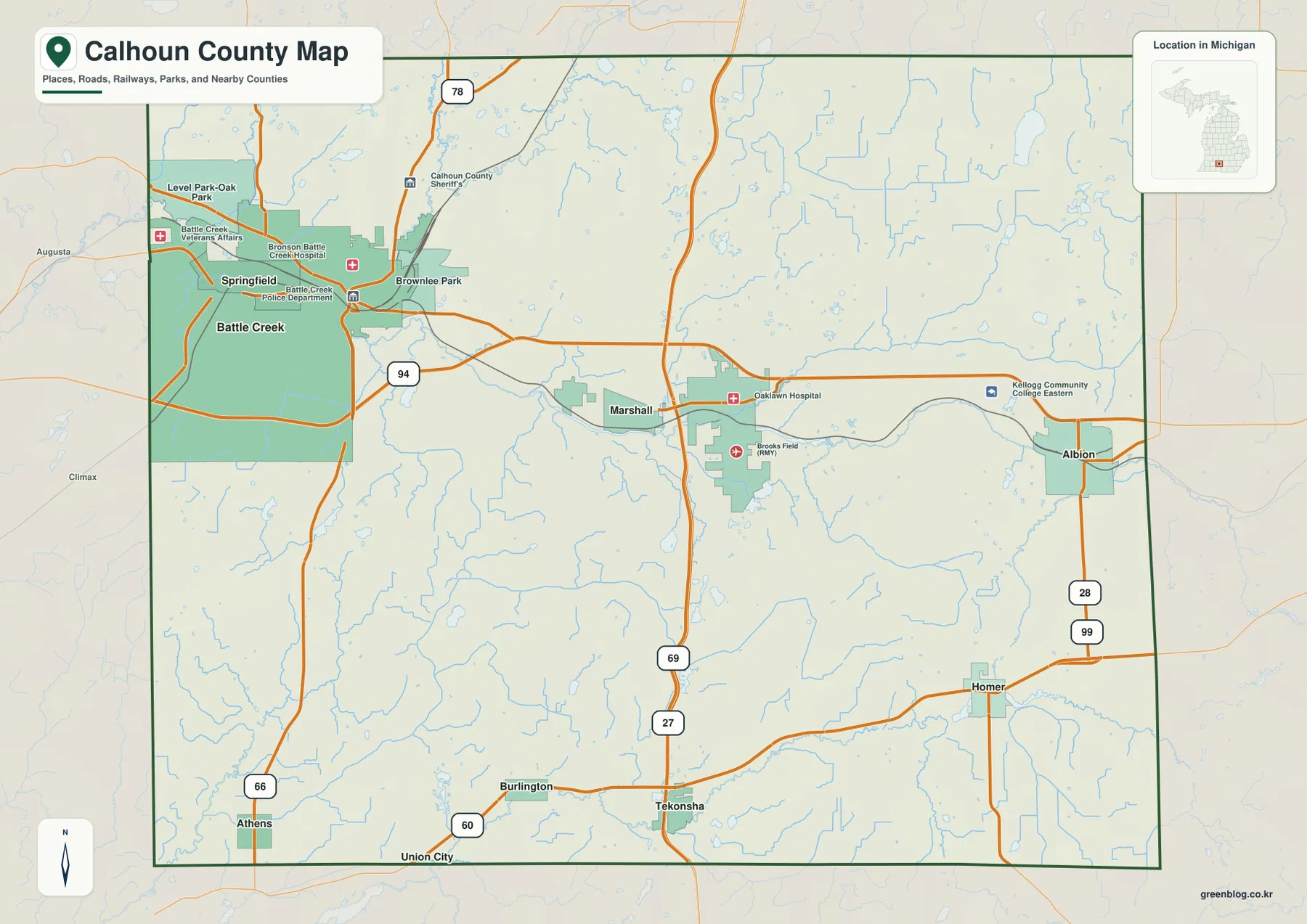
Choctaw County sits in central Mississippi with Ackerman as the main named hub on the supplied maps, while Weir and French Camp provide useful reference points toward the southwest and west. The road map gives the quickest overview, but the water and elevation views reveal a much more textured county: branching creeks cross the interior, the Yockanookany River becomes a major southern reference, and ridges rise well above the lower valleys. This page uses the four supplied maps to explain those relationships without treating any one image as a complete substitute for the others.
The page uses lightweight WEBP previews for viewing, and the map file box below provides a ZIP with the matching high-resolution JPG originals for download. Use the general map for towns and roads, the connector map for the straight-line spacing from Ackerman, the terrain-and-water map for rivers and tributaries, and the elevation map for the roughly 81–223 meter range. Choosing the file by the question you need to answer is more useful than trying to read every detail from one crowded image.
Table of Contents
Ackerman, Weir, and French Camp give the county an easy set of reference points
Ackerman is the strongest named center on the general county map. It lies slightly east of the county’s middle, with Mississippi 12 and 15 serving as important route references in the supplied county material. Weir appears southwest of Ackerman near Route 12, while French Camp sits farther west near the county edge and is associated on the map with Routes 407 and 413. Looking at those three places together makes the county’s layout easier to understand than focusing on the irregular boundary alone.
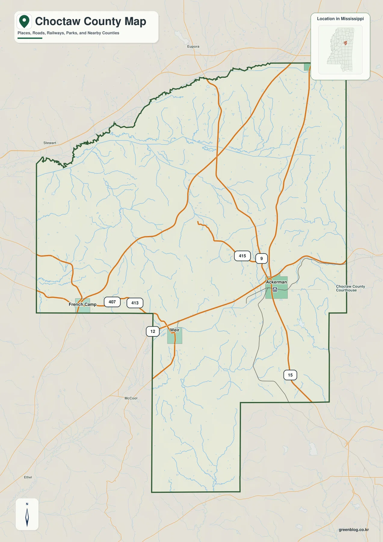
North of Ackerman, Route 415 is labeled before the road network spreads toward the upper part of the county. Route 9 continues through the eastern half, and another major north-south road is visible near the eastern edge. Around Weir, Route 12 provides a clear east-west reference, while French Camp helps define the western side of the county. Small outside labels such as Eupora, Stewart, McCool, and Ethel are also visible beyond the boundary, which helps place Choctaw County in relation to surrounding communities without turning the map into a statewide road atlas.
This is an orientation map rather than an address-level navigation product. It does not attempt to show every local road, forest track, driveway, or building. Its value is in showing where the named communities sit, how the selected highways cross the county, and how the unusual outline extends south of the main body. Once that broad layout is clear, the other maps make much more sense.
Population, area, and elevation put the map at a useful scale
The existing county material includes population and Gazetteer area values, while the supplied elevation image adds a countywide relief range. They are useful together as background, but they come from different reference dates and products. The census count, later population estimate, Gazetteer area, and generalized elevation surface should therefore be read as separate measurements rather than one synchronized dataset.
| Item | Value shown in the supplied material | How to use it |
|---|---|---|
| FIPS | 28019 | Identifier for Choctaw County, Mississippi |
| 2020 census population | 8,246 | Official decennial population count |
| July 2025 population estimate | 8,048 | Later estimate with a different reference date |
| 2025 Gazetteer area | 418.197 sq mi land · 1.658 sq mi water | Land and water area reference |
| Elevation map | about 81–223 m · mean 143 m | Generalized county-scale relief reference |
The earlier county material also gives a 2020 land-area density of about 19.7 residents per square mile. That is a countywide average, not a description of how people are evenly spread from Ackerman to the rural edges. The wide gaps between labeled communities on the general map are a better visual reminder that settlement is concentrated in particular places while large areas remain lightly populated.
The connector map places Weir 8 miles and French Camp 13 miles from Ackerman
The city-connections map simplifies the county by using Ackerman as the hub. It shows Weir at 8 miles and French Camp at 13 miles from Ackerman. Those numbers are straight-line distances between the mapped points, not driving distances along the road network. They are therefore useful for comparing relative spacing and direction, but they should not be used to estimate travel time or the exact mileage of a trip.
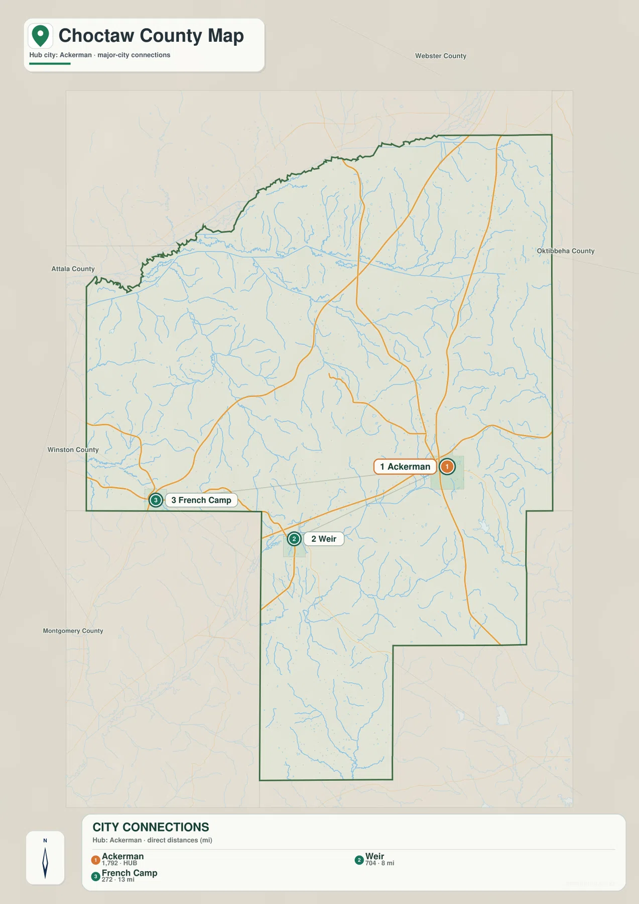
The same image labels several neighboring counties around the boundary. Webster County is to the north, Oktibbeha County is to the east, and Attala, Winston, and Montgomery counties appear along the western and southwestern sides. This surrounding context is especially helpful because Ackerman sits in the eastern half of the county, Weir is farther southwest, and French Camp is close to the western edge. The three points are not clustered around one small urban center.
The numbered markers are simply part of the connector-map design. They do not rank the communities by legal status, importance, or population. The general map remains the better source for road context, while the connector map is intentionally stripped down so that the spacing between the hub and the other named places is easy to compare.
Yockanookany River and Noxubee River anchor a dense network of smaller streams
The terrain-and-water map shifts attention away from highways and toward drainage. The Yockanookany River is a major labeled feature in the south-central part of the county, while the Noxubee River appears along the eastern side. In the northern and central areas, labels such as Big Bywy Ditch, Bywy Creek, Middle Bywy Creek, Little Bywy Creek, and Farmington Branch show how many smaller channels feed the larger drainage network. Tibby Creek is another prominent southern label.
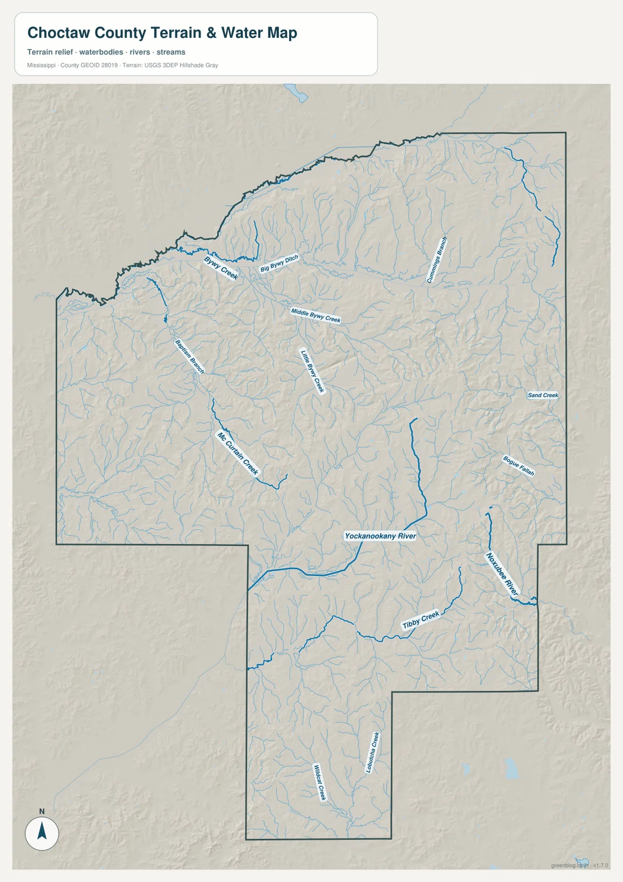
Many of the smaller streams begin as short branches on the higher ground and then merge into longer channels. McCurtain Creek is visible in the western interior, and the Bywy-named channels spread across the northern half. In the south, tributaries converge toward the Yockanookany River, while the eastern side contains a separate set of channels associated with the Noxubee River. The map makes clear that the county is cut by many narrow valleys rather than dominated by one single river corridor.
This image is a geographic reference, not a flood-risk or navigation map. It does not show regulatory flood zones, expected flood depth, parcel ownership, safe boating routes, or legal water boundaries. For those questions, the appropriate agency product is required. Here the useful task is to see how named rivers, creeks, and branches are distributed across the county and how they relate to the terrain.
Relief ranges from about 81 to 223 meters, with higher hills concentrated through the middle and east
The elevation map reports an actual range of about 81 to 223 meters and a mean elevation of 143 meters. The county does not rise smoothly from one edge to another. Instead, tan and brown ridges are concentrated through much of the central and eastern interior, while green lower corridors weave between them. Parts of the north are noticeably lower, and the southern extension contains another mix of ridges and valleys rather than a flat continuation of the main county body.
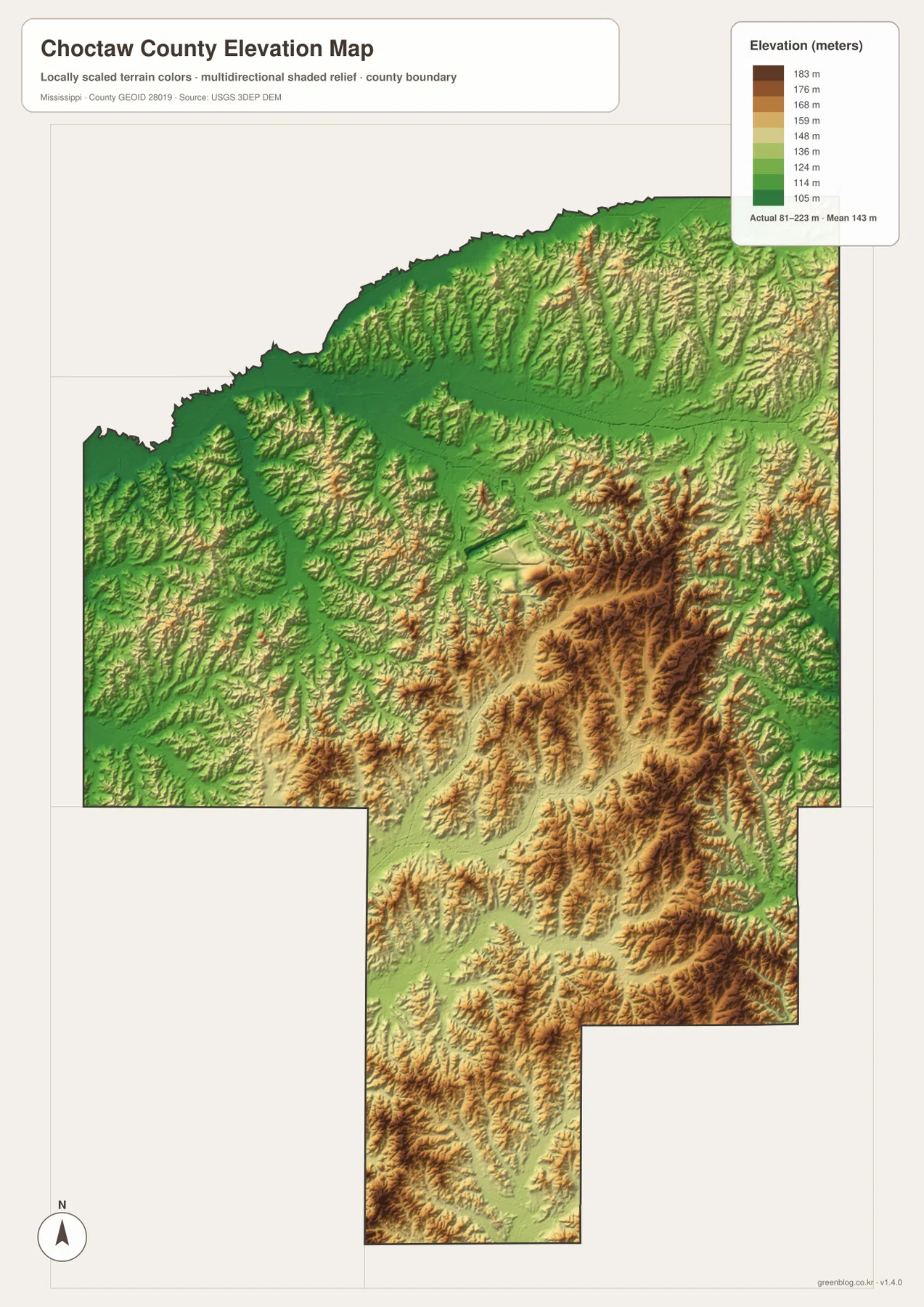
The elevation image becomes more informative when compared with the water map. Long lower corridors frequently occur where streams occupy valleys, while higher ridges remain between drainage lines. The strongest brown relief is not confined to one isolated hill; it forms branching uplands through the central and eastern sections. The broad green areas toward the north and some western portions create a clear contrast with those higher ridges.
The color scale is designed to make differences inside Choctaw County visible. A similar color on a different county map does not necessarily represent the same elevation if that map uses another local scale. The surface is also generalized for county-level viewing and should not be treated as survey-grade elevation. Construction, engineering, drainage design, and other site-specific work require the original elevation data or a proper survey.
Roads explain where the towns connect; water and relief explain why the landscape looks broken up
Ackerman is a useful example of how the map views change the story. On the general map, it is the primary road and administrative reference. On the connector map, it becomes the hub used to measure straight-line distance to Weir and French Camp. On the terrain-and-water image, the town label is less important than the surrounding creek network, and on the elevation map the nearby ridges and lower valleys become the dominant features.
Weir and French Camp change in the same way. Their road positions and county-edge context are clearest on the general map; their relative spacing from Ackerman is clearest on the connector map. The natural-landscape views then show that those communities sit within a county carved by many tributaries and varied relief. A classroom handout, local-history illustration, or presentation will be easier to read if the chosen image matches the subject rather than trying to force roads, water, and elevation into one graphic.
Choose the map by whether you need location, spacing, water, or elevation
Use the general county map when Ackerman, Weir, French Camp, selected roads, and the county boundary are the main subject. Use the connector map when the key point is the 8-mile and 13-mile straight-line spacing from Ackerman. The terrain-and-water map is better for the Yockanookany River, Noxubee River, creeks, and valleys, while the elevation image is the clearest choice for the 81–223 meter range and the pattern of higher ridges separated by lower corridors.
- Town and road orientation: compare Ackerman, Weir, French Camp, and selected routes inside the county boundary.
- Relative spacing: show Weir at 8 mi and French Camp at 13 mi from the Ackerman hub using straight-line distance.
- Drainage: locate the Yockanookany River, Noxubee River, Bywy-named channels, Tibby Creek, and other tributaries.
- Terrain: explain the roughly 81–223 m range, higher central and eastern ridges, and lower valleys.
Three details to keep in mind when reading the maps
First, the connector distances are straight-line measurements, so actual road mileage will be longer or simply different depending on the route. Second, the water map is not a regulatory flood product; it is meant to show the location and organization of rivers and tributaries. Third, the elevation image is generalized and locally scaled, which makes the county’s ridges and valleys easy to compare but does not provide survey precision.
It is also worth keeping the whole county in view. A close crop around Ackerman can hide how far French Camp sits toward the western edge and how Weir occupies the southwestern side. A road-only view can also hide the strong relationship between the branching stream network and the relief. Starting with the county overview and then moving to the specialized map usually gives the clearest reading sequence.
Frequently Asked Questions
Are the 8-mile and 13-mile distances from Ackerman driving distances?
No. The connector map uses straight-line distance. It shows Weir 8 miles from Ackerman and French Camp 13 miles from Ackerman. Driving distance and travel time depend on the available roads and will not necessarily match those values.
Which water features stand out most on the Choctaw County terrain-and-water map?
The Yockanookany River in the south-central area and the Noxubee River along the eastern side are major references. The map also labels Big Bywy Ditch, several Bywy Creek branches, Tibby Creek, McCurtain Creek, and many smaller tributaries, so the drainage network is much denser than a two-river description would suggest.
What elevation range is shown for Choctaw County?
The supplied elevation map reports an actual range of about 81 to 223 meters and a mean of 143 meters. Higher relief is concentrated through much of the central and eastern interior, with lower green valleys and broader low areas in parts of the north and west. The map is a county-scale reference rather than a survey product.
Map File Information
The download ZIP contains the four high-resolution JPG originals that match the map topics shown on this page. Use the original files when you need a sharper image for print, documents, presentations, or classroom material.
- Included Files: 4 high-resolution JPG map files shown in this article
- File Type: JPG files in a ZIP archive
- Intended Use: Printing, education, presentations, and map-based projects
Related Maps
Sources and References
- U.S. Census Bureau QuickFacts for Choctaw County – population reference
- U.S. Census Bureau Gazetteer Files – land and water area reference
- USGS National Hydrography – water-feature reference
- USGS 3D Elevation Program – elevation reference
- Mississippi Department of Transportation official highway map – road reference
Green Map creates custom-edited map images using open geographic data sources such as geoBoundaries, Natural Earth, OpenStreetMap, and government open data. These maps are edited visual materials, not raw data files, and are provided for education, documents, presentations, and graphic reference.