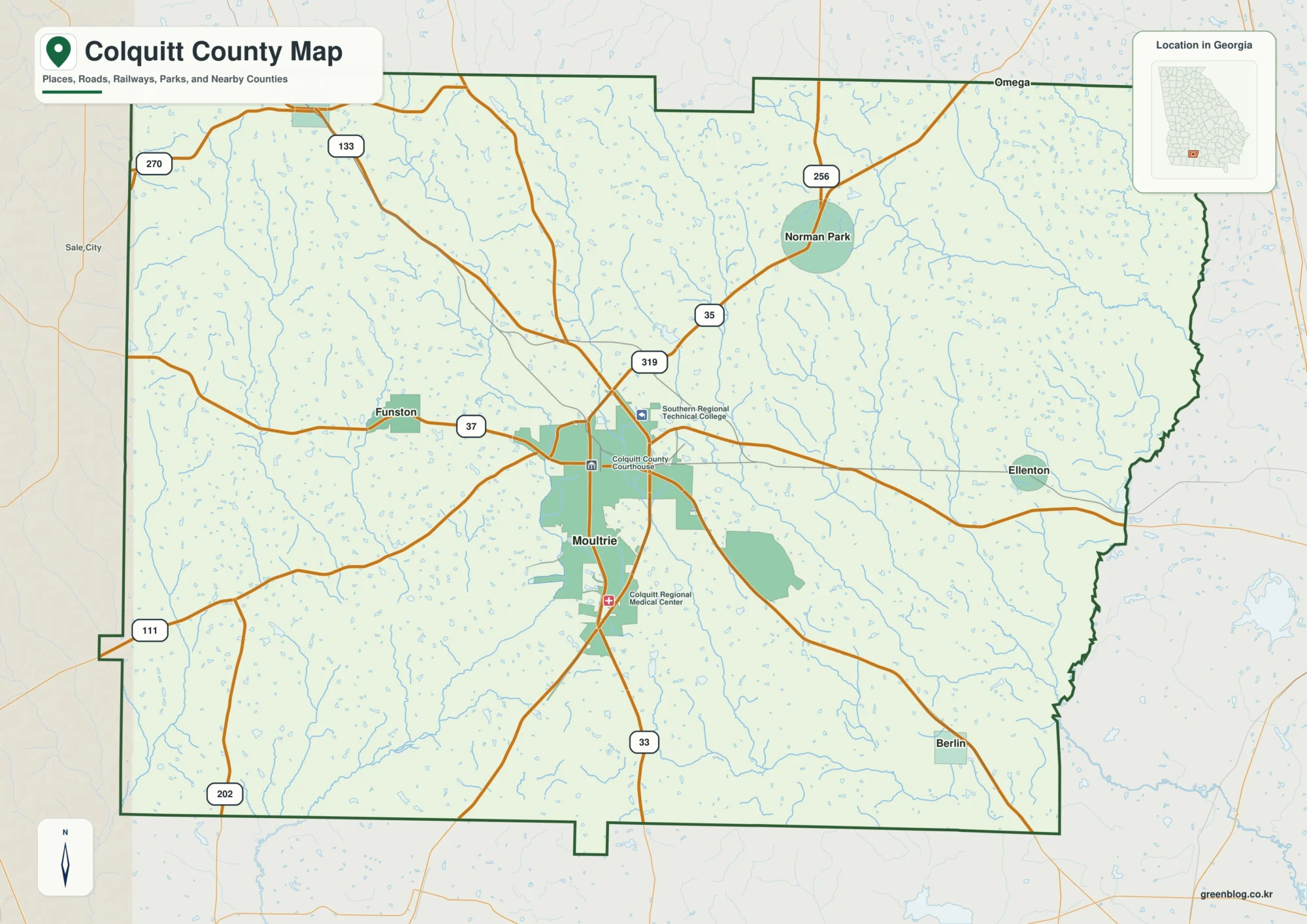
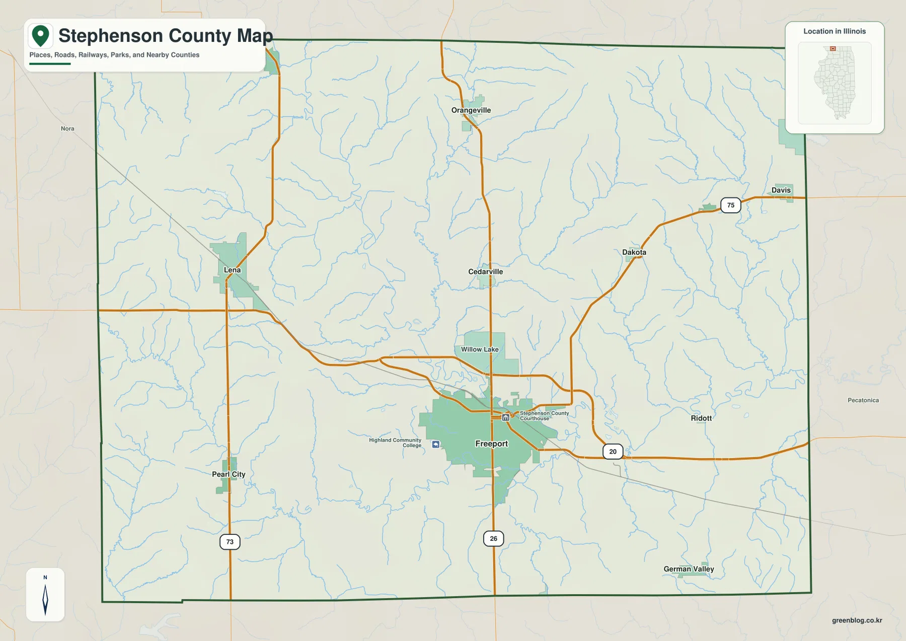
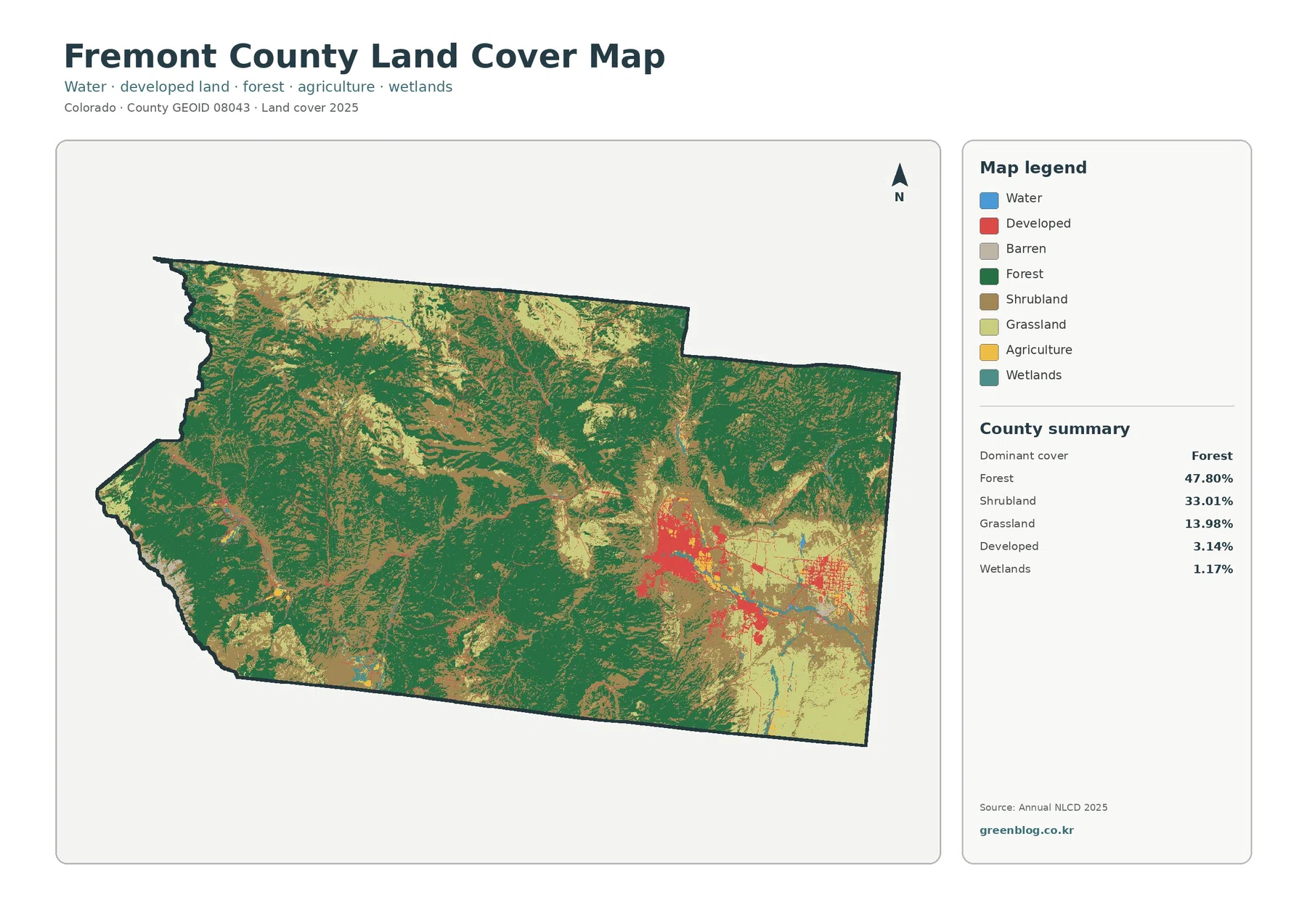
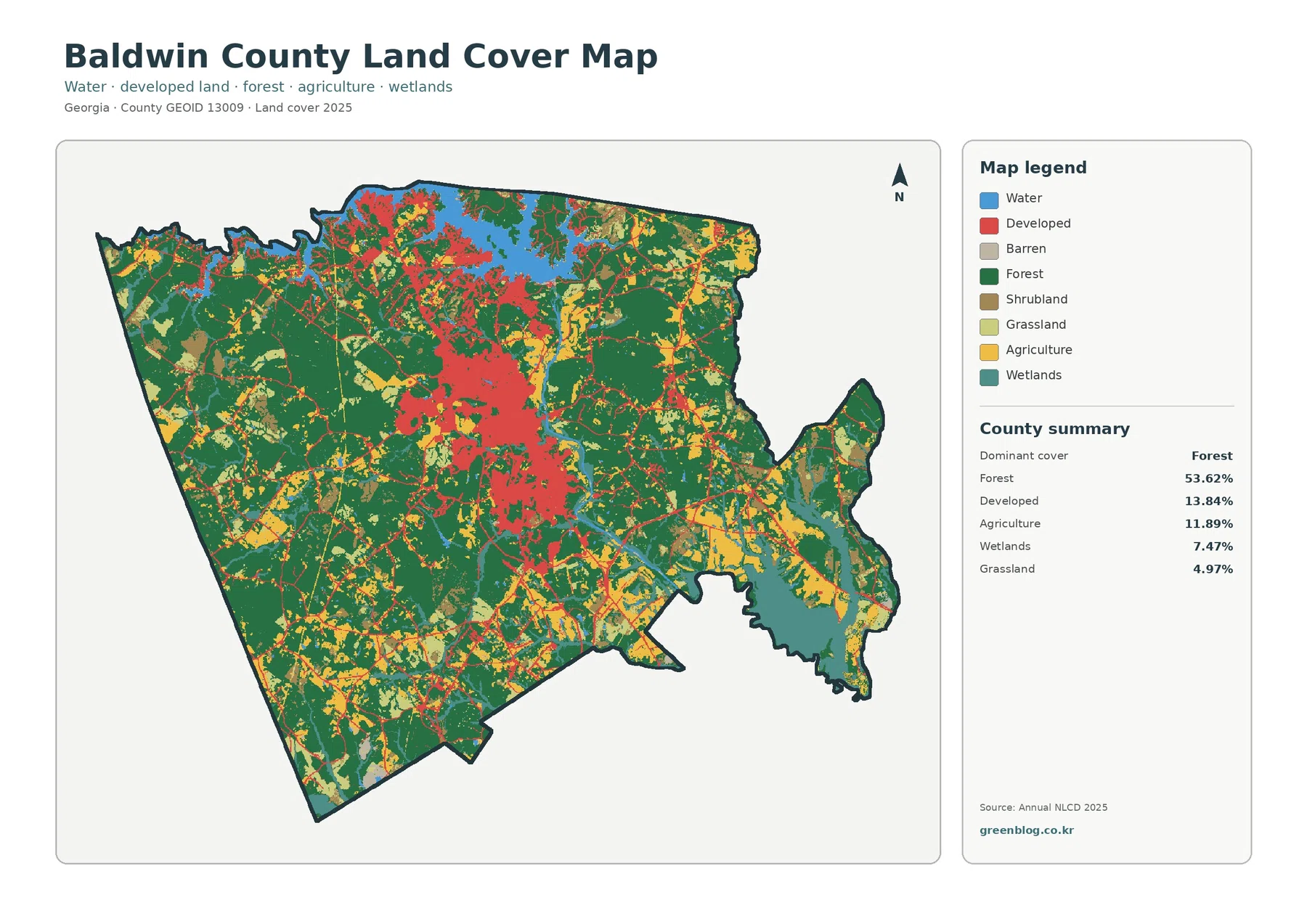
Calhoun County is easier to understand as a network of small towns than as a county built around one dominant center. You can download the four matching high-resolution JPG maps from this Calhoun County Mississippi Map page in one ZIP file, while the on-page previews show Bruce, Pittsboro, Calhoun City, Derma, Vardaman, major highways, waterways, and hill-country relief. Bruce sits in the northern half, Pittsboro marks county government farther south, and Vardaman stands apart toward the east.
The road map and city map are the quickest choices when the goal is orientation, but they do not tell the whole story. A dense web of tributaries crosses the county, with the Skuna River system prominent in the north and east and the Yalobusha system farther south. The elevation map then explains why those waterways occupy long low corridors between rougher hills. Moving from one map to the next gives a much more useful picture than simply treating Calhoun County as a boundary on a state map.
Table of Contents
A quick reference before reading the maps
| Item | Reference shown in the supplied material |
|---|---|
| County seat | Pittsboro |
| Mapped communities | Calhoun City, Bruce, Vardaman, Derma, Pittsboro, Big Creek, and Slate Springs |
| Main numbered roads | MS 8, MS 9, MS 32, MS 330, MS 331, MS 341, and MS 157 |
| Named waterways | Skuna River, Yalobusha River, Yalobusha River Canal, Old River Run, plus numerous tributaries |
| Elevation shown | About 65–187 meters, with a mean near 100 meters |
| 2020 Census population | 13,266 |
| July 2025 population estimate | 12,643 |
| 2025 Gazetteer area | 586.573 square miles of land and 1.386 square miles of water |
Those countywide numbers are useful for scale, but they should not be mistaken for a picture of where people actually live. The city index on the supplied map lists Calhoun City at 1,745, Bruce at 1,483, Vardaman at 1,100, Derma at 963, Pittsboro at 300, and Big Creek at 124. Pittsboro therefore matters because it is the county seat, not because it is the largest population center. That distinction is especially helpful for readers who expect the courthouse town to be the county’s biggest community.
The road network links several separate town centers
The general county map gives the clearest first look at how these communities connect. MS 9 runs through the central part of the county, passing Bruce and continuing south by Pittsboro toward the Calhoun City area. MS 32 enters from the west in the north, MS 330 reaches toward Bruce from the west, and MS 331 serves the northern and northeastern side. Farther south, MS 8 provides an important east-west reference, while MS 341 runs by Vardaman on the eastern side. MS 157 appears in the eastern part of the county as another useful locator.
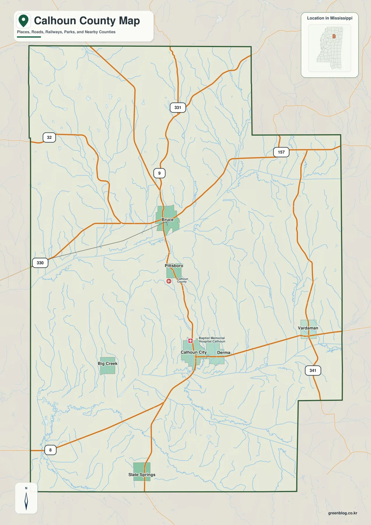
This arrangement matters because no single highway serves every community in the same way. Bruce is a northern road focus, Calhoun City and Derma lie farther south along a different set of connections, and Vardaman is offset to the east. Big Creek and Slate Springs are more peripheral on the supplied map. For a classroom locator, a county overview, or a presentation that needs to explain how the towns sit relative to one another, this is the most useful map to start with. It is not intended to replace a turn-by-turn road map, but it provides enough detail to establish direction before consulting a navigation service or a larger highway sheet.
Pittsboro is the seat, while Calhoun City and Bruce form larger population centers
The city map shifts attention away from road numbers and toward settlement distribution. Its ranked labels make the difference between administrative importance and population size immediately visible. Calhoun City is ranked first on the map and Bruce second, while Vardaman and Derma follow. Pittsboro appears fifth even though it is the county seat. Big Creek, farther to the west, is sixth. The pattern is useful because a reader can see several distinct local centers instead of assuming that services, homes, and activity are concentrated around the courthouse.
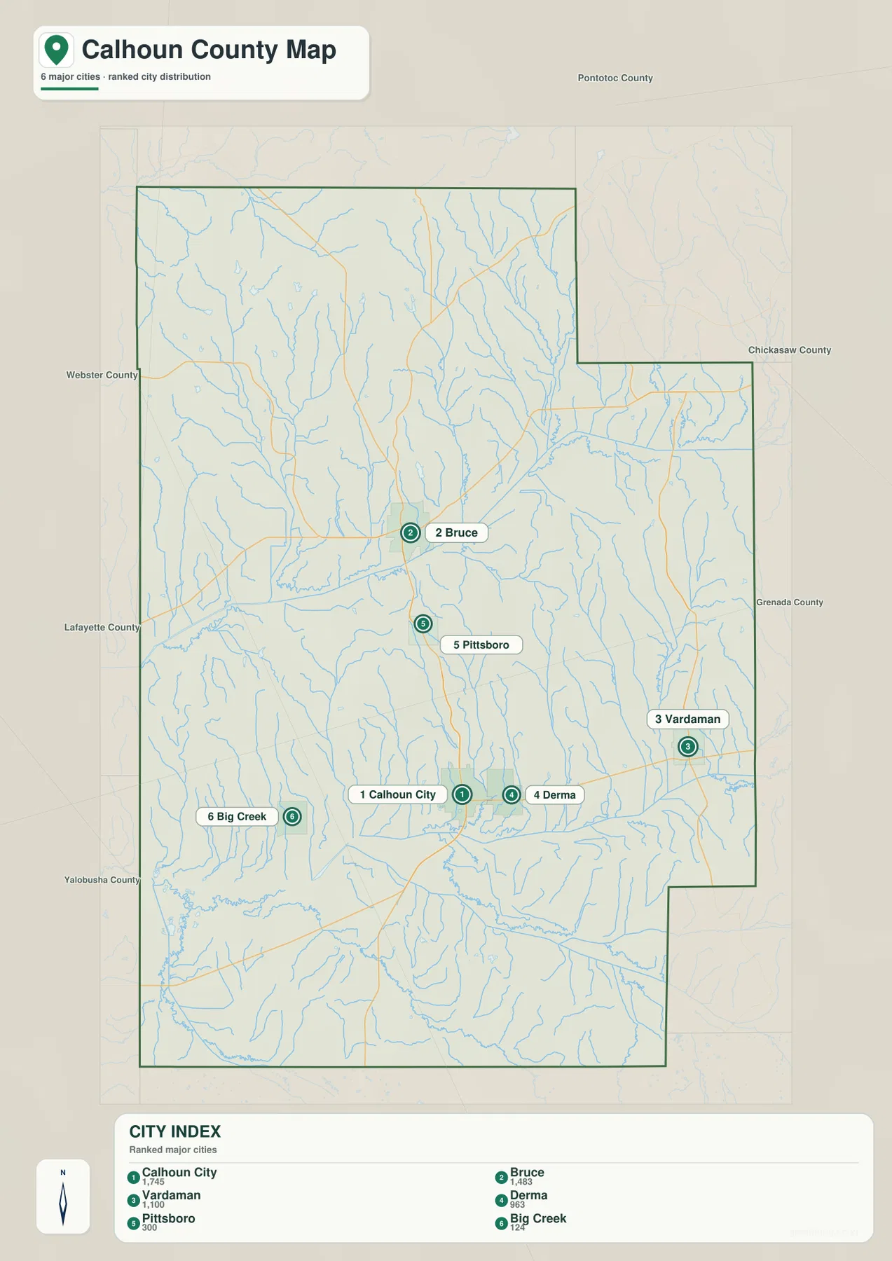
The geometry of the settlements is also worth noticing. Bruce, Pittsboro, and Calhoun City are broadly aligned through the middle of the county, though they are separated by rural land and stream valleys. Derma sits close to Calhoun City, while Vardaman is distinctly farther east. That makes Vardaman an important reference when explaining the eastern side of the county rather than treating every place as part of one north-south strip. The current county material also identifies Vardaman with sweet-potato production and distribution, so its location gives geographic context to a local agricultural name that readers may encounter elsewhere.
Skuna River in the north, Yalobusha waters in the south
The terrain-and-water map reveals a feature that is easy to overlook on the road map: small streams are everywhere. The Skuna River and Old River Run are labeled in the northeastern part of the county, while the Yalobusha River and Yalobusha River Canal stand out farther south. Between them, many unnamed tributaries descend through the hills and feed broader low areas. The result is a county whose local geography is strongly tied to narrow valleys even though there is no single huge lake dominating the map.
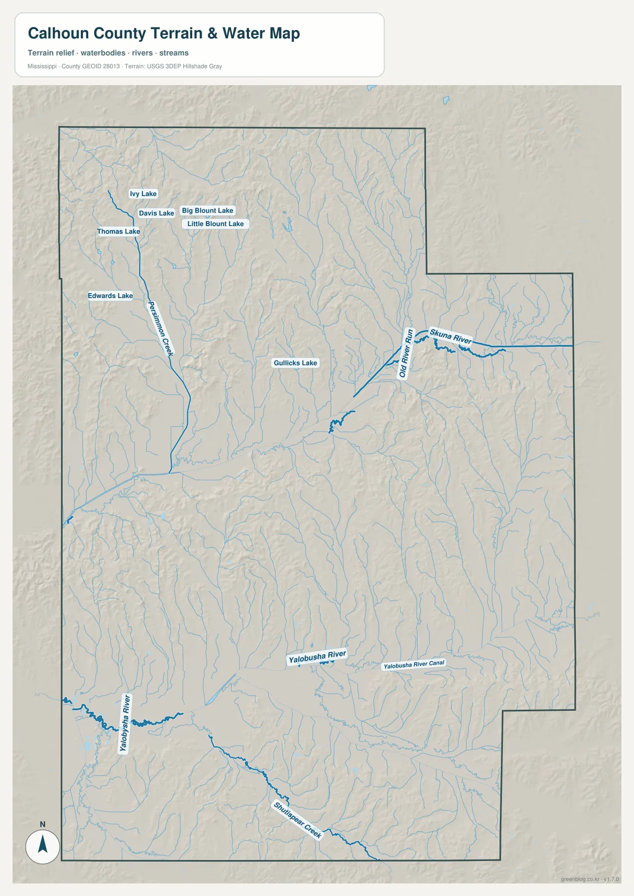
A cluster of named lakes appears in the northwestern part of the map, including Ivy Lake, Davis Lake, Big Blount Lake, Little Blount Lake, Thomas Lake, and Edwards Lake. Gullicks Lake is labeled nearer the center. These labels make the water map useful when a general county image does not provide enough room for smaller water features. The map should be used as a geographic reference rather than a flood-hazard, property-boundary, or navigation product; it shows where water features lie in relation to the surrounding terrain, not the legal or engineering conditions at a particular site.
The river labels also help connect the northern and southern halves of the county. Instead of describing Calhoun County only through town names, the water map shows that communities and roads occupy land cut by many valleys. A road that looks nearly straight on a simplified county map may cross or follow low ground that becomes much more apparent here. This is why the water and elevation maps are most informative when viewed together.
Hill country rises around broad lower corridors
The elevation map lists an actual range of roughly 65 to 187 meters and a mean near 100 meters. Brown and tan ridges are especially noticeable across the northern part of the county and in several eastern and southeastern hill areas. Green lower ground forms wider corridors through the middle and south. The contrast is strong enough to show that Calhoun County is not simply a flat agricultural surface; rolling and dissected hills occupy substantial parts of the county, while stream valleys create lower passages between them.
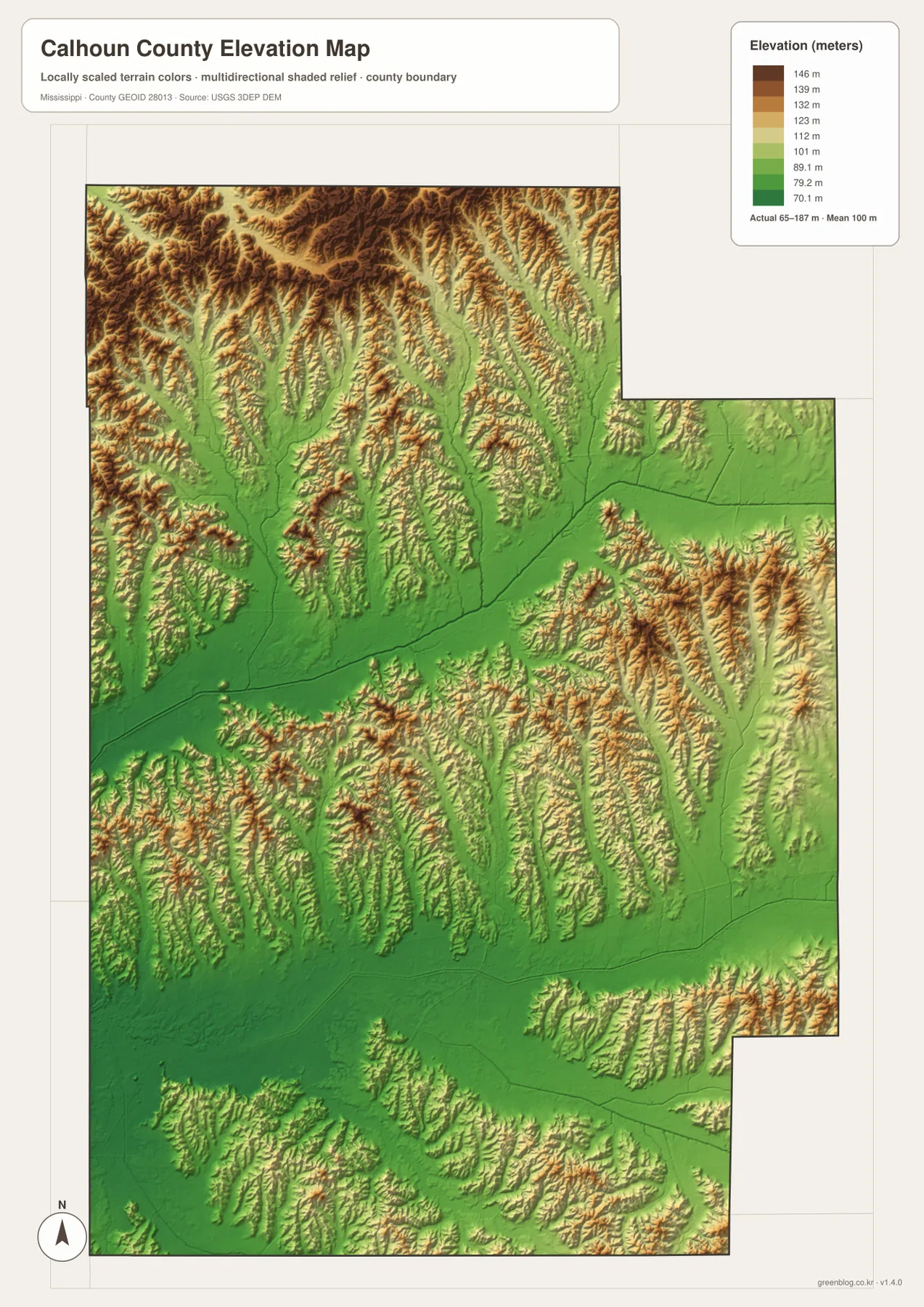
Once the relief is visible, the water map becomes easier to interpret. The branching tributaries occupy the lower cuts between ridges, and the larger river corridors coincide with broader low areas. The same relationship explains why a county that looks simple in outline can contain many locally different landscapes. For regional comparison, education, or general planning context, this shaded relief is very useful. It should not be treated as survey-grade elevation for construction, drainage design, or a parcel-level height determination.
Which Calhoun County map is best for the task?
Choose the general county map when the main question is where a town, road, or boundary lies. It is the best single-page overview for Bruce, Pittsboro, Calhoun City, Derma, Vardaman, and the numbered highways. Choose the city map when population ranking and the separation of local centers matter more than road detail. It is particularly useful for explaining why Pittsboro can be the county seat while Calhoun City and Bruce appear as larger settlements on the map.
The water map is the stronger choice for the Skuna River, Yalobusha River, tributaries, and named lakes. The elevation map is better when the question is why those waterways occupy certain corridors or where the rougher hills stand relative to the lower valleys. For a presentation about the county’s physical setting, using the water and elevation maps side by side makes that relationship much clearer than either one alone.
The in-page images are WEBP previews intended for convenient viewing. The downloadable archive contains the matching four high-resolution JPG files—general county, city distribution, terrain and water, and elevation—in a format better suited to printing, cropping, or placement in a larger document. The files use an A3-oriented layout, so starting from the JPG originals is preferable when image quality matters.
Frequently Asked Questions
Why is Pittsboro important if Calhoun City and Bruce are larger on the city map?
Pittsboro is the county seat, so it identifies the administrative center of Calhoun County. The ranked city map serves a different purpose: it shows that larger population centers are found elsewhere. Reading both pieces of information together prevents the common assumption that the courthouse town must also be the county’s largest community.
Which map should I use to locate the Skuna and Yalobusha river systems?
Use the terrain-and-water map. It labels the Skuna River and Old River Run in the northeastern part of the county and the Yalobusha River and Yalobusha River Canal farther south, while also showing many tributaries and several named lakes that are less prominent on the general map.
Does the elevation map show that Calhoun County is mostly flat?
No. The supplied elevation map spans about 65 to 187 meters and shows extensive ridged terrain, especially in the north and parts of the east and south. Lower green corridors follow broader valleys. The map is appropriate for county-scale terrain comparison, but it is not a substitute for a survey or site-specific engineering elevation.
Map File Information
The ZIP contains high-resolution JPG versions of the Calhoun County general map, city map, terrain-and-water map, and elevation map. Use the original files when you need more detail than the WEBP previews shown in the article.
- Included Files: 4 high-resolution JPG maps
Related Maps
Sources and references
- U.S. Census Bureau QuickFacts – Calhoun County, Mississippi
- U.S. Census Bureau Gazetteer Files
- Mississippi Encyclopedia – Calhoun County
- Mississippi Department of Transportation official highway map
- USGS National Hydrography
- USGS 3D Elevation Program
Green Map creates custom-edited map images using open geographic data sources such as geoBoundaries, Natural Earth, OpenStreetMap, and government open data. These maps are edited visual materials, not raw data files, and are provided for education, documents, presentations, and graphic reference.