A Berlin Map is especially useful when the goal is to understand more than the location of Germany’s capital. Berlin is both a city and one of Germany’s 16 federal states, so its municipal and state boundaries are the same. Brandenburg surrounds the city on every side, creating a compact city-state that can be difficult to explain with a simple point on a national map. A borough-level map makes it easier to compare central Berlin with the larger residential, woodland, and lakeside areas near the outer boundary.
This downloadable collection contains three image-based versions: a color borough map, a labeled black and white map, and a blank outline map. Each file measures 4,962 × 3,510 pixels and was prepared for printing up to A3 size. Korean and Romanized place names appear on the labeled versions, while the outline image removes names and fills so users can add routes, statistics, attraction markers, custom colors, or presentation notes. The files are grouped in a ZIP archive for classroom materials, travel planning, reports, blog graphics, and infographic work.
Berlin covers about 892 square kilometers and is divided into 12 boroughs. At the end of 2025, the official population update recorded 3,700,577 residents, while the residents’ register counted 3,913,644 people with a main residence in the city. The difference comes from the way each statistical system defines and updates its population base. When using demographic figures beside the Berlin Map, it is therefore helpful to identify both the reference date and the statistical method rather than presenting the two totals as interchangeable.
The layout also reflects Berlin’s history and present-day urban structure. Mitte contains the Brandenburg Gate, the Reichstag, Museum Island, and Berlin Cathedral. Friedrichshain-Kreuzberg includes the East Side Gallery, while Charlottenburg-Wilmersdorf is associated with Kurfürstendamm and Charlottenburg Palace. Farther from the center, Treptow-Köpenick contains extensive woodland and lakes, Spandau reaches the western edge along the Havel, and Pankow and Reinickendorf meet Brandenburg along the north.
Table of Contents
What the Berlin Map Covers
Berlin’s administration is organized across 12 boroughs, each of which contains smaller neighborhoods and local areas. The map focuses on borough boundaries rather than every Ortsteil or Kiez, keeping the layout readable at print size. Borough administrations handle many services connected with daily life, including local schools, green spaces, cultural facilities, and neighborhood-level administration.
| Part of the city | Boroughs |
|---|---|
| Central Berlin | Mitte; Friedrichshain-Kreuzberg |
| West and southwest | Charlottenburg-Wilmersdorf; Spandau; Steglitz-Zehlendorf; Tempelhof-Schöneberg |
| East and southeast | Neukölln; Treptow-Köpenick; Lichtenberg; Marzahn-Hellersdorf |
| North | Pankow; Reinickendorf |
Central Berlin presents the main labeling challenge. Mitte is compact, and Friedrichshain-Kreuzberg and Tempelhof-Schöneberg have long names that would cover important boundary lines if placed directly inside small spaces. The Berlin Map therefore uses numbered markers for two crowded central boroughs and matches those numbers with a separate label list. This keeps the center legible without shortening or omitting the official borough names.
Outer boroughs occupy much more space. Treptow-Köpenick stretches across the southeast and includes broad lake and forest areas, while Spandau forms the western extension of the city. Pankow reaches far into the north, and Marzahn-Hellersdorf defines much of the eastern edge. Seeing these areas together makes Berlin’s east-west extent and the contrast between the dense core and the larger outskirts easier to understand.
Color-Coded Borough Layout
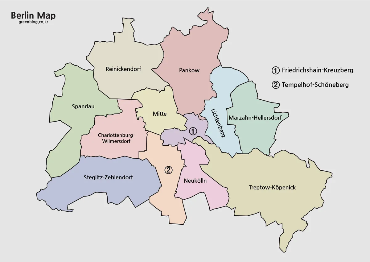
In the Berlin Map color version, adjacent boroughs use different fills so the compact center does not merge into a single block. Color also makes the broad shape of Pankow, Spandau, Steglitz-Zehlendorf, and Treptow-Köpenick easy to compare with smaller central boroughs. Brandenburg remains a neutral gray outside the city, reinforcing the unusual fact that Berlin is a federal state completely enclosed by another state.
This version works well on presentation slides and travel-planning graphics. Attractions can be grouped by borough: the Brandenburg Gate and Museum Island in Mitte, the East Side Gallery in Friedrichshain-Kreuzberg, and Charlottenburg Palace in Charlottenburg-Wilmersdorf. Organizing locations this way gives a clearer sense of direction than listing landmarks without their surrounding boroughs.
Black and White Map for Documents
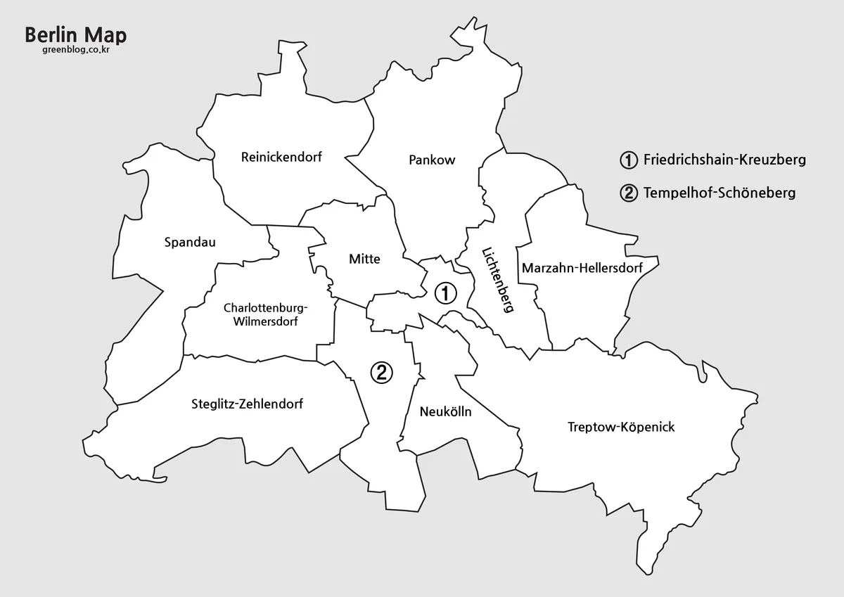
The black and white Berlin Map removes the colored fills but keeps the borough names and boundary lines. With fewer visual elements competing for attention, long labels remain easier to read in reports, worksheets, and photocopied handouts. The numbered central markers are retained, allowing Friedrichshain-Kreuzberg and Tempelhof-Schöneberg to be identified without covering nearby borders.
The 4,962 × 3,510-pixel layout was reviewed at A3 scale to check that the Korean and Romanized names did not become too small when printed. It is also a practical choice for travelers who want to print a reference sheet and write station names, hotel locations, or daily routes directly on the page.
Outline Map for Custom Information
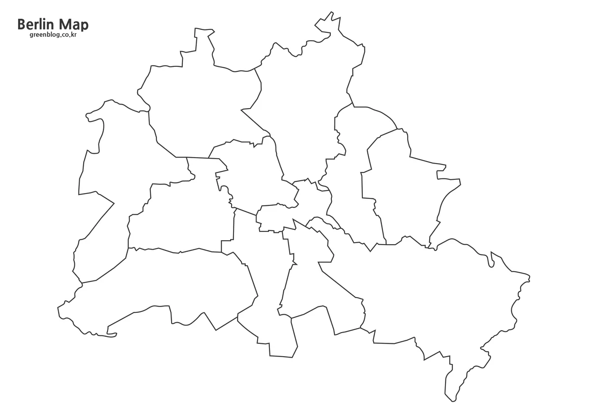
The outline Berlin Map removes the labels and interior colors, leaving the state outline and all 12 borough boundaries. It is intended as a clean image base rather than a claim of editable vector source files. Users can place population values, rail routes, accommodation areas, attraction symbols, green-space data, or custom color groupings over the image in a graphics or presentation program.
For classroom activities, students can color the boroughs and add selected landmarks. Designers can use the same layout to compare east and west Berlin, highlight the former Wall corridor, or build a borough-level statistical graphic. The simple boundary treatment also makes it easier to focus on Berlin’s shape within Brandenburg without unrelated road or facility detail.
Practical Ways to Use the Files
For travel presentations, the Berlin Map can group attractions by borough and show how central stops relate to outer districts. Teachers may use the labeled file as a reference and the outline version as a worksheet. Bloggers and infographic creators can add icons for museums, parks, historical sites, or transport hubs while preserving consistent borough boundaries across several graphics.
The files are administrative reference maps, not street, transit, or attraction maps. Roads, rail lines, and detailed neighborhood boundaries are not included. Choose the color version for quick visual comparison, the black and white version for printed text-based material, and the outline version when the project needs custom annotations.
Frequently Asked Questions
How many boroughs are included?
All 12 Berlin boroughs are shown. Smaller neighborhoods and Ortsteile within those boroughs are not individually mapped.
Is Berlin a city or a federal state?
It is both. Berlin is Germany’s capital city and one of the country’s 16 federal states, with the same outer boundary serving both roles.
Why are two population totals listed?
The official population update and the residents’ register use different population bases and update methods. Cite the date and statistical system when adding either figure to a project.
Can the Berlin Map be printed at A3 size?
Yes. The 4,962 × 3,510-pixel image files were prepared and checked for A3 printing.
Which file is best for adding my own information?
Choose the outline image for custom colors, routes, labels, symbols, or statistics. It is a blank image base, not an included vector source file.
Map File Information
This download includes printable Berlin map versions for educational use, presentation design, document printing, and editable graphic projects.
- Included Versions: Color map, black and white map, outline map
- Image Size: 4962 × 3510 pixels
- Printable Size: A3 layout
- File Type: Image files in a ZIP archive
- Intended Use: Classroom handouts, presentations, travel planning, blog graphics, infographic editing, and printable reference materials
Related Maps
Additional Resources
- Berlin Neighborhoods and Districts – visitBerlin: Explore visitor information and local highlights across all 12 Berlin boroughs.
Green Map creates custom-edited map images using open geographic data sources such as geoBoundaries, Natural Earth, OpenStreetMap, and government open data. These maps are edited visual materials, not raw data files, and are provided for education, documents, presentations, and graphic reference.