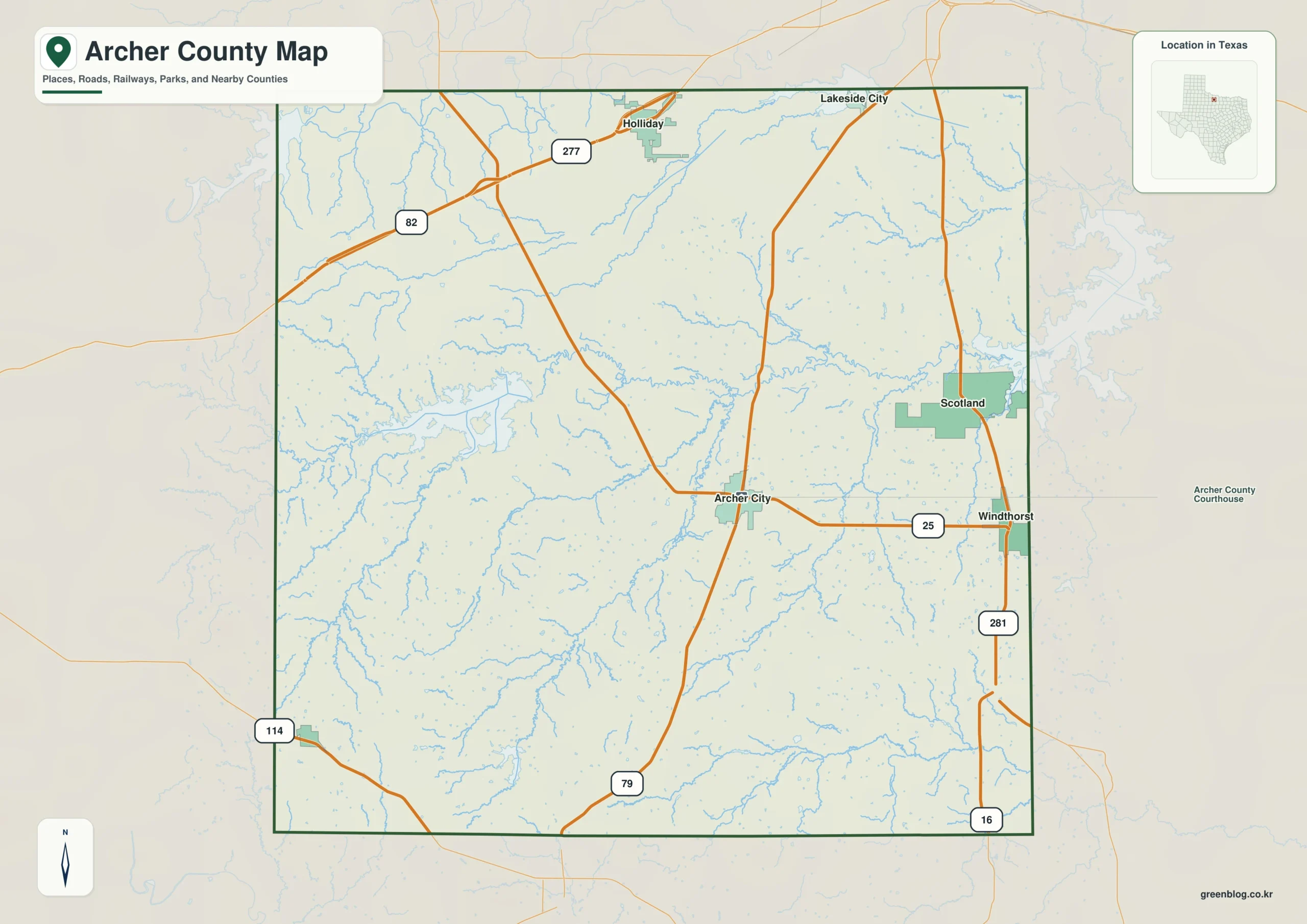
This Archer County Texas map page introduces a North Central Texas county shaped by ranching, farming, severe weather, and railroad expansion. Archer City is the county seat, while communities such as Holliday, Dundee, Scotland, and Megargel grew along transportation routes. Cattle dominated the early economy, but wheat, cotton, corn, and oats later broadened local agriculture. The map is most informative when the county seat and the smaller railroad-era communities are considered together.
Table of Contents
Ranch country around Archer City
Archer County developed on the plains south of Wichita Falls, with Archer City serving as its administrative center. Early ranchers faced destructive winters and drought, yet cattle remained a major part of the economy. As settlement increased, cultivated land expanded and wheat became one of the county’s most important crops.
Railroads and the pattern of small towns
Several rail lines crossed the county between the late nineteenth and early twentieth centuries. Their stations encouraged the development of Holliday, Dundee, Scotland, Megargel, and other communities. Rail connections linked ranches and farms with larger markets and explain why the county’s population is distributed among several distinct towns rather than concentrated only in Archer City.
Color map for regional comparison
The filled map gives the clearest first look at the county’s position and extent. Archer City can be used as the administrative reference point while the colored boundary shows the larger county area. This version is best suited to screens, presentations, and introductory graphics.

Boundary-focused black-and-white map
This version replaces color fills with linework and tonal contrast. The county form and the location of Archer City remain readable in reports or classroom pages. It is especially useful when multiple copies are needed or when color is not part of the document design.

Planning with the outline map
The outline file removes most explanatory elements and leaves the boundary ready for annotation. Archer City, selected communities, travel routes, or survey points can be added on a copy of the original. Keeping one untouched file makes it easier to create several different versions.

Map package and file details
One ZIP provides the complete Archer County set. The archive contains separate A3 color, black-and-white, and outline JPGs; use the previews and filenames to identify the needed version. The same package supports both a finished reference and custom work involving Archer City.
Archer County, Texas Map Download
The ZIP package includes color, black-and-white, and outline maps. Compare the formats and use cases below, then select the version that best matches the project.
- Map set: Color, black-and-white, and outline maps
- File format: Three high-resolution A3 JPG files in one ZIP
- Suggested uses: Screen reference, printing, worksheets, and custom editing
- Coverage: The complete boundary of Archer County, Texas
The download is provided as a ZIP archive. Extract the ZIP to open each of the three map versions as a separate file.
Frequently Asked Questions
Where is the county seat?
The files use the official county boundary for Archer County and are intended to show the county as one administrative area within Texas. The county outline remains separate from the county-seat marker and other local labels, allowing names to be added without altering the boundary.
Which map works best for a printed report?
The black-and-white edition works well in printed reports because its boundary and labels remain clear without color. The color map is suited to presentations, while the outline map provides open space for notes, routes, categories, and data symbols.
What is included in the ZIP package?
Yes. The ZIP includes individual JPG files for the color, black-and-white, and outline maps. Separate files let you place one version in a document while keeping the others available for later editing.
What can be added to the outline map?
Archer City is the county seat and is the clearest first reference for an administrative map. Users can then add selected communities, roads, project locations, or thematic data to match the final purpose.
References
- U.S. Census Bureau
- 2024 Gazetteer Files
- Texas State Library: Counties and County Seats
- Texas Counties: Year Created and Organized
- Handbook of Texas: county history, geography, and economy
Related Maps
- Sterling County Texas map|Sterling City, North Concho Ranchland, and Oil Country
- Sutton County Texas map|Sonora, Caverns, Ranch Country, and Two Watersheds
- Victoria County Texas map|Victoria, the Guadalupe River, and Coleto Creek Reservoir
- Wilson County Texas map|Floresville, La Vernia, Poth, and Stockdale
- Rockwall County Texas map|Lake Ray Hubbard, I-30, and fast-growing communities
Green Map creates custom-edited map images using open geographic data sources such as geoBoundaries, Natural Earth, OpenStreetMap, and government open data.
These maps are edited visual materials, not raw data files, and are provided for education, documents, presentations, and graphic reference.