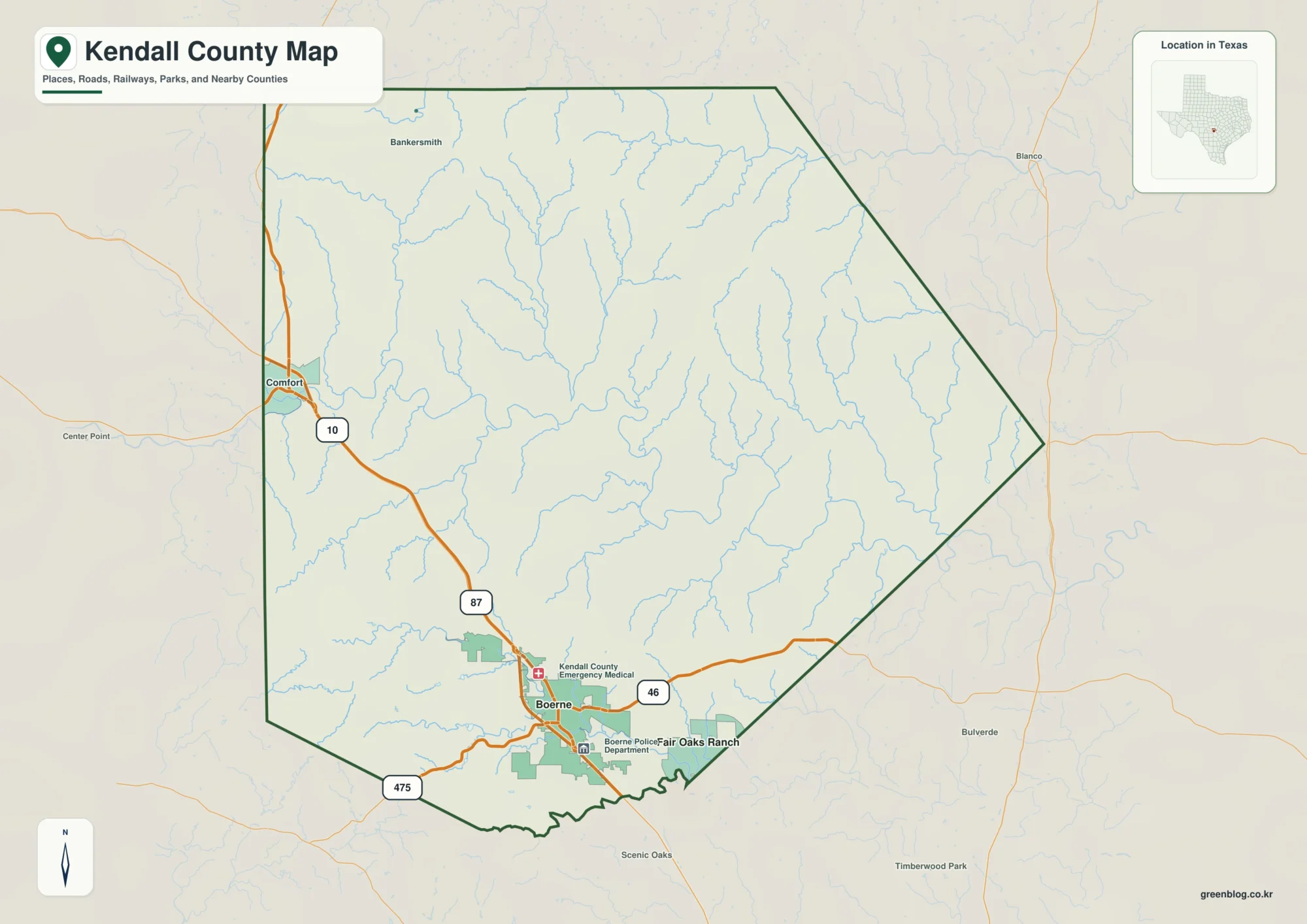
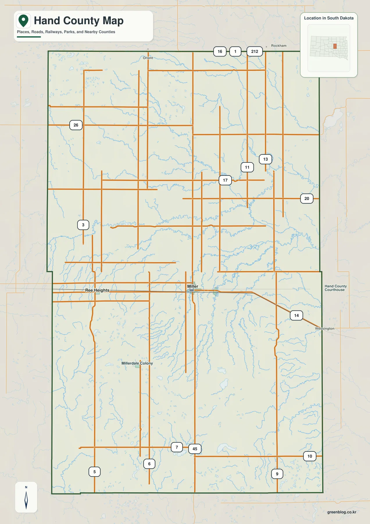
A Conecuh County Map is easiest to understand by starting at Evergreen, where the county’s main north-south and east-west roads come together. Interstate 65 and U.S. 31 pass through the central part of the county, while U.S. 84 crosses near Evergreen and continues toward the western and eastern edges. This page also goes beyond the road view: the city, water, and elevation maps show how Repton, Castleberry, the Sepulga River system, and the county’s ridges fit together. All four maps are available as high-resolution A3 JPG files in one ZIP download, so you can use the web previews for quick reference and the larger files for printing or closer inspection.
Conecuh County lies in southern Alabama and has a mostly rural settlement pattern. Evergreen is the clearest central reference point, Repton sits to the west, and Castleberry lies to the south. Outside those towns, the map is dominated by long roads, irregular county boundaries, many small streams, and rolling terrain. The northwest and north are generally higher, while lower ground becomes more prominent toward the east and southeast. Looking at the four views together makes it easier to connect transportation, towns, drainage, and relief without forcing every detail onto a single crowded map.
Table of Contents
Evergreen anchors the county road network
On the county overview, Evergreen sits near the meeting point of the strongest routes. I-65 runs through the central part of Conecuh County and provides the clearest north-south corridor. U.S. 31 follows the same general direction but serves local travel through the county, while U.S. 84 creates the strongest east-west line. Alabama 83, 41, 3, 71, 12, and 113 fill in connections toward smaller communities and the county edges. Because several of these routes meet or pass near Evergreen, the city works as a practical starting point for reading the entire map.
The boundary itself is worth noticing. Conecuh County narrows into a taller northern section, bends repeatedly along the west side, and steps inward on the east before extending toward the southeast. Nearby labels such as Georgiana, Monroeville, McKenzie, Red Level, and Frisco City help place the county within south Alabama. These outside references are especially useful when the goal is to understand the county’s position rather than only the roads inside it.
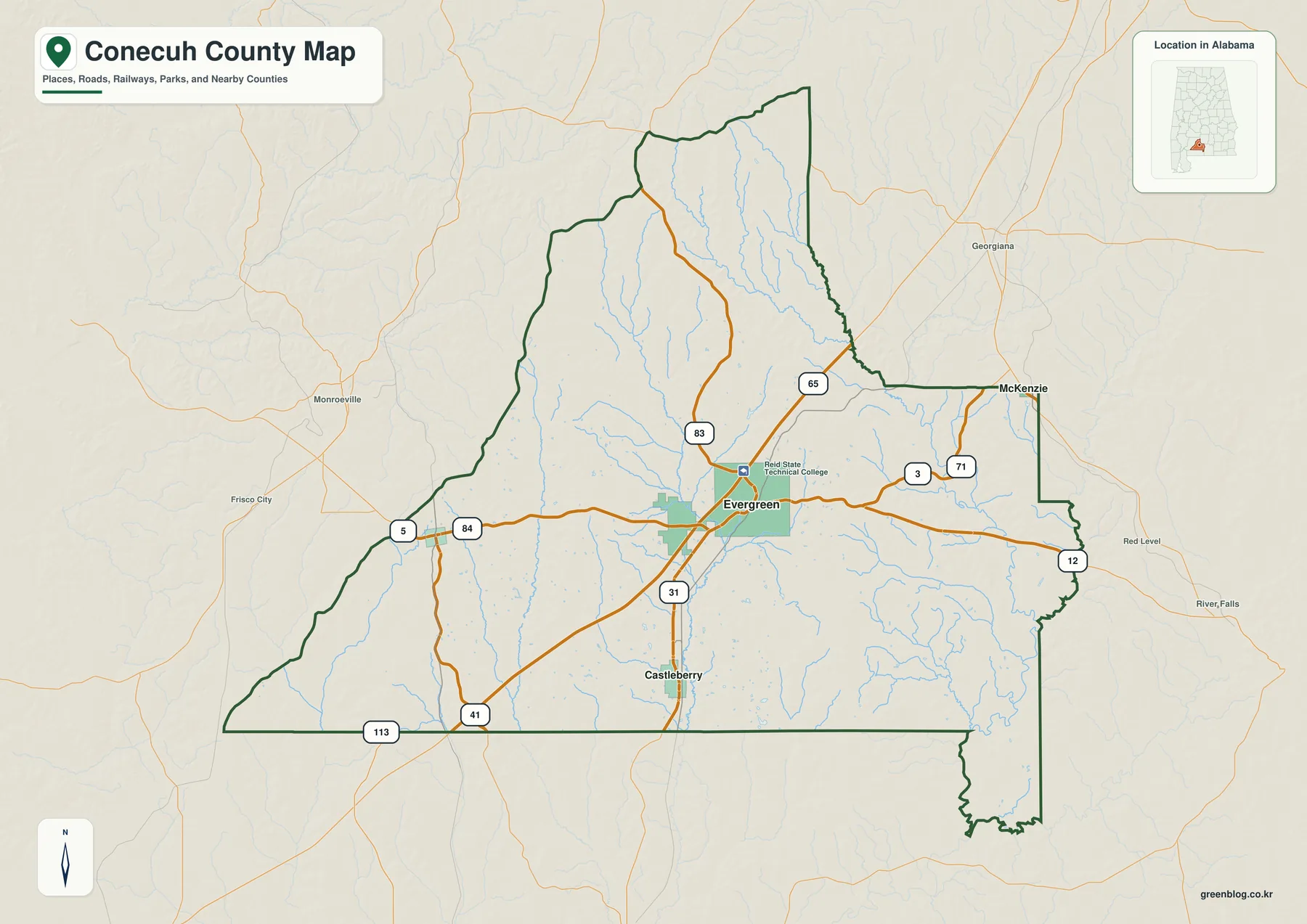
The road pattern also explains why Evergreen appears more prominent than the other labeled towns. U.S. 84 brings traffic across the county, I-65 and U.S. 31 provide north-south movement, and several state routes meet this central area. Moving west leads toward Repton, while travel south brings Castleberry into view. East of Evergreen, U.S. 84 continues toward the stepped eastern boundary. Once that framework is clear, the simplified city map becomes much easier to interpret.
Repton and Castleberry show how settlements are spaced
The city connection map removes most secondary detail and concentrates on Evergreen, Castleberry, and Repton. Evergreen is marked as the hub, Castleberry lies south of it, and Repton lies to the west. The connection panel shows a straight-line distance of roughly 10 miles from Evergreen to Castleberry and about 17 miles from Evergreen to Repton. Those distances give a simple sense of scale and make it clear that the county’s main communities are separated by substantial rural space rather than forming one continuous urban area.
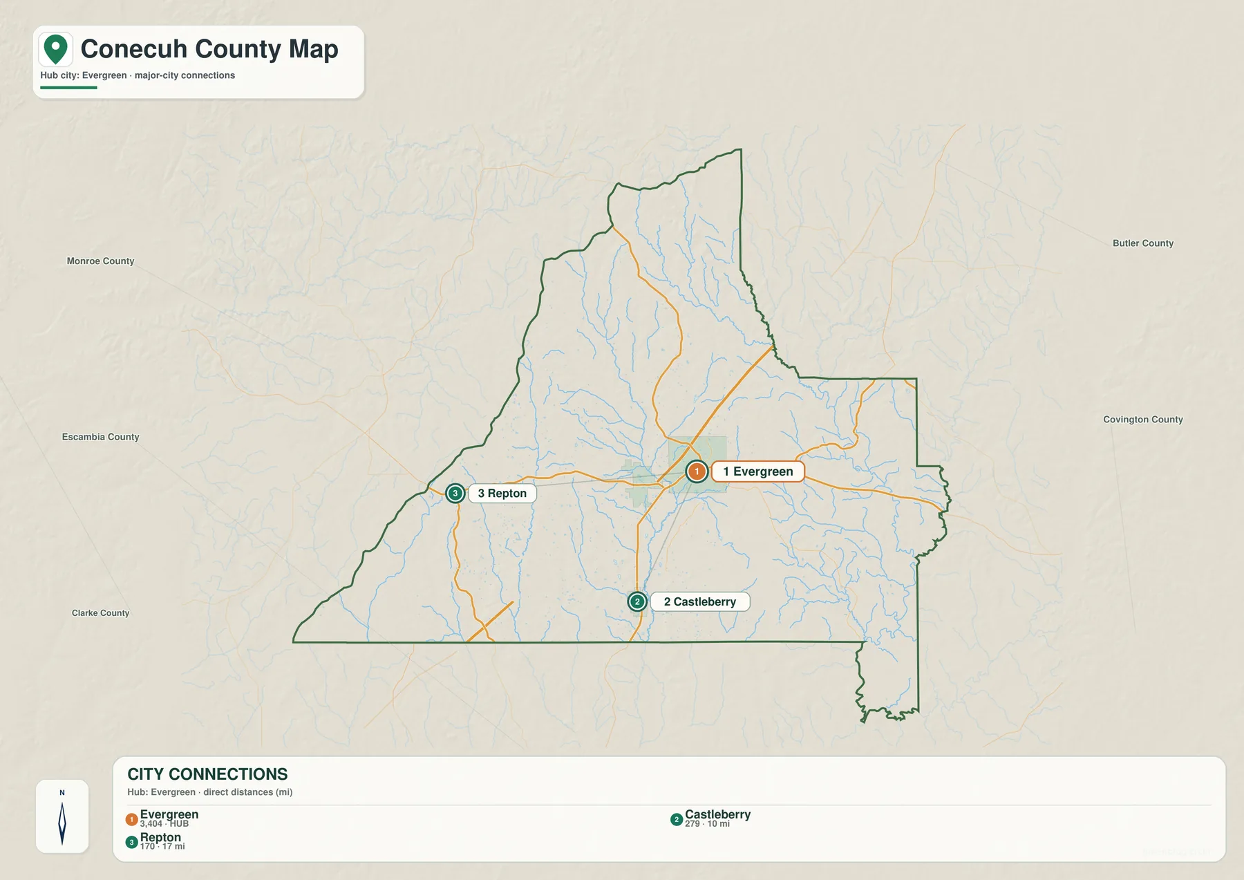
The surrounding county labels add another useful layer. Monroe County and Escambia County appear to the west, Clarke County to the southwest, Butler County to the northeast, and Covington County to the east. These labels help explain the elongated shape of Conecuh County and show how Evergreen sits well inside the county while Repton is much closer to the western side. Castleberry’s southern position also becomes obvious when the main outline is simplified.
For readers who only need town relationships, this view can be more useful than the full county map. It avoids competing road numbers and stream labels, making the basic pattern easy to grasp: Evergreen is central, Repton is west, and Castleberry is south. That simple orientation is also helpful before moving to the water map, where many stream names would otherwise make the geography harder to follow.
Sepulga River and long creek corridors shape the water map
The water map replaces most road detail with rivers, creeks, ponds, and smaller tributaries. Sepulga River forms the most obvious drainage feature on the eastern side, and East Sepulga River enters through the narrow northern section. Farther west, Murder Creek creates another long north-south drainage line, while Burnt Corn Creek runs through the western side. Between these larger channels are Sandy Creek, Mill Creek, Simmons Creek, Bell Creek, Panther Creek, Brushy Creek, and many unnamed tributaries.
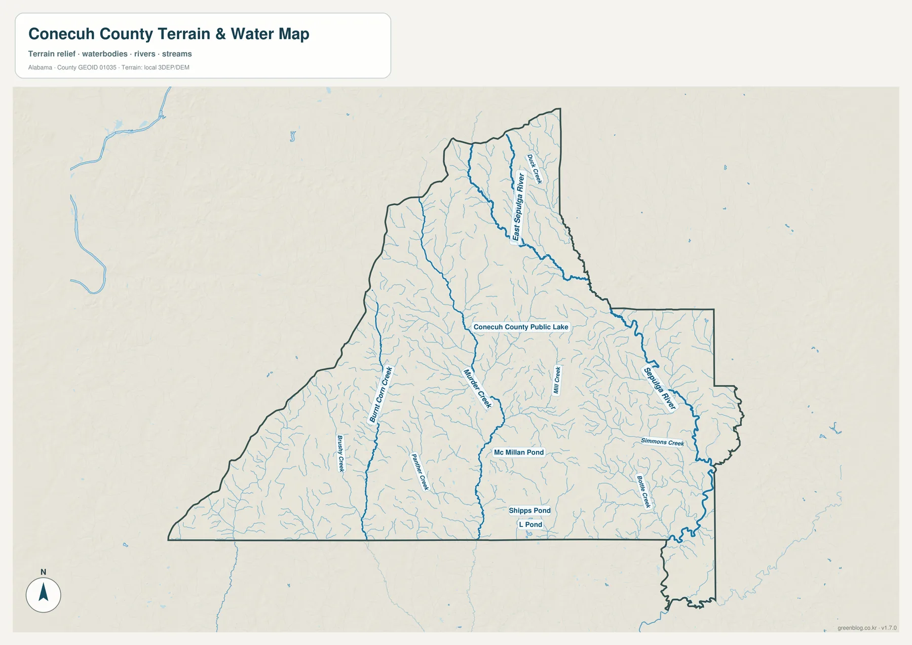
Several small water bodies provide additional reference points. Conecuh County Public Lake appears north of the center, while McMillan Pond, Shipps Pond, and L Pond are shown farther south. These ponds are small compared with the major river and creek systems, but they help readers distinguish different parts of the county and see that surface water is spread across more than one drainage corridor.
The eastern side is particularly easy to recognize because Sepulga River and its tributaries run close to the county boundary. Murder Creek and Burnt Corn Creek, by contrast, cut through the county interior. Once those three major corridors are identified, the many smaller tributaries become less confusing. They can be read as branches feeding into the larger systems rather than as a long list of unrelated names.
Higher northwest ridges descend toward lower eastern ground
The elevation map changes the county again by removing most place and road labels. Its legend reports an actual elevation range of about 29 to 173 meters, with a mean near 88 meters. Brown and tan shades are more common in the northwest and the narrow northern section, indicating higher ridges. Greens become broader toward the east and southeast, where lower ground is more common. The central part of the county mixes ridges and valleys, so the landscape is rolling rather than uniformly flat.
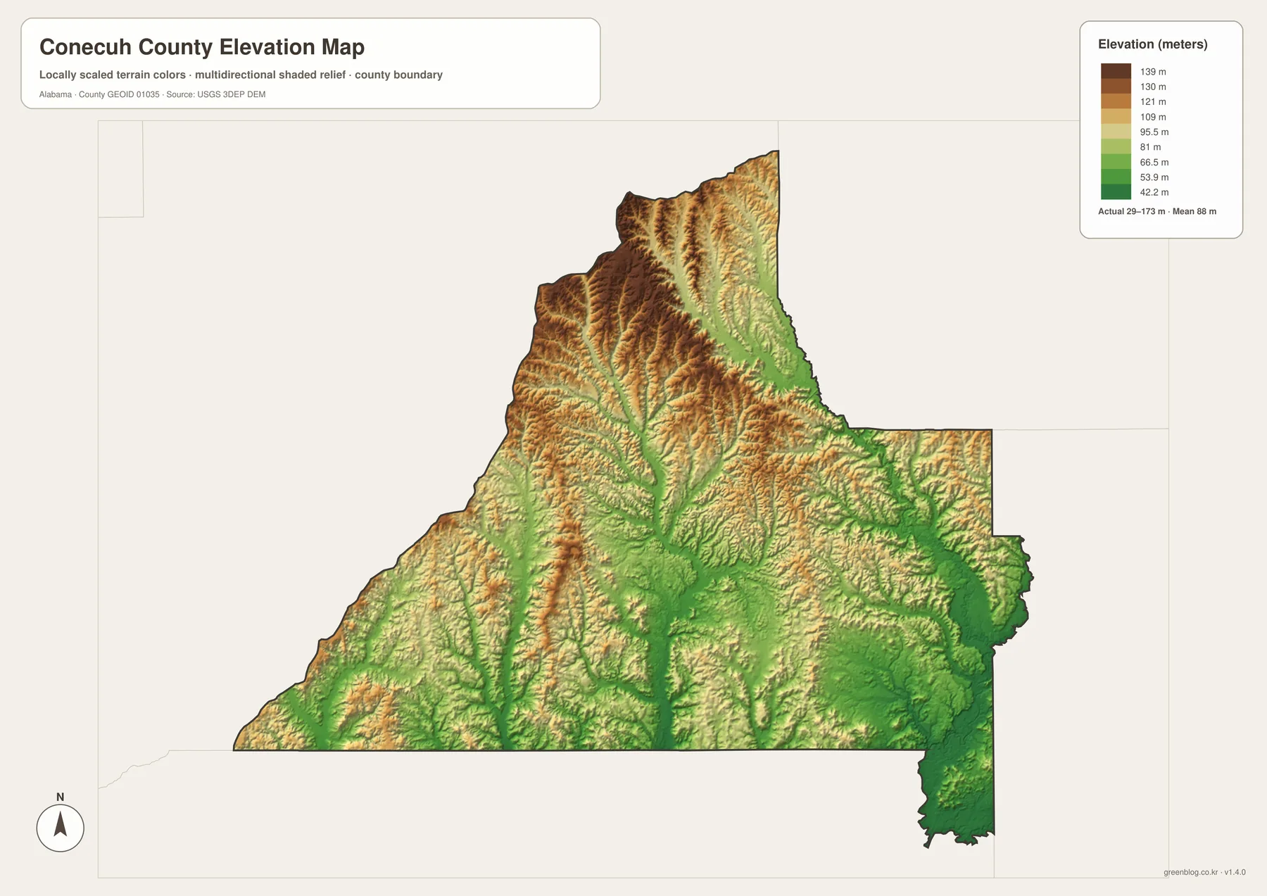
Comparing the relief map with the water map explains why the drainage network branches the way it does. Narrow green valleys run between higher ridges, and many small streams follow those lower channels before joining Murder Creek, Burnt Corn Creek, or the Sepulga system. In the northwest, the ridges are more tightly packed and the terrain appears more dissected. Toward the southeast, broader low areas become more visible even though small hills and stream valleys remain.
The elevation colors are best used for relative comparison rather than precise surveying. The display legend uses several bands from about 42.2 to 139 meters, while the map separately notes the wider actual minimum and maximum. For a general county map, that is enough to show which sections sit higher and how the low valleys connect to the mapped streams.
Choose the map that matches the question
If your main goal is orientation, start with the county map. Find Evergreen, trace I-65, U.S. 31, and U.S. 84, then note where the county outline bends toward the west and east. If you are comparing settlements, switch to the city map and focus on Evergreen, Repton, and Castleberry. The water map is better for rivers, creeks, and ponds, while the elevation map is the clearest choice for comparing the higher northwest with the lower eastern and southeastern sections.
Using the maps in that order is helpful for school projects, local reference, trip planning, or printed study material because each map removes details that are not needed for its specific purpose. The web images are designed for quick viewing. When you need a larger image for printing or closer inspection, the ZIP below contains four high-resolution A3 JPG files: one county map, one city map, one water map, and one elevation map.
Frequently Asked Questions
What is the best starting point on the Conecuh County Map?
Evergreen is the most useful starting point because it lies near the center of the county’s road network. I-65, U.S. 31, and U.S. 84 are all close by, making it easy to orient yourself before looking west toward Repton or south toward Castleberry.
Which waterways stand out on the water map?
Sepulga River and East Sepulga River dominate the eastern side, while Murder Creek and Burnt Corn Creek form long interior drainage corridors. Smaller named streams such as Sandy Creek, Mill Creek, Simmons Creek, Bell Creek, Panther Creek, and Brushy Creek connect into the wider network.
What is included in the download ZIP?
The download includes four A3 high-resolution JPG files: a county map, city map, water map, and elevation map. They are larger than the web previews and are suitable for printing or detailed reference.
Map File Information
The ZIP contains four A3 high-resolution JPG maps for Conecuh County. Use the county map for roads and boundaries, the city map for Evergreen–Repton–Castleberry relationships, the water map for rivers and creeks, and the elevation map for ridges and lower valleys.
- Included Files: General county, city, water, and elevation maps
- File Type: Four high-resolution A3 JPG files bundled in one ZIP archive
- Intended Use: Printing, education, presentations, and map-based projects
Related Maps
- Along the Cahaba Valley: Bibb County Alabama Map
- Between Two River Systems: A Clarke County Alabama Map
- Calhoun County Alabama Map
Sources and reference material
- U.S. Census Bureau TIGER/Line Shapefiles
- ALDOT Conecuh County functional-classification map
- Outdoor Alabama: Sepulga River
- USGS National Hydrography
- USGS 3D Elevation Program
- The Encyclopedia of Alabama: Conecuh County
Green Map creates custom-edited map images using open geographic data sources such as geoBoundaries, Natural Earth, OpenStreetMap, and government open data. These maps are edited visual materials, not raw data files, and are provided for education, documents, presentations, and graphic reference.