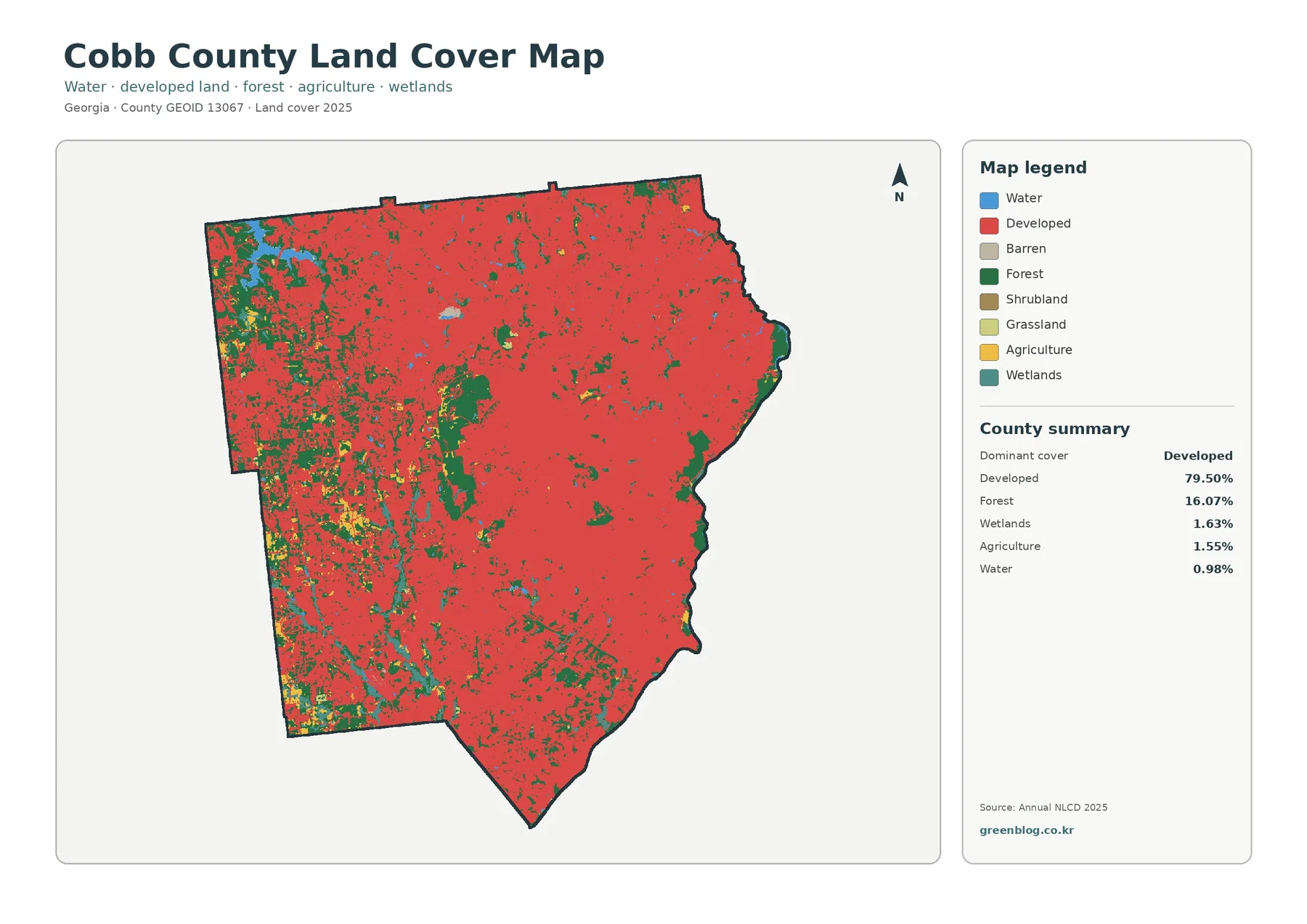
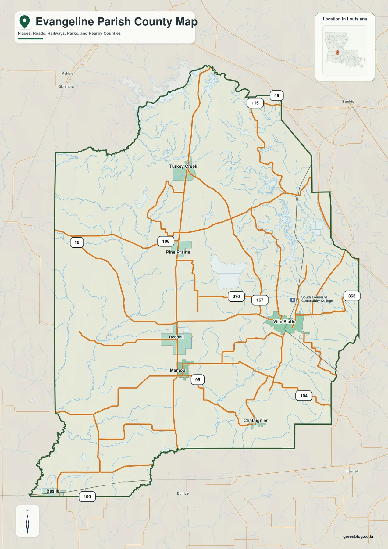
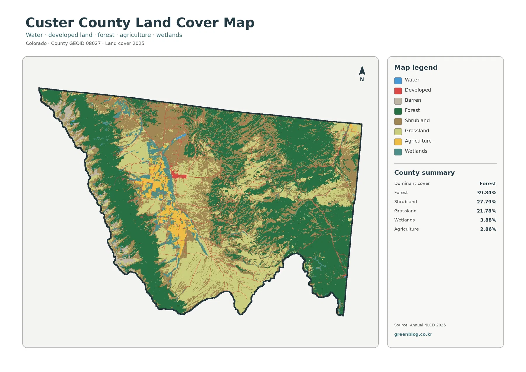
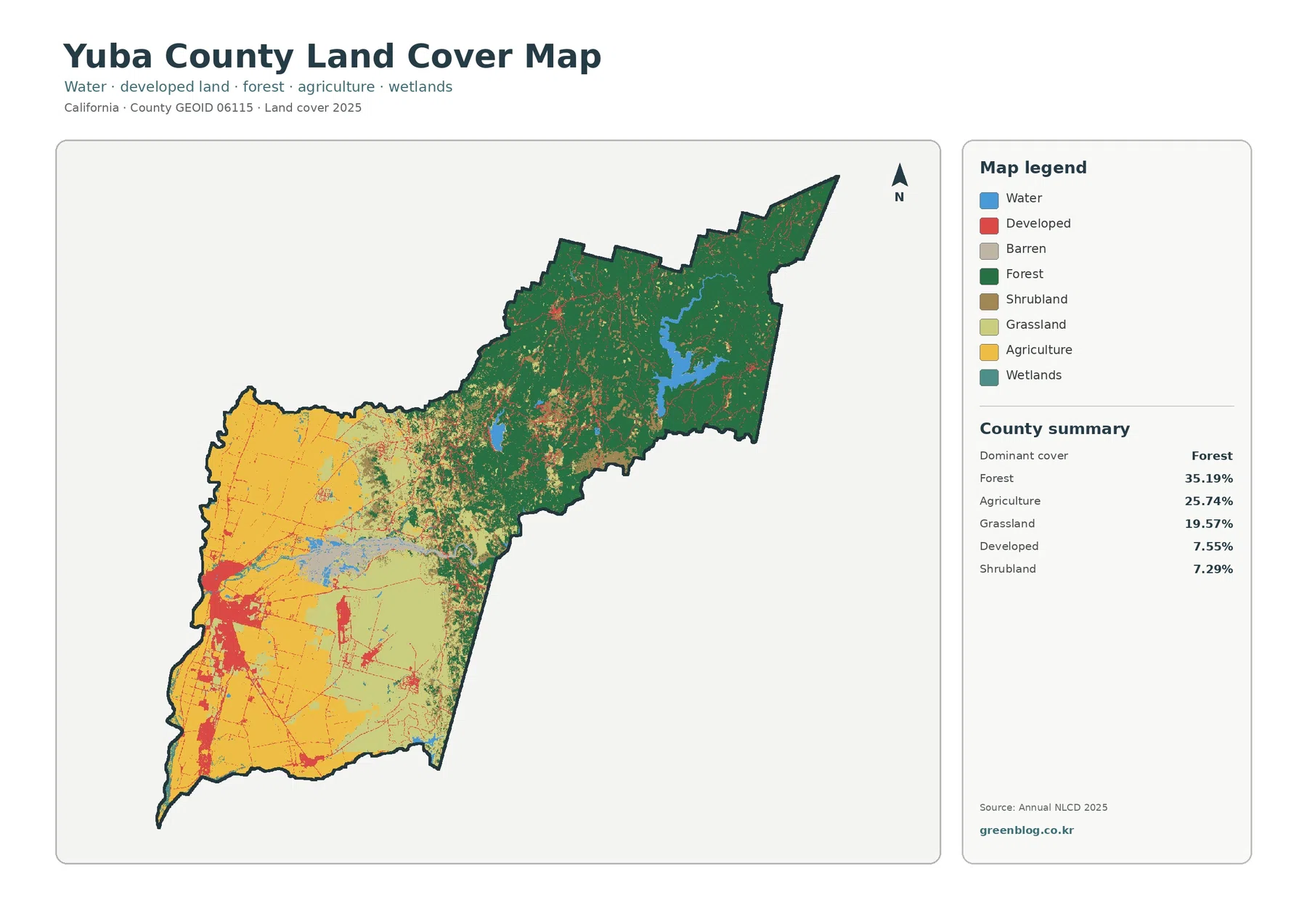
Nance County sits in east-central Nebraska, where the Loup River crosses the county and the Cedar River reaches it near Fullerton. The county’s three best-known communities—Fullerton, Genoa, and Belgrade—occupy different parts of that landscape, so their locations make a useful starting point for understanding roads, waterways, and relief. This Nance County Map page brings those features together in four complementary views. The web images can be inspected on the page, and the same map set is available farther down as high-resolution JPG files in a downloadable ZIP.
Fullerton is the county seat and lies near the meeting of the Loup and Cedar Rivers. On the maps it also stands out as a transportation reference point: Nebraska Highway 14 runs north and south through town, while Highway 22 heads east toward Genoa. Belgrade sits to the northwest, closer to the more dissected western and northern uplands. This arrangement means Nance County is not simply a row of towns along one road. The communities are tied to different valleys and road approaches, and the map set makes those relationships much easier to see than a boundary outline alone.
Table of Contents
Fullerton as the meeting point for roads, rivers, and county travel
The county overview combines the Nance County boundary with communities, roads, rail lines, and waterways. Fullerton appears slightly south of the county’s middle, close to the broad Loup River corridor. Highway 14 crosses the county from north to south through the town, and Highway 22 leaves Fullerton toward Genoa on the east side. Near Genoa, Highway 39 provides another north-south connection, while Highway 52 is labeled near Belgrade in the northwestern part of the county. Seeing these route numbers together shows that local movement is spread across several corridors rather than concentrated on one highway.
The eastern side of the county looks more tightly organized around Genoa, the river lowland, and converging roads. Farther west, roads are more widely spaced and the map is crossed by a denser web of small drainage lines. That contrast matters when using the overview for orientation. Fullerton works well as the first reference point, Genoa identifies the eastern river corridor, and Belgrade helps locate the northwestern rural part of the county. Once those three places are fixed, the boundary’s stepped shape and the direction of the main highways become much easier to follow.
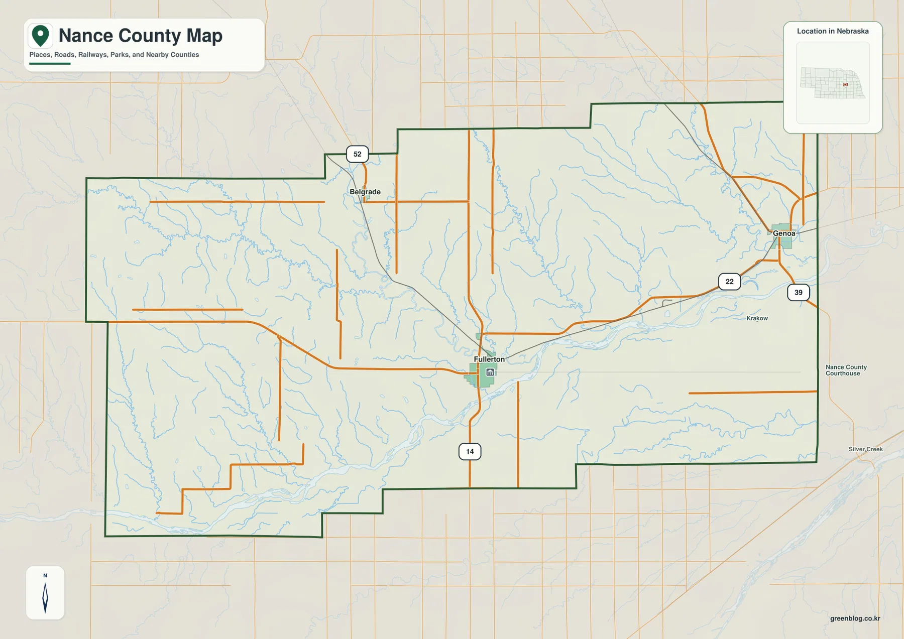
This first map is the best choice when the question is broad: Where is a town inside the county? Which numbered highway reaches it? How does a road sit relative to the river? The surrounding area is left faint enough to preserve regional context without competing with the Nance County boundary. It should not be treated as a live navigation product, however. Road construction, closures, turn-by-turn routing, and current travel times require up-to-date transportation or navigation services rather than a static county reference map.
Three communities in different directions: Fullerton, Genoa, and Belgrade
The city-connections map strips away much of the extra detail and makes the three-community pattern clear. Fullerton is used as the hub. Genoa lies to the east and is labeled at about 13 miles from Fullerton, while Belgrade is northwest at about 9 miles. Those figures are straight-line distances between the mapped locations, not driving mileage. Actual road trips can be longer because highways and local roads do not follow a perfect line, but the numbers are useful for comparing the relative spacing of the communities.
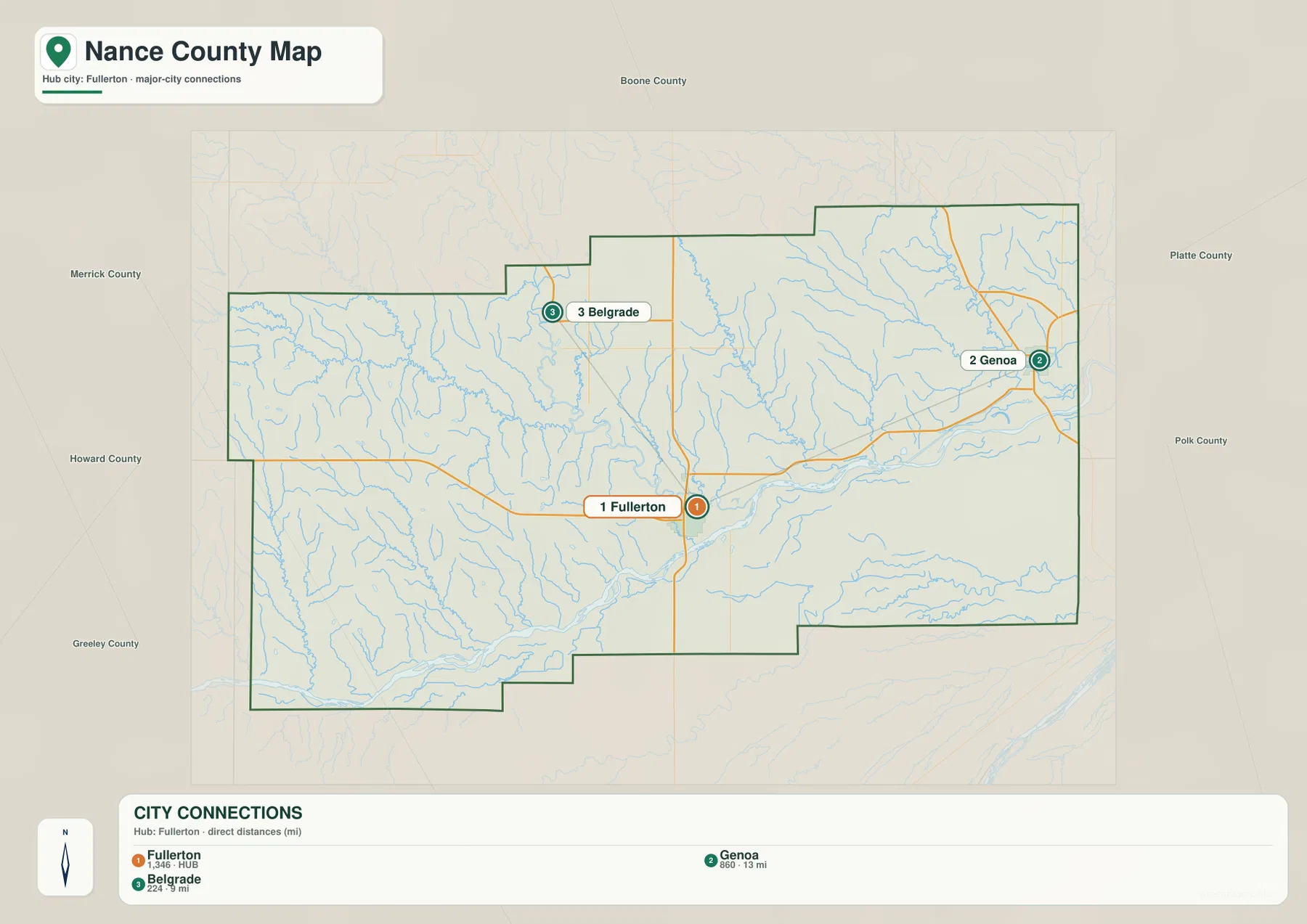
The pattern is more informative than a simple list of town names. Fullerton and Genoa occupy the broader Loup River corridor, while Belgrade sits away from that main east-west lowland and closer to the rolling country in the northwest. This helps explain why the three communities do not form a single evenly spaced line. A student or visitor can first learn this simple triangle, then return to the county overview to find Highway 22 between Fullerton and Genoa, Highway 14 through Fullerton, and Highway 52 near Belgrade.
Nance County’s official website reports a 2020 population of 3,380 and identifies Fullerton as the county seat, with Genoa and Belgrade also listed among the county’s towns. Those local facts fit the map’s visual hierarchy: Fullerton is the central administrative reference, Genoa anchors the eastern side, and Belgrade gives the northwestern part of the county a named community reference. Population size is not the main purpose of this map, but knowing the role of each place makes the simple connector lines more meaningful.
Cedar River, Loup River, and a network of smaller creeks
The terrain-and-water map reveals how much of Nance County is shaped by valleys. The broad Loup River corridor crosses the lower central and eastern part of the county. The Cedar River comes down from the north toward Fullerton, where official city information places Fullerton at the confluence of the Cedar and Loup Rivers. That meeting of waterways gives Fullerton an important physical-geography role in addition to its county-seat function. The map also shows many smaller channels feeding toward the larger valleys from the uplands on both sides.
In the west and northwest, labels include South Branch Timber Creek, North Branch Timber Creek, Timber Creek, Cedar River, and Ash Creek. Plum Creek descends through the central-northern part of the county. Farther east, Council Creek, Skeedee Creek, and Beaver Creek cut toward the lower river corridor near Genoa. Horse Creek and Cottonwood Creek are prominent in the southwest, while Prairie Creek appears in the southeastern section. These names turn what might look like a uniform rural county on a road map into a landscape divided by many small valleys and drainage lines.
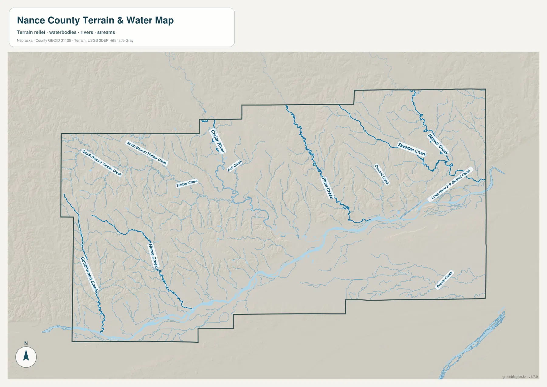
East of Genoa, the map also labels the Loup River Public Power District Canal. Its presence is a reminder that not every blue line in the eastern county is a natural stream. The water map is intended for geographic reference—locating rivers, creeks, and a canal in relation to the county terrain. It is not a flood-hazard map, a parcel or legal-boundary product, a boating chart, or a source for water-rights decisions. Those questions require current authoritative material from agencies responsible for hydrology, flood management, property records, or navigation.
Comparing the water map with the county overview is especially useful around Fullerton and Genoa. Highway 22 and the eastward travel corridor remain close to the low Loup River valley, while the Cedar River provides a natural north-south valley toward Fullerton. The western half of the county, by contrast, contains fewer named communities and more branching tributaries. This is one of the clearest county-specific differences in the map set: transportation and settlement are easiest to follow in the lower river corridor, while the western uplands are defined more strongly by relief and small drainage channels.
Higher western ground descending toward the eastern Loup River lowland
The elevation map turns that west-to-east contrast into a strong color pattern. Browns and tans dominate much of the western side, where the terrain is higher and more deeply cut by small valleys. Greens spread across the east and along the broader Loup River lowland. The displayed legend uses locally scaled bands from roughly 476 to 595 meters, and the map notes an actual countywide range of about 469 to 621 meters with a mean near 530 meters. The precise numbers matter less than the overall pattern: western uplands stand above the lower eastern river corridor.
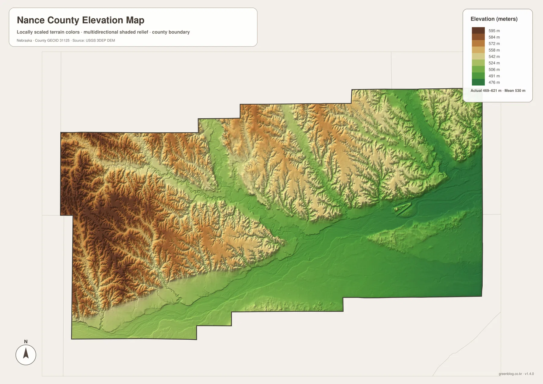
The western half is not simply a flat high plateau. Narrow valleys branch through the higher ground, creating a textured surface of ridges and drainage cuts. The Cedar River and Plum Creek valleys form lower north-south lines through the middle of the county, eventually connecting with the broader lowland near Fullerton. In the northeast, numerous smaller channels also cut into the terrain, but their surrounding ground is generally lower than the western edge. An older Nance County comprehensive plan similarly described the county’s lowest elevation near the point where the Loup River crosses the eastern boundary and its highest ground near the western boundary.
This relief helps explain the setting of the three mapped communities. Fullerton and Genoa sit within the lower river system, while Belgrade is closer to the higher, more rolling northwestern landscape. Checking the city map first and then finding the same three locations on the elevation map is an easy way to connect settlement with terrain. It also shows why a single county-wide average elevation would hide important local differences: the river valleys and western uplands occupy noticeably different height ranges.
The elevation image is a generalized county-scale surface, not a surveying or engineering product. It is useful for comparing broad highs and lows, identifying river valleys, and seeing where the terrain becomes more rugged. It should not be used to determine a construction grade, a parcel corner, an exact building elevation, or a precise slope at a specific site. Those tasks require project-level measurements and authoritative elevation data such as the source products available through the USGS 3D Elevation Program.
Choosing the map that answers the specific question
Use the county overview for the broadest orientation: the boundary, Fullerton, Genoa, Belgrade, and Highways 14, 22, 39, and 52 appear together. The city-connections view is better when the only question is how the three communities are positioned relative to Fullerton. The terrain-and-water map is the strongest choice for following the Loup and Cedar Rivers or identifying named creeks, while the elevation map is the clearest way to compare the western uplands with the lower eastern river corridor.
Fullerton provides a convenient common reference when comparing all four. Locate the town and the Highway 14/22 junction on the overview, then move to the water map to see the nearby Loup and Cedar River valleys. On the elevation map, the same area sits in the lower green corridor. Repeat the process with Genoa to connect Highway 39, eastern waterways, and lower terrain, or with Belgrade to compare Highway 52 with the more rolling northwestern country. Matching one known place across several maps is often more useful than trying to absorb every label at once.
The downloadable archive contains the high-resolution JPG originals for the county overview, city connections, terrain and water, and elevation. These larger files are better suited to printing than the reduced web previews. They can also be placed individually in school projects, presentations, local reference notes, or regional comparisons. Because each image emphasizes a different kind of information, selecting the one that fits the task usually produces a clearer result than placing every map on the same page.
Frequently Asked Questions
Where are Genoa and Belgrade relative to Fullerton?
Genoa lies east of Fullerton along the broader Loup River corridor, while Belgrade is northwest of Fullerton. The city-connections map labels Genoa at about 13 miles and Belgrade at about 9 miles from the Fullerton hub. These are straight-line distances, not driving distances, so an actual trip will depend on the road network and can be longer.
Which map best shows the relationship between the Cedar and Loup Rivers?
The terrain-and-water map is the best choice. It shows the Cedar River descending from the north toward Fullerton and the broad Loup River corridor crossing the lower part of the county. It also labels smaller tributaries such as Timber Creek, Plum Creek, Skeedee Creek, Horse Creek, and Cottonwood Creek. Compare it with the county overview when you also need highways and community locations.
Can the elevation map be used for surveying or site design?
No. The elevation map is designed to show countywide differences, including the higher western uplands and the lower Loup River corridor toward the east. It is not survey-grade or engineering-grade data and should not be used for parcel corners, construction elevations, exact slopes, or site design. Those uses require authoritative, location-specific measurements.
Map File Information
Download one ZIP containing the four high-resolution JPG maps shown on this page.
- Included Files: Use only the versions confirmed in the article and supplied images
- File Type: Use the confirmed download contents
- Intended Use: Printing, education, presentations, and map-based projects
Related Maps
Sources and references
The county description is supported by official local information and public U.S. boundary, hydrography, and elevation sources. The links below provide background on Nance County and Fullerton as well as the national datasets used for geographic reference.
- Nance County official website – About Our County
- City of Fullerton – Locations & Directions
- U.S. Census Bureau – TIGER/Line Shapefiles
- USGS – National Hydrography
- USGS – 3D Elevation Program
Green Map creates custom-edited map images using open geographic data sources such as geoBoundaries, Natural Earth, OpenStreetMap, and government open data. These maps are edited visual materials, not raw data files, and are provided for education, documents, presentations, and graphic reference.