The Hinds County Mississippi map combines Mississippi's capital city with a much larger rural county extending west and south. Jackson and Clinton dominate the northeastern I-20 corridor, while Raymond, Utica, Bolton, and Edwards reveal a second set of administrative and agricultural landscapes.
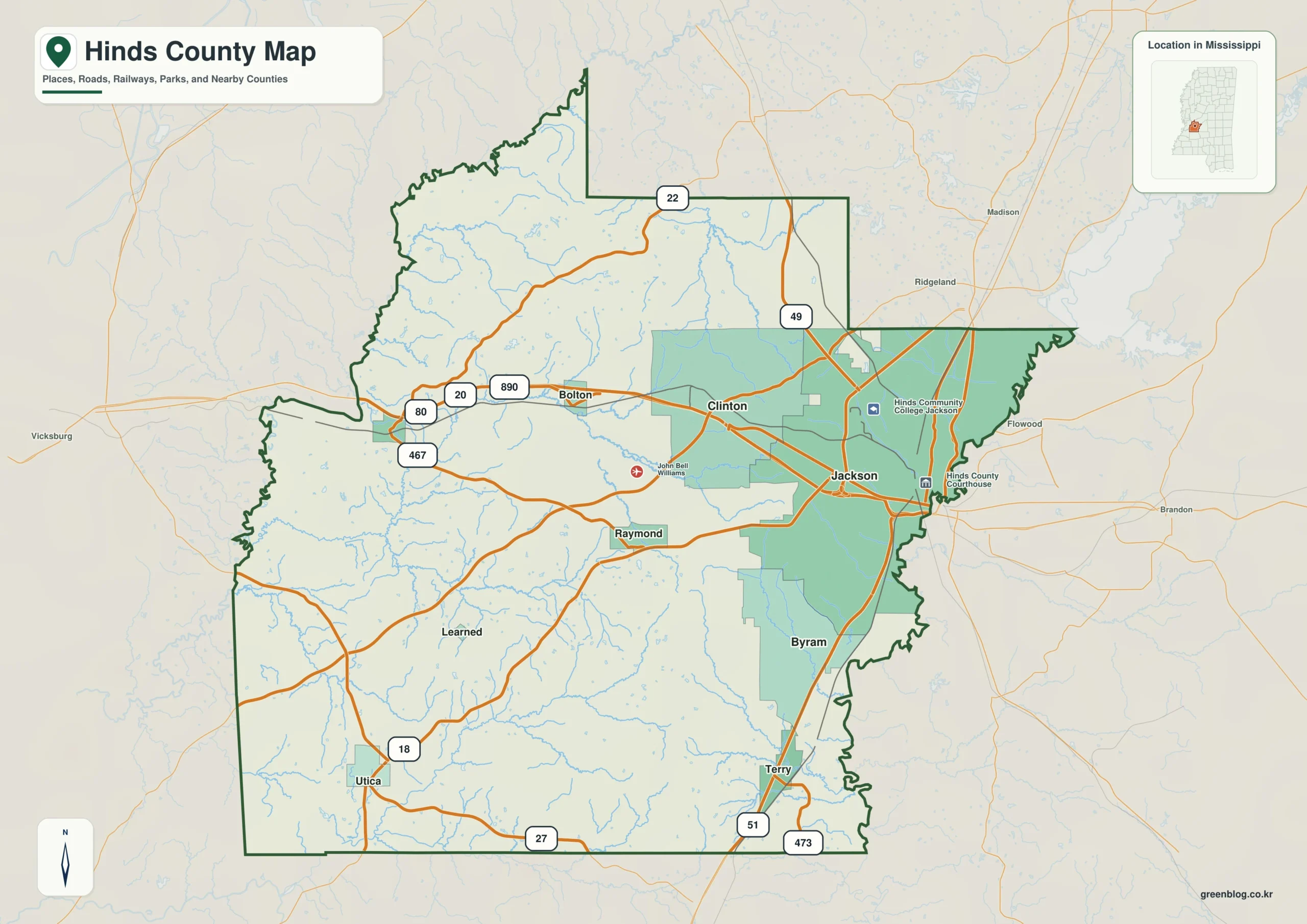
Hinds County Mississippi map download
The WebP preview is optimized for the page, while the button preserves the original high-resolution JPG for printing and reuse.
- File: County reference map
- Format: JPG
- Print layout: A3
Quick Facts
- State and identifier: Mississippi, Hinds County; FIPS 28049
- County seat: Jackson and Raymond
- Selected map labels: Jackson, Clinton, Raymond, Utica, Bolton, Edwards
- 2020 census population: 227,742
- July 2025 population estimate: 211,888
- 2025 Gazetteer area: 869.845 sq mi land and 7.436 sq mi water
- 2020 land-area density: 261.8 residents per sq mi
- Primary route references: I-20, I-55, US 49, US 80, and the Natchez Trace Parkway
- Landscape references: Pearl River, Big Black River, loess hills, and the Jackson metropolitan area
The decennial count and July 2025 estimate use different reference dates. Land and water measurements come from the 2025 Gazetteer. The density of 261.8 residents per square mile divides the 2020 population by 2025 land area and does not imply an even distribution among cities, farms, forest, or wetland.
Reading the Hinds County Mississippi map
Jackson supplies the strongest urban reference, but it should not be treated as the whole county. Follow I-20 and US 80 west through Clinton, Bolton, and Edwards, then shift south to Raymond and southwest to Utica. The page map omits the fine municipal boundaries and street detail needed for city-level navigation.
Boundary, Water, and Terrain
The Pearl River forms a major eastern reference beside Rankin County. Westward, the terrain crosses loess hills toward the Big Black River and Warren County. I-55 and I-20 concentrate movement around Jackson, whereas the broad southern and western sections use a thinner network of state and local roads.
Settlement and Regional Context
Hinds County has two county seats. Jackson carries state-government, medical, university, and metropolitan functions; Raymond provides a historic courthouse and administrative focus farther southwest. The gap between the 2020 census count and lower 2025 estimate is relevant to the urban core, yet it does not erase the county's role as the state's largest governmental center.
Practical Map Uses
- Trace the I-20 sequence from Jackson through Clinton to Edwards
- Distinguish Raymond's county-seat role from Jackson's capital-city role
- Compare the Pearl River edge with the Big Black River side
Frequently Asked Questions
Does this county map provide enough detail for Jackson streets?
No. Jackson's road and municipal pattern is too dense for a county-level reference. Use this page to place the capital within Hinds County and consult a city map for local routing.
What does Pearl River add between Jackson, Clinton, and the boundary with Yazoo?
Jackson and Clinton locate communities, whereas Pearl River explains terrain or drainage before the map reaches the Yazoo boundary.
Sources
- U.S. Census Bureau QuickFacts
- U.S. Census Bureau 2025 Gazetteer Files
- Mississippi Department of Transportation official highway map
- Regional landscape or institution reference
Related County Maps
Green Map creates custom-edited map images using open geographic data sources such as geoBoundaries, Natural Earth, OpenStreetMap, and government open data.
These maps are edited visual materials, not raw data files, and are provided for education, documents, presentations, and graphic reference.