The Covington County Mississippi map begins at Collins, where US 49 and US 84 create a prominent regional crossroads. Seminary, Mount Olive, and Sanford then pull the view beyond that junction into creek valleys, pine uplands, and smaller communities on three different sides of the county.
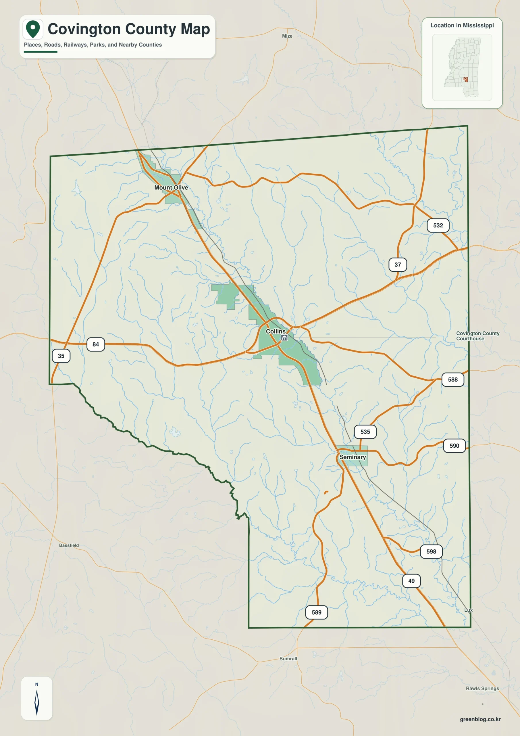
Covington County Mississippi map download
The WebP preview is optimized for the page, while the button preserves the original high-resolution JPG for printing and reuse.
- File: County reference map
- Format: JPG
- Print layout: A3
Quick Facts
- State and identifier: Mississippi, Covington County; FIPS 28031
- County seat: Collins
- Selected map labels: Collins, Seminary, Mount Olive, Sanford
- 2020 census population: 18,340
- July 2025 population estimate: 17,898
- 2025 Gazetteer area: 413.819 sq mi land and 1.112 sq mi water
- 2020 land-area density: 44.3 residents per sq mi
- Primary route references: US 49, US 84, MS 35, and MS 37
- Landscape references: Okatoma Creek, Bouie River headwaters, pine forests, and rolling uplands
The decennial count and the July 2025 estimate represent different reference dates. Land and water values come from the 2025 Gazetteer. The density of 44.3 residents per square mile uses the 2020 population and land area; it does not imply an even distribution among towns, farms, forests, or floodplain.
Covington County Mississippi map: What It Shows
Collins supplies the central road reference. Seminary lies southeast along US 49, Mount Olive identifies the northwest, and Sanford marks the southwestern interior. US 84 carries the eye across the county, while MS 35 and MS 37 reveal local connections that do not converge exclusively on the main interchange.
County Layout and Location
Covington is not large by Mississippi standards, yet its layout is divided by both roads and drainage. Okatoma Creek runs through the western and southern landscape, while headwaters toward the east feed the Bouie and Leaf river systems. Pine ridges keep the county from functioning as a flat highway grid.
Local Context: Collins at the Okatoma Crossing
Collins grew as a rail, road, and county-government center. Beyond the junction, timber and agriculture shaped dispersed settlement, while Okatoma Creek became a recognizable recreation corridor. These layers give Covington a dual identity as both a crossroads county and a rural watershed landscape.
Ways to Use This Map
- Explain the US 49–US 84 crossroads at Collins
- Relate Okatoma Creek to rural settlement and recreation
- Compare Seminary with the northwest and southwest communities
Frequently Asked Questions
Where is Seminary in relation to Collins?
Seminary lies southeast of Collins along the US 49 corridor. It helps extend the map beyond the central highway junction.
Why compare Okatoma Creek with Collins before reading the side toward Simpson?
Collins is a settlement anchor, while Okatoma Creek supplies a physical reference for separating the county interior from the approach to Simpson.
Sources
- U.S. Census Bureau QuickFacts
- U.S. Census Bureau Gazetteer Files
- Mississippi Encyclopedia: Covington County
- Mississippi Department of Transportation official highway map
Related County Maps
Green Map creates custom-edited map images using open geographic data sources such as geoBoundaries, Natural Earth, OpenStreetMap, and government open data.
These maps are edited visual materials, not raw data files, and are provided for education, documents, presentations, and graphic reference.