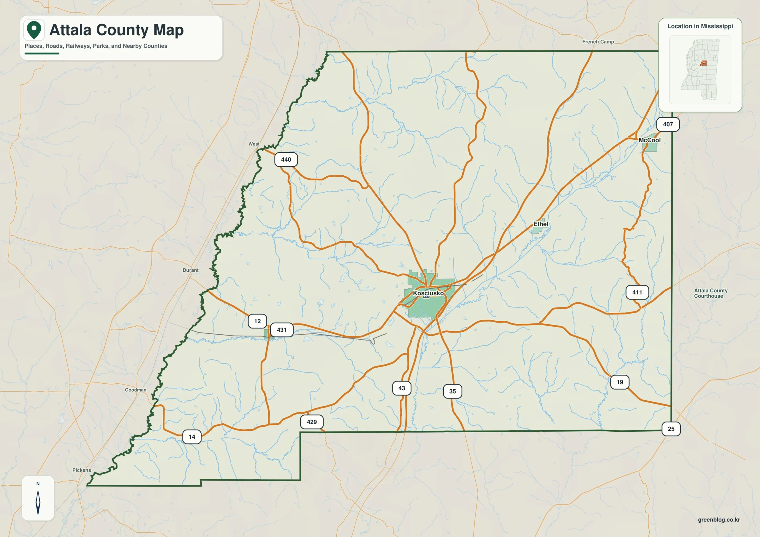
The Attala County Mississippi map uses Kosciusko as its central reference while the Big Black River defines much of the western side. Ethel, McCool, and Sallis spread the orientation across a large hilly county, preventing the seat from being mistaken for the only meaningful location.
Attala County Mississippi map download
The WebP preview is optimized for the page, while the button preserves the original high-resolution JPG for printing and reuse.
- File: County reference map
- Format: JPG
- Print layout: A3
Quick Facts
- State and identifier: Mississippi, Attala County; FIPS 28007
- County seat: Kosciusko
- Selected map labels: Kosciusko, Ethel, McCool, Sallis
- 2020 census population: 17,889
- July 2025 population estimate: 17,100
- 2025 Gazetteer area: 734.957 sq mi land and 1.709 sq mi water
- 2020 land-area density: 24.3 residents per sq mi
- Primary route references: MS 12, MS 14, MS 19, MS 35, and Natchez Trace Parkway
- Landscape references: Big Black River, central Mississippi hills, and Natchez Trace Parkway
The decennial count and the July 2025 estimate represent different reference dates. Land and water values come from the 2025 Gazetteer. The density of 24.3 residents per square mile uses the 2020 population and land area; it does not imply an even distribution among towns, farms, forests, or floodplain.
Attala County Mississippi map: What It Shows
Kosciusko anchors the route network, but the map’s scale becomes clearer through Ethel to the south, McCool to the northeast, and Sallis to the west. MS 12 crosses the county broadly east–west, while MS 19 and MS 35 supply north–south references. The Natchez Trace Parkway follows a separate regional logic.
County Layout and Location
Attala occupies rolling central Mississippi terrain. The Big Black River creates a natural western edge, while the land rises and divides toward Winston and Leake counties. The county’s size and relief make route direction more informative than straight-line distance between labels.
Local Context: Kosciusko and Big Black Hills
Created in 1833 from lands ceded by the Choctaw Nation, Attala developed around farming, timber, and a network of small communities. Kosciusko’s concentration of administrative and commercial functions contrasts with the dispersed settlement visible beyond the central road junctions.
Ways to Use This Map
- Locate Kosciusko within central Mississippi
- Compare the river boundary with the Natchez Trace corridor
- Explain the directional relationship among Ethel, McCool, and Sallis
Frequently Asked Questions
How do Sallis and McCool frame Kosciusko on the map?
Sallis lies to the west of the county seat, while McCool provides a northeastern reference. Their separation reveals the county’s breadth more effectively than a single central label.
Which different map roles are served by Kosciusko, Big Black River, and the Carroll side?
Kosciusko works as a place anchor, Big Black River as a landscape anchor, and Carroll as an outer reference for reading three different layers of the county.
Sources
- U.S. Census Bureau QuickFacts
- U.S. Census Bureau Gazetteer Files
- Mississippi Encyclopedia: Attala County
- Mississippi Department of Transportation official highway map
Related County Maps
Green Map creates custom-edited map images using open geographic data sources such as geoBoundaries, Natural Earth, OpenStreetMap, and government open data.
These maps are edited visual materials, not raw data files, and are provided for education, documents, presentations, and graphic reference.