A Latvia Map is especially helpful when a small Baltic country needs to be understood through both its coastline and its local boundaries. Latvia lies between Estonia and Lithuania, faces the Baltic Sea to the west, and borders Russia and Belarus in the east and southeast. The Gulf of Riga cuts deeply into the northwestern side of the country, giving the coast a shape that is difficult to explain with a simple locator image. Riga sits near the southern end of the gulf, while western Kurzeme, northern Vidzeme, southern Zemgale, and eastern Latgale extend in noticeably different directions.
This printable Latvia Map collection contains three image-based versions: a color municipal map, a labeled black and white map, and a blank outline map. The images measure 4,962 × 3,036 pixels and were prepared for A3-size printing, enlarged screen viewing, classroom handouts, presentation slides, blog graphics, and infographic projects. Korean place names appear on the labeled versions. The outline image can be opened in common graphics or presentation software for adding colors, symbols, routes, and notes, but it should be treated as a raster base image rather than an editable vector source.
The boundary date matters in this collection. Its internal divisions follow the 2021 arrangement in which Varakļāni remained separate, producing 36 municipalities alongside seven independently governed state cities. Varakļāni Municipality was incorporated into Madona Municipality on July 1, 2025. Latvia now has 35 municipality governments and seven independently governed state-city governments, for 42 local governments in total. The files are therefore most appropriate for showing the boundary structure used from 2021 through the first half of 2025, not for claiming a fully current 2026 municipal layout.
Table of Contents
Collection at a Glance
- Included styles: color, black and white, and outline
- File category: image files
- Image dimensions: 4,962 × 3,036 pixels
- Print use: prepared for an A3 layout
- Labels: Korean place names on the labeled maps
- Boundary reference: 36-municipality arrangement used before the July 2025 Varakļāni–Madona merger
- Suitable projects: worksheets, reports, regional comparisons, slides, blog visuals, and annotated graphics
Reading the Latvia Map Through the Gulf of Riga
The Gulf of Riga divides the northern coast into two broad sides and makes coastal orientation an important part of the layout. A route between places on opposite sides of the gulf cannot be understood from straight-line distance alone, while Riga’s position near the gulf explains why the capital is such a strong reference point. Estonia appears to the north, Lithuania to the south, and the eastern border meets Russia and Belarus.
The local-government pattern also changes across the country. Areas around Riga are comparatively compact, while municipalities farther west and east cover broader spaces. Vidzeme, Kurzeme, Zemgale, and Latgale may also appear in regional discussions, but they are historical and cultural lands rather than local governments at the same administrative level as the municipalities shown here.
Color Municipal Version
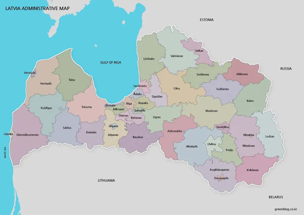
The color Latvia Map separates adjoining municipalities without allowing the sea areas to disappear into the page. Distinct fills help readers compare the smaller divisions around Riga with the broader municipal areas toward Kurzeme and Latgale. They also make Varakļāni easier to identify between Madona and Rēzekne when explaining why this map differs from a post-July 2025 reference.
During preparation, extra space was preserved around the Gulf of Riga instead of enlarging the land until the coastline felt cramped. That decision keeps the curve of the gulf, the western peninsula, and the northern coastal edge recognizable on a presentation slide. The color image is the strongest choice for Baltic-region comparisons, geography lessons, and visual introductions to Latvia’s former 36-municipality arrangement.
Labeled Black and White Version
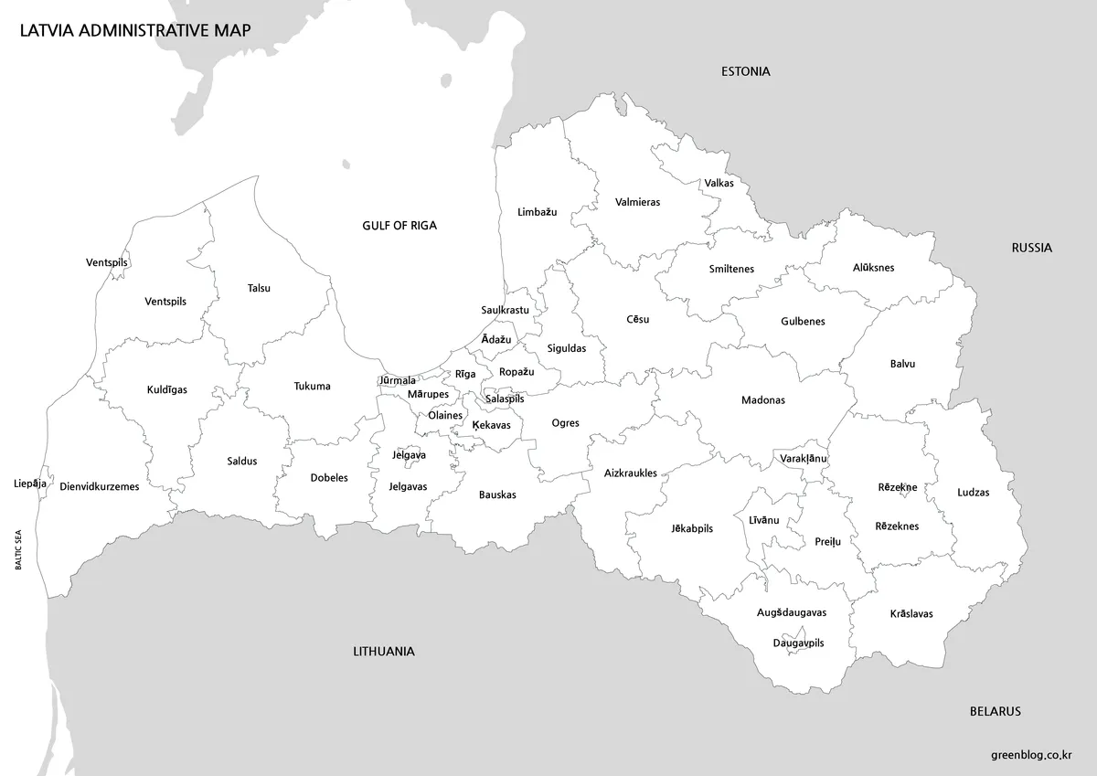
For reports and classroom sheets, the black and white Latvia Map removes the colored fills while retaining Korean names and boundary lines. The cleaner surface gives users room to underline municipalities, circle Riga, or add short notes without competing with background colors. It is also more practical when several copies need to be printed on a monochrome printer.
Label spacing deserves attention because the divisions around the capital and parts of the east sit closer together than the larger western areas. The line balance and text placement were reviewed with enlarged printing in mind, so the coast and local boundaries remain distinguishable when the image is placed in an A3 handout or a document page.
Blank Outline Base for Custom Projects
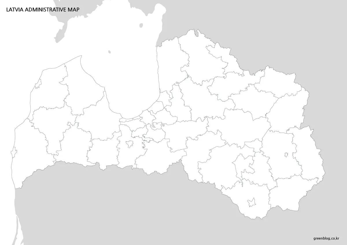
The outline Latvia Map keeps the national coastline and internal municipal boundaries while removing place names and color fills. Teachers can turn it into a Baltic geography worksheet, students can color selected municipalities, and designers can add population shading, city markers, national parks, or travel routes. A project about the 2025 boundary change could also shade Varakļāni and Madona together to demonstrate the updated arrangement.
Because the file is an image rather than a supplied vector source, individual boundary objects are not promised as independently selectable elements. It works best as a clean visual base placed beneath annotations in a graphics, document, or presentation application.
Choosing a Version for Your Project
Choose the color file when the main task is rapid visual comparison, especially around Riga and the two sides of the Gulf of Riga. Select the black and white image for handouts, reports, photocopies, and written annotations. Use the blank boundary version when the project requires custom categories or location markers rather than existing labels.
The collection is administrative in purpose. Roads, railways, elevation, and detailed attraction symbols are not included. For travel content, users can add Riga, Jūrmala, Sigulda, Cēsis, or national-park markers to the outline image while keeping the municipal structure visible in the background.
Practical Uses
These files work well for Baltic states comparison lessons because Latvia can be viewed between Estonia and Lithuania with the Baltic coast kept in context. They are also suitable for presentations about the Gulf of Riga, worksheets on neighboring countries, document illustrations, and graphics explaining the Varakļāni–Madona change.
A finished color image gives an audience immediate regional separation, while the simpler files leave more room for the user’s own information. This makes the set useful to teachers, students, bloggers, and presentation creators who need the same geography presented at different levels of visual detail.
Frequently Asked Questions
What period does the Latvia Map represent?
The municipal boundaries reflect the arrangement used from 2021 through the first half of 2025, before Varakļāni Municipality became part of Madona Municipality on July 1, 2025.
How many local governments does Latvia have now?
The current classification contains 35 municipality governments and seven independently governed state-city governments, making 42 local governments.
Can the files be printed at A3 size?
Yes. The 4,962 × 3,036-pixel images were prepared for an A3 layout and enlarged viewing.
Which file is best for adding my own information?
Use the outline image for custom colors, city markers, routes, statistics, or classroom activities. It is a raster image base, not a supplied vector source file.
Are Latvia’s historical regions the same as municipalities?
No. Vidzeme, Kurzeme, Zemgale, and Latgale are historical and cultural lands, while municipalities and independently governed state cities are local-government units.
Map File Information
This download includes printable Latvia map versions for educational use, presentation design, document printing, and editable graphic projects.
- Included Versions: Color map, black and white map, outline map
- Printable Size: A3 layout
- File Type: Image files
- Intended Use: Classroom handouts, presentations, blog graphics, infographic editing, and printable reference materials
Related Maps
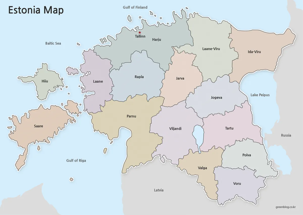
- Estonia Map Download for Printing, Classroom Use, and Graphic Editing
- Belarus Map Collection: Printable Administrative, Labeled, and Outline Maps
- Sweden Map Collection: Printable Color, Black and White, and Outline Maps
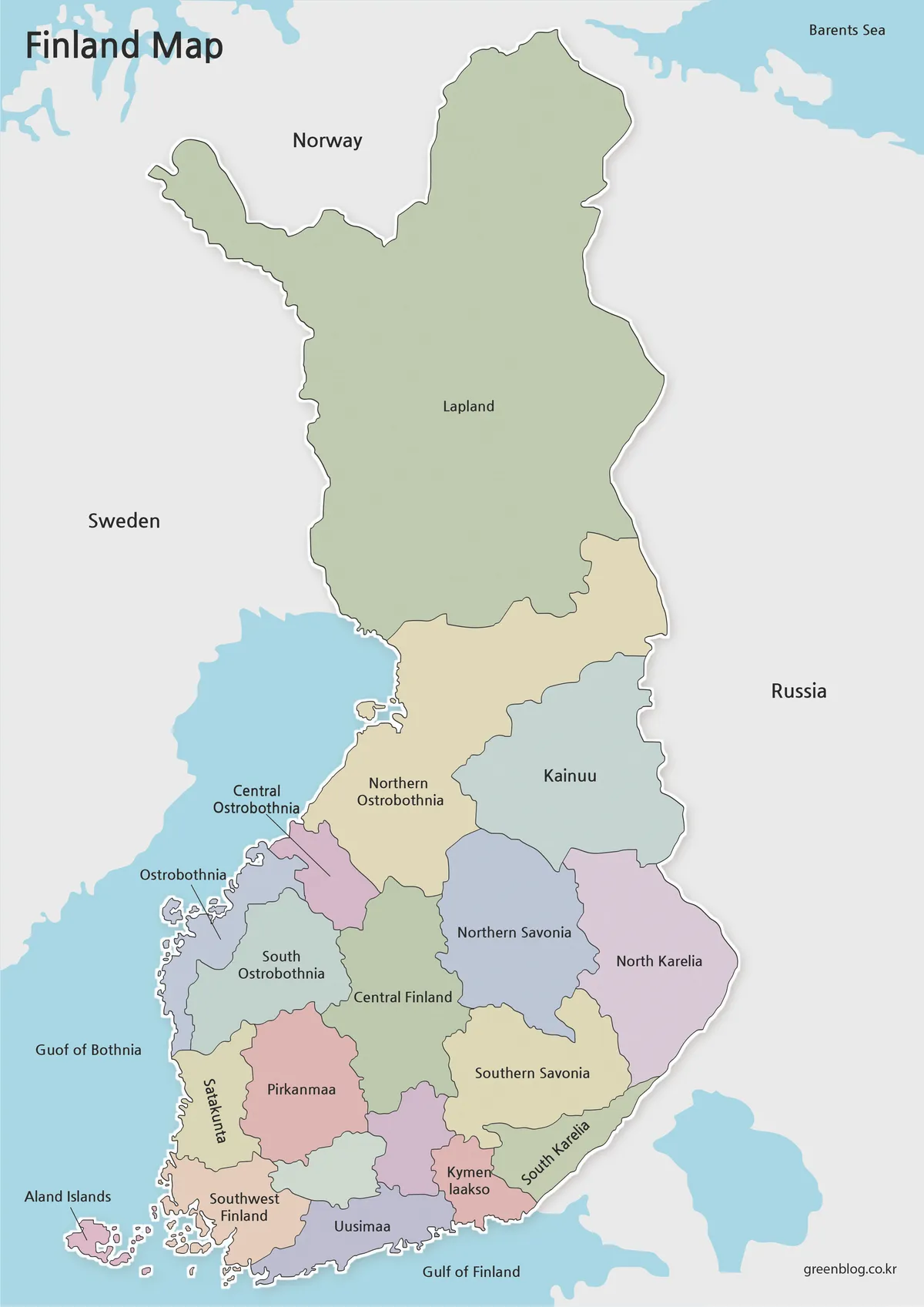
- Finland Map Collection: Printable Color, Black and White and Outline Maps
Additional Resources
- Official Latvia Travel Website: Explore visitor information for Riga, Jūrmala, Gauja National Park, the Baltic coast, and other destinations that can be marked on the outline map.
Green Map creates custom-edited map images using open geographic data sources such as geoBoundaries, Natural Earth, OpenStreetMap, and government open data.
These maps are edited visual materials, not raw data files, and are provided for education, documents, presentations, and graphic reference.