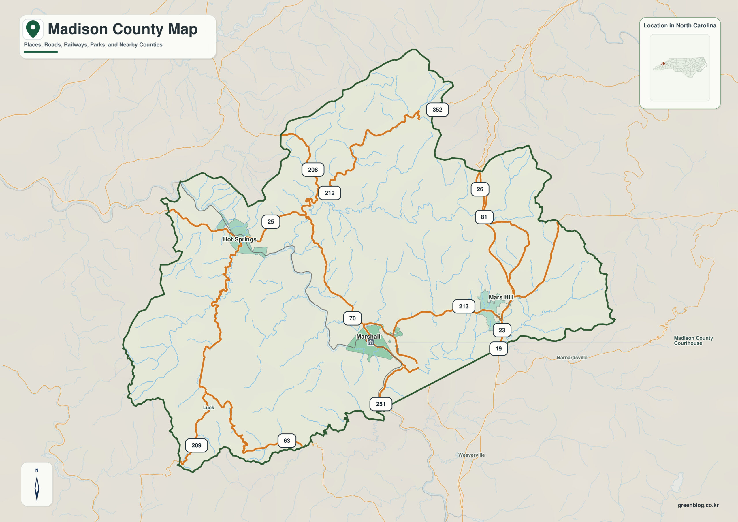
Madison County North Carolina map follows three different mountain corridors: Marshall on the French Broad, Hot Springs farther west where the river meets the Appalachian Trail, and Mars Hill in a separate northeastern upland setting.
Marshall is a starting point, not a complete description of the county. Hot Springs, Mars Hill, French Broad River, and Appalachian Trail corridor reveal additional settlement and landscape zones that would otherwise disappear.
Madison County quick facts
- County seat: Marshall
- Place references: Marshall, Hot Springs, Mars Hill
- Physical references: French Broad River, Appalachian Trail corridor
- Neighboring counties: Buncombe, Haywood, Yancey
Three mountain centers along different corridors
Marshall occupies a narrow French Broad valley, Hot Springs lies farther downriver toward Tennessee, and Mars Hill is removed from that river axis. The three centers therefore cannot be read as one linear town chain.
Hot Springs and Marshall use the French Broad differently
The French Broad winds northwest from Buncombe through Madison and into Tennessee. Ridges between the river corridor and the Mars Hill/Yancey side create a complex internal geography despite the county’s modest size.
Mars Hill belongs to another mountain setting
Madison County was formed from Buncombe and Yancey Counties in 1851. Hot Springs sits at the junction of the French Broad River and Appalachian Trail, while Marshall is the county seat.
This county is clearer when settlement references (Marshall, Hot Springs, Mars Hill) and physical references (French Broad River, Appalachian Trail corridor) remain separate. The distinction improves both geographic interpretation and later use of demographic, transport, or recreation layers.
Reading valleys, passes, and river direction
Use the Marshall–Hot Springs river relationship and the separate Mars Hill upland reference before adding hiking, road, or recreation information. The river and ridges determine practical movement.
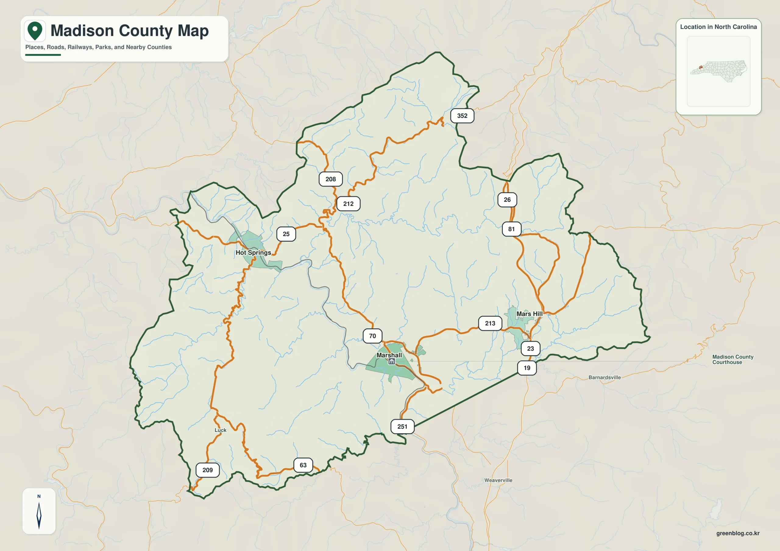
Madison County single map file
The image above is a web preview; the button is reserved for the separate original map asset.
Download the Madison County map fileFrequently Asked Questions
Why is French Broad River useful when comparing Marshall with the outer county?
The value of French Broad River is that it explains physical orientation while the named communities explain settlement. Using both layers together produces a more accurate county-scale reading.
What would be lost by folding Hot Springs into a Marshall-centered description?
Marshall and Hot Springs do not need to have the same administrative status to be equally useful for orientation. One marks the seat; the other helps represent a different part of the county.
Sources
Related County Maps
Green Map creates custom-edited map images using open geographic data sources such as geoBoundaries, Natural Earth, OpenStreetMap, and government open data.
These maps are edited visual materials, not raw data files, and are provided for education, documents, presentations, and graphic reference.