Railroad towns occupy the inland prairie, refinery and marine industries line the southeast, and suburban growth faces Corpus Christi Bay. A San Patricio County Texas map brings those contrasting areas together through Sinton, Taft, Odem, Mathis, Portland, Gregory, Ingleside, and Aransas Pass. The county seat is near the geographic center, but the largest population and industrial corridors lie closer to the bay.
The Census Bureau estimated 72,053 residents on July 1, 2025, 4.8 percent above the 2020 estimate base of 68,757. Portland and other Corpus Christi-linked communities account for much of the recent growth, while agriculture and county government remain important inland.
Table of Contents
The Railroad Reorganized an Older Ranching County
San Patricio County began with Mexican and Irish colonial settlement near the Nueces River region, but nineteenth-century ranching dominated much of the landscape. The San Antonio and Aransas Pass Railway entered the county in the 1880s and encouraged new townsites along its route. Mathis, Sinton, Gregory, and other communities gained shipping access for cattle, cotton, vegetables, grain, and supplies.
The Coleman-Fulton Pasture Company donated land for Sinton near the center of the county. Sinton became county seat in 1893, replacing the older community of San Patricio. Rail junctions, cattle-loading pens, grain elevators, and highways reinforced its role as the administrative center even as population later shifted toward the coast.
Portland Became a Corpus Christi Suburb
Portland grew on the north shore of Corpus Christi Bay and extends into Nueces County. Early plans emphasized rail shipping and wharf access, but hurricanes and regional changes limited its port ambitions. Industrial development and rapid residential growth after the 1950s turned the city into a major Corpus Christi bedroom community.
Gregory lies immediately inland, while Ingleside and Aransas Pass continue east toward Redfish Bay and Aransas County. The resulting urban-industrial corridor crosses municipal and county lines, so a county map is essential for separating place names from jurisdiction boundaries.
Ship Channel Industry Changed the Coastal Economy
The Corpus Christi Ship Channel and associated harbor complex supported refineries, petrochemical plants, metal processing, marine fabrication, pipelines, and bulk cargo facilities. Gregory and Ingleside became closely tied to industrial sites along the channel and bay. These facilities link San Patricio County to a port economy much larger than the county seat.
Aransas Pass developed a strong shrimping and seafood sector and also serves as a route toward Port Aransas and the Gulf. Redfish Bay, Corpus Christi Bay, and nearby estuarine habitats support fishing, birdlife, and recreation, while industrial navigation and shoreline development create competing land uses.
Cotton, Grain, and Cattle Remain Inland
Taft, Odem, Edroy, and the country around Sinton retain strong agricultural identities. Cotton, sorghum, corn, grain handling, cattle, and related services use the level Coastal Bend prairie. Irrigation, rail shipment, highways, and proximity to port elevators connected inland farms with wider markets.
Mathis anchors the northwestern corner near Lake Corpus Christi and Interstate 37. Its setting differs from the saline bays and industrial shoreline in the southeast. That contrast explains why the county supports farming, lake recreation, manufacturing, logistics, suburban housing, and seafood activity at the same time.
Map Orientation Table
| Reference | Map role |
|---|---|
| Sinton | County seat and inland highway-rail center |
| Portland | Largest city and Corpus Christi suburban shoreline |
| Gregory–Ingleside | Ship channel and industrial corridor |
| Aransas Pass | Seafood, bay access, and route toward the Gulf |
| Mathis | Northwestern farm and Lake Corpus Christi gateway |
Color Map
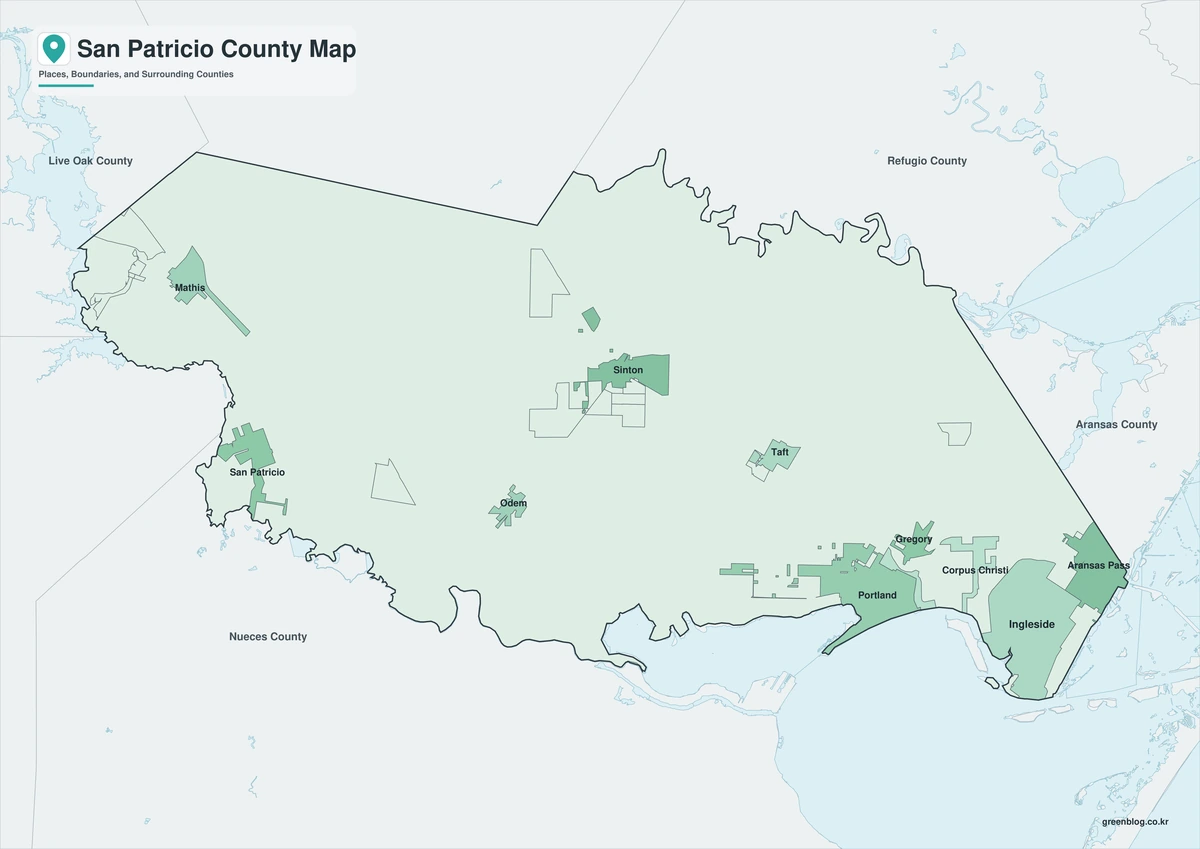
The color map separates San Patricio County from Nueces, Jim Wells, Live Oak, Bee, Refugio, and Aransas counties. Portland and Gregory form a southeastern bay-side cluster, while Sinton and Taft sit farther inland. Corpus Christi Bay, Redfish Bay, and the Aransas Pass corridor make the eastern edge visually distinct from the agricultural northwest.
Black-and-White Map
Colored fills are removed, but selected labels and county lines remain. Mathis and Odem can be compared across the northwestern and southwestern road network, while Ingleside remains identifiable near the bay corridor. The format is suitable for reports and low-ink classroom printing.
Outline Map
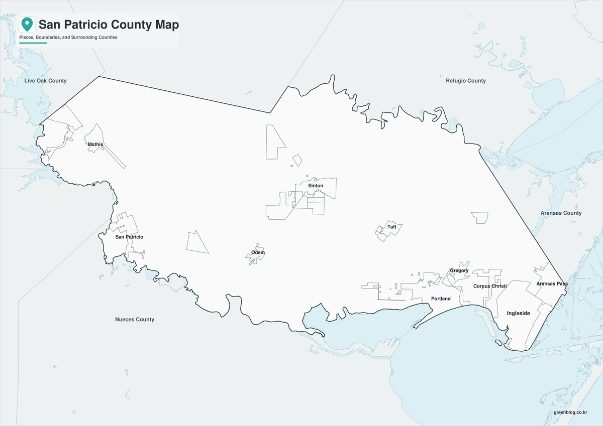
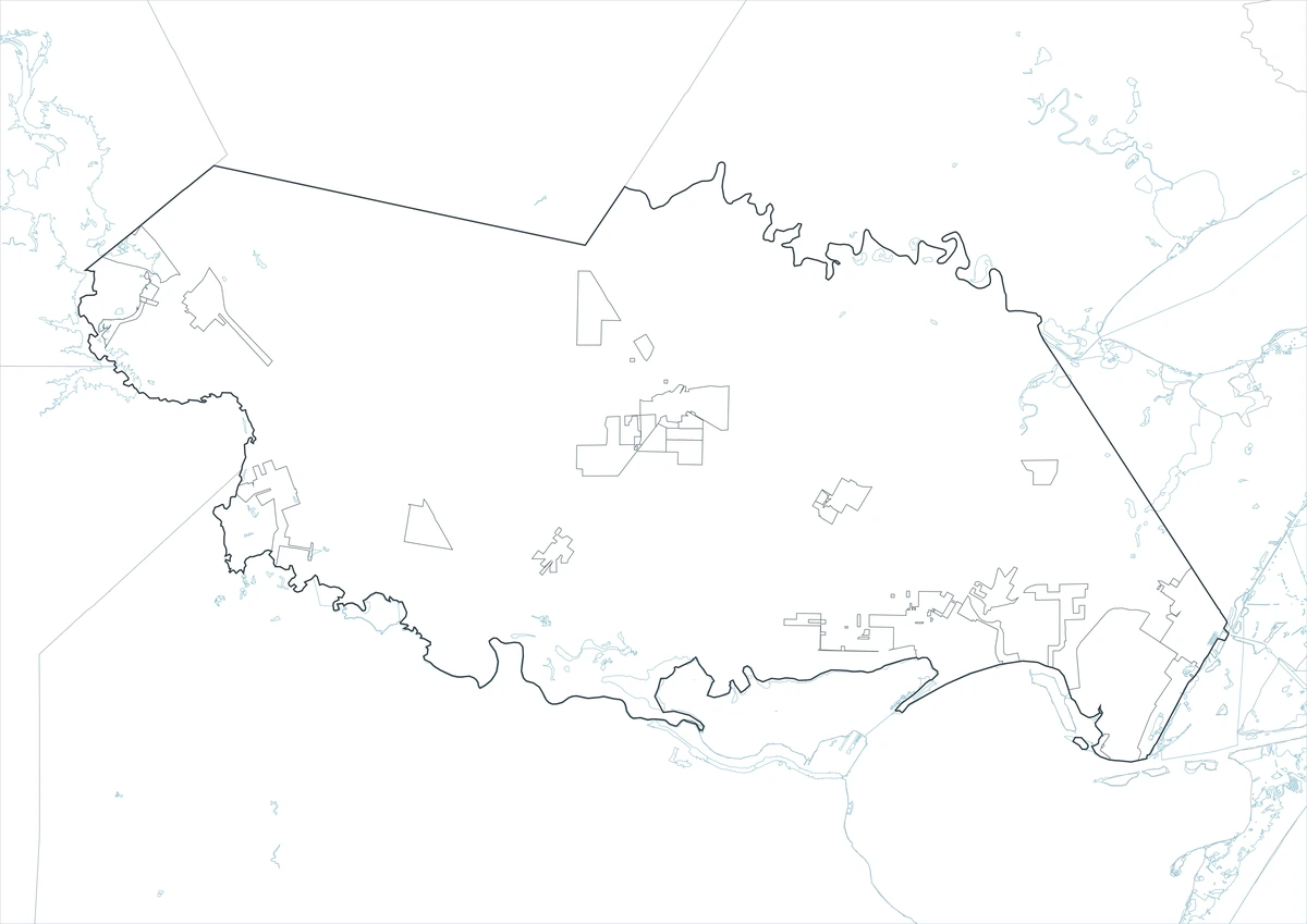
The outline version removes names and fills, retaining San Patricio County and the surrounding boundary framework. Users can plot Sinton and Aransas Pass, add Corpus Christi Bay and Redfish Bay, or trace U.S. 77, U.S. 181, and industrial transport routes. It provides a clean base for port, agriculture, population, or coastal-land-use projects.
Download the Printable County Maps
The San Patricio County Texas map set includes labeled color and black-and-white files plus an unlabeled outline base. Each JPG uses an A3 layout for printing, presentations, classroom work, and digital reference.
County Map File Information
This download includes three A3 JPG versions of the San Patricio County map. The labeled maps use selected place names for readability, while the outline version contains boundary lines without labels or color fills.
- Included Versions: Color, Black and White, Outline
- File Type: JPG
- Printable Size: A3 high-resolution layout
- Map Detail: County boundary, selected place boundaries, and surrounding county reference
- Intended Use: Printing, classroom materials, presentations, documents, blog graphics, and custom annotations
Frequently Asked Questions
Why did Sinton become the county seat?
Its central railroad location and a donated townsite made it more accessible to the developing inland communities. Voters transferred county government there in 1893.
Is Aransas Pass entirely inside San Patricio County?
No. Aransas Pass extends into San Patricio and Aransas counties, and its broader urban area is closely connected to Nueces County routes.
Does the outline map show refinery or terminal property lines?
No. It provides only the county framework. Current industrial parcels, pipelines, terminals, and restricted port areas require specialized official maps.
Sources and Further Reading
The Handbook of Texas entry for San Patricio County documents colonial settlement, ranching, railroads, farming, towns, and coastal industry.
U.S. Census Bureau QuickFacts provides the 2020 estimate base, 2025 population estimate, and percentage change.
Texas Parks and Wildlife Department describes the Corpus Christi Bay System and its component bays.
Regional Information
Continent: North America
Country: United States
State: Texas
County: San Patricio County
Location in State: Texas Coastal Bend north of Corpus Christi
Adjacent Counties: Bee County, Refugio County, Aransas County, Nueces County, Jim Wells County, Live Oak County
Major Places: Sinton, Portland, Ingleside, Aransas Pass, Taft, Mathis, Odem, Gregory
Geographic Features: Corpus Christi Bay, Nueces Bay, Redfish Bay, Chiltipin Creek, Lake Corpus Christi
Related Maps
- Upton County Texas map|Rankin, McCamey, and West Texas Oil Country
- Wilson County Texas map|Floresville, La Vernia, Poth, and Stockdale
- Tarrant County Texas map|Fort Worth, Arlington, Airport Cities, and Trinity Lakes
- Zapata County Texas map|Zapata, San Ygnacio, and Falcon Lake
- Travis County Texas map|Austin, Lake Travis, and the Colorado River
Green Map creates custom-edited map images using open geographic data sources such as geoBoundaries, Natural Earth, OpenStreetMap, and government open data.
These maps are edited visual materials, not raw data files, and are provided for education, documents, presentations, and graphic reference.