Forested land, poultry and cattle production, manufacturing, and reservoir recreation all meet in a compact Northeast Texas county centered on Mount Pleasant. A Titus County Texas map provides a practical way to place that regional hub beside Winfield, Cookville, Talco, and the lake country southwest of the city.
The 2020 census counted 31,247 residents, and the July 2025 estimate was 31,563. The county seat, Mount Pleasant, plays a significantly larger administrative and commercial role compared to the county’s other incorporated cities.
Table of Contents
A Northeast Texas County Built Around Mount Pleasant
Interstate 30 and U.S. highways make Mount Pleasant the county’s main service and travel center between Dallas and Texarkana. County offices, retail activity, schools, healthcare, and industry are concentrated there. The surrounding towns remain distinct, but daily orientation usually begins with their direction from Mount Pleasant.
How to Read the County at a Glance
The Titus County Texas map is easiest to read by locating Mount Pleasant first, then following the east-west corridor toward Winfield and Cookville. Talco provides a northwestern reference, while the reservoir area lies southwest of the county seat. The map is a general county reference rather than a parcel survey, complete road atlas, flood map, or lake-navigation chart.
Two Drainage Systems and a Wooded Landscape
The county lies within the East Texas timberlands, where pine, oak, and other hardwoods cover rolling or gently undulating terrain. Water in the northern half drains toward the Sulphur River, while the southern half belongs to the Big Cypress Creek system. This divide helps explain why reservoirs and wooded shorelines are prominent in the southern part of the local landscape.
Lake Bob Sandlin and Lake Monticello
Lake Bob Sandlin forms a major recreation and habitat setting southwest of Mount Pleasant. A state park on its wooded northern shore offers camping, trails, fishing, paddling, and lake access. Visitors should rely on current agency notices for both reservoirs instead of assuming they have identical facilities due to Lake Monticello’s different access history.
County Formation and Economic Identity
Texas created Titus County in 1846 and named it for Andrew Jackson Titus. Its original territory also included areas that later became Morris and Franklin counties, resulting in the current boundaries being part of a larger regional reorganization. Agriculture, timber, lignite, oil and gas, trailer manufacturing, and food production have all contributed to the county’s economy at different times.
- County seat and largest city: Mount Pleasant
- Western city: Winfield
- Eastern community: Cookville
- Northwestern reference: Talco
- 2025 population estimate: 31,563
- Regional setting: East Texas timberlands and reservoir country
Color Map
The color edition separates Titus County from Red River, Morris, Camp, and Franklin counties with distinct area fills. Mount Pleasant anchors the center, while Talco and Cookville give the northern and eastern sides recognizable community references. Winfield points toward the western corridor, and the Lake Bob Sandlin–Lake Monticello area adds a clear water-based contrast southwest of the county seat.
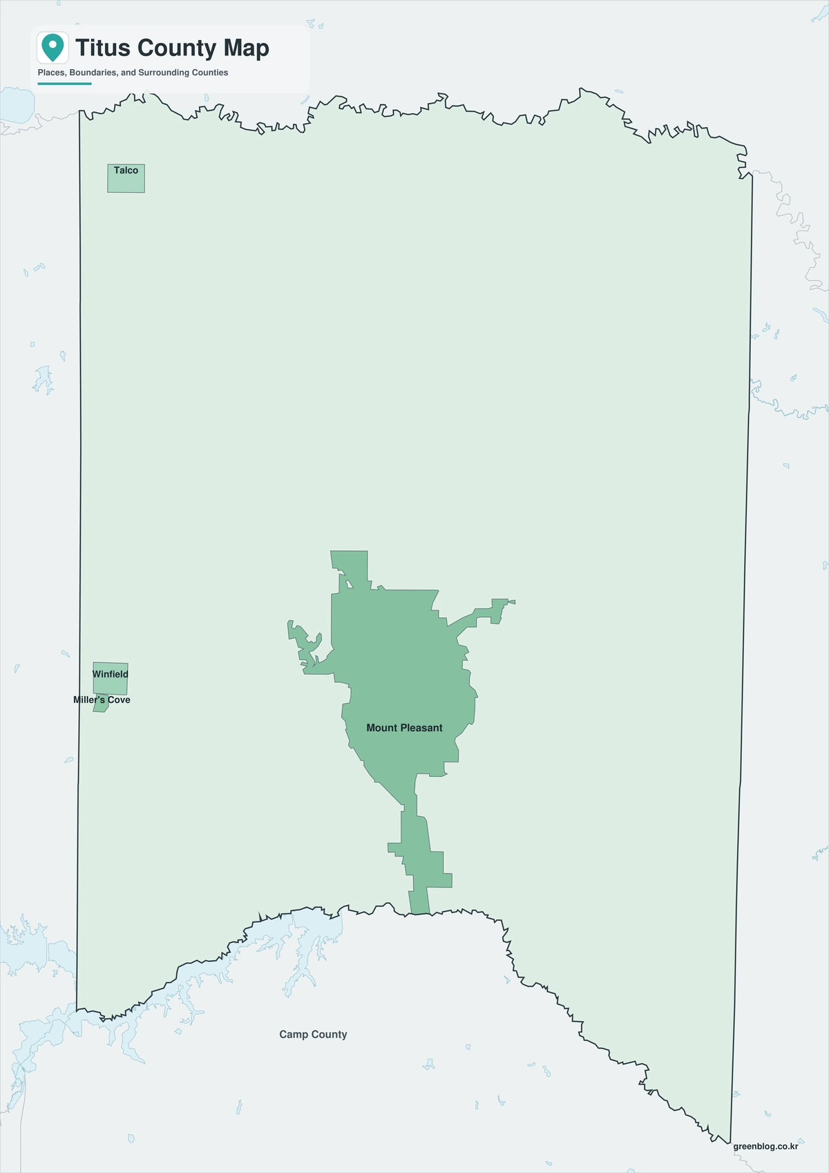
Black-and-White Map
Mount Pleasant remains the strongest reference point when the county fills are removed, with Winfield to the west and Cookville to the east still readable through the retained labels and boundary framework. The monochrome layout is useful for comparing those community positions or adding notes without competing with multiple background colors. Reservoir locations can also be marked more clearly for a focused water or recreation handout.
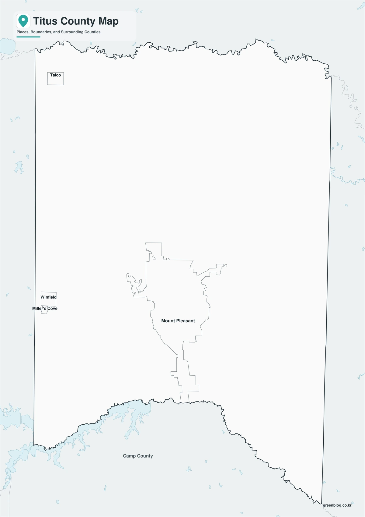
Outline Map
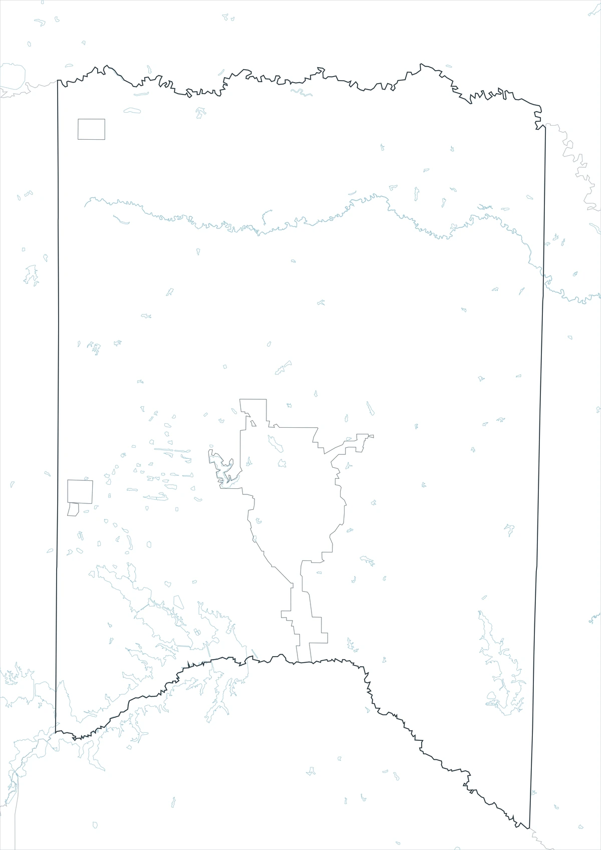
The outline file removes fills and place labels while preserving the Titus County boundary and the surrounding county framework. Users can add Mount Pleasant and Talco, trace the I-30 corridor, or sketch Lake Bob Sandlin and Lake Monticello in the open interior. The same base can support a custom watershed comparison between the Sulphur River and Big Cypress Creek drainage areas.
Download the Printable County Maps
The Titus County Texas map download includes color, black-and-white, and outline versions in an A3 JPG layout. Choose the labeled color file for regional orientation, the monochrome file for printing and notes, or the boundary-only sheet for adding community, transportation, and watershed themes.
County Map File Information
The download contains color, black-and-white, and outline maps of Titus County. Selected place labels appear on the first two versions, while the outline file retains boundaries without fills or place names.
- Included Versions: Color, Black and White, Outline
- File Type: JPG
- Printable Size: A3 high-resolution layout
- Map Coverage: County boundary, neighboring counties, and selected communities
- Intended Use: Printing, reports, classrooms, presentations, and custom annotations
Frequently Asked Questions
Which city is the main center of Titus County?
Mount Pleasant is the county seat, largest city, and main concentration of government, services, retail, and transportation connections.
Are both reservoirs shown as recreation sites?
The county’s reservoir setting can be used for geographic orientation, but access and recreation conditions differ by lake. Current park and fisheries notices should be checked before a visit.
What can be added to the outline version?
It can be customized with community names, interstate and highway routes, lake outlines, drainage divides, forest areas, or project-specific symbols.
Sources and Further Reading
Population values come from the U.S. Census Bureau QuickFacts profile. County formation, settlement, landscape, drainage, and economic background are summarized by the Handbook of Texas. Current public information for Lake Bob Sandlin is available from the Texas Parks and Wildlife Department.
This map is intended for general geographic reference. Use current public GIS, transportation, flood, reservoir, appraisal, and property records for legal boundaries, emergency planning, water access, or land decisions. Navigation and property decisions are best handled through other means.
State: Texas
County: Titus County
Location: Northeast Texas, East Texas timberlands
Adjacent counties: Red River County, Morris County, Camp County, Franklin County
Major places: Mount Pleasant, Winfield, Cookville, Talco, Miller’s Cove
Geographic features: Lake Bob Sandlin, Lake Monticello, Sulphur River drainage, Big Cypress Creek drainage
Related Maps
- Wheeler County Texas map|Wheeler, Shamrock, Mobeetie, and the Red River
- Throckmorton County Texas map|Cow Country, Throckmorton, and the Brazos Forks
- Yoakum County Texas map|Plains, Denver City, and the Permian Basin
- Washington County Texas map|Brenham, Burton, and Lake Somerville
- Upshur County Texas map|Gilmer, Big Sandy, and Lake O’ the Pines
Green Map creates custom-edited map images using open geographic data sources such as geoBoundaries, Natural Earth, OpenStreetMap, and government open data.
These maps are edited visual materials, not raw data files, and are provided for education, documents, presentations, and graphic reference.