A Tajikistan Map has to distinguish administrative structure from a border outline. The supplied images show five top-level territorial categories: Sughd Region, Khatlon Region, the Gorno-Badakhshan Autonomous Region, the Districts of Republican Subordination, and Dushanbe. They also preserve the highly intricate northern boundary around the Fergana Valley. That line needs a date note because Tajikistan and Kyrgyzstan signed a state-border treaty in March 2025 and exchanged instruments of ratification later that month.
The three coordinated previews measure 1,200 × 849 pixels. One uses pastel fills and labels, one keeps the labels in monochrome, and one removes all names and colors. The source package describes an A3-oriented image set. This Tajikistan Map collection can support regional identification, Central Asia lessons, presentation graphics, and blank-map exercises, but it is not a district, road, terrain, river, population, or navigation map.
Tajikistan is landlocked and shares borders with Uzbekistan, Kyrgyzstan, China, and Afghanistan. All four are labeled around the color and monochrome views. Pakistan is also printed below the southeast, but Afghanistan’s narrow Wakhan Corridor separates Pakistan from Tajikistan; Pakistan is nearby regional context, not a land neighbor. The map likewise shows no mountain names, even though the large eastern unit is closely associated with the Pamir highlands.
Table of Contents
Map Versions Included
The Tajikistan Map files share the same national extent and internal lines, allowing a reader to move from labeled reference to blank practice without changing the base. The five visible areas are not five identical provinces. Sughd and Khatlon are regions; Gorno-Badakhshan is an autonomous region; the Districts of Republican Subordination are a collective first-level grouping; and Dushanbe is the capital city with separate administrative standing.
- Color regional map: five territorial units in separate pastel fills, plus country labels around the border
- Monochrome regional map: the same boundaries and names without colored fills
- Blank outline map: internal divisions and surrounding land shapes without labels
Dushanbe appears as a very small outlined unit in the west-central part of the country and is identified with a leader line. The graphic does not place point symbols for Dushanbe or other cities such as Khujand, Bokhtar, and Khorugh. The broad eastern area is labeled “Gorno-Badakhshan,” while “Republican Subordination” is a shortened label for the Districts of Republican Subordination.
Why the northern boundary needs verification
The source image does not identify the date or dataset used for its external border. Its small detached shapes, narrow projections, and deep indentations near Sughd reflect the complicated border geography inherited from earlier mapping. Because the 2025 Tajik–Kyrgyz treaty resolved long-standing delimitation questions and was accompanied by agreements on roads and access to infrastructure, do not assume that every fine northern segment in this raster preview represents the post-treaty demarcation.
This caution does not prevent ordinary educational use. It means the map should be described as a simplified regional illustration with an unspecified boundary-data date. A classroom worksheet can still ask learners to locate Sughd or GBAO, while a legal, cadastral, transport, security, or border-crossing project should use a current authoritative boundary source.
Color Tajikistan Regional Map
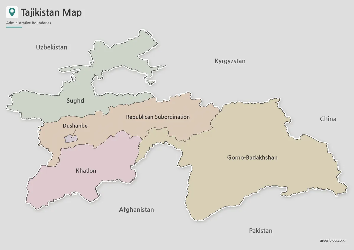
The color Tajikistan Map makes the unequal scale of the five units immediately visible. Gorno-Badakhshan fills most of the east, Khatlon occupies the southwest, Sughd spreads across the northwest and north, and the Districts of Republican Subordination form the central band. Dushanbe is easy to miss without its leader line because its polygon is tiny beside the surrounding republican-subordination districts.
Pastel fills are most helpful where the internal boundary turns around the Dushanbe unit and along the jagged meeting points between Khatlon, the central districts, and Gorno-Badakhshan. Gray neighboring land separates the country from the background. No legend is needed to match a color to a value because the fills identify regions rather than data classes.
Use this version for a first-reference slide, a country profile, or a state-level comparison. Do not describe the colored east as an elevation layer: the image contains no contours, hillshade, altitude bands, peaks, or passes. Similarly, the neighboring-country labels provide orientation but not detailed international crossings or travel routes.
Black and White Tajikistan Map
The monochrome version retains every major label while opening the interiors for pencil notes, numbering, hatching, or a learner-created color key. It suits grayscale reports and low-ink handouts, especially when the goal is to identify the five territorial categories rather than present statistical values.
Line clarity is good at the native preview size, but the tiny Dushanbe outline and narrow northern features can weaken when the image is reduced. Test one printed page before producing a class set. Keep the Pakistan caveat in any neighbor exercise, and avoid asking students to identify unlabeled enclaves or exact border segments from this simplified view.
Blank Tajikistan Outline Map for Editing
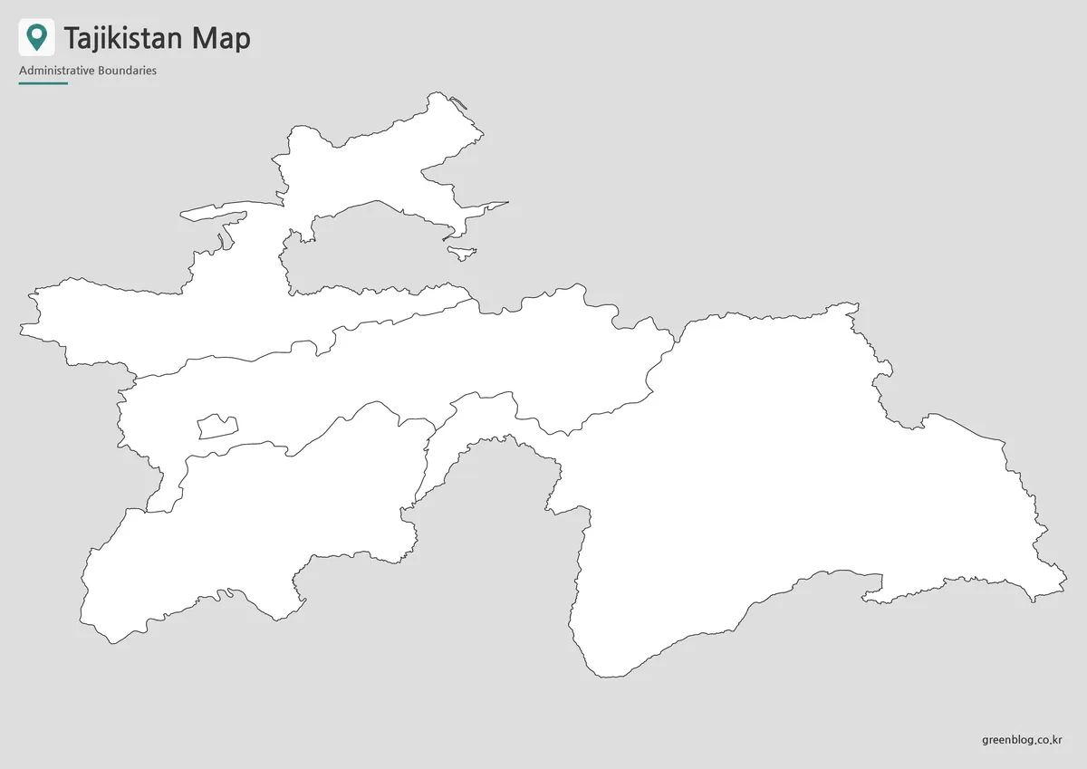
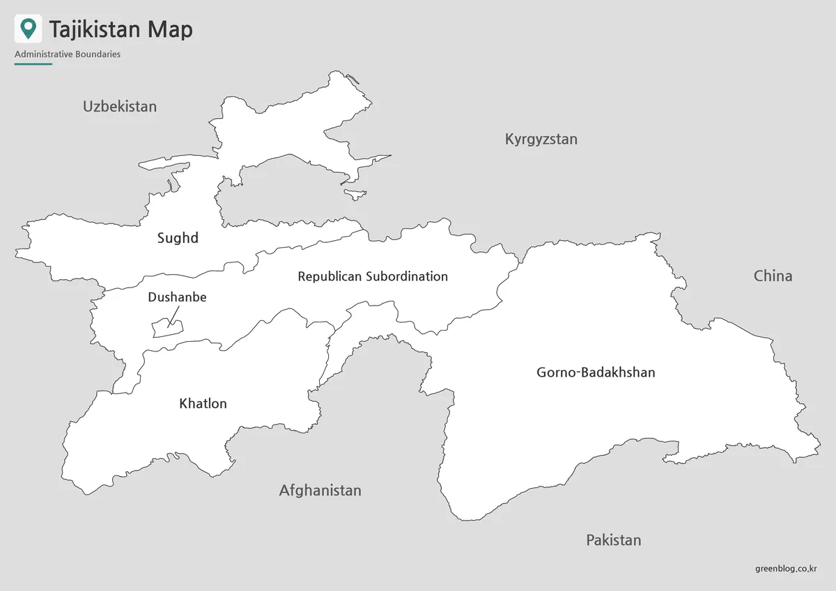
The blank Tajikistan Map removes names and fills but preserves all internal and external lines from the other previews. It works well for labeling the five units, shading GBAO, locating the small Dushanbe polygon, or comparing the relative areas of Sughd and Khatlon. Teachers can provide the color view as an answer key without needing to realign the exercise.
This WebP preview is a raster image, not an editable vector boundary dataset. Add text and symbols on separate layers, keep an untouched copy, and avoid enlarging it far beyond 1,200 × 849 pixels. A custom overlay should not add unverified roads, elevation, rivers, or demographic data merely because the blank interiors provide space.
Practical Uses for This Tajikistan Map
- Administrative recognition: distinguish two regions, one autonomous region, the republican-subordination districts, and Dushanbe.
- Central Asia context: identify the four land neighbors and explain why nearby Pakistan is not one of them.
- Scale comparison: contrast the expansive GBAO east with the very small capital unit.
- Cartographic literacy: discuss why an undated border outline must be checked after a major treaty.
A dependable Tajikistan Map workflow begins by choosing the administrative level and boundary date. Use the color image for introduction, the monochrome image for reference, and the blank outline for recall. Correct “Republican Subordination” to the fuller Districts of Republican Subordination in explanatory text, define GBAO on first use, and state that Pakistan is separated from Tajikistan by Afghanistan.
For a presentation, place the boundary note near the image rather than hiding it in a distant source list. A concise caption such as “Five top-level territorial categories; external border data date not supplied” is accurate and readable. If the slide discusses the Kyrgyz border specifically, replace this illustration with a verified post-treaty map or label it as general regional context only.
Frequently Asked Questions
What is included in this Tajikistan map collection?
The collection includes a color map, a black and white map, and an outline map of Tajikistan. Each version is intended for a different use, including printing, classroom reference, presentation design, and graphic editing.
Can I print the Tajikistan map in A3 size?
Yes. The map set is prepared for A3 layout printing, making it suitable for larger classroom handouts, reference sheets, and presentation boards.
Which version is best for editing?
The outline map is the best choice for editing. It provides the regional boundary layout without color, so users can add labels, highlights, icons, travel routes, or data overlays.
Does the map include Tajikistan’s administrative regions?
Yes. The map includes the main ADM1 regions: Sughd, Dushanbe, Districts of Republican Subordination, Khatlon, and Gorno-Badakhshan Autonomous Region.
Is the black and white map good for worksheets?
Yes. The black and white version is useful for classroom worksheets, printed assignments, document inserts, and simple regional reference materials.
Does this Tajikistan Map show the post-2025 Kyrgyz border?
The image does not state its boundary dataset or date, so that cannot be confirmed. Tajikistan and Kyrgyzstan signed their state-border treaty in March 2025 and exchanged ratification instruments later that month. Use a current authoritative source for any border-sensitive task.
Map File Information
This Tajikistan map collection includes color, black-and-white, and blank outline images for regional reference and labeling activities.
- Included Files: Use only the versions confirmed in the article and supplied images
- File Type: Use the confirmed download contents
- Intended Use: Printing, education, presentations, and map-based projects
Related Maps
Additional Resources
- Official 2025 Tajik–Kyrgyz Border Documents — Review Tajikistan’s announcement of the state-border treaty and related transport and access agreements.
Green Map creates custom-edited map images using open geographic data sources such as geoBoundaries, Natural Earth, OpenStreetMap, and government open data.
These maps are edited visual materials, not raw data files, and are provided for education, documents, presentations, and graphic reference.