A South Africa Map is useful when you need to explain one of the most recognizable countries in southern Africa with more detail than a simple location marker. South Africa sits at the southern end of the African continent, bordered by countries such as Namibia, Botswana, Zimbabwe, Mozambique, Eswatini, and Lesotho. Its position between the Atlantic Ocean and Indian Ocean also makes it important for regional geography lessons, travel presentations, country comparison materials, and infographic projects.
This printable South Africa map collection includes three versions: a color map, a black and white map, and an outline map. The files are prepared as image files for classroom handouts, presentation slides, blog graphics, printable study materials, and editable design projects. The color version is designed for quick provincial comparison, the black and white version works well for printed documents, and the outline version gives users a clean base for adding labels, data marks, route lines, or custom colors.
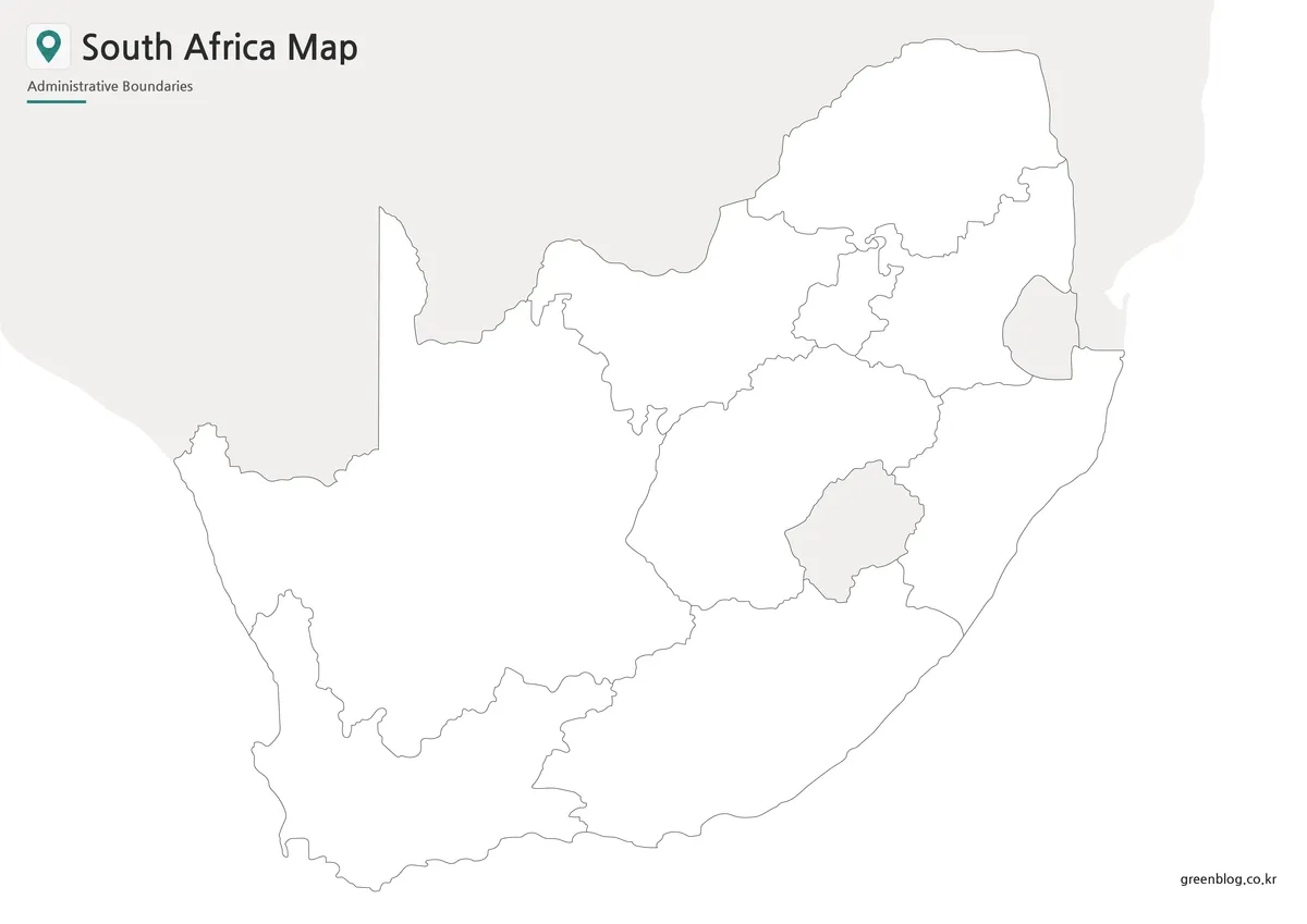
South Africa has a regional layout that benefits from a map-based explanation. The country has three capital functions associated with Pretoria, Cape Town, and Bloemfontein, and it also surrounds Lesotho while bordering Eswatini. These details can be difficult to explain clearly with text alone. While preparing this map collection, the layout was kept clean so the provinces, capital markers, and neighboring country names would remain readable at large print sizes. The original Korean draft emphasized A3-size map production, province coloring, bilingual labeling, and separate versions for printing and editing; this English page rewrites that purpose as a practical printable resource for English-speaking users.
Table of Contents
South Africa Map Overview
South Africa is located at the southern edge of Africa and has a wider geographic layout than many country maps in this collection. It includes long coastlines, large provincial areas, and important neighboring-country context. A South Africa Map is especially helpful when explaining how the country connects to Namibia, Botswana, Zimbabwe, Mozambique, Lesotho, and Eswatini.
For classroom use, the map can support lessons about southern Africa, coastal geography, provincial divisions, and capital-city functions. For presentation creators and bloggers, it gives a clear visual base for country profiles, travel content, regional comparison posts, and educational graphics. Because South Africa includes Lesotho inside its national surroundings and Eswatini along the eastern side, the map layout needs to show more than just the outer national boundary.
Printable Map Collection
The collection is divided into three main styles so users can choose the version that fits the project. The color map works best when the goal is quick visual comparison between provinces. The black and white map keeps the layout clean for printing, worksheets, and document inserts. The outline map removes labels and color so users can build their own custom map design.
This structure is useful for different types of work. Teachers may choose the black and white map for classroom handouts, students may use the color map for country reports, and designers may use the outline map as a base for infographics or presentation graphics.
Color South Africa Map for Provincial Comparison
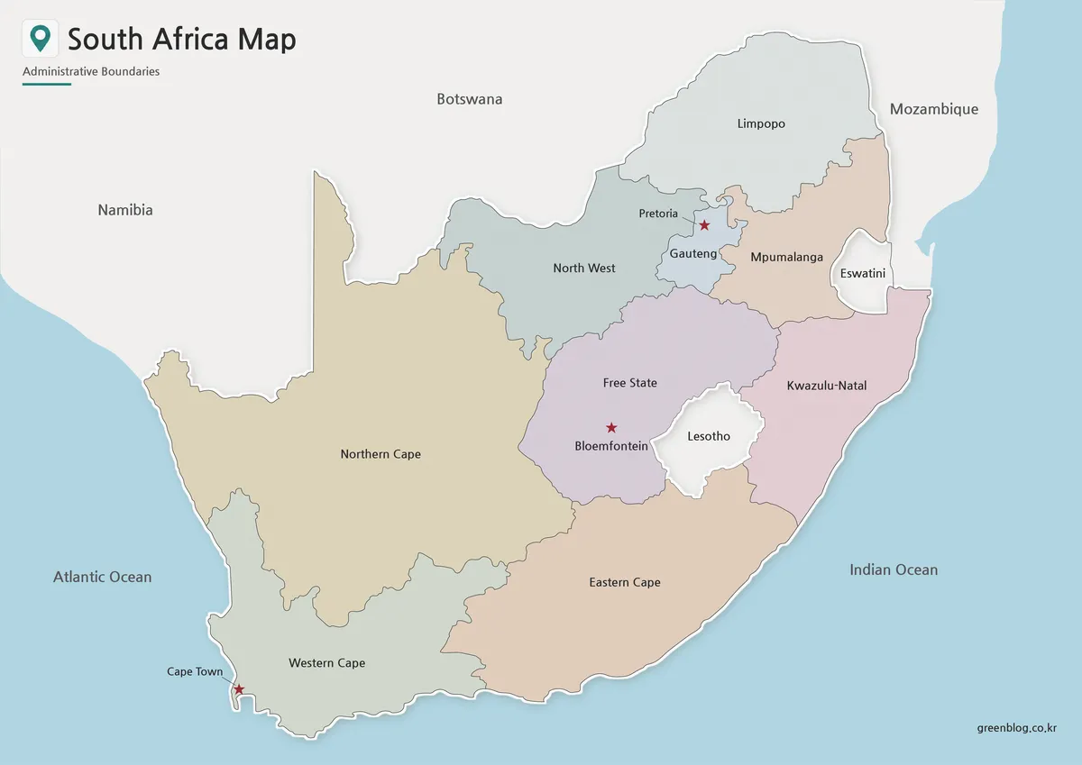
Designed around South Africa’s provincial layout, the color map separates each major region with clear visual contrast. Because the country covers a broad area and includes both coastal and inland provinces, color separation helps readers compare the national structure more quickly.
The three capital markers are included so users can identify Pretoria, Cape Town, and Bloemfontein in the same visual reference. Lesotho and Eswatini are also shown in a simplified way, helping readers understand their location without making the map too crowded. This version works well for blog visuals, educational slides, and country overview graphics where the map needs to be understood quickly.
Black and White Printable South Africa Map
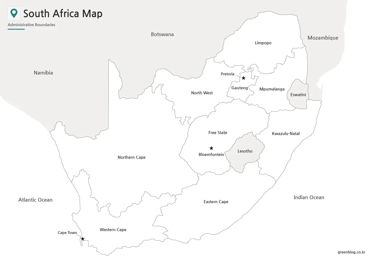
For printed materials, the black and white version removes the color layer while keeping province boundaries and place labels readable. This is useful for worksheets, reports, study notes, and classroom reference sheets where users may want to add handwritten notes.
The cleaner layout also works well when printing multiple copies. Since South Africa has a large national outline and several major internal divisions, the black and white version gives enough visual structure without relying on color. It is a practical choice for students marking neighboring countries, capital locations, or selected provinces.
Blank South Africa Outline Map for Editing
The outline map is intended as a flexible working base. It removes color and labels so users can add their own information, such as travel routes, provincial highlights, data shading, city markers, or infographic annotations.
For South Africa, the blank version is useful when preparing custom materials about southern Africa, coastal regions, provincial comparison, tourism routes, or classroom coloring activities. Designers can add their own visual layers without first removing existing text or color, which makes this version easier to adapt for presentations and graphic projects.
Practical Uses for the South Africa Map
A printable South Africa Map can support many types of projects. In classrooms, it can be used for geography lessons, country reports, and regional comparison worksheets. In presentations, it helps explain South Africa’s position at the southern end of the continent and its relationship with nearby countries. For blog writers, it can serve as a clear visual reference for country profiles, travel articles, history-related posts, or regional overview pages.
The color version is best for quick visual explanation. The black and white version is better for printed handouts and study materials. The outline version gives the most flexibility when users need to add their own information, such as routes, labels, highlighted provinces, or statistical data.
Choosing the Best Version
Choose the color map when you need a presentation-ready visual that shows the provincial structure clearly. It works well for blog graphics, educational slides, and quick country introductions.
Choose the black and white map when printing is the main purpose. It keeps the page clean, leaves room for notes, and works well in worksheets, reports, and classroom handouts.
Choose the outline map when you need a base for editing. It is the best option for custom colors, infographic labels, data visualization, travel route marking, and classroom activities.
Frequently Asked Questions
What is included in this South Africa Map collection?
The collection includes a color map, a black and white map, and an outline map. Each version is prepared for a different use, such as printing, presentations, classroom materials, or editing.
Is this South Africa Map useful for classroom projects?
Yes. The black and white and outline versions are especially useful for worksheets, geography activities, country reports, and southern Africa comparison assignments.
Can I edit the outline map?
Yes. The outline version is a blank base map, so users can add labels, colors, route lines, city markers, province highlights, or regional data.
Why are Lesotho and Eswatini important on a South Africa Map?
Lesotho is surrounded by South Africa, and Eswatini is located along the eastern side of the country. Showing them helps readers understand the regional layout more clearly.
Download South Africa Map
This download includes printable South Africa map versions for educational use, presentation design, document printing, and editable graphic projects.
- Included Versions: Color map, black and white map, outline map
- Printable Size: A3 layout
- File Type: Image files
- Intended Use: Classroom handouts, presentations, blog graphics, infographic editing, and printable reference materials
Additional Resources
- Natural Earth – Free Vector and Raster Map Data : Natural Earth provides country-level map data that can help users compare South Africa with other countries in southern Africa.
Related Maps
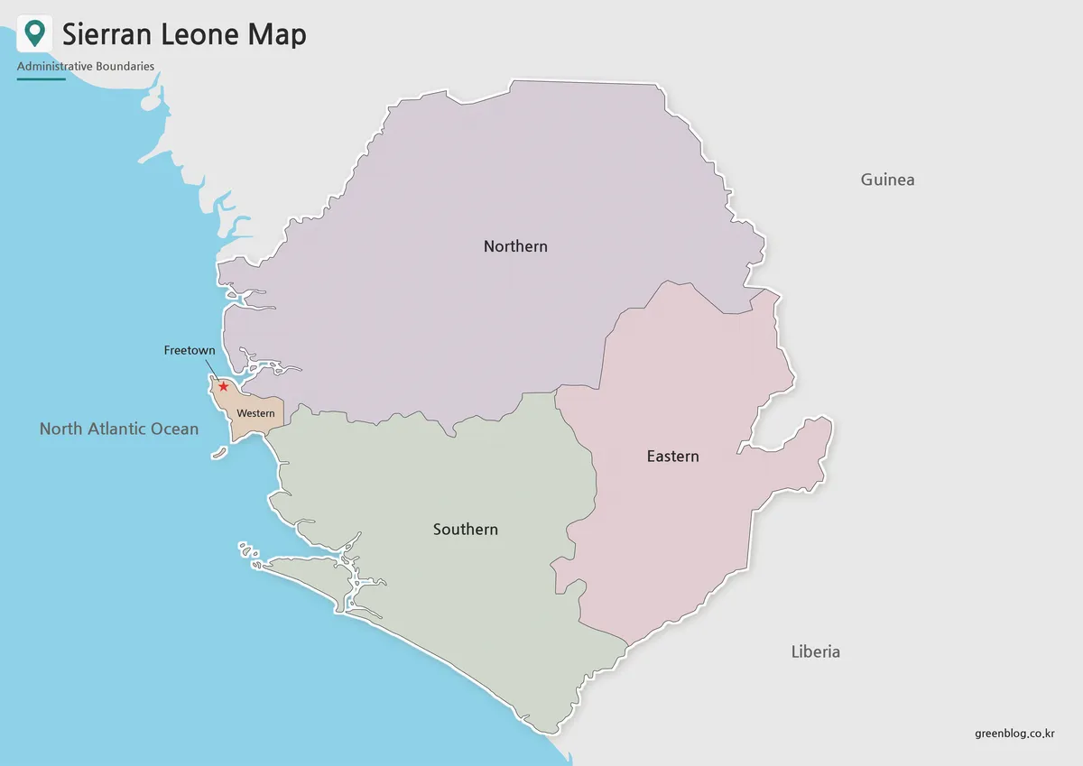
- Sierra Leone Map for Presentations, Worksheets, and Infographic Projects
- Rwanda Map Download – Printable Administrative Maps
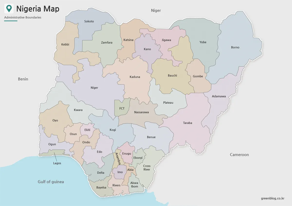
- Printable Nigeria Map – Color, Black and White, Outline Version
- Mozambique Map Download – Labeled, Basic, and Blank Outline Maps