A Moldova Map is useful when you need more than a small country outline on a general Europe map. Moldova is a landlocked country in Eastern Europe, positioned between Romania and Ukraine. Because of its narrow north-south shape, its border with two neighboring countries, and the separate Transnistria area along the eastern side, a clear map helps readers understand the country’s layout much faster than text alone.
This printable Moldova map collection includes three map styles: a color map, a basic labeled map, and a blank outline map. The maps were prepared for A3-size use and are suitable for classroom handouts, presentation slides, blog graphics, regional comparison materials, and editable infographic projects. A Moldova flag image is also included as a supporting visual element for country information pages or educational layouts.
Moldova is not a large country, so it can easily appear small or overlooked on broader European maps. When preparing this map set, the vertical shape of the country was kept as the main layout direction so that the full outline could be shown clearly. Romanian and Ukrainian neighboring areas are kept visually simple, while the Transnistria area is separated as an important map reference.
The goal of this Moldova Map collection is not to create a road map or a political article. It is designed as a practical visual resource for people who need a clean country map for education, design, presentations, blog posts, and printable study materials.
Table of Contents
Moldova Map Overview
Moldova sits between Romania to the west and Ukraine to the east. Although it is close to the Black Sea region, the country does not currently have direct access to the sea. This geographic position makes Moldova useful in Eastern Europe comparison maps, especially when explaining the relationship between Romania, Ukraine, and the wider Black Sea area.
The country’s map layout is relatively simple at first glance, but some internal divisions are easier to read when they are separated by color or shown with clear boundary lines. Smaller regions such as Taraclia, Criuleni, and Dubasari can make the administrative structure appear more detailed than expected, so label placement and boundary clarity matter.
Transnistria is one of the most noticeable features when viewing Moldova on a map. In this collection, it is shown as a separate visual area so users can recognize its position without making the map too crowded.
Printable Map Collection Included
This Moldova Map set includes:
- Color Moldova map
- Basic labeled Moldova map
- Blank Moldova outline map
- Moldova flag image
- A3-size layout
- Korean and English place names on the labeled versions
Each version has a different purpose. The color map works well when you want to explain regional divisions visually. The basic map is cleaner for printing and document use. The outline map is best when you need to add your own colors, data, labels, or project notes.
Color Moldova Map for Regional Comparison
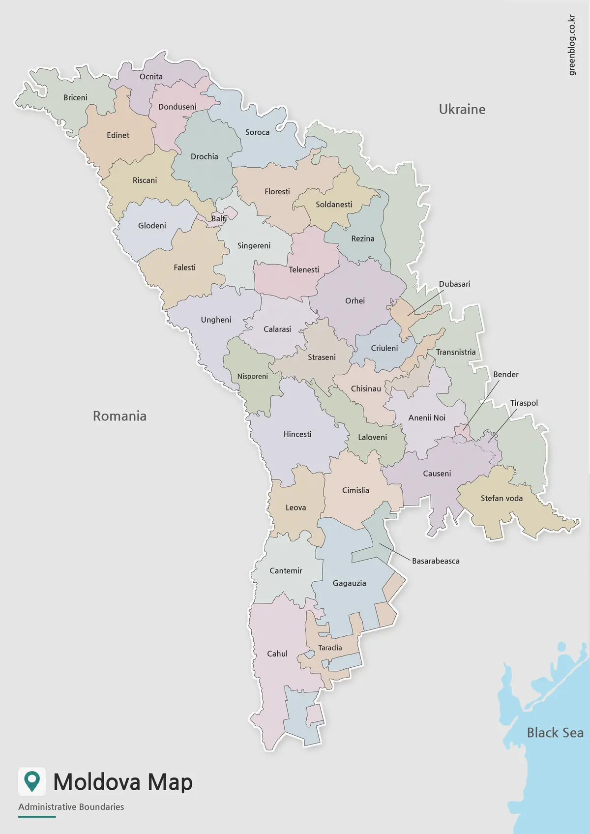
Designed with Moldova’s vertical shape in mind, the color map separates regions so the country can be read more clearly at a glance. This is helpful because several areas are small and close together, making the map harder to understand if all regions are shown without color contrast.
Transnistria is marked separately, which makes its location easier to identify along the eastern side of the country. Romania and Ukraine are included as neighboring country labels rather than detailed background areas, keeping the focus on Moldova itself.
The color version works well for blog articles, classroom slides, country comparison graphics, and educational pages about Eastern Europe. It gives readers a quick visual starting point before they move into more detailed information.
Basic Moldova Map for Printing
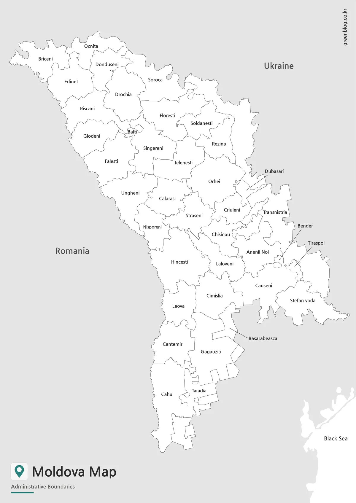
For printed materials, a simpler labeled map can be easier to use than a fully colored version. The basic Moldova map removes the color fills and keeps the focus on place names and boundary lines.
Because Moldova has a narrow shape, the map was arranged vertically to keep the country from feeling compressed. The labeled version is useful for reports, worksheets, classroom reference sheets, and presentation handouts where readability matters more than color.
This version is also practical when users want to highlight only one region by hand. Teachers, students, and bloggers can mark specific areas without the background becoming visually heavy.
Blank Moldova Outline Map for Editing
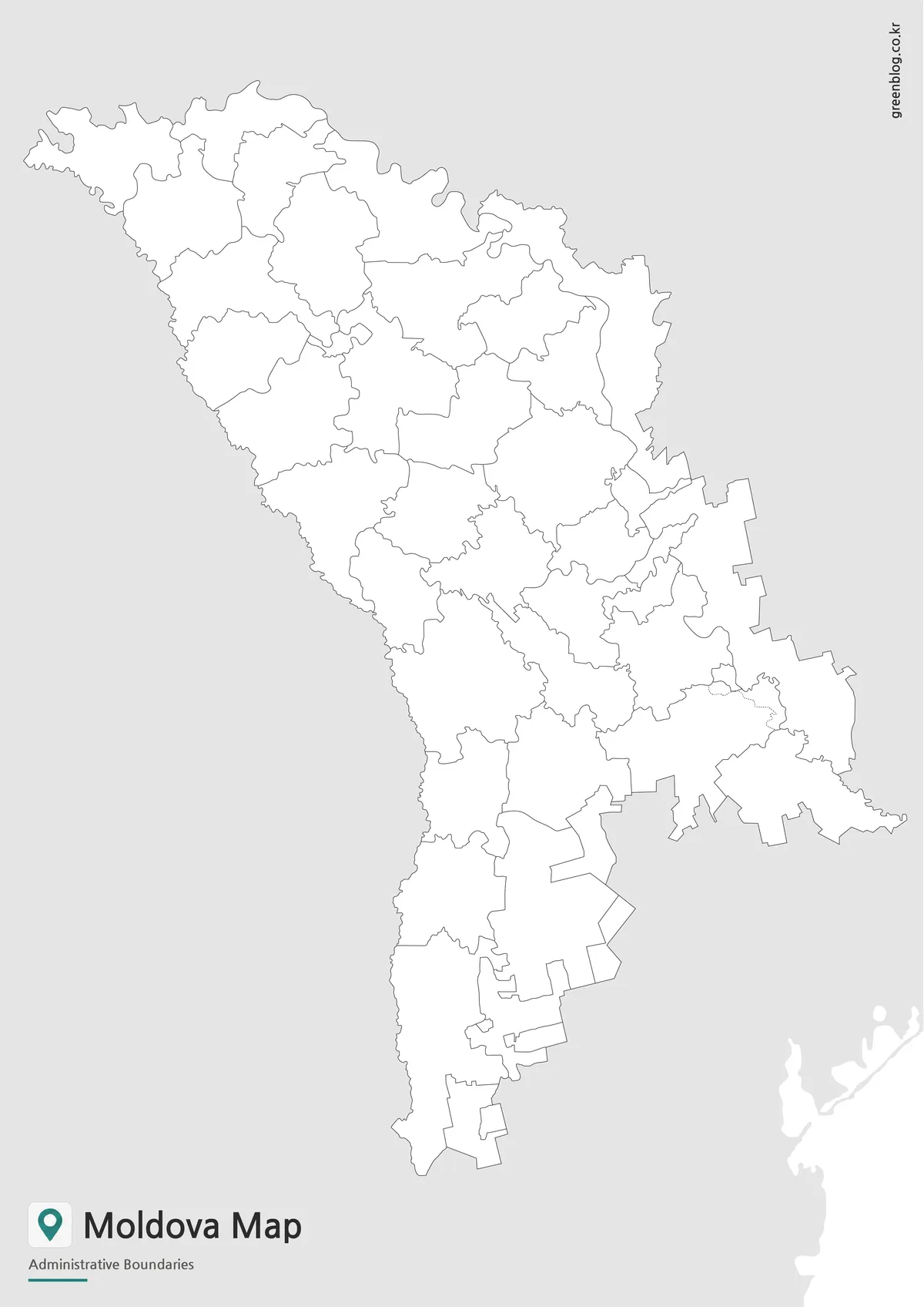
The blank outline map leaves only the main boundary structure, making it the most flexible version in the set. It is intended as a base map for users who want to add their own information.
Designers can add regional colors, arrows, icons, or data labels. Teachers can use it for coloring activities or country-location exercises. Bloggers and presentation creators can mark Transnistria, neighboring countries, travel routes, or comparison points without needing to erase existing labels.
The outline was prepared with connected boundary lines so color-filling and custom editing can be done more smoothly. Since it was made for A3-size use, it can also be enlarged for visual materials without becoming too cramped.
Moldova Flag Image
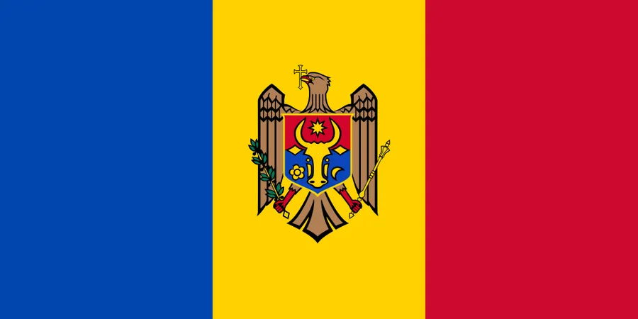
The Moldova flag image can be used together with the map when creating country information materials. A map explains location and regional structure, while the flag gives the page a stronger national reference.
This is especially helpful for classroom slides, country profile pages, blog thumbnails, and educational graphics where the map and flag need to appear together.
Practical Uses for This Moldova Map
The Moldova Map collection is useful for several types of projects. Students can include the map in geography assignments, teachers can prepare printable worksheets, and bloggers can use it as a visual reference when writing about Eastern Europe. It also works well for presentation slides, infographic layouts, and regional comparison materials involving Romania, Ukraine, and the Black Sea area.
The outline version is especially helpful for custom projects. It gives users a clean base for marking population data, regional differences, border relationships, or specific study topics.
Frequently Asked Questions
What versions are included in this Moldova Map collection?
The collection includes a color map, a basic labeled map, a blank outline map, and a Moldova flag image.
Is this Moldova Map suitable for A3 printing?
Yes. The map was prepared for A3-size use, making it suitable for classroom handouts, reports, and presentation materials.
Why is Transnistria shown separately?
Transnistria is visually important when reading Moldova’s map structure. Showing it separately helps users understand its location along the eastern side of the country.
Which version is best for editing?
The blank outline map is best for editing. It gives users a clean base for adding colors, labels, arrows, data points, or custom notes.
Can I use the map for classroom materials?
Yes. The basic and outline versions work especially well for worksheets, classroom reference sheets, and geography activities.
Moldova Map Download
Download the Moldova Map collection with color, basic, and outline versions. The maps are prepared for printing, classroom reference, presentation use, blog graphics, and custom editing projects.
- Included Versions: Color Map / Basic Map / Outline Map
- Additional Image: Moldova Flag
- Printable Size: A3
- Intended Use: Classroom materials, presentations, blog images, infographic editing
Additional Resources
- OpenStreetMap : A useful online map resource for checking Moldova’s location, neighboring countries, and regional geography.
Related Maps
- Printable North Macedonia Map for Classroom, Presentation, and Editing Use
- Free Lithuania Map Resource with Labeled and Blank Versions
- Bulgaria Map with Regions and Sofia – Color, Detailed, and Outline Versions
- Belarus Map Collection: Printable Administrative, Labeled, and Outline Maps