A Madagascar Map needs a tall composition because the island extends much farther north to south than east to west. The Mozambique Channel lies along its western side, while the Indian Ocean borders the east. Within that recognizable outline, the supplied maps divide the island into six broad areas labeled Antsiranana, Mahajanga, Toamasina, Antananarivo, Fianarantsoa, and Toliara.
The collection contains four visual resources: a pastel administrative view, a labeled black-and-white version, a blank outline, and the national flag. The three map previews measure 1,200 × 849 pixels and share the same landscape canvas, while the flag measures 900 × 600 pixels. Teachers can pair a labeled reference with a recall exercise, presentation creators can choose between color and monochrome, and country-profile layouts can combine a map with the flag.
An important date-and-scale caution belongs at the start. The artwork shows six province-scale divisions rather than Madagascar’s finer present-day regional framework, so it should not be described as a current detailed map of all regions. It is best treated as a broad historical or province-grouping reference whose labels make the island’s large north–south structure easy to compare.
Table of Contents
Madagascar Map Collection Overview
The six labeled areas create a clear directional sequence. Antsiranana occupies the narrow north, Mahajanga covers much of the northwest, and Toamasina follows the east-central coast. Landlocked Antananarivo sits near the center, Fianarantsoa extends through the south-central interior and southeastern side, and Toliara wraps around much of the west and far south.
This Madagascar Map also preserves two surrounding water labels that help explain orientation. The Mozambique Channel separates the island from mainland southeastern Africa, and the Indian Ocean opens to the east. The maps do not show roads, cities, elevation, rivers, or a distance scale, so the colored divisions and coastline—not transport or terrain—are the intended subject.
Antananarivo is both the country’s capital name and the label used for the central province-scale area in this artwork. Readers should not infer a city boundary from that polygon. The same caution applies to the other five labels: they identify the broad divisions represented by the map rather than locating a single city point.
- Color view: pastel fills distinguish the six large areas and blue water emphasizes the island setting.
- Monochrome view: names and boundaries remain without the colored fills.
- Blank outline: text and color are removed while the island shape and six-part boundary pattern stay visible.
- Flag image: a separate rectangular national symbol complements the geographic files.
Regional Color Map
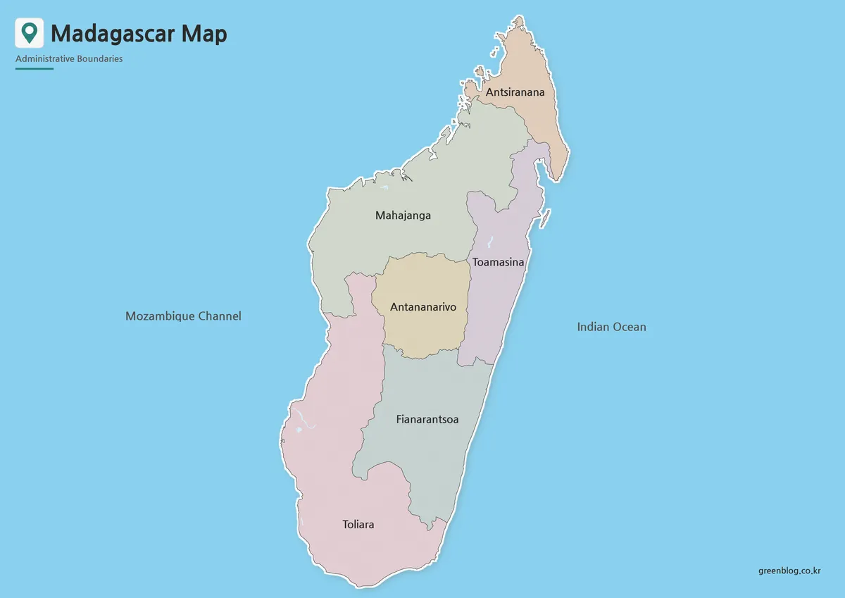
The color Madagascar Map is the fastest version for comparing how the six areas share the island. Antsiranana’s small northern shape contrasts with the larger Mahajanga and Toliara areas, while narrow coastal extensions make Toamasina and Fianarantsoa visually distinct from central Antananarivo. Pastel colors keep neighboring polygons separate without implying a statistical scale.
Blue water gives the long island a strong silhouette and makes the Mozambique Channel–Indian Ocean relationship immediately visible. This makes the color view suitable for an introductory slide, a broad province-grouping reference, or an answer key placed beside the blank map. It can also support a comparison of major island countries when every page uses a similarly simple administrative level.
The palette does not represent population, climate, vegetation, language, biodiversity, or economic activity. Anyone adding a thematic layer should provide a separate legend and data date rather than reusing the original fills as if they already carried meaning. A caption should also state that the six polygons are province-scale areas, preventing readers from mistaking them for the current finer regional structure.
Black and White Printable Version
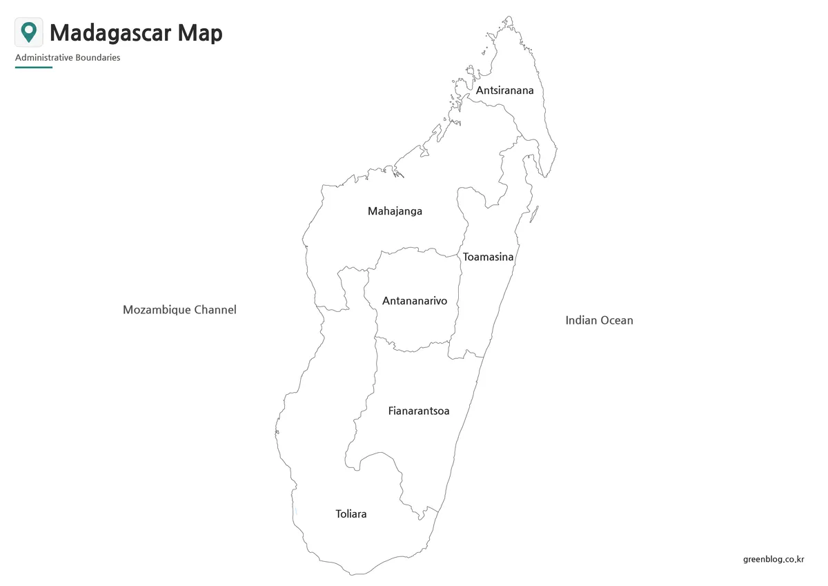
The monochrome Madagascar Map keeps the six names, boundaries, and water labels while removing the blue sea and pastel interiors. Its quieter appearance fits grayscale reports, classroom handouts, and study packets in which a color figure would compete with nearby text or tables. White areas also accept pencil notes and highlighter marks more clearly.
Toamasina and Antananarivo are useful print checkpoints because their names sit near a narrow shared boundary, while Antsiranana tests legibility near the pointed northern end. Preserve the 1,200 × 849 aspect ratio and inspect a proof at the final size. Repeated recompression or aggressive reduction may weaken the fine coastline and internal lines even when the large labels remain readable.
This version is still a labeled reference rather than a blank worksheet. Students can use it to learn the north-to-south order before attempting the outline, and editors can place it next to a table without relying on color reproduction. The open interiors leave room for numbered callouts, but any added information needs a source and explanation.
Blank Outline Map for Editing
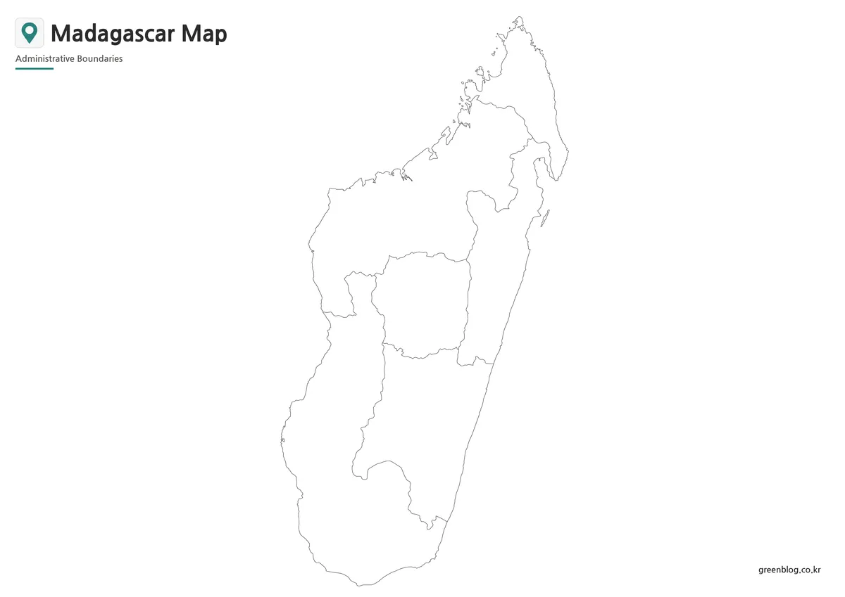
The blank Madagascar Map removes all geographic labels and fills but retains the coastline and six interior divisions. Learners can add the six area names, identify the northern and southern ends, place Antananarivo in the central polygon, or label the water on both sides. Designers can instead add sourced categories or symbols without first covering existing text.
The supplied outline preview has a visible presentation limitation: the title and subtitle at the upper left are cropped, although the island itself remains intact. Users who need a polished title should add a new heading outside the image rather than claiming that the preview includes a complete one. A worksheet can avoid the issue by using the island body as the main activity area.
This is a flat raster preview, not a confirmed vector or layered source file. Enlargement beyond the available pixel dimensions may soften the narrow northern coastline, so added labels should be tested at final output size. The blank map is also not a current 24-region exercise; it reproduces the same six broad areas shown in the labeled versions.
Madagascar Flag Image
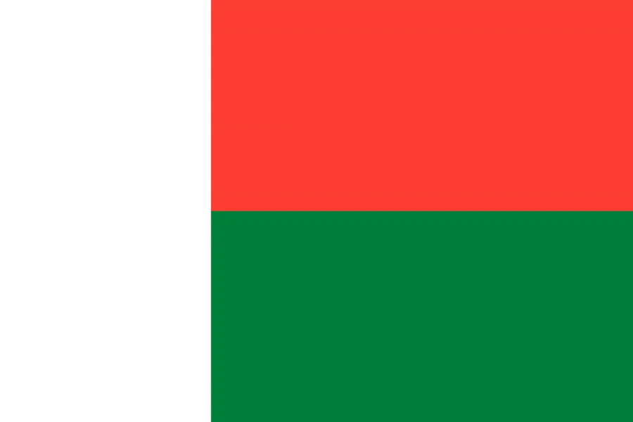
The flag provides a different kind of reference from the Madagascar Map. A vertical white band fills the hoist side, while the fly is divided horizontally into red above and green below. Because the image is a simple 900 × 600 rectangle, it can accompany a country title, comparison table, or presentation cover without competing with the taller island silhouette.
Use the flag when the project needs national identification, not geographic detail. It contains no provincial boundaries, city positions, or ocean context, so it should complement rather than replace a map. Pairing it with the color view creates a concise country profile, while placing it beside the outline can give students both a national symbol and a labeling task.
Practical Uses for This Map Set
Choose the appropriate Madagascar Map according to the reader’s action. Color is best for immediate separation on a screen, monochrome retains labels in a restrained document, and the outline provides space for recall or custom annotation. The flag belongs in national identity material rather than in an administrative comparison.
- Pair the color map with the outline for a six-area labeling exercise.
- Compare Antsiranana at the north with Toliara at the south to teach the island’s long orientation.
- Use the monochrome map beside a table and connect the six labels with short numbered notes.
- Add a separate Africa locator when an audience may not know Madagascar’s position east of the Mozambique Channel.
- Place the flag next to the selected map in a country profile or comparison slide.
None of these images is a road, terrain, biodiversity, population, or navigation map. Travel planning requires a current route source, and formal administrative work requires a current detailed boundary reference. Within those limits, the set is effective for broad province-scale orientation, print exercises, presentation graphics, and clearly sourced annotations.
A final quality check should match the chosen version to its caption. Do not call the blank preview labeled, describe the six areas as the complete current regional framework, or imply that flag colors encode map data. Keeping those roles separate makes the four-file collection easier for readers to understand and reuse accurately.
Frequently Asked Questions
What is included in this Madagascar Map collection?
The collection includes a color map, a black and white map, a blank outline map, and a Madagascar flag image.
Can I print the Madagascar Map in A3 size?
Yes. The map was prepared for A3-size use, making it suitable for classroom materials, posters, presentation sheets, and printed reference pages.
Is the outline map editable?
Yes. The blank outline version is useful for adding custom colors, labels, travel routes, regional data, or infographic elements.
What file format is included?
The confirmed file format is JPG.
Is this map suitable for classroom use?
Yes. The black and white map and blank outline map are especially useful for worksheets, geography lessons, and student activities.
Map File Information
Select the color, labeled monochrome, blank outline, or flag image according to your reference, lesson, presentation, or design task.
- Included Versions: Color · Black and white · Outline · Flag
- File Type: JPG
- Intended Use: Printing, classroom activities, presentations, and graphic projects
Related Maps
Additional Resources
- Discover Madagascar — Government Guide — Find official introductory information about the country’s regions, districts, sites, and national parks.
Green Map creates custom-edited map images using open geographic data sources such as geoBoundaries, Natural Earth, OpenStreetMap, and government open data.
These maps are edited visual materials, not raw data files, and are provided for education, documents, presentations, and graphic reference.