A Kazakhstan Map has to make an exceptionally wide country readable without shrinking its regional labels into the background. Kazakhstan extends from the Caspian Sea in the west to the Chinese border in the east, while Russia follows a long arc across the north. That scale makes the country easier to understand visually than through a list of regions, especially when readers are comparing Central Asia, planning a lesson, or preparing a presentation.
The supplied collection contains three image-based versions prepared for A3 use: a labeled color map, a labeled black-and-white map, and an unlabeled outline map. Each image keeps Kazakhstan central while retaining selected neighboring-country context. The versions support different tasks, from identifying broad regional positions to creating a worksheet that students can label themselves.
There is an important date issue to understand before using the files. With a Kazakhstan Map of administrative areas, names and boundaries should always be checked against the intended reference year. The artwork uses an older 14-region arrangement and includes the label “South Kazakhstan,” so it should not be presented as a current administrative map. It remains useful for general orientation, design exercises, and comparisons of how the country’s regional structure has changed.
Table of Contents
Kazakhstan Map Overview
Kazakhstan is the world’s largest landlocked country, and its border relationships explain much of the map’s shape. Russia lies to the north and northwest; China is to the east; Kyrgyzstan, Uzbekistan, and Turkmenistan meet the southern side. The Caspian coastline creates the large western indentation beside Mangystau and Atyrau, while the eastern half broadens toward mountain systems shared with China and Kyrgyzstan.
The Kazakhstan Map in this set labels West Kazakhstan, Atyrau, Mangystau, Aktobe, Kostanay, North Kazakhstan, Akmola, Pavlodar, East Kazakhstan, Karaganda, Kyzylorda, Jambyl, Almaty, and South Kazakhstan. Astana is marked with a star inside the north-central area. Russia, China, Uzbekistan, and Kyrgyzstan are named around the country, providing enough context to explain direction without turning the page into a continent-wide atlas.
Those labels also reveal the artwork’s administrative date limitations. South Kazakhstan Region was renamed Turkistan Region in 2018. In 2022, Kazakhstan created Abai, Jetisu, and Ulytau regions from parts of East Kazakhstan, Almaty, and Karaganda regions. The Bureau of National Statistics reports 17 regions and three cities of republican significance as of January 1, 2026, whereas the supplied images retain the earlier regional divisions and do not draw the three nationally significant cities as separate administrative units.
This distinction matters in classrooms and reports. The files can illustrate Kazakhstan’s overall silhouette, relative regional scale, capital location, and neighboring countries, but they should not be used to verify a current regional boundary or current regional name. For a historical comparison activity, however, the older layout can be paired with a current reference so students can identify where the three newer regions were formed.
Printable Map Versions Included
The collection offers the same broad national extent in three treatments. The color image emphasizes regional comparison, the monochrome image preserves names while reducing visual competition, and the outline image removes labels for annotation. All three use a landscape composition suited to Kazakhstan’s east–west proportions and retain the Caspian coastline as a major orientation feature.
- Labeled color regional map with an Astana marker
- Labeled black-and-white regional reference
- Unlabeled outline with internal regional boundaries
The download is best treated as a coordinated visual set rather than three interchangeable pictures. A presenter can introduce the color version, switch to monochrome for a printed handout, and use the blank version for an exercise. Because the underlying layout is consistent, readers do not have to relearn the country’s orientation when moving between formats.
Color Kazakhstan Map
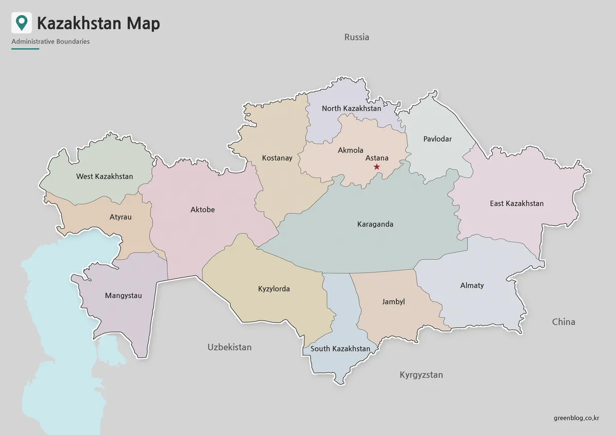
Pastel fills make the large western and central regions easier to separate at a glance. Karaganda occupies a broad central position, Aktobe stretches across the west-central interior, and East Kazakhstan forms the large eastern section beside China. The smaller northern regions are more crowded, so color differences help distinguish North Kazakhstan, Akmola, Kostanay, and Pavlodar without requiring heavy boundary lines.
This Kazakhstan Map is the strongest choice for a slide that needs quick regional orientation. The red star for Astana provides a fixed reference point, while the muted neighboring areas keep attention on the country. When using the image in a current-affairs presentation, add a note that Abai, Jetisu, and Ulytau are absent and that the southern label predates the Turkistan name.
Black and White Printable Version
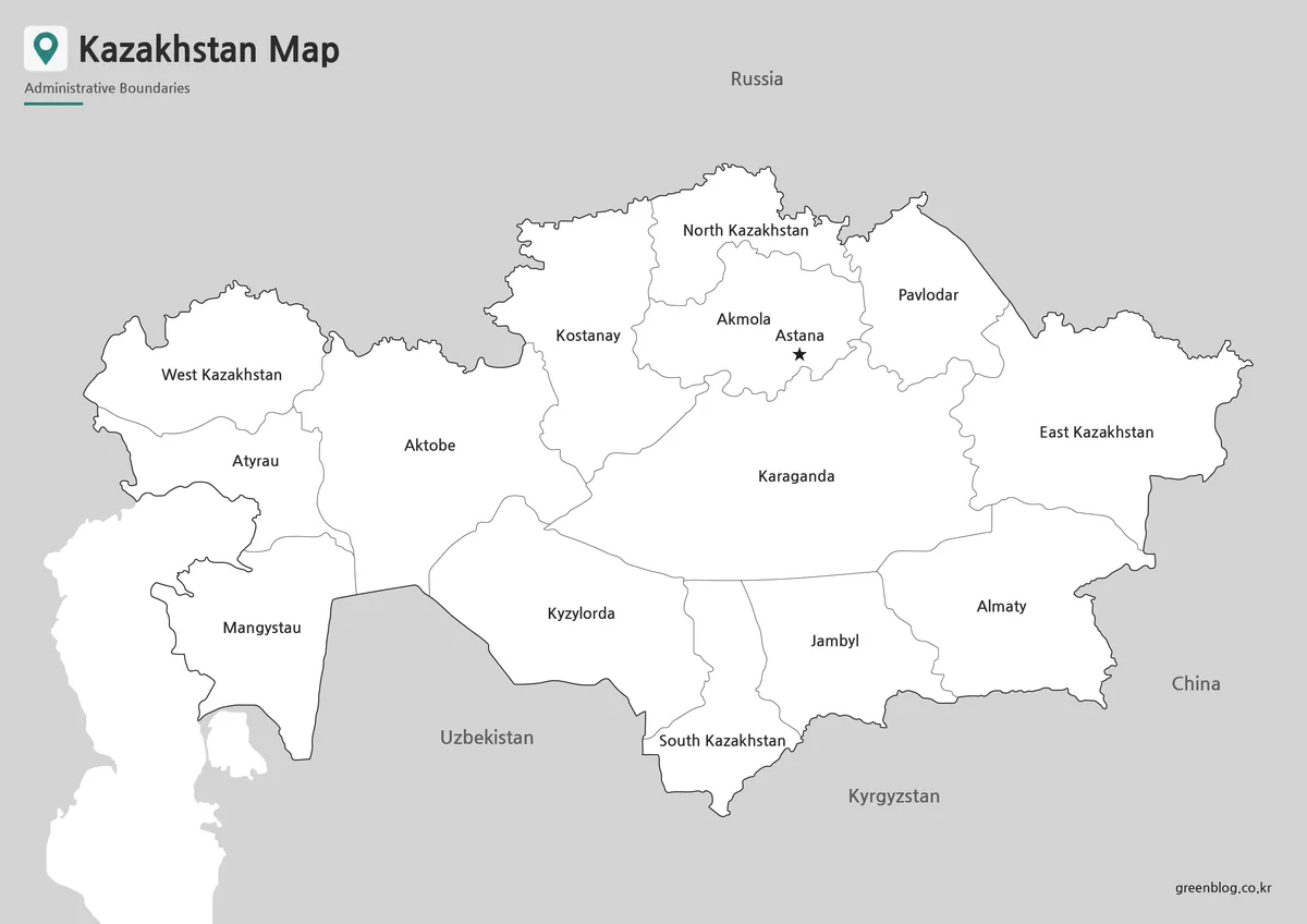
The monochrome version keeps the region names, national outline, neighboring-country labels, and Astana symbol but replaces the colored fills with white. On a printed worksheet, the dark national border remains distinct from the lighter internal divisions. This treatment is particularly effective for Kazakhstan because the country’s long horizontal form already supplies a strong silhouette; the page does not need color to establish direction.
Choose this Kazakhstan Map when readers need to consult labels while making their own notes. It can sit beside a textbook passage, support a regional-name exercise, or serve as a neutral figure in a report. Users can shade the west, north, center, south, and east manually, but any activity involving present-day administration should include the same boundary-date caution used with the color image.
Blank Outline Map for Editing
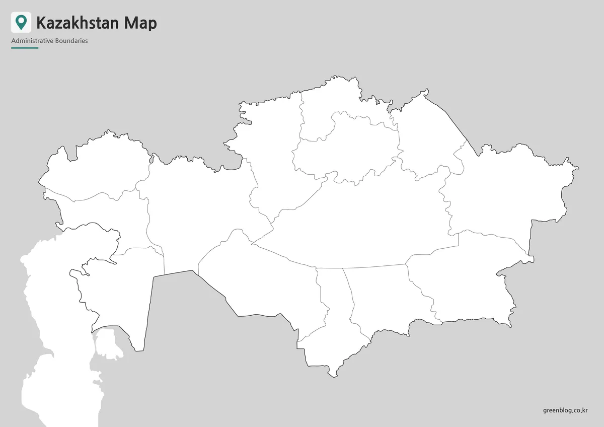
Removing names changes the file from a reference image into an activity base. The coastline, national border, and internal regional lines remain visible, but students or designers decide what information to add. Suitable annotations include Astana and Almaty city markers, the Caspian Sea, Lake Balkhash, the Russian and Chinese borders, or arrows tracing an east–west comparison across the steppe.
The outline Kazakhstan Map can also support an administrative-change exercise. Learners may label the older regions first, then use a current source to mark Turkistan, Abai, Jetisu, and Ulytau. Since the supplied file is an image rather than a confirmed vector source, it is better suited to visual annotation and page layout than to precise GIS analysis.
Built for Classroom, Blog, and Presentation Use
Version choice should follow the reader’s task. Use color when regional separation must be understood quickly on screen, monochrome when labels need to remain visible in a printed document, and outline when the audience will add information. The A3 landscape format gives Kazakhstan’s elongated shape more room than a portrait page and leaves surrounding space for short notes or a legend.
Before printing, check the image at the intended size and avoid enlarging a small web preview beyond what remains legible. The labels are densest across the north-central belt around Akmola and Astana, whereas western regions have more open space. A test preview helps confirm that names such as North Kazakhstan and South Kazakhstan remain readable in the chosen document layout.
For a classroom sequence, begin with the blank image, ask students to locate the five land neighbors and Caspian coast, then reveal the labeled version. A second step can compare the older 14-region artwork with the current 17-region structure. For a blog or infographic, a concise caption should identify the map as an earlier administrative layout so readers do not mistake it for a present-day boundary reference.
Frequently Asked Questions
What versions are included in this Kazakhstan Map collection?
The collection includes a color map, a black and white map, and a blank outline map.
Can I print the Kazakhstan Map in A3 size?
Yes. The map was prepared with A3-size use in mind, so it works well for enlarged printing and classroom reference.
Which version is best for editing?
The blank outline map is the best choice for editing. You can add labels, colors, routes, markers, or regional data.
Is the black and white version useful for school materials?
Yes. The black and white map is suitable for worksheets, reports, printed assignments, and handouts.
What can I add to the outline map?
You can add city names, travel routes, population data, regional colors, border notes, or infographic labels.
Map File Information
Download the three Kazakhstan regional map images for print reference, presentations, labeling activities, and historical boundary comparison.
- Included Versions: Labeled color, labeled black and white, and unlabeled outline maps
- Printable Size: A3
- File Type: Image files
- Intended Use: Handouts, slides, annotations, regional orientation, and administrative-change exercises
Related Maps
Additional Resources
- Kazakhstan Bureau of National Statistics — Review the administrative-territorial units reported for January 1, 2026 before using the supplied artwork for current boundary reference.
Green Map creates custom-edited map images using open geographic data sources such as geoBoundaries, Natural Earth, OpenStreetMap, and government open data.
These maps are edited visual materials, not raw data files, and are provided for education, documents, presentations, and graphic reference.