An Armenia Map is useful for much more than simply locating the country on a world map. Teachers preparing geography lessons, students creating regional reports, bloggers writing about the Caucasus region, and designers building travel graphics often need a map that is easy to read, print, and customize. Finding a clear administrative map that works equally well for educational materials, presentations, worksheets, and graphic editing projects can sometimes be surprisingly difficult.
Located in the South Caucasus region between Eastern Europe and Western Asia, Armenia shares borders with Turkey, Georgia, Azerbaijan, and Iran. Although relatively small in size, the country has a complex regional structure that makes administrative maps particularly useful. Major population centers are concentrated around Yerevan, while the surrounding provinces vary significantly in geography and settlement patterns. Lake Sevan, one of the country’s most recognizable landmarks, also plays an important role in understanding Armenia’s layout.
This printable Armenia Map collection includes three versions: a color administrative map, a black and white labeled map, and a blank outline map. The files were prepared in high resolution and arranged for A3 printing, making them suitable for classroom handouts, travel presentations, educational worksheets, infographic projects, and graphic editing work. PNG and JPG formats are included to support both digital and printed use.
While preparing this Armenia Map collection, special attention was given to administrative boundary visibility and label readability. Province names were reviewed at larger print sizes, and the simplified outline version was designed to make annotation and editing easier. The final layouts were also checked to ensure that labels remain readable when enlarged for presentations or printed materials.
Table of Contents
Armenia Map Versions Included
Three different map styles are included, each designed for a specific purpose.
Administrative Color Map
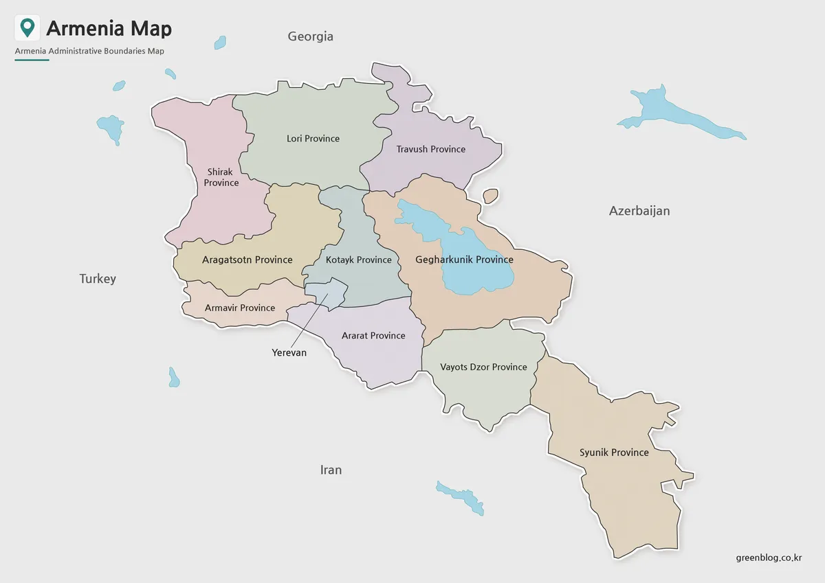
Designed for quick visual reference, the color Armenia Map uses separate colors for each province and highlights Yerevan, the capital city. This approach makes regional boundaries easier to distinguish and helps users understand the country’s administrative structure at a glance.
Neighboring countries are identified without adding unnecessary visual clutter, while Lake Sevan remains visible as an important geographic feature. The map works particularly well for classroom presentations, educational content, and regional comparison projects.
Best for:
- Educational presentations
- Regional comparison materials
- Travel content
- Blog graphics
- Classroom reference
Black and White Labeled Map
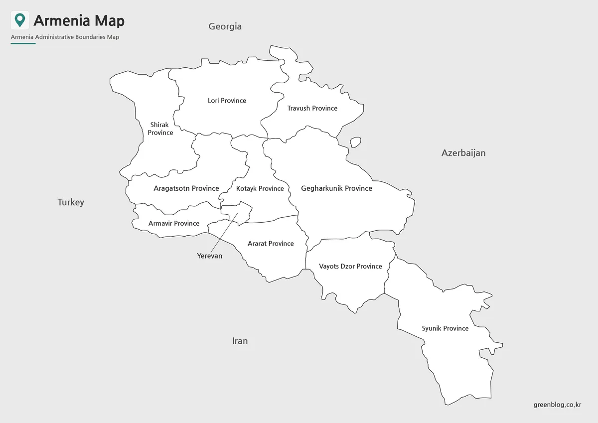
The labeled Armenia Map removes color elements and focuses on province names and boundary lines. This format is especially useful when printing documents or preparing worksheets where readability is more important than visual styling.
Because the layout is simplified, province names remain easy to identify even after printing. It also provides a cleaner appearance for reports, study materials, and document inserts.
Best for:
- Classroom printing
- Worksheets
- Reports
- Study materials
- Educational handouts
Blank Outline Map for Editing
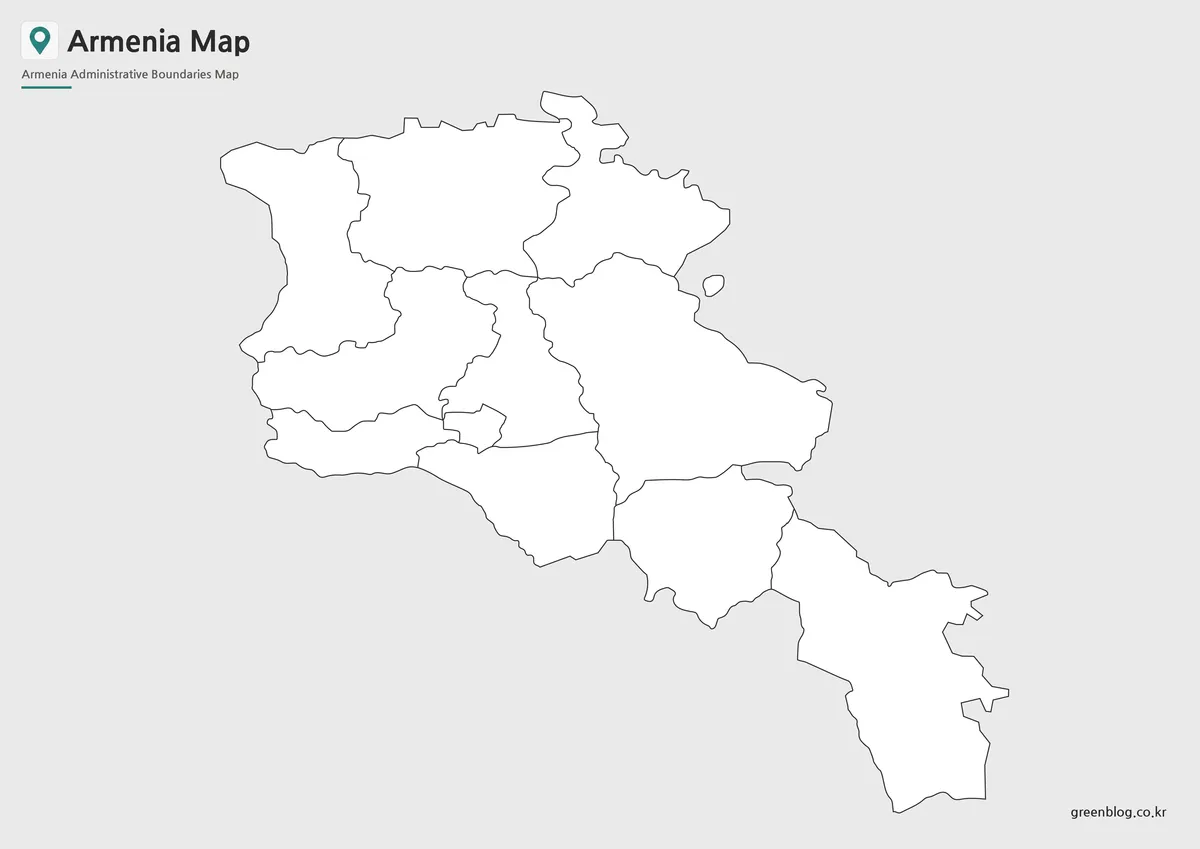
The outline Armenia Map contains only administrative boundaries, creating a flexible base for customization. This version is often used when adding demographic information, travel routes, educational labels, or infographic elements.
During the preparation process, boundary lines were reviewed to ensure clean connections and consistent visibility. As a result, users can begin editing immediately without needing additional cleanup work.
Best for:
- Infographic design
- Data visualization
- Educational activities
- Graphic editing
- Custom regional maps
Regional Structure and Geographic Layout
The Republic of Armenia covers approximately 29,743 square kilometers and is divided into ten provinces plus the special administrative city of Yerevan. While the country itself is relatively compact, its administrative divisions are important for understanding regional geography and population distribution.
One thing that became clear while organizing this Armenia Map collection was the importance of displaying Lake Sevan and provincial boundaries together. Many educational resources discuss the country’s geography and administrative structure separately, but showing both elements in the same visual reference makes the overall layout easier to understand.
The combination of mountainous terrain, provincial divisions, and neighboring international borders makes an administrative Armenia Map particularly useful for regional studies and educational projects.
Designed for Printing, Education, and Presentations
This Armenia Map collection was created with both digital and printed use in mind. Large-format readability was reviewed during production, and labels were adjusted to remain legible when enlarged.
Common uses include:
- Geography lessons
- Classroom handouts
- Travel presentations
- Blog illustrations
- Infographic projects
- Educational worksheets
- Regional comparison studies
- Graphic design projects
Whether printed as a reference sheet or used digitally in presentations, the collection provides multiple formats to match different project requirements.
Frequently Asked Questions
Can I print the Armenia Map in A3 size?
Yes. The files were prepared in high resolution and are suitable for A3 printing.
Which Armenia Map version is best for presentations?
The color administrative map is usually the easiest to read during presentations.
Is the Armenia Map outline version editable?
Yes. The outline version was created specifically for editing, annotation, and graphic design projects.
Does the Armenia Map include provincial boundaries?
Yes. All included versions display Armenia’s provincial boundaries, although labeling varies depending on the map style.
Armenia Map Download
Choose the map version that best fits your project. Administrative, labeled, and outline versions are included for printing, presentations, and editing work.
- File Format: JPG / PNG
- Image Size: A3 High Resolution
- Intended Use: Education, Printing, Presentations, Editing
Select the version that matches your project. Printable and editable formats are included.
Additional Resources
- Armenian Government – Official government portal providing administrative information, public services, and national policy updates.
Related Maps
- Estonia Map Download for Printing, Classroom Use, and Graphic Editing
- Free Norway Map Collection with Color, Labeled and Outline Versions
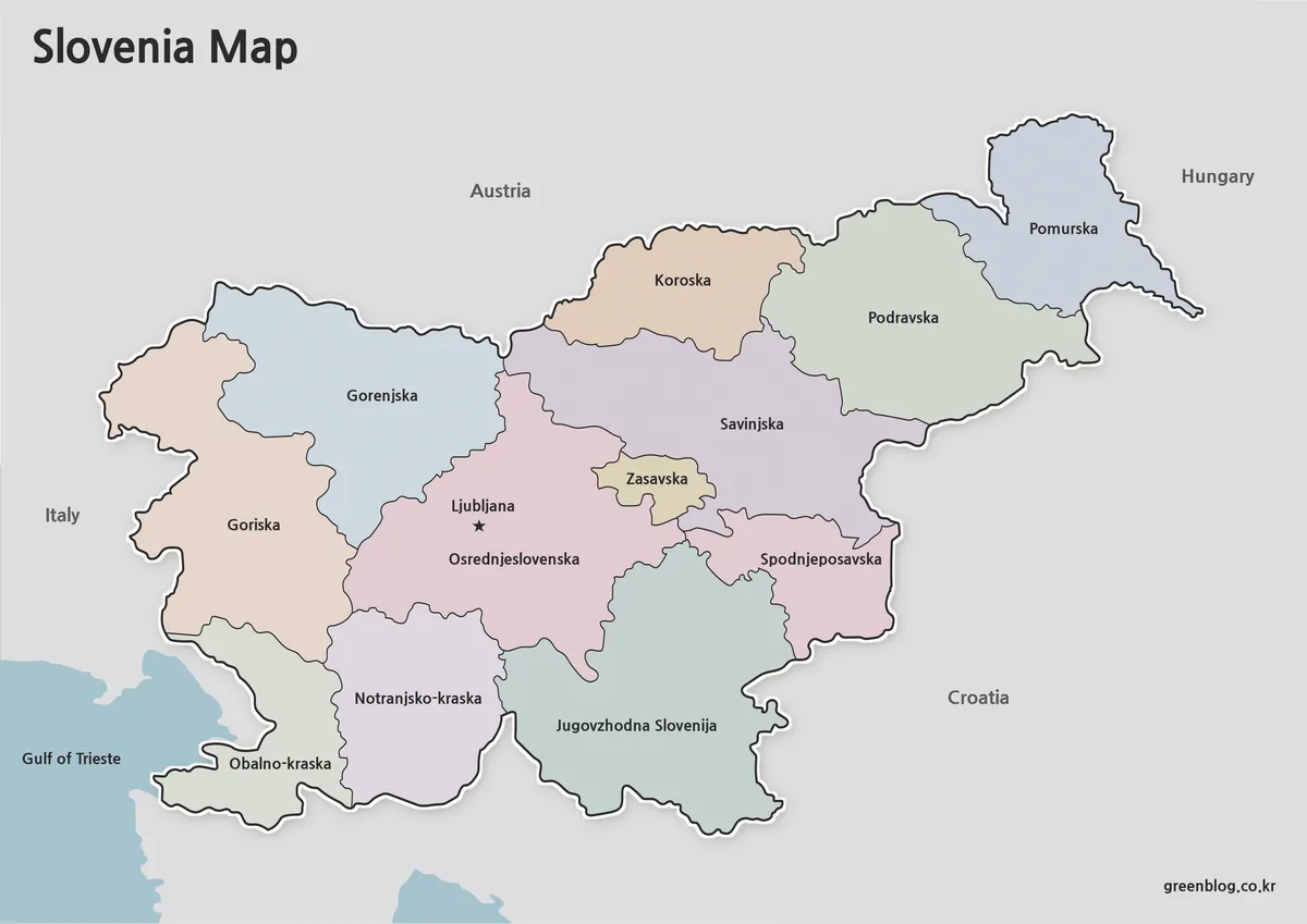
- Printable Slovenia Map in Color, Grayscale, and Outline Formats
- Ireland Map Set with Color, Basic and Outline Versions