A Spain Map needs to solve a geographic problem that a mainland-only outline cannot: the country extends from the Iberian Peninsula to two island groups in different seas. The Balearic Islands sit east of the peninsula in the Mediterranean, while the Canary Islands lie far to the southwest in the Atlantic. The three regional sheets handle that separation with a mainland view, the Balearics beside the east coast, and a boxed Canary Islands inset.
This page brings together five visuals with different jobs. The color and black-and-white maps label the autonomous communities and selected cities; the outline keeps the regional boundaries but removes the labels; the flag-filled silhouette turns the national shape into an identity graphic; and the separate rectangular flag provides the conventional emblem. Choosing between them depends on whether the reader needs geographic reference, an activity base, or a national symbol.
The published regional previews measure 1200×849 pixels for the color and monochrome versions and 1200×871 pixels for the outline. The flag silhouette is 1980×1080 pixels, and the separate flag is 900×600 pixels. These dimensions describe the supplied previews, not a promise that every graphic shares one aspect ratio or print behavior. Teachers, presenters, bloggers, and designers should select the version first and test it at the intended output size.
Spain Map at a Glance
- Color regional reference: green land, blue water, community boundaries, selected cities, neighboring areas, and island context
- Black-and-white reference: the same labels and markers on a restrained background for printing and annotation
- Outline activity base: national and community boundaries without regional names or city points
- Flag silhouette: Spain’s land shape filled with the red-yellow-red flag design and coat of arms
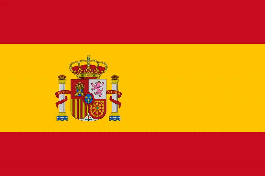
- National flag: a separate rectangular graphic for title panels and country profiles
The labeled Spain Map is a selective regional reference, not a complete atlas. It shows the 17 autonomous-community areas through names and boundaries, highlights Madrid, and marks a limited set of other cities. It does not provide province or municipality lines, road networks, terrain, scale, coordinates, or comprehensive place names. Ceuta and Melilla, Spain’s two autonomous cities on the North African coast, are not identified in the artwork.
Table of Contents
Choosing Regional Scope Over Fine Division
Spain’s first-level structure consists of 17 autonomous communities and the autonomous cities of Ceuta and Melilla. The artwork concentrates on the communities across the peninsula and the Balearic and Canary archipelagos. That choice makes the principal regional pattern readable on one landscape page, but users should not interpret the sheets as a complete inventory of every first-level territory when the two autonomous cities matter to the project.
Northern Spain creates the greatest labeling pressure. Galicia, Asturias, Cantabria, the Basque Country, Navarra, and La Rioja occupy a chain of irregular and sometimes compact areas between the Atlantic edge, Bay of Biscay, and the Pyrenees. By contrast, Castilla y León spans a broad interior area, and Castilla-La Mancha, Extremadura, Andalucía, Aragón, and Catalonia create larger shapes elsewhere. A Spain Map makes these differences in size and adjacency easier to compare than a written list.
The source graphic uses shortened or mixed regional forms, including “Vasco,” “Castilla Leon,” “Castilla La Mancha,” “Cataluna,” and “Valencia.” These labels are useful for locating the intended areas, but they are not a style guide for official English or Spanish names. When a publication requires formal terminology, add verified names in the surrounding text or in a separate legend rather than overwriting the protected reference image.
How the Map Is Organized
Portugal forms the long western neighbor on the regional sheets, and France appears beyond the northeastern border. The North Atlantic Ocean, Bay of Biscay, Mediterranean Sea, and Strait of Gibraltar provide broad water context. The maps do not identify Andorra or Gibraltar as separate labeled areas, so they should not be used as a complete political-border diagram. They are more effective for understanding Spain’s internal regions and the relative placement of the peninsula and island groups.
The Canary Islands inset is necessary because a single true-scale frame would either leave a large empty gap or make the mainland too small. It preserves the shapes of the main islands but relocates the archipelago for page layout, so distances from the peninsula cannot be measured from this Spain Map. The Balearics are placed east of the mainland in their Mediterranean context. Neither island group is shown as a substitute for a navigational chart.
One visible source-image error also needs to be recognized: “Bay of Biscay” appears correctly along the north coast and is repeated incorrectly near the Balearic Islands. The eastern water is the Mediterranean Sea. Because the image URLs, media IDs, and artwork are protected, this rewrite does not alter the graphic; instead, readers should ignore the misplaced eastern label and rely on the surrounding geographic explanation.
1️⃣ Regional Map With Color
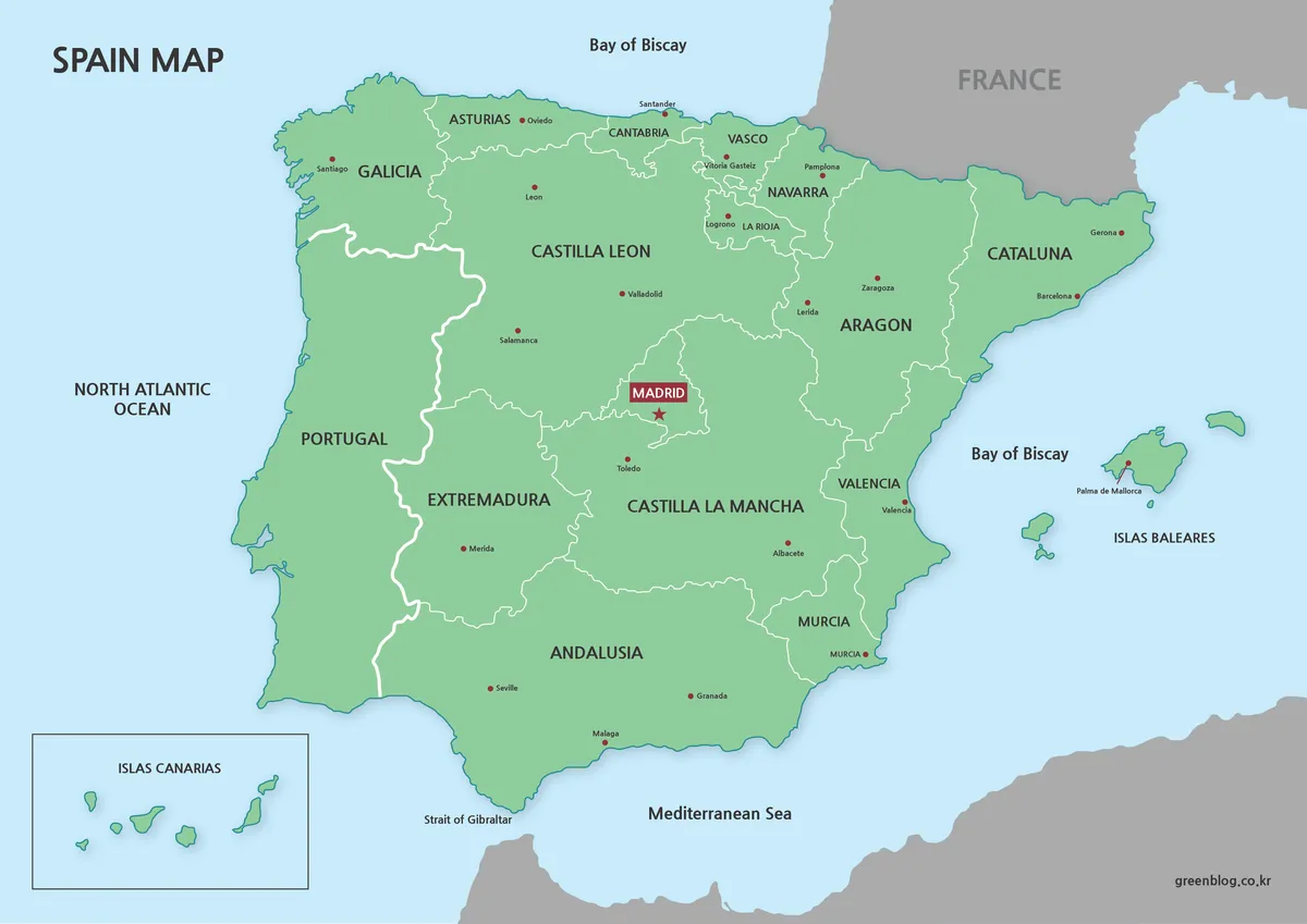
The color Spain Map establishes a clear visual hierarchy. Green separates Spanish territory from pale blue water and gray neighboring land; white internal lines divide the communities; red dots mark selected cities; and Madrid receives an additional box and star. The single green fill is decorative rather than thematic, so it does not represent population, climate, politics, or any other measured variable.
2️⃣ Black and White Map for Print and Editing
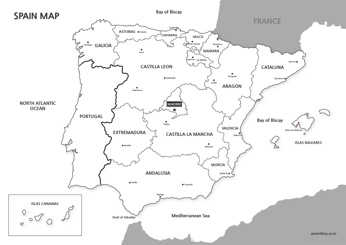
The black-and-white Spain Map keeps the community names, city points, island arrangement, and surrounding geographic labels while removing the green land and blue water fields. The heavier international border with Portugal remains easy to distinguish from finer community lines. This balance makes the sheet suitable for photocopies, report appendices, study notes, and layouts where another chart already supplies the color.
3️⃣ Outline-Only Map for Custom Work
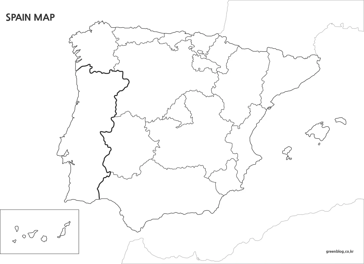
The outline Spain Map removes community names, city points, and most water labels while retaining the peninsula’s coast, internal divisions, Balearic Islands, and boxed Canary Islands. Neighboring outlines remain faintly visible around the mainland. The open areas make this the most adaptable file for labeling exercises, regional color keys, route sketches, and original thematic graphics.
A classroom sequence can begin with the color reference, move to the monochrome sheet for guided notes, and finish with the outline for recall. Students might label all 17 communities, mark Madrid, distinguish the island groups, or color communities that share a coast. Since Ceuta and Melilla are not represented as labeled units, any exercise claiming complete first-level coverage should add that limitation to its instructions.
For data graphics, apply fills only after defining the categories, units, date, and source in a legend. Compact shapes may need numbered callouts rather than internal text. The image is a raster base rather than a set of independently selectable vector polygons, so keep an original copy before erasing lines or painting regions. Legal, cadastral, and precision GIS work requires current authoritative boundary data.
Flag-Based Map Variation
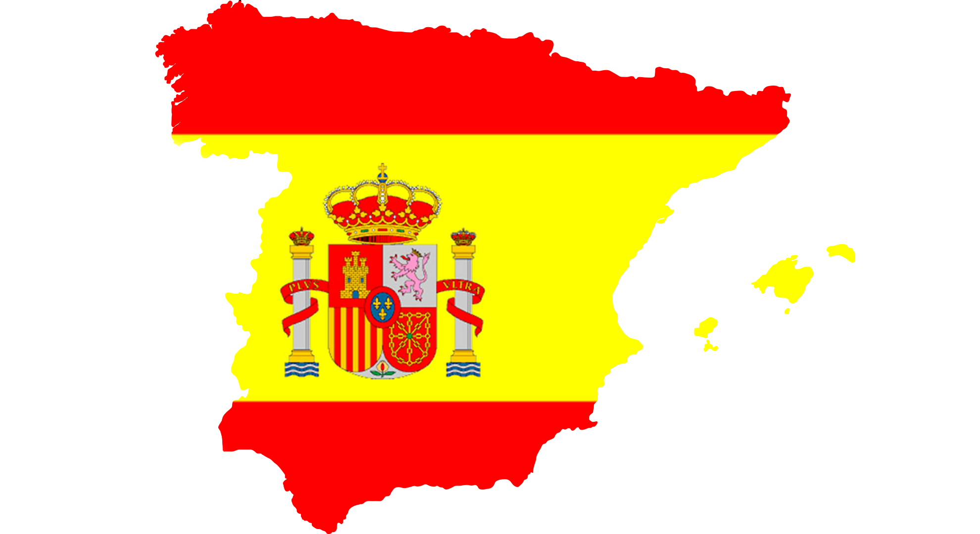
The flag-filled Spain Map shifts attention from administration to national identity. Red and yellow bands run through the country silhouette, and the coat of arms sits inside the mainland shape. The Balearic Islands appear separately in the same colors. Because the flag is clipped by geography and the rectangular proportions are lost, this graphic should be treated as an illustration rather than a replacement for the national flag.
The fifth image supplies the conventional red-yellow-red rectangle with the coat of arms positioned toward the hoist. It is better suited to a country profile, title panel, or legend that needs an unmistakable flag. The silhouette is stronger when shape matters. In either case, leave clear space around the coat of arms and avoid placing labels over its detailed elements.
Practical Contexts for Using the Map
Choose a visual according to the question, not simply according to color preference. A labeled regional sheet answers where communities and selected cities are located. The outline invites the reader to add information. The flag silhouette and rectangular flag identify the country without explaining its internal divisions. Keeping these roles separate prevents a decorative graphic from being mistaken for an administrative reference.
For a lesson, display the color Spain Map while introducing the peninsula, the Mediterranean Balearics, and the Atlantic Canaries, then distribute the outline for labeling. For a report, use the monochrome version when annotations or data must command attention. For a presentation, crop only after confirming that the island inset and neighboring context are not essential to the argument.
- Regional study: compare community size, adjacency, and coastal position.
- Print activity: use monochrome for guided notes and outline for recall.
- Presentation: use color for orientation and add only essential callouts.
- Identity design: choose between the geographic silhouette and conventional flag.
Frequently Asked Questions
The preserved FAQ below answers common questions about using, printing, creating, and editing the files. When working with the regional versions, remember that each Spain Map is a general visual resource rather than a complete legal or navigational reference.
Can the Spain maps be used freely?
Yes. The maps may be used in personal projects, school assignments, presentations, and informational posts. Please note that sharing or re-uploading the original files in their unchanged form is not allowed.
Are these maps suitable for printing?
All files were prepared at a large size, so boundary lines remain clear when printed. The black-and-white and outline versions work especially well for handouts and printed documents.
Which tools were used to create the maps?
The map outlines were drawn in Illustrator to keep edges clean at any size. Color adjustments and final layout were handled in Photoshop.
Can I edit the maps in graphic software?
Yes. The files can be opened directly in common design programs, making it easy to add labels, highlights, or custom notes for your own use.
Download Information
The protected ZIP provides the five visual types described on this page. Download the archive, preserve the original files, and work from copies when adding labels, colors, routes, or data. The regional maps and flag graphics have different purposes and dimensions, so compare the previews before choosing a file.
Map File Information
This archive combines regional reference maps, an outline activity base, and two flag-based graphics.
- Included Versions: Color regional, black-and-white regional, outline, flag silhouette, and national flag
- Intended Use: Study, printing, presentations, annotation, and design
Related Maps
Additional Resources
The Government of Spain’s territorial organization overview explains the country’s autonomous communities, provinces, municipalities, and autonomous cities.
Green Map creates custom-edited map images using open geographic data sources such as geoBoundaries, Natural Earth, OpenStreetMap, and government open data.
These maps are edited visual materials, not raw data files, and are provided for education, documents, presentations, and graphic reference.