
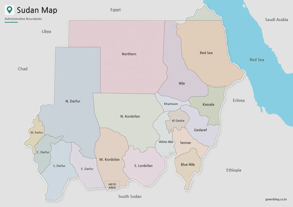
Reading 18 States and Border Disputes on a Sudan Map
A Sudan Map becomes much more useful when its boundary choices are explained rather than treated as neutral. The supplied
Reading 18 States and Border Disputes on a Sudan Map Read More »
A Sudan Map becomes much more useful when its boundary choices are explained rather than treated as neutral. The supplied
Reading 18 States and Border Disputes on a Sudan Map Read More »
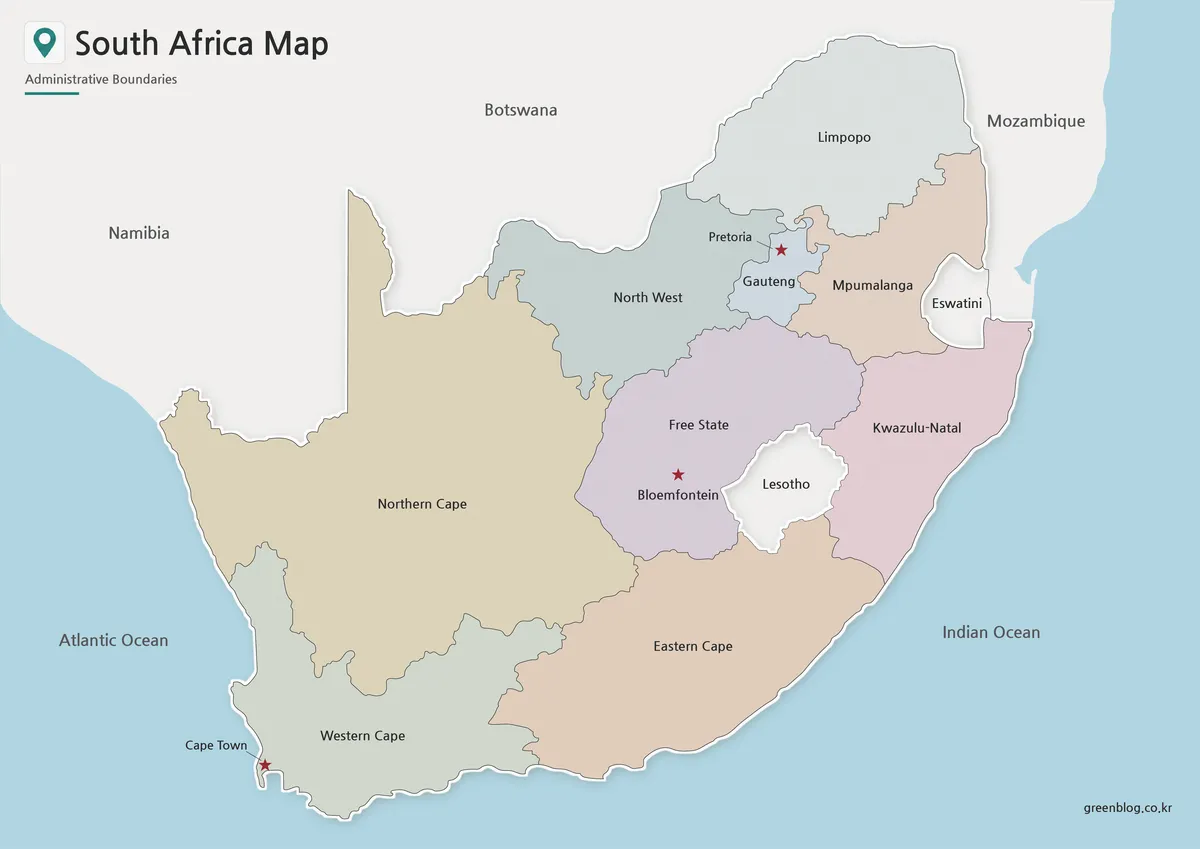
A South Africa Map provides a clear way to read the country’s nine-province structure, two-ocean coastline, and distinctive relationships with
South Africa Map: Provincial Reference for Print and Annotation Read More »
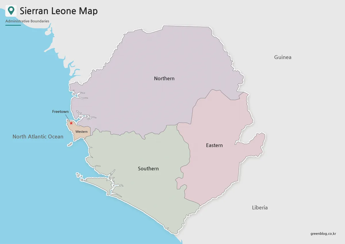
A Sierra Leone Map should make the country’s Atlantic coast, Freetown peninsula, and borders with Guinea and Liberia easy to
Sierra Leone Map: A Four-Region Reference with a Boundary Note Read More »
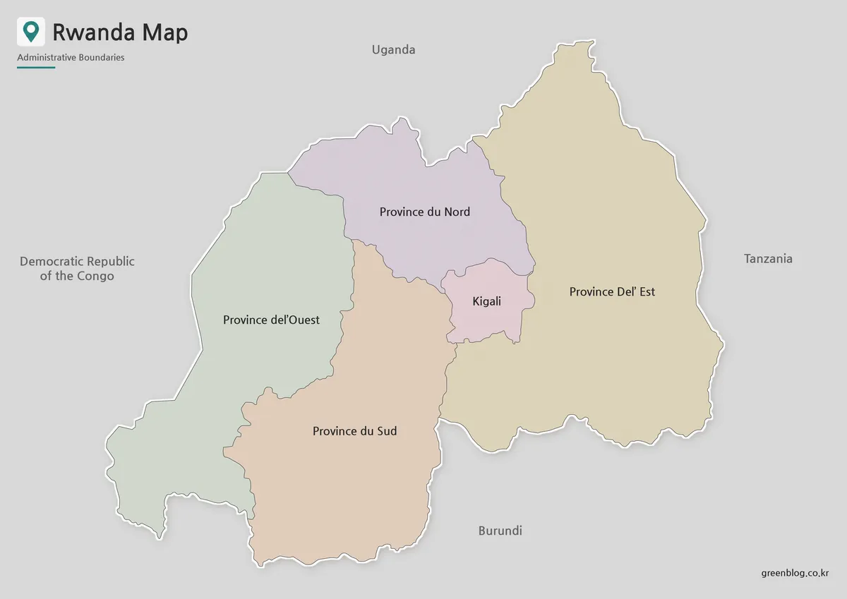
A Rwanda Map is useful when you need a clear visual reference for this compact landlocked country in East Africa.
Rwanda Map Download – Printable Administrative Maps Read More »
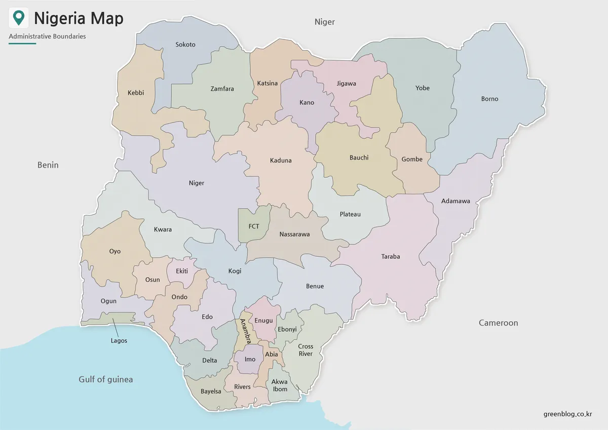
This Nigeria Map fits a broad northern interior, a narrow southern coast, 36 states, and the Federal Capital Territory into
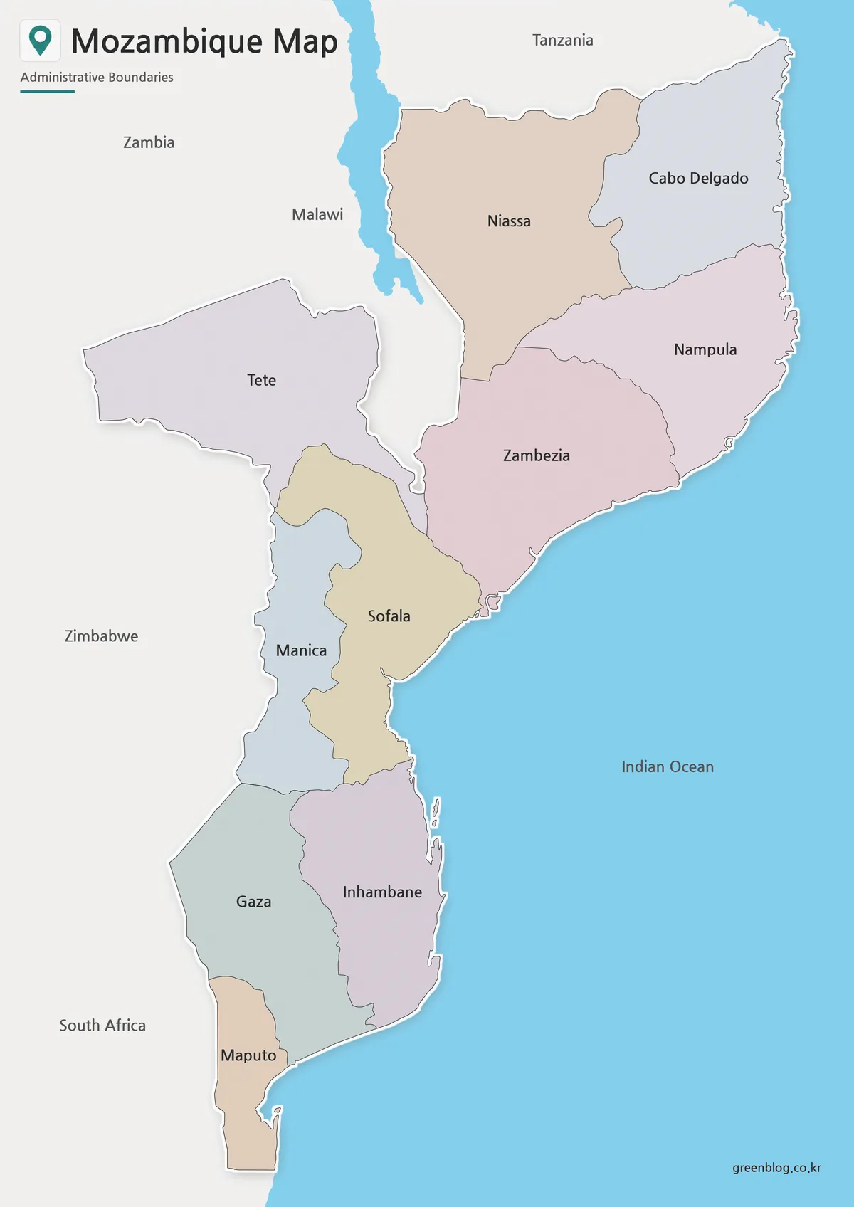
A Mozambique Map is especially helpful for understanding a country whose territory runs in a long arc along southeastern Africa
Mozambique Map for Provincial Reference, A3 Printing, and Annotation Read More »
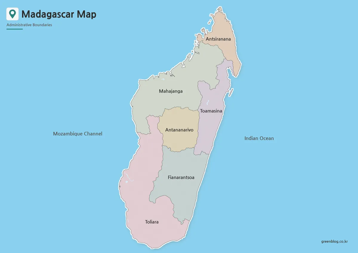
A Madagascar Map needs a tall composition because the island extends much farther north to south than east to west.
Madagascar Map from Antsiranana to Toliara in Four Views Read More »
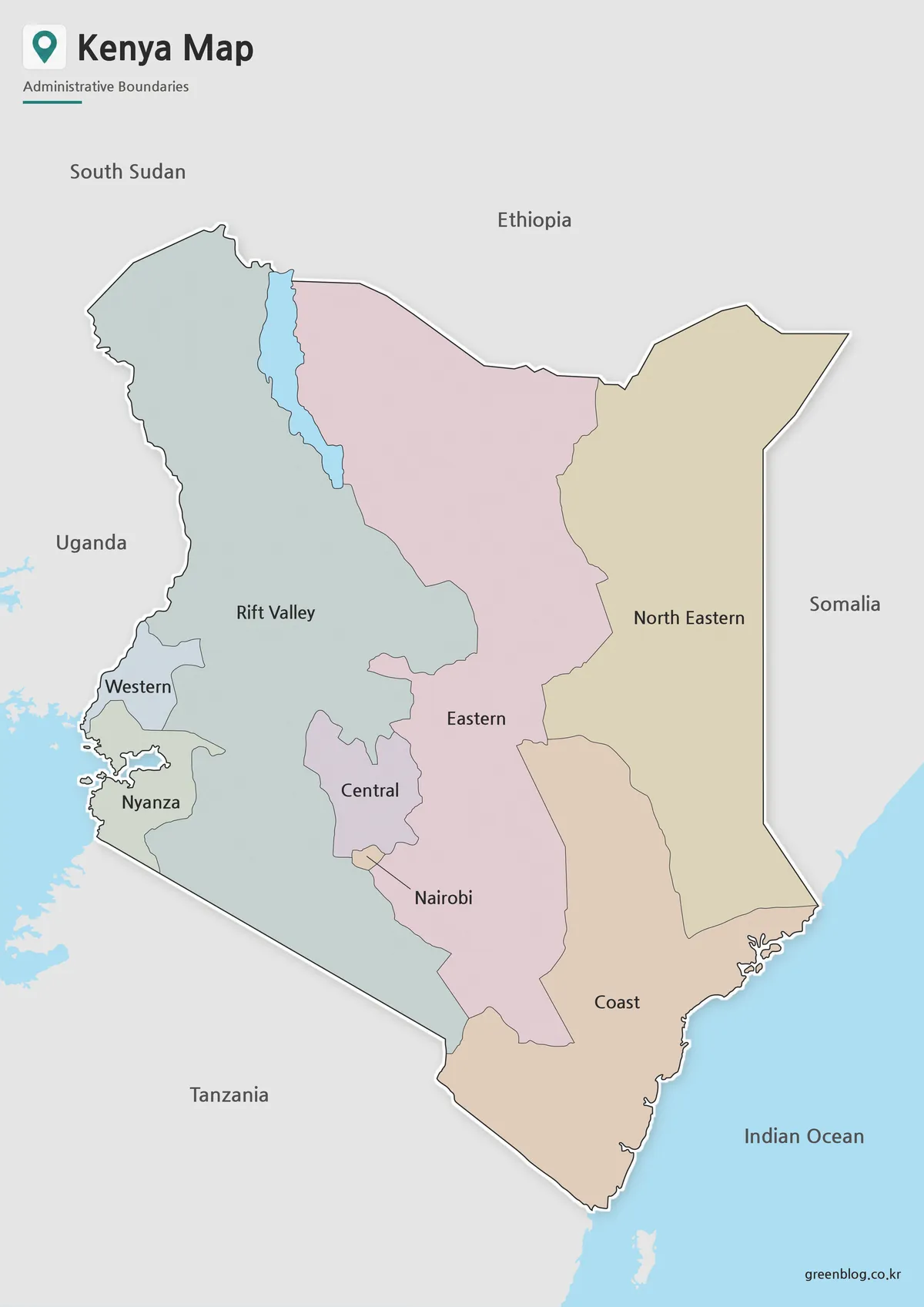
This Kenya Map shows the eight provinces used before the country’s present 47-county system. Central, Coast, Eastern, Nairobi, North Eastern,
Why This Kenya Map Has Eight Regions Instead of 47 Counties Read More »
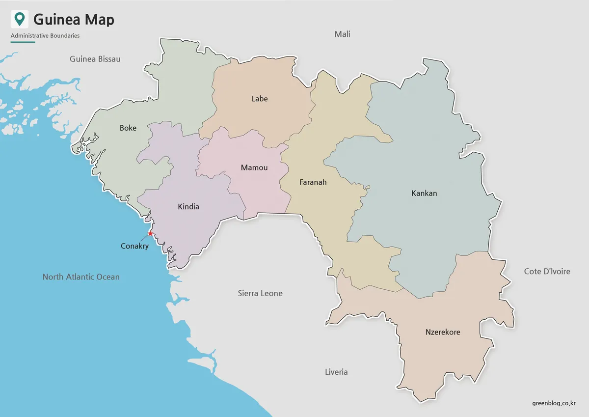
A Guinea Map reveals a country whose shape begins on the North Atlantic coast and reaches far inland across West
Guinea Map from Conakry to Kankan: Regional Files for A3 Use Read More »