
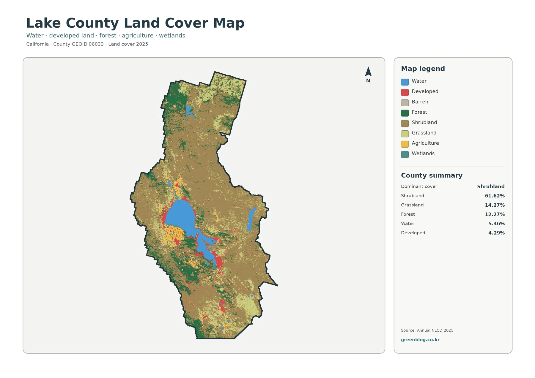
Lake County California Land Cover Map — Clear Lake, Shrubland Hills, and Shoreline Development
The Lake County California Land Cover Map is organized around one feature that immediately separates this county from many inland […]
The Lake County California Land Cover Map is organized around one feature that immediately separates this county from many inland […]
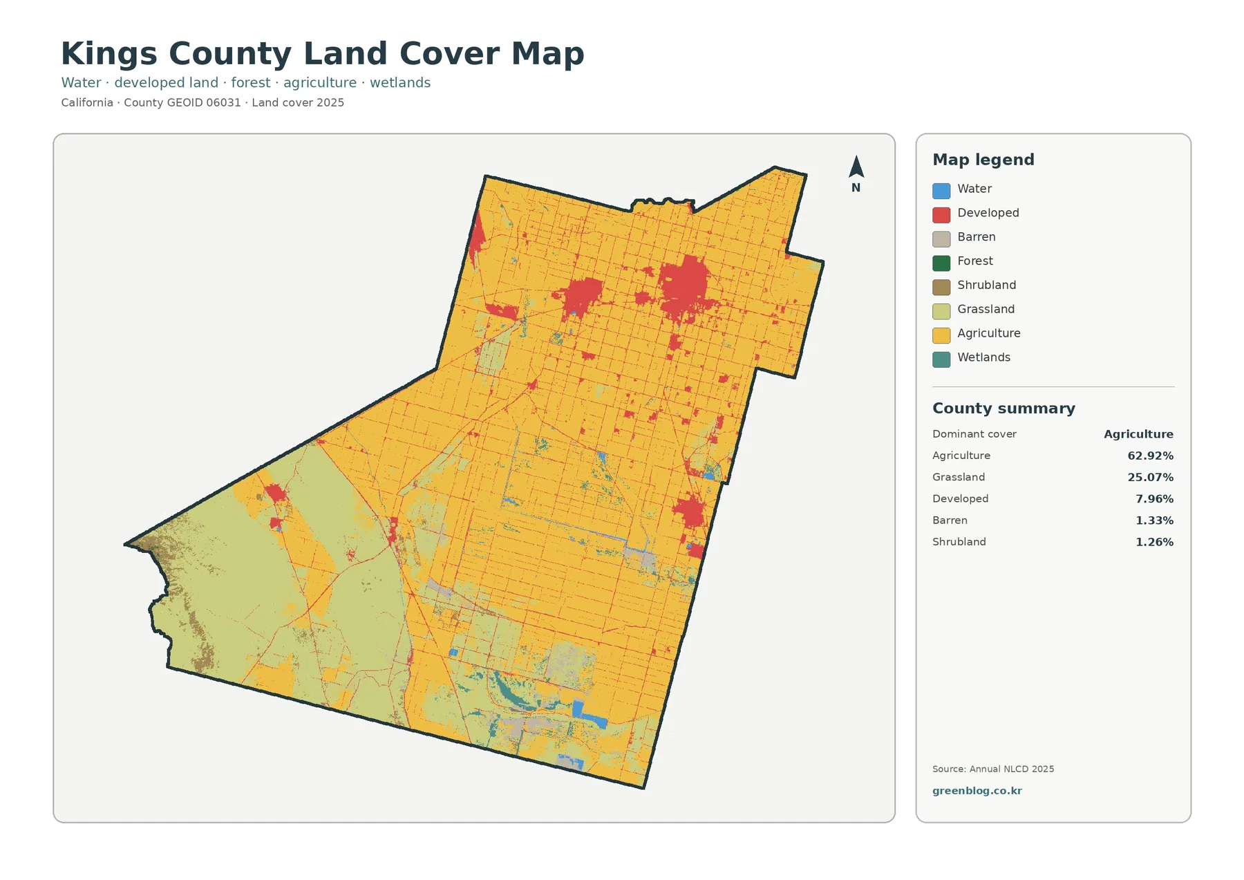
The Kings County California Land Cover Map makes one contrast immediately clear. A tight agricultural grid fills most of the
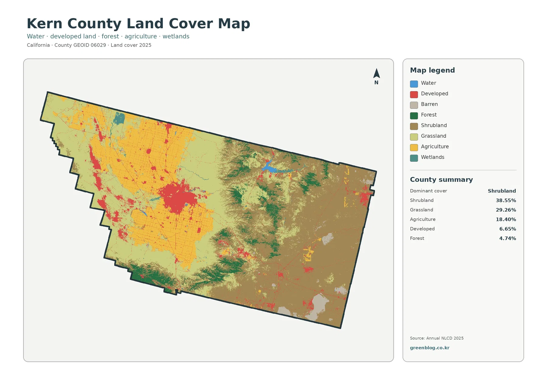
The Kern County California Land Cover Map shows a county where broad dry-land vegetation, irrigated agriculture, mountain forest, and a
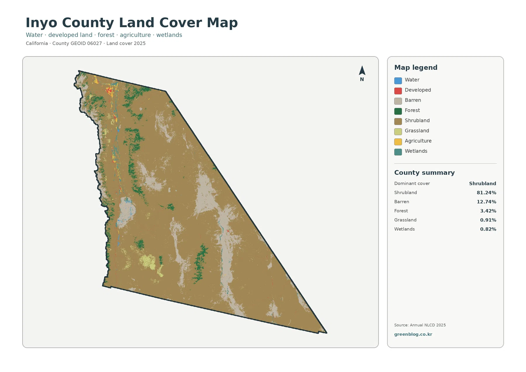
The Inyo County California Land Cover Map is dominated by a pattern that is unusual compared with many more developed
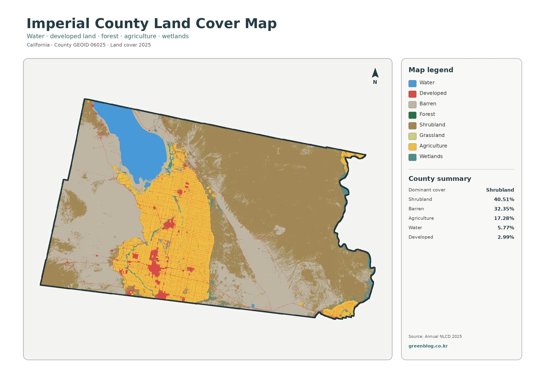
The Imperial County California Land Cover Map is defined by contrast. Desert shrubland and barren ground cover most of the
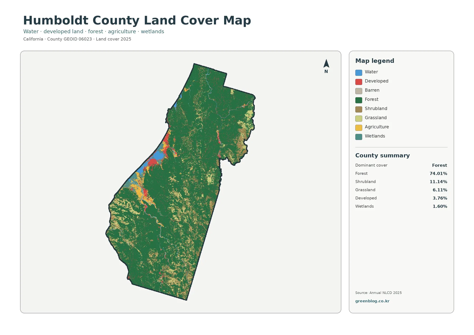
The Humboldt County California Land Cover Map gives a countywide view of a landscape dominated by forest, with smaller areas
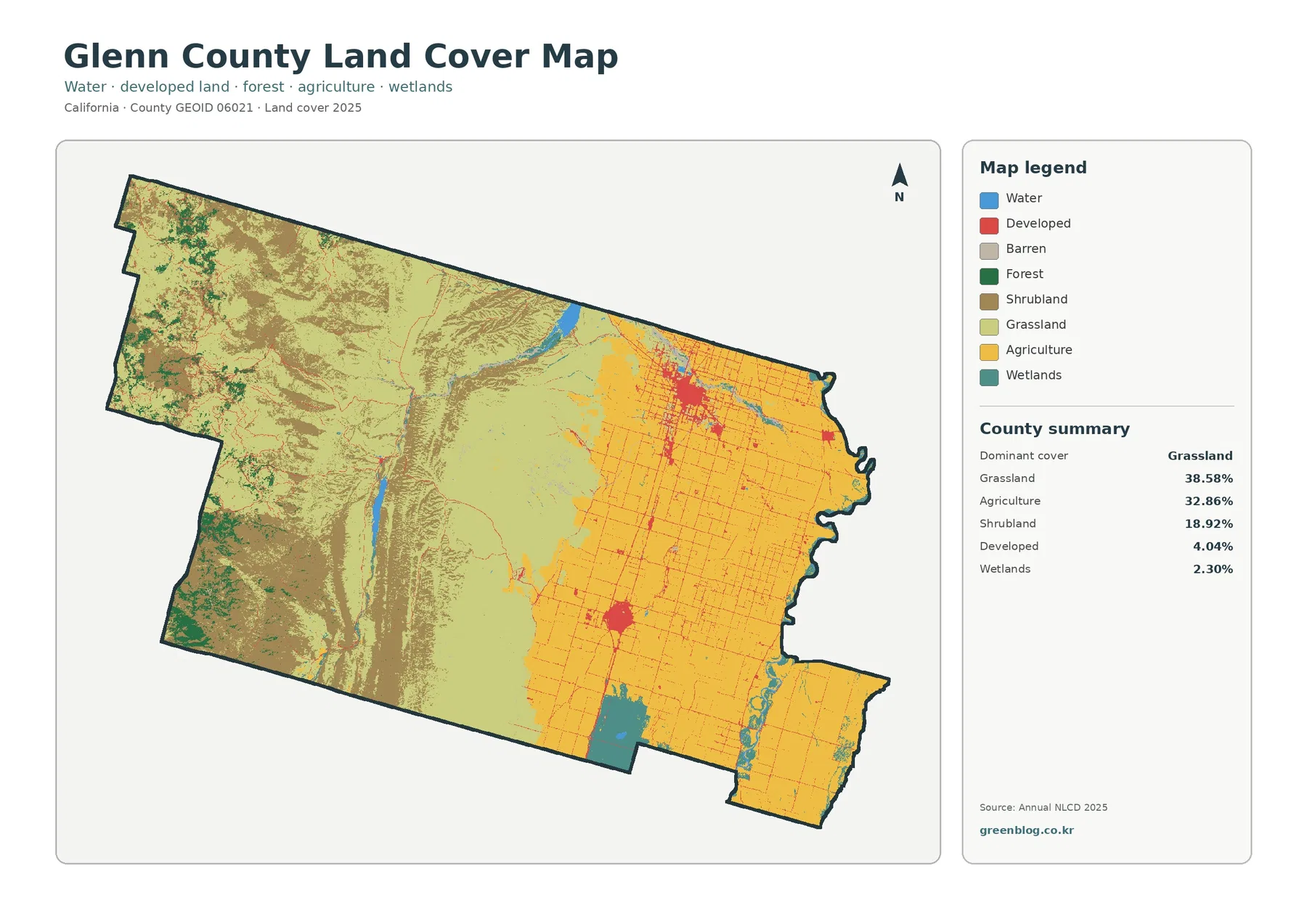
The Glenn County California Land Cover Map set makes the county’s east–west contrast easy to see. Grassland is the largest
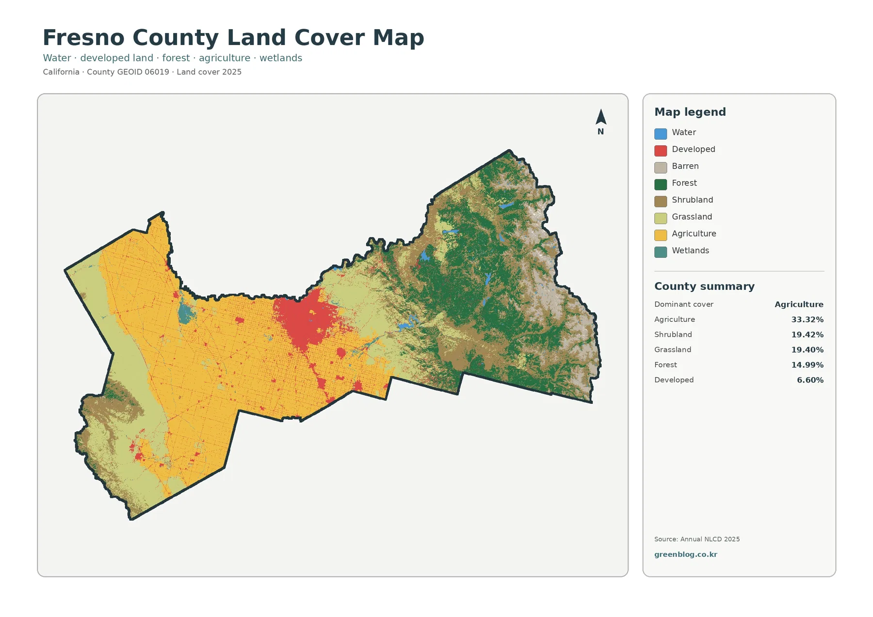
Fresno County crosses several very different landscapes within one long east–west boundary. The 2025 land-cover map is dominated by agriculture
Fresno County California Land Cover Map — 33.32% Agriculture and a Forested Eastern Rise Read More »
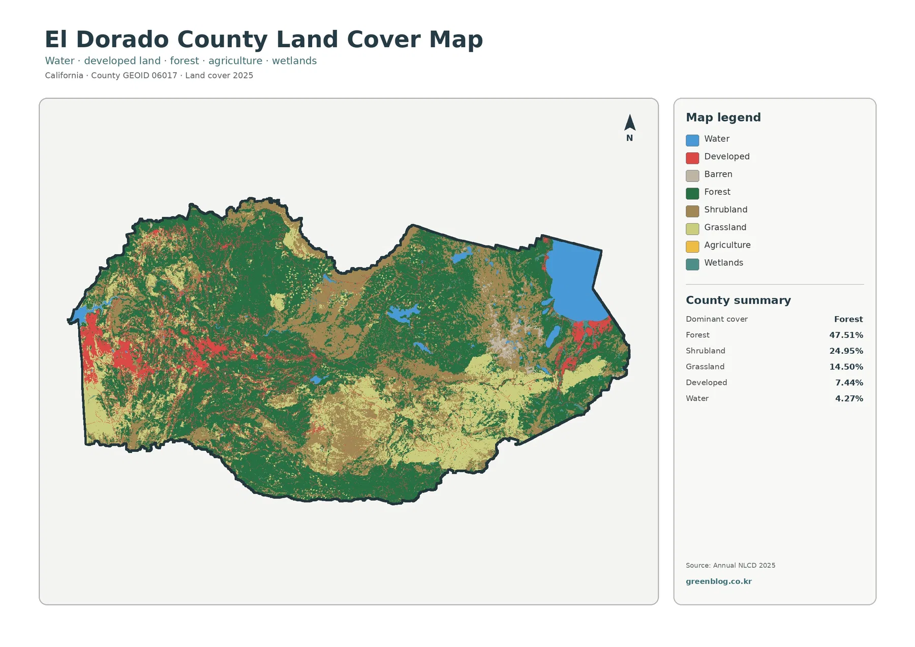
The El Dorado County California Land Cover Map captures an unusual countywide contrast: a developed western edge, a broad Sierra