
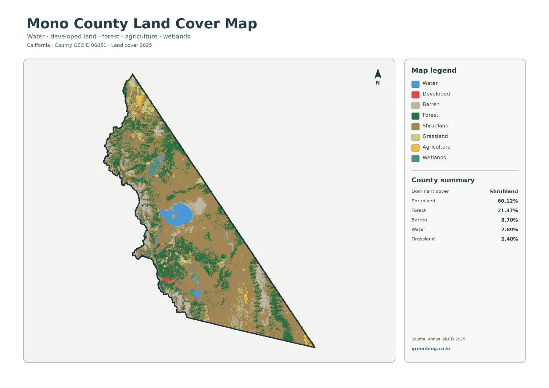
Mono County California Land Cover Map: Sagebrush Basins, Mono Lake and Sparse Development
Mono County’s 2025 land-cover map is dominated by shrubland, but the county is far from visually uniform. Shrubland accounts for […]
Mono County’s 2025 land-cover map is dominated by shrubland, but the county is far from visually uniform. Shrubland accounts for […]
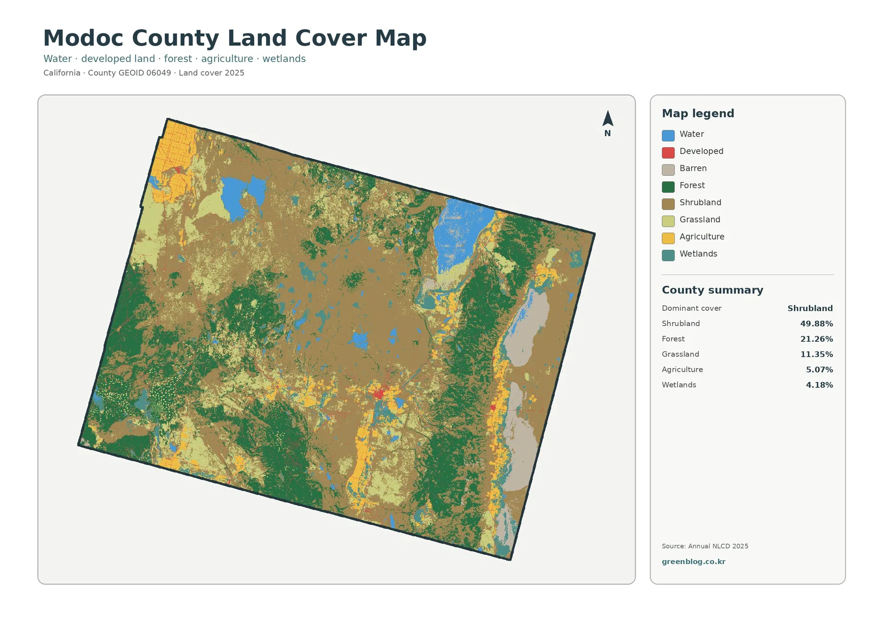
Modoc County occupies a very different land-cover setting from California’s coastal cities and Central Valley farm counties. The 2025 summary
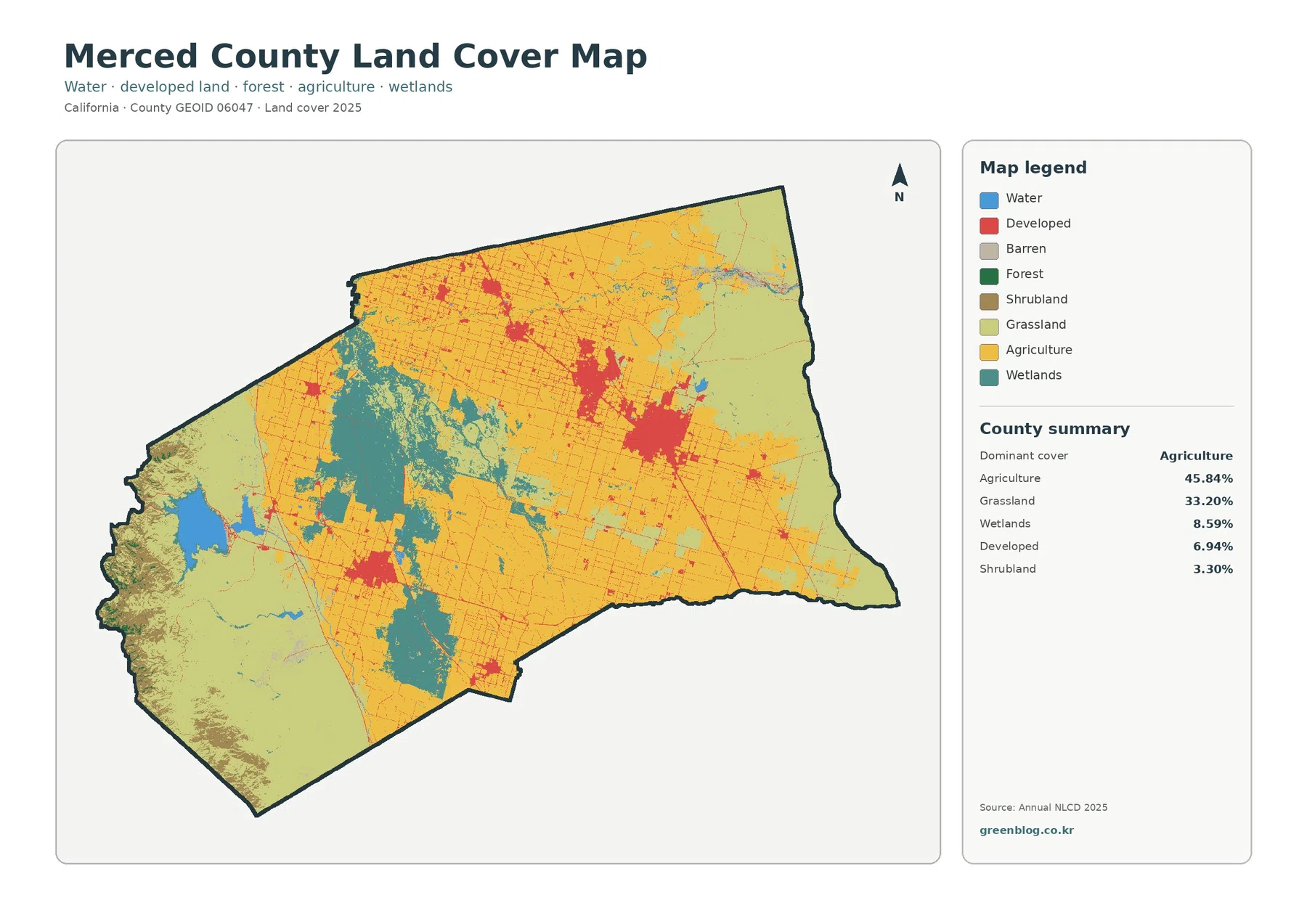
The Merced County California Land Cover Map is dominated by agriculture and grassland, but those two categories do not tell
Merced County California Land Cover Map | Farmland, Wetland Belt, and San Luis Reservoir Read More »
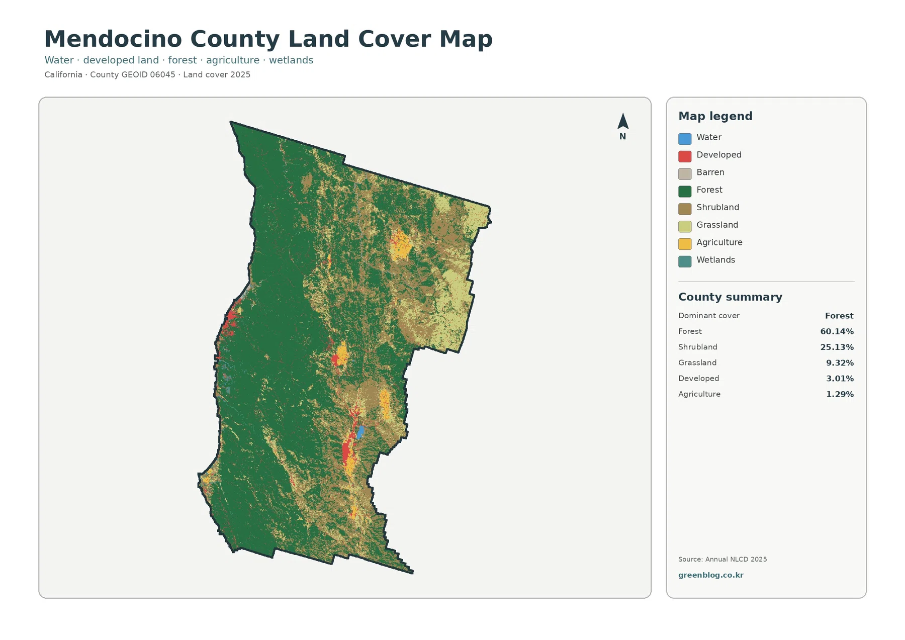
The Mendocino County California Land Cover Map is dominated by forest, but the county does not look uniform from the
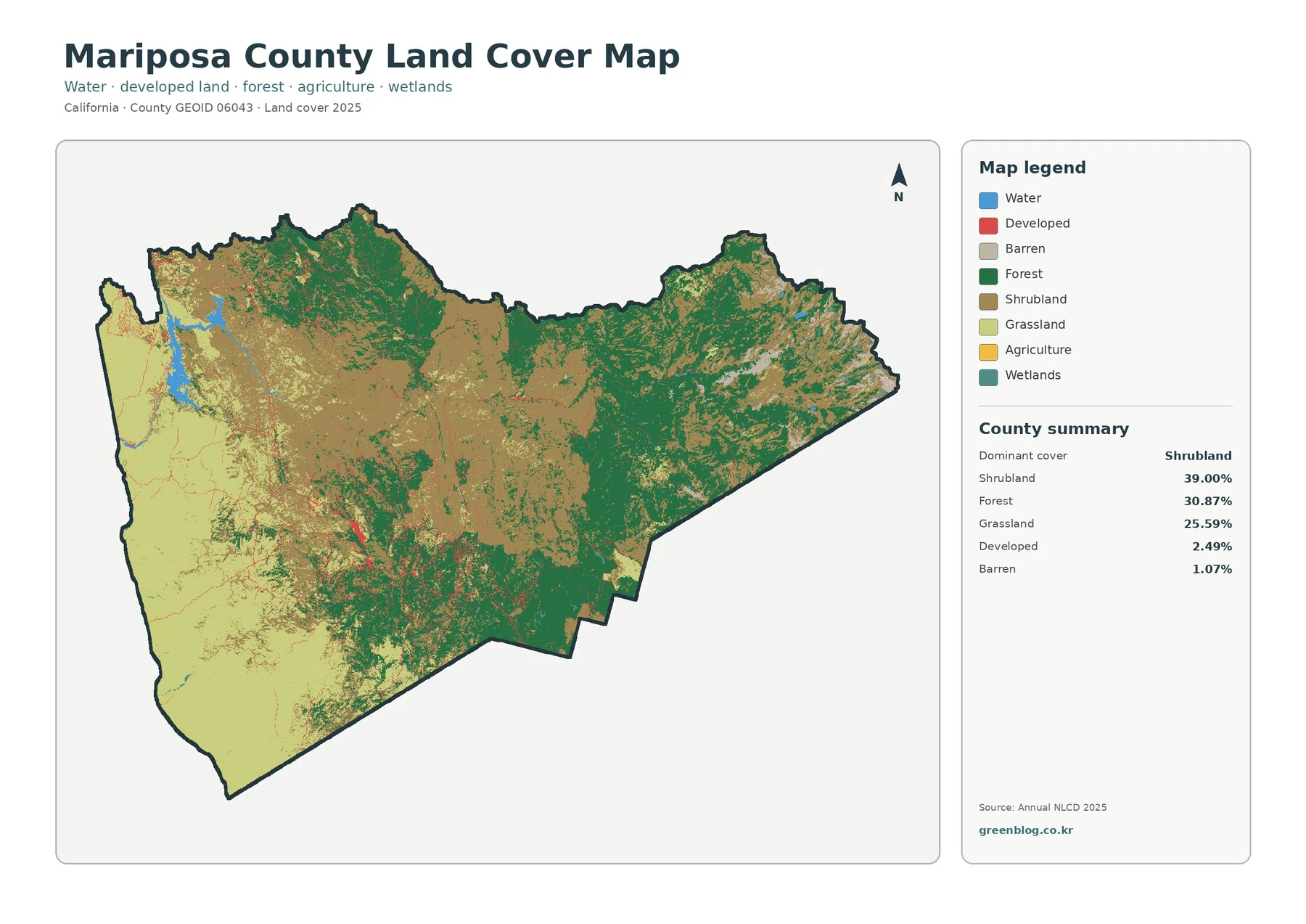
The Mariposa County California Land Cover Map set shows a county dominated by open shrubland, forest, and grassland rather than
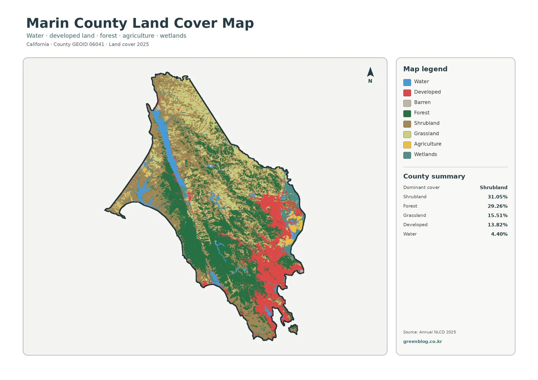
Marin County is close to one of California’s largest urban regions, yet its 2025 land-cover pattern is dominated by shrubland
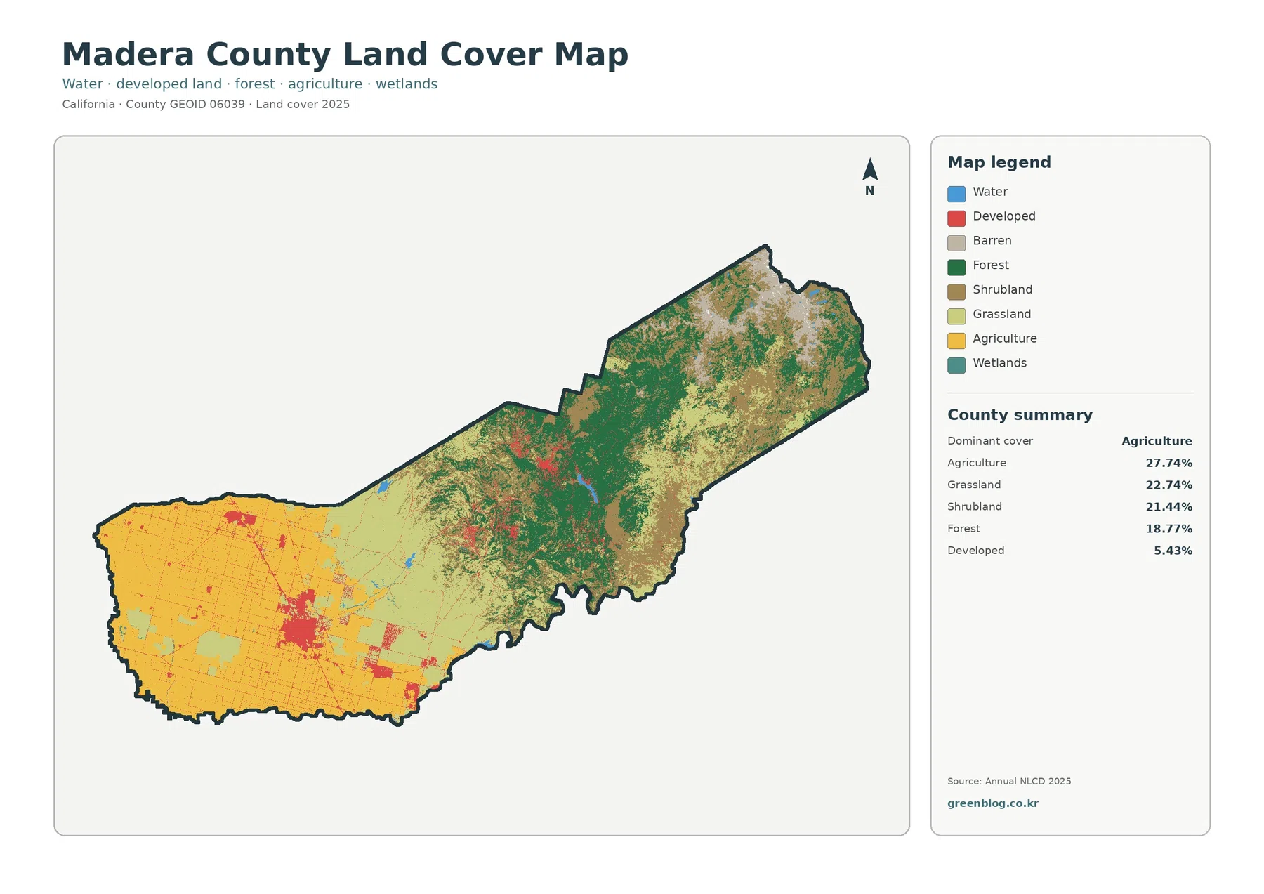
Madera County stretches across two very different California landscapes, and the land-cover maps make that contrast immediately visible. Broad agricultural
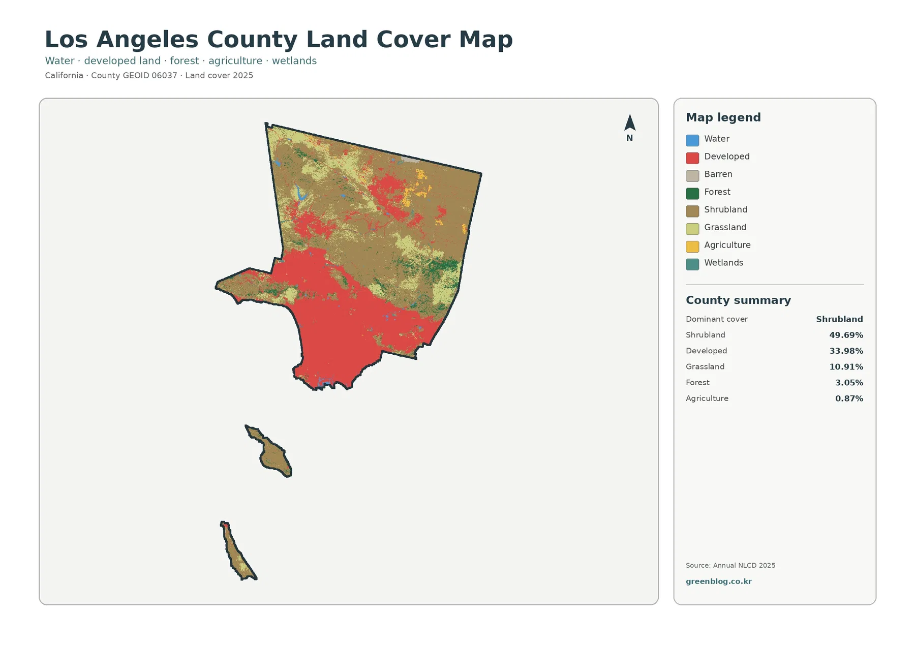
The Los Angeles County California Land Cover Map brings together two landscapes that are easy to think of separately: one
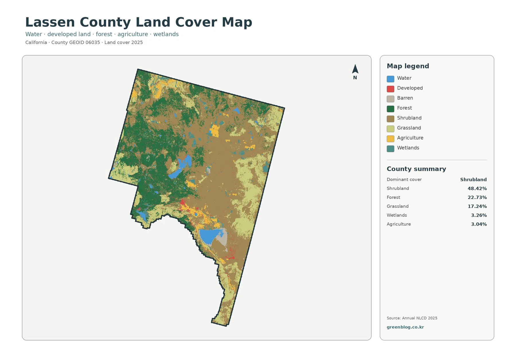
The Lassen County California Land Cover Map reveals a strong west-to-east contrast: broad forest in the western half gives way
Lassen County California Land Cover Map — Sagebrush East, Forested West, and Major Lakes Read More »