
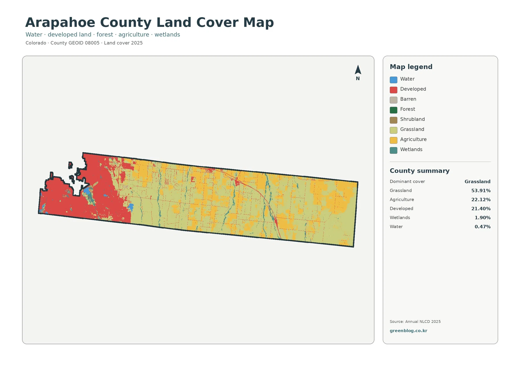
Arapahoe County Colorado Land Cover Map | 53.91% Grassland and a Hard-Surfaced Western Core
Arapahoe County stretches from a densely developed western end into a long eastern landscape where grassland and agriculture dominate. The […]
Arapahoe County stretches from a densely developed western end into a long eastern landscape where grassland and agriculture dominate. The […]
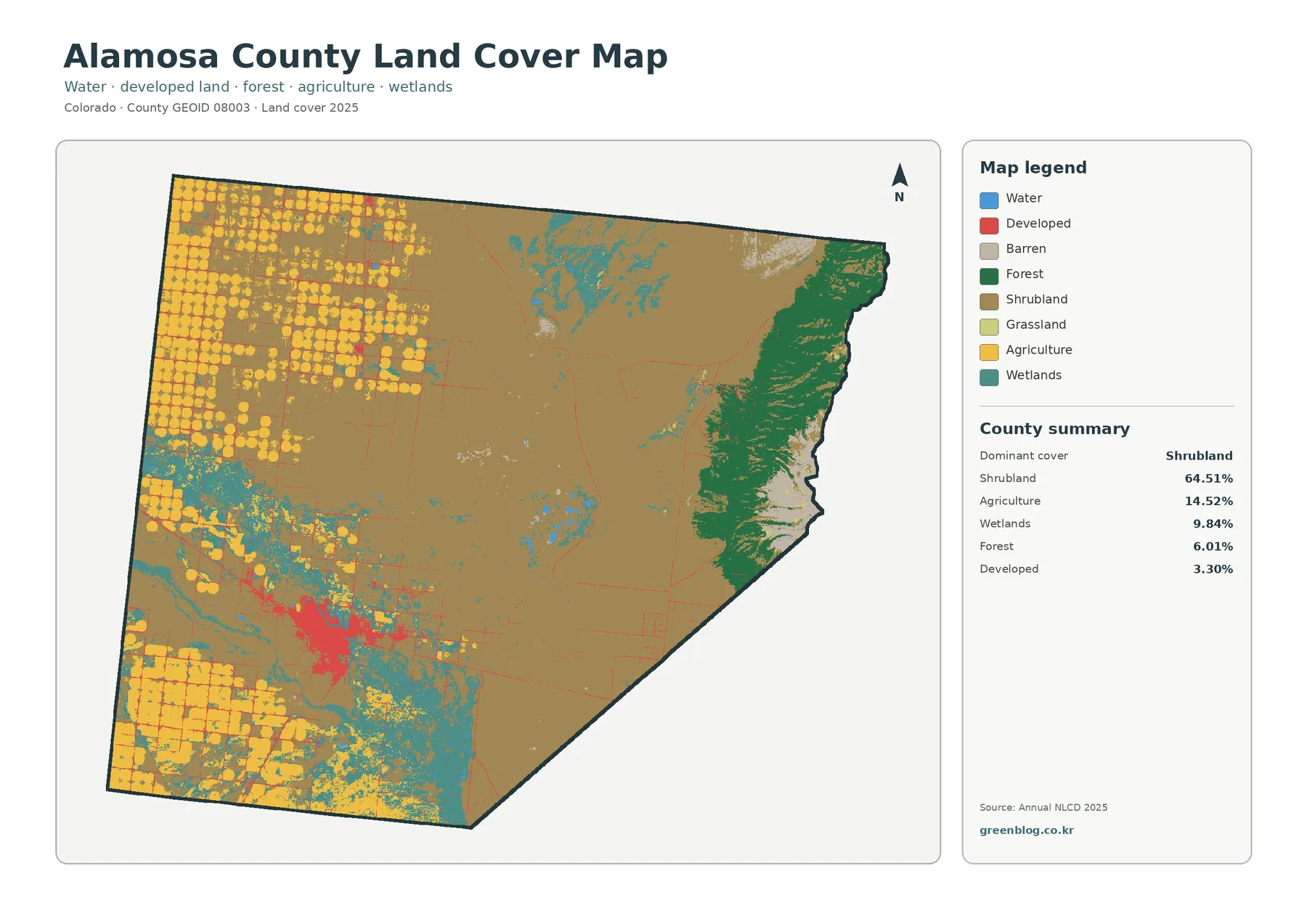
Alamosa County sits on the floor and eastern edge of Colorado’s San Luis Valley, where the 2025 land-cover map changes
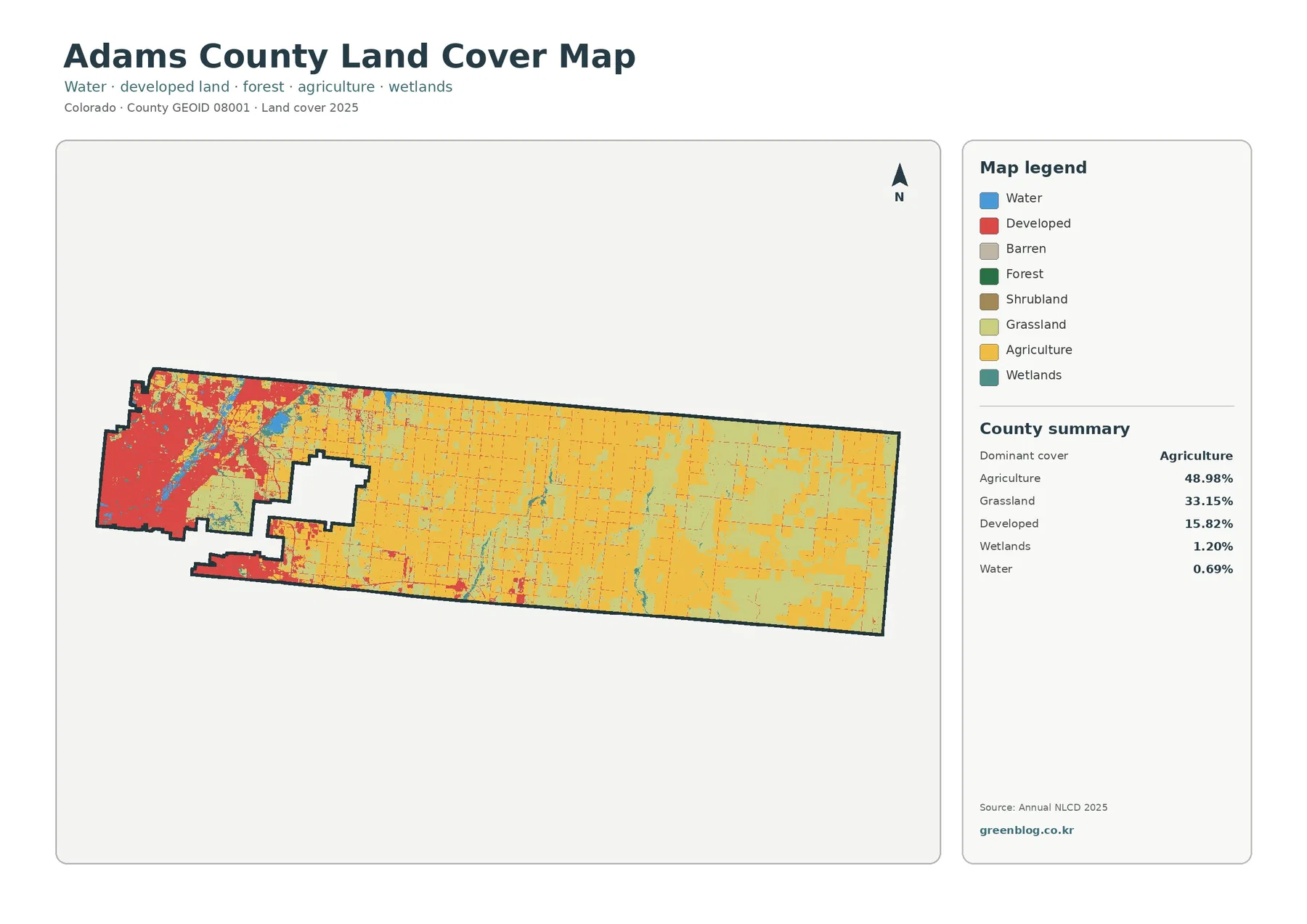
Adams County has one of the clearest west-to-east land-cover contrasts in the Denver-area plains. The 2025 map shows a dense
Adams County Colorado Land Cover Map | 48.98% Agriculture and a Dense Western Urban Edge Read More »
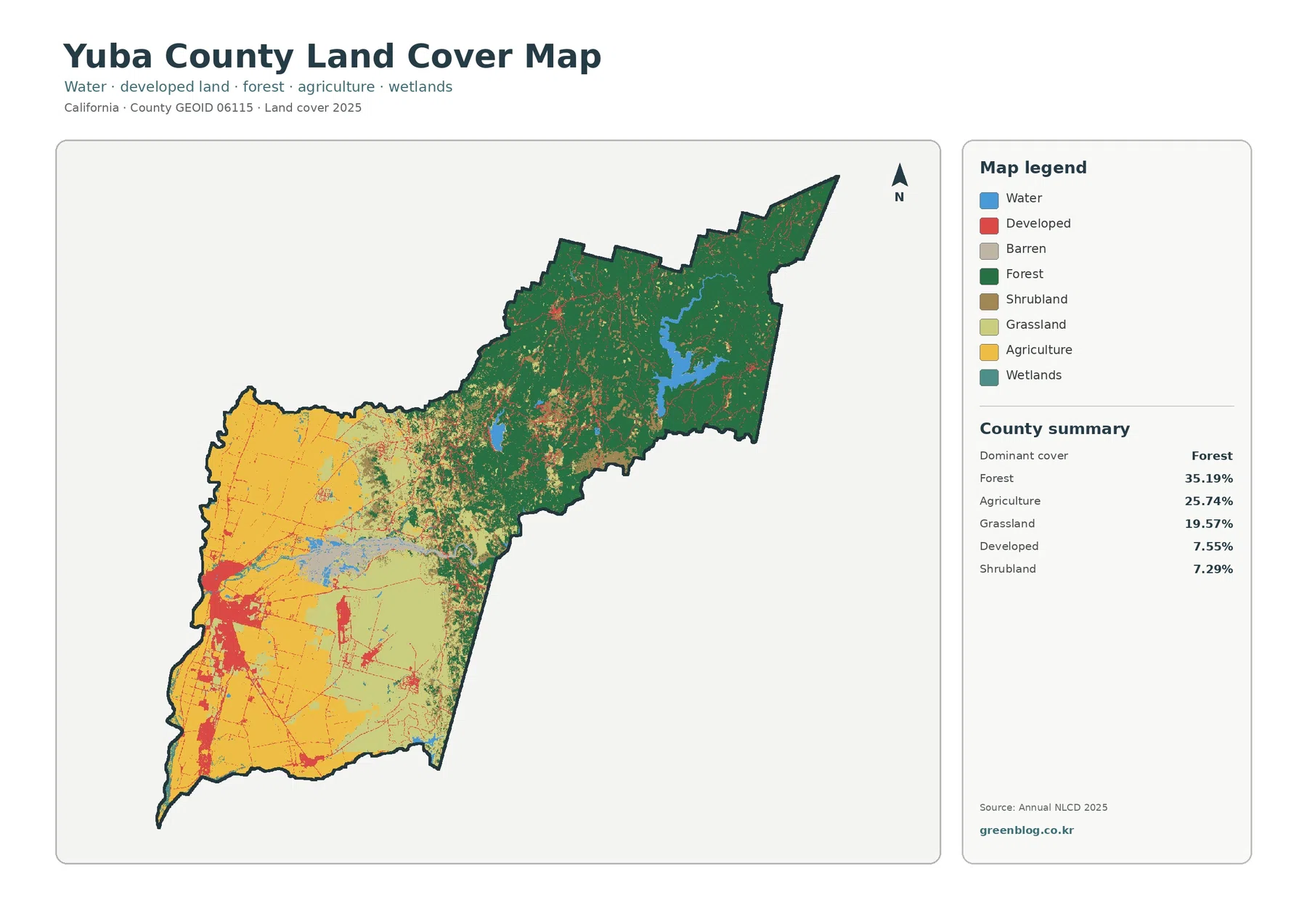
Yuba County crosses two very different California landscapes. The western side lies on the Sacramento Valley floor, where cropland and
Yuba County California Land Cover Map | Forested Foothills Above a Farmed Valley Floor Read More »
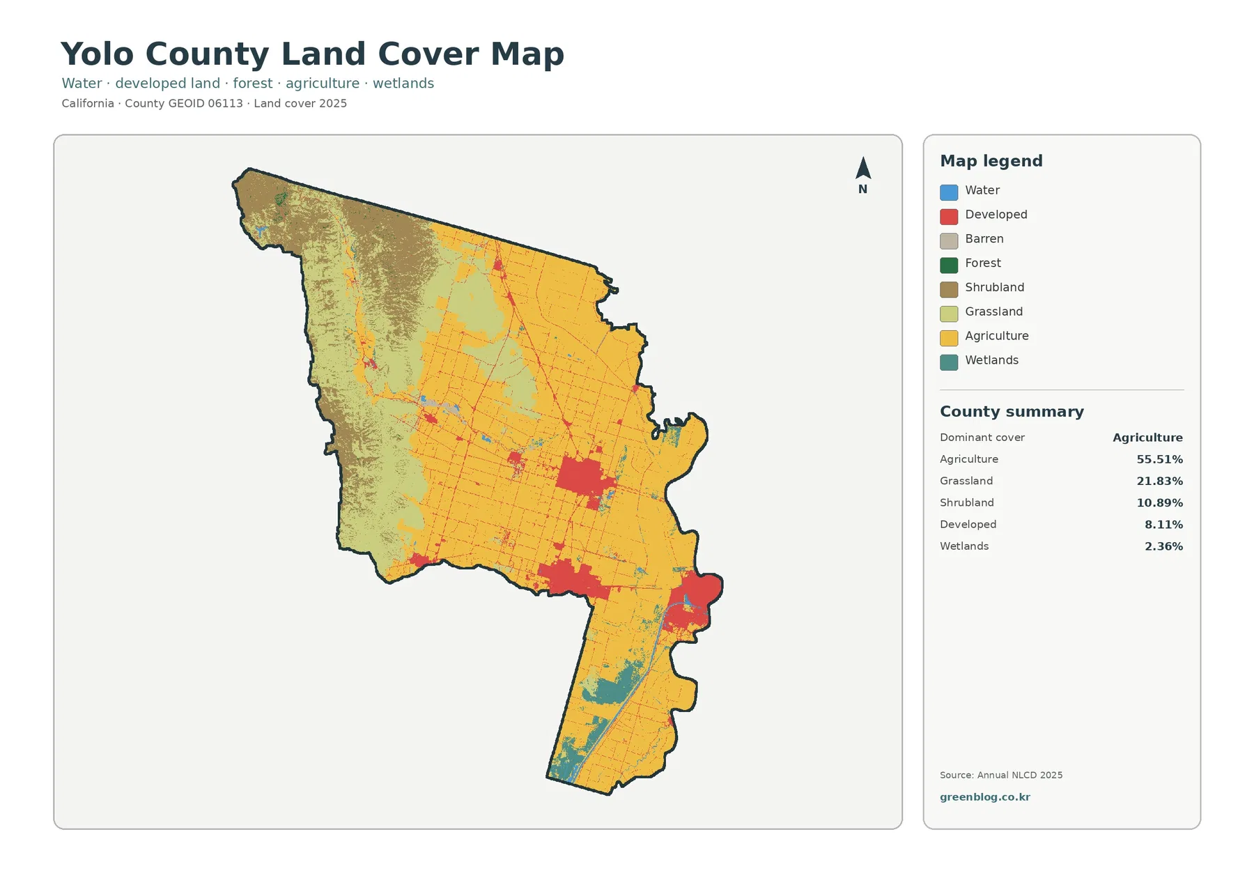
The Yolo County California Land Cover Map is dominated by agriculture at first glance, but the county changes sharply from
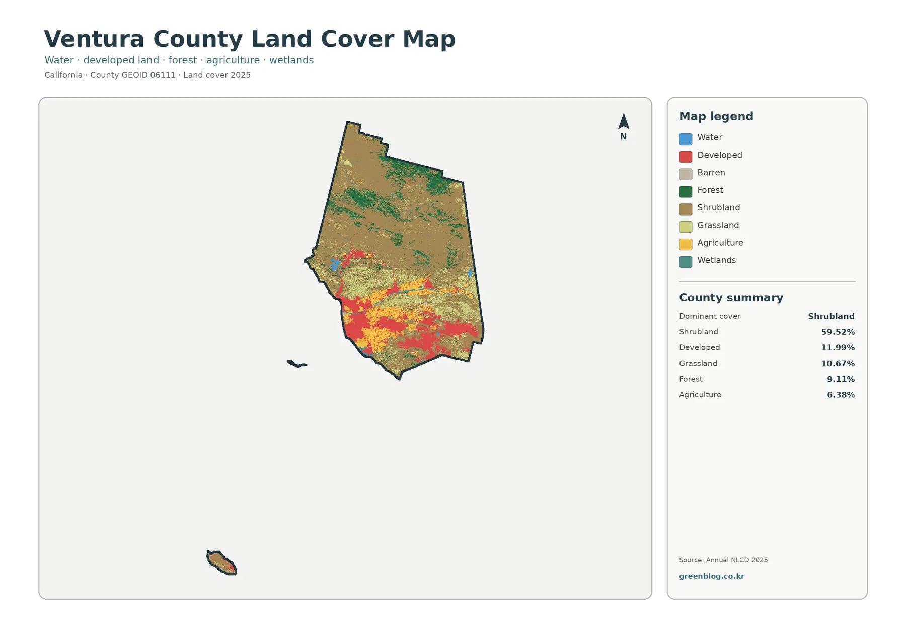
Ventura County has a land-cover pattern that changes quickly from rugged interior uplands to farmed valleys and heavily developed lowlands
Ventura County California Land Cover Map | 59.52% Shrubland Meets the Oxnard Plain Read More »
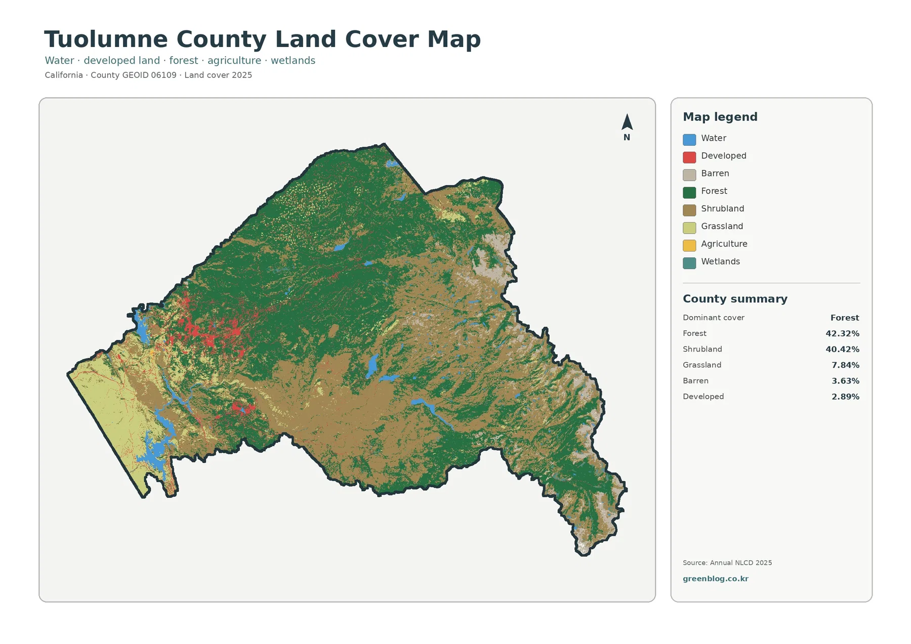
Tuolumne County is a Sierra Nevada county where the land-cover story is dominated by natural vegetation rather than a large
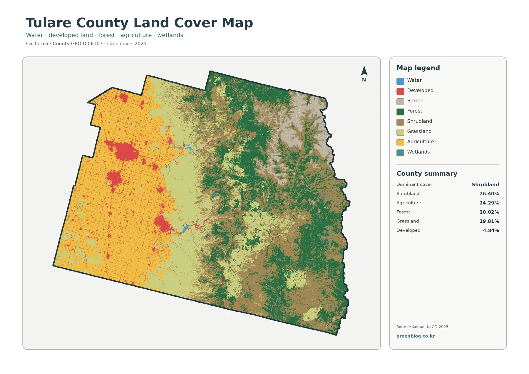
A Tulare County California Land Cover Map makes one of the county’s strongest geographic contrasts easy to see. Broad agricultural
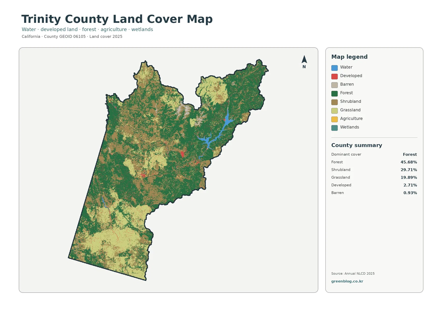
The Trinity County California Land Cover Map is dominated by natural cover rather than built surfaces. Forest accounts for 45.68%