
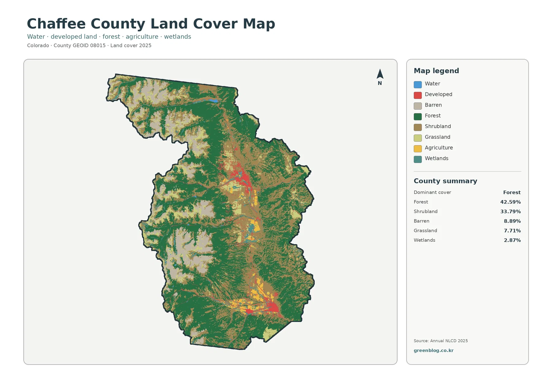
Chaffee County Colorado Land Cover Map | Forested Ranges, Arkansas Valley, and JPG Downloads
Chaffee County sits in central Colorado where broad mountain slopes surround the long Arkansas Valley. The 2025 land-cover summary is […]
Chaffee County sits in central Colorado where broad mountain slopes surround the long Arkansas Valley. The 2025 land-cover summary is […]
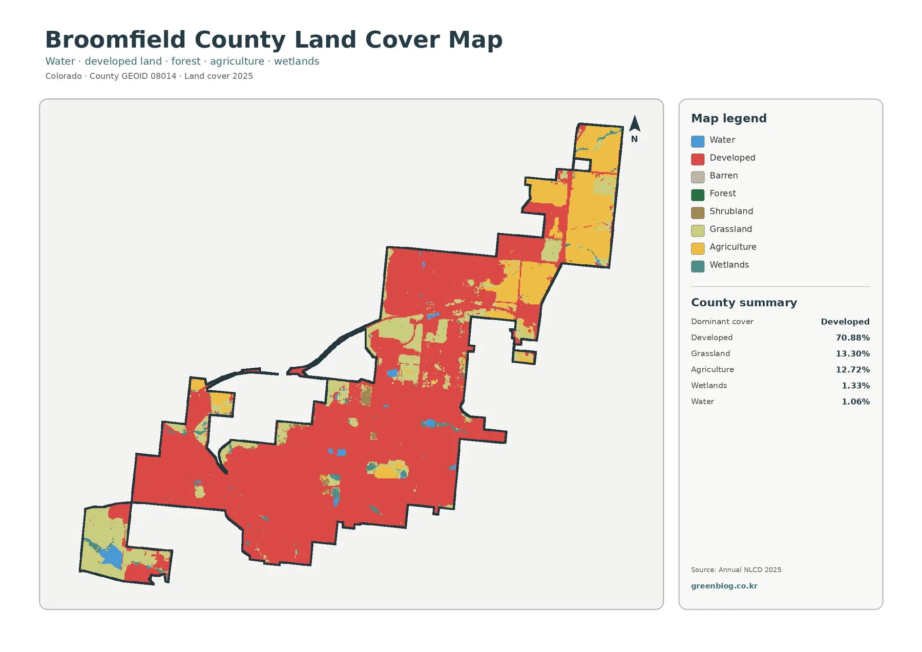
Broomfield County has a distinctly urban land-cover signature even though open and agricultural surfaces remain visible around its edges. The
Broomfield County Colorado Land Cover Map — Urban Cover, Farmland, and Change Since 1985 Read More »
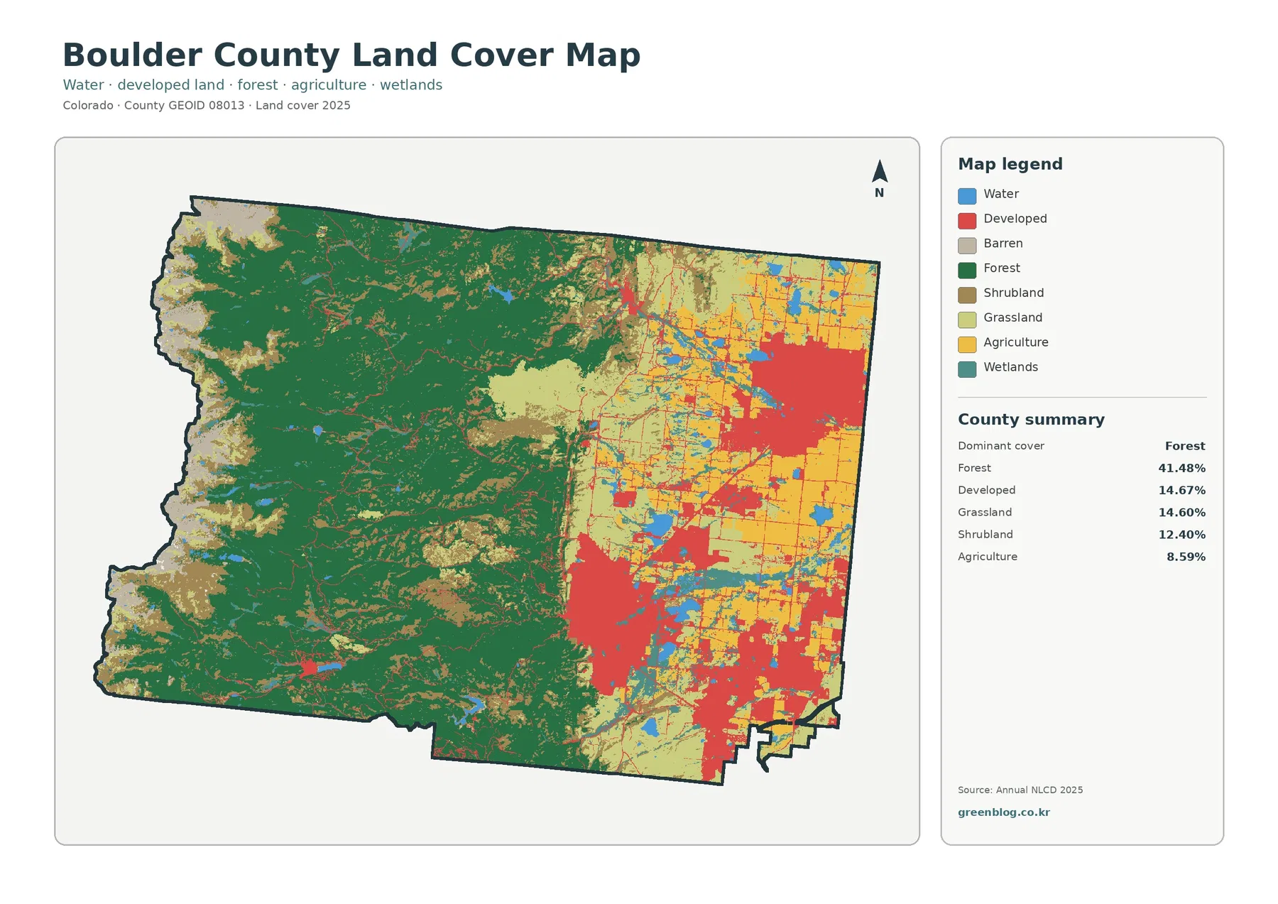
The Boulder County Colorado Land Cover Map brings two very different Colorado landscapes into one county view. The 2025 land-cover
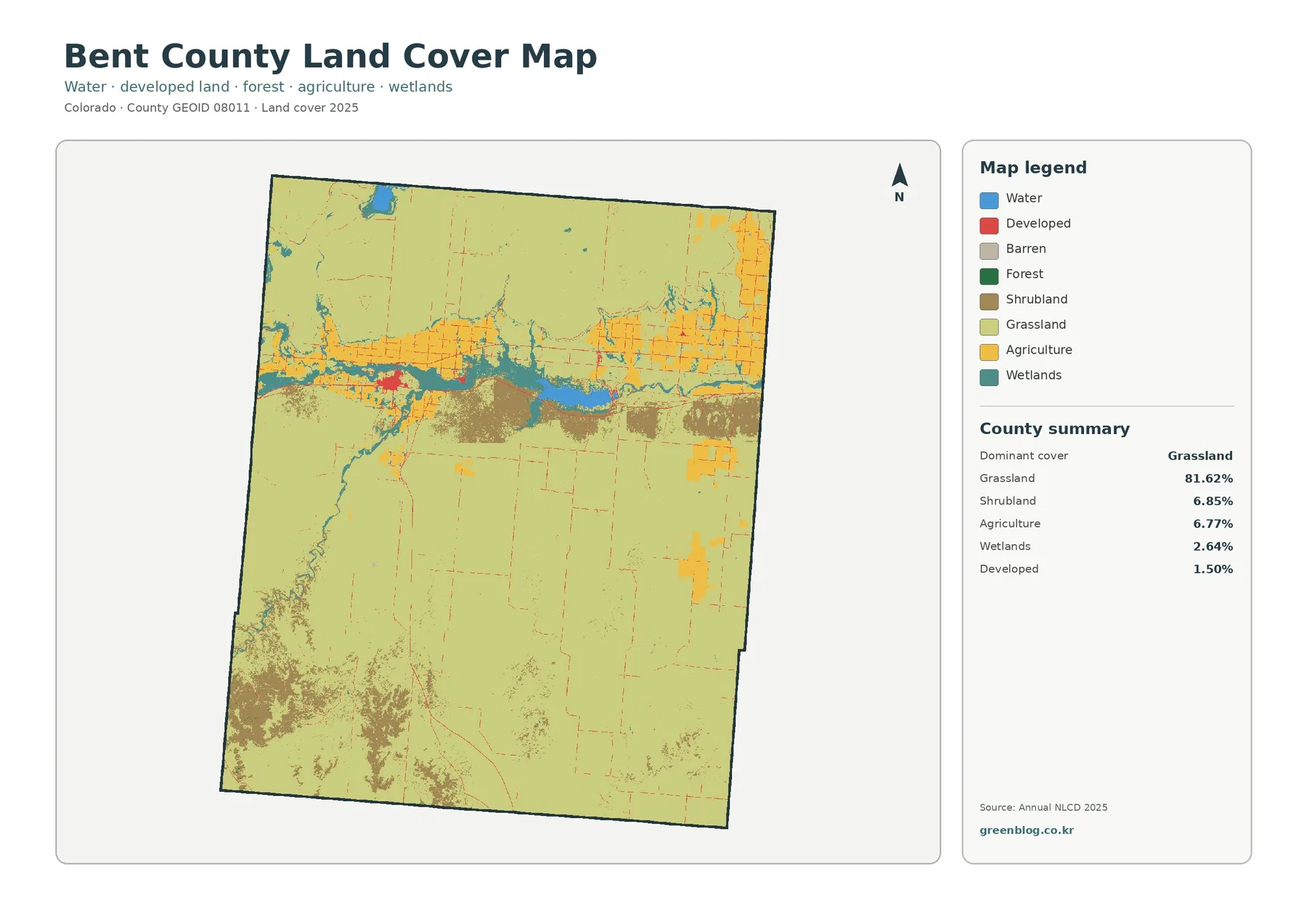
Bent County sits in southeastern Colorado, and its 2025 land-cover map is overwhelmingly open: grassland accounts for 81.62% of the
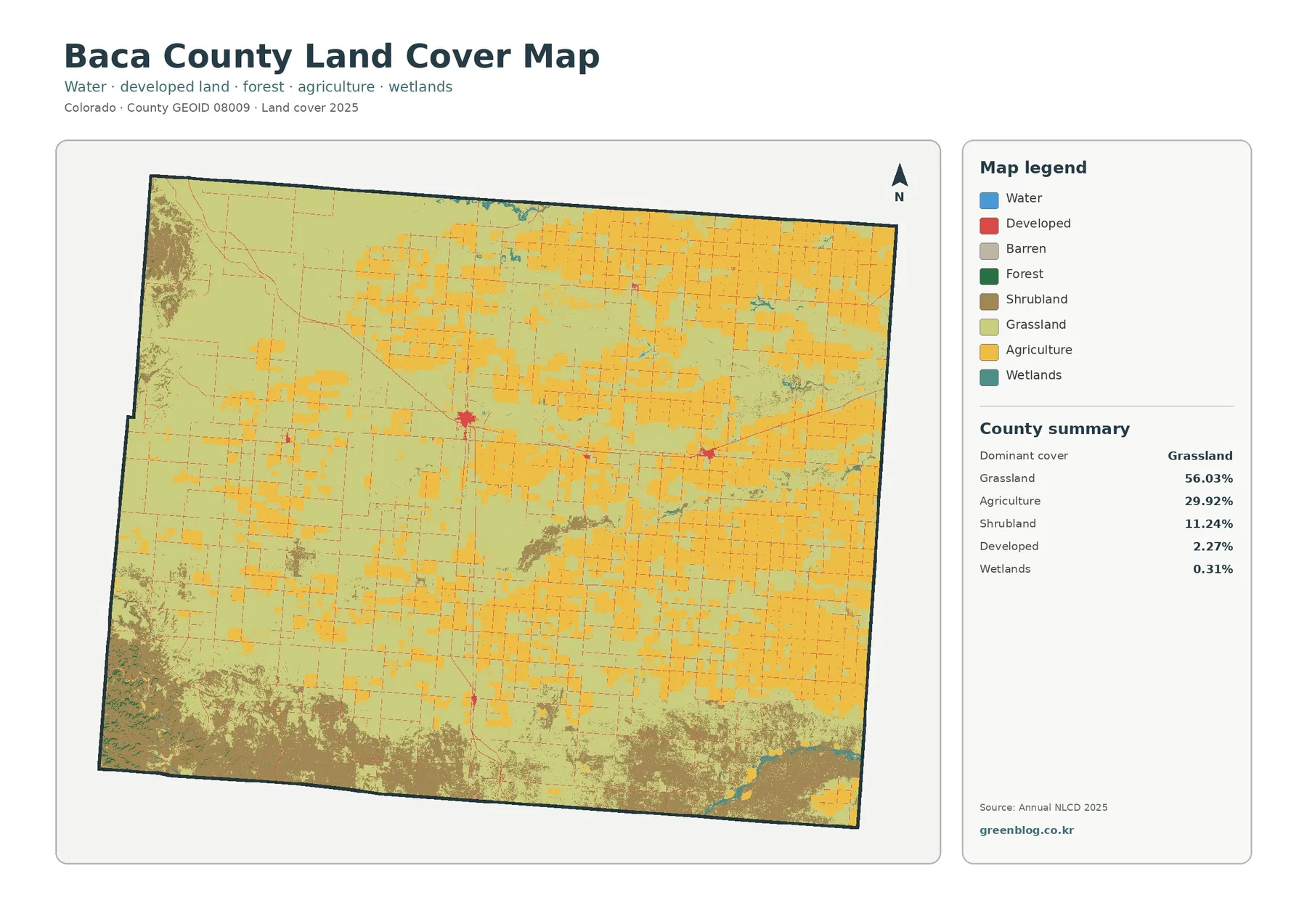
Baca County sits in Colorado’s far southeastern corner, and its 2025 land-cover picture is dominated by open ground rather than
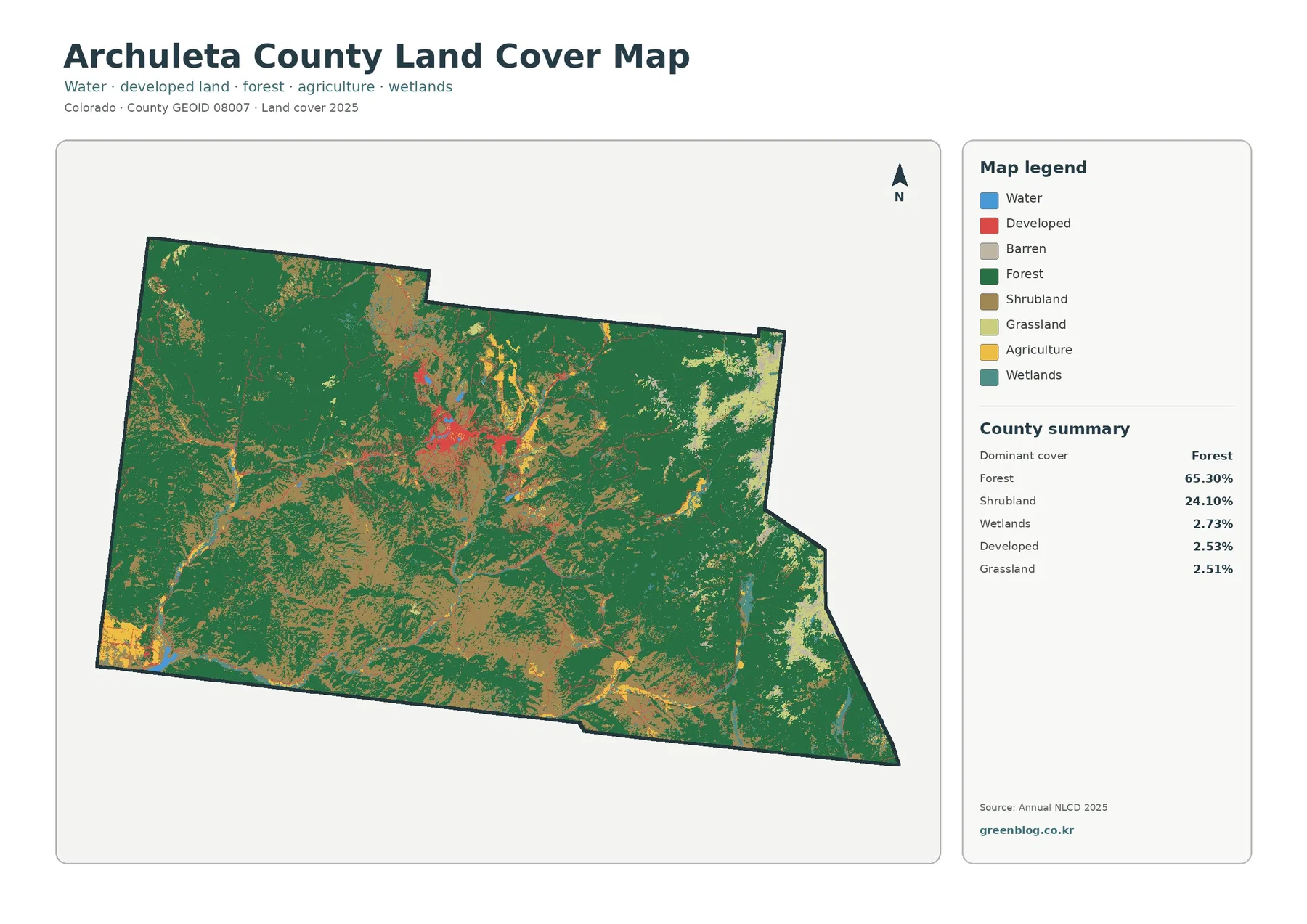
The Archuleta County Colorado Land Cover Map set covers a mountain county where forest is the defining surface pattern and
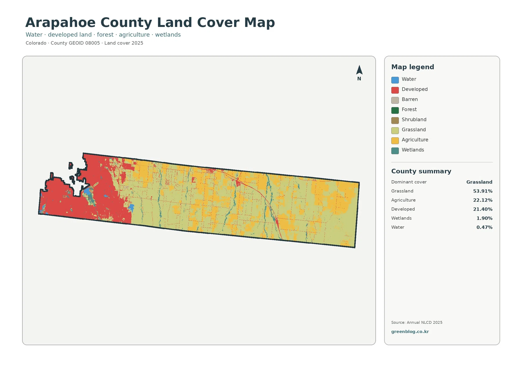
Arapahoe County stretches from a densely developed western end into a long eastern landscape where grassland and agriculture dominate. The
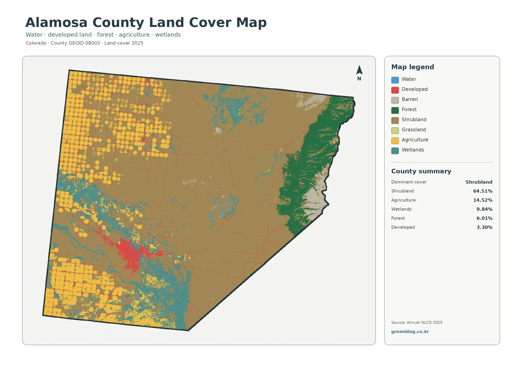
Alamosa County sits on the floor and eastern edge of Colorado’s San Luis Valley, where the 2025 land-cover map changes
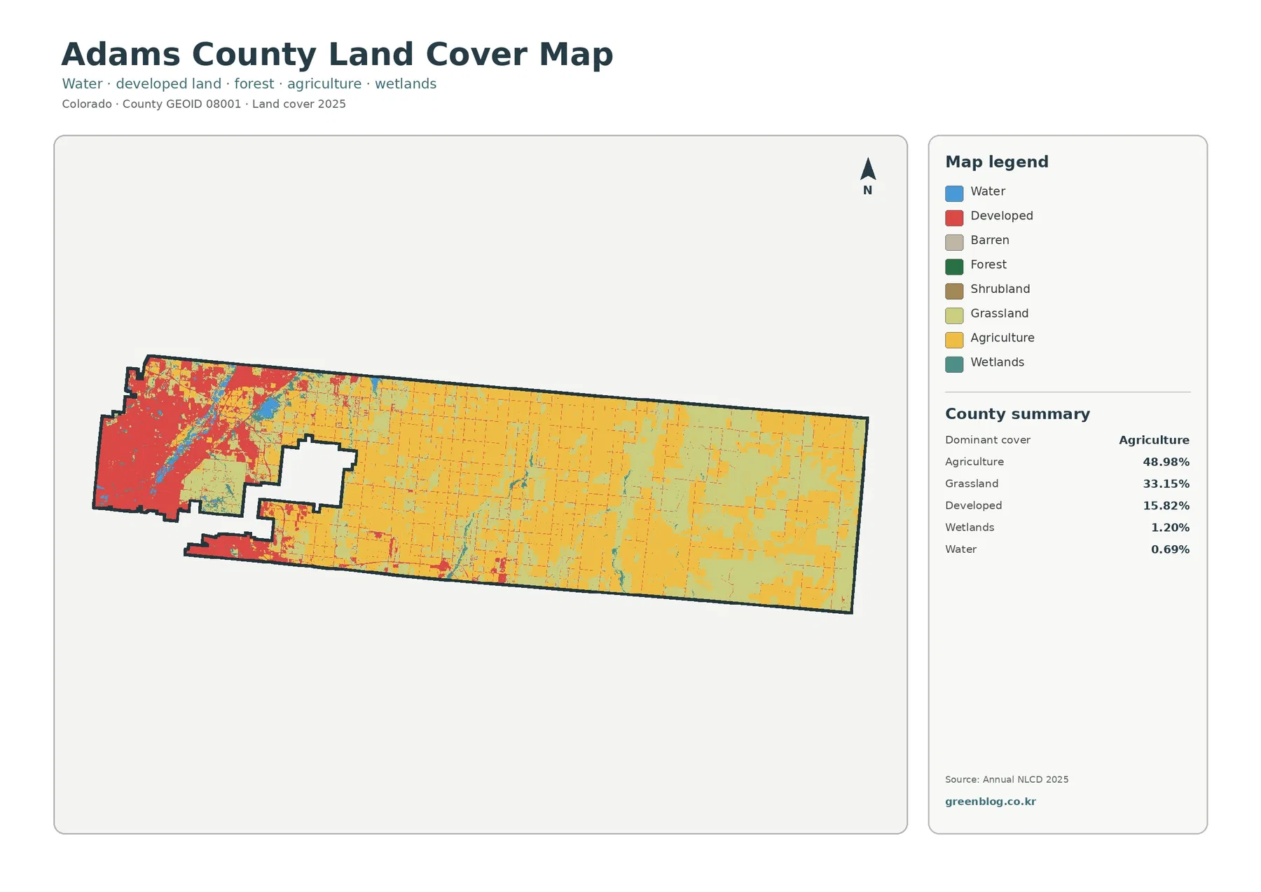
Adams County has one of the clearest west-to-east land-cover contrasts in the Denver-area plains. The 2025 map shows a dense
Adams County Colorado Land Cover Map | 48.98% Agriculture and a Dense Western Urban Edge Read More »