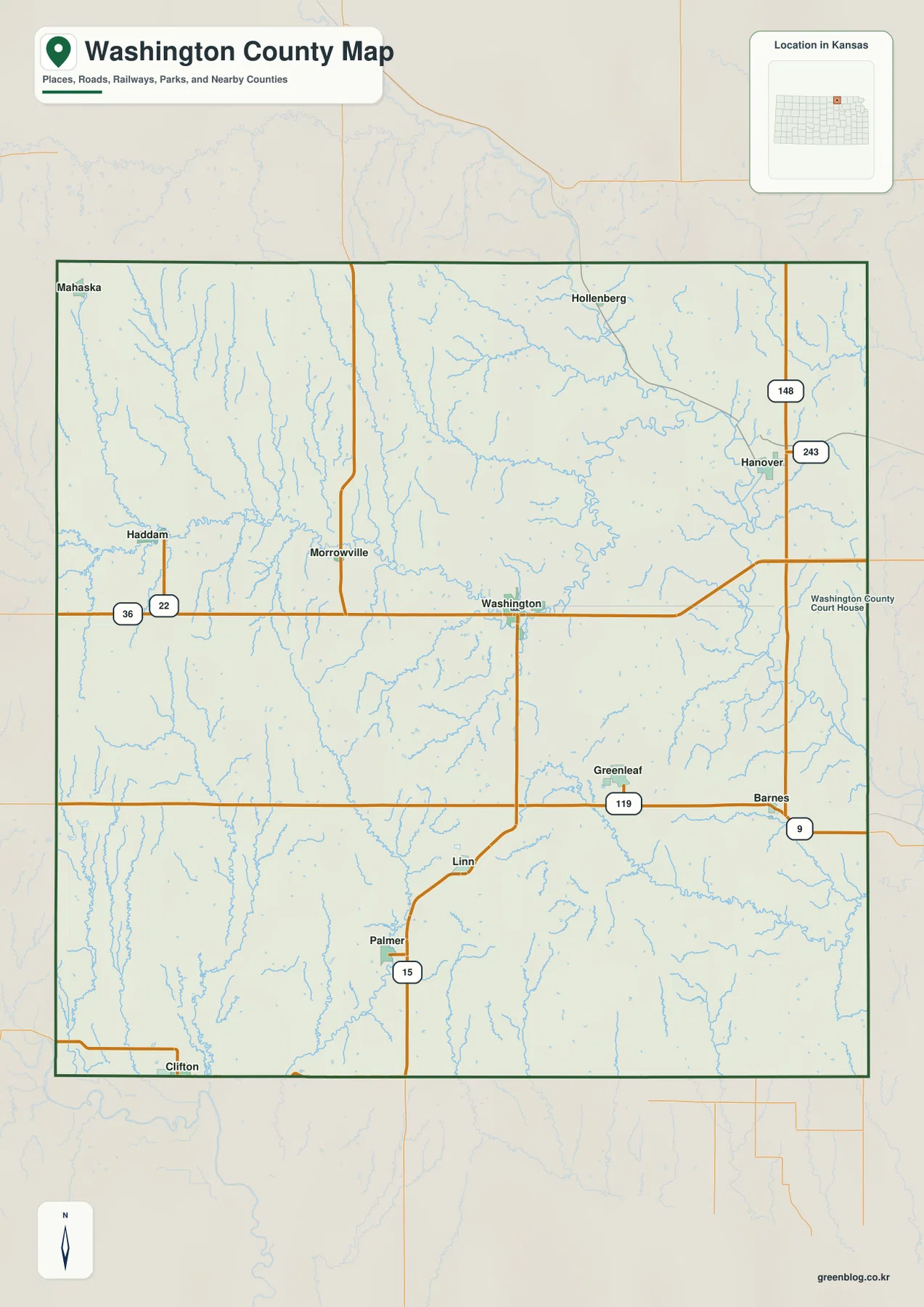
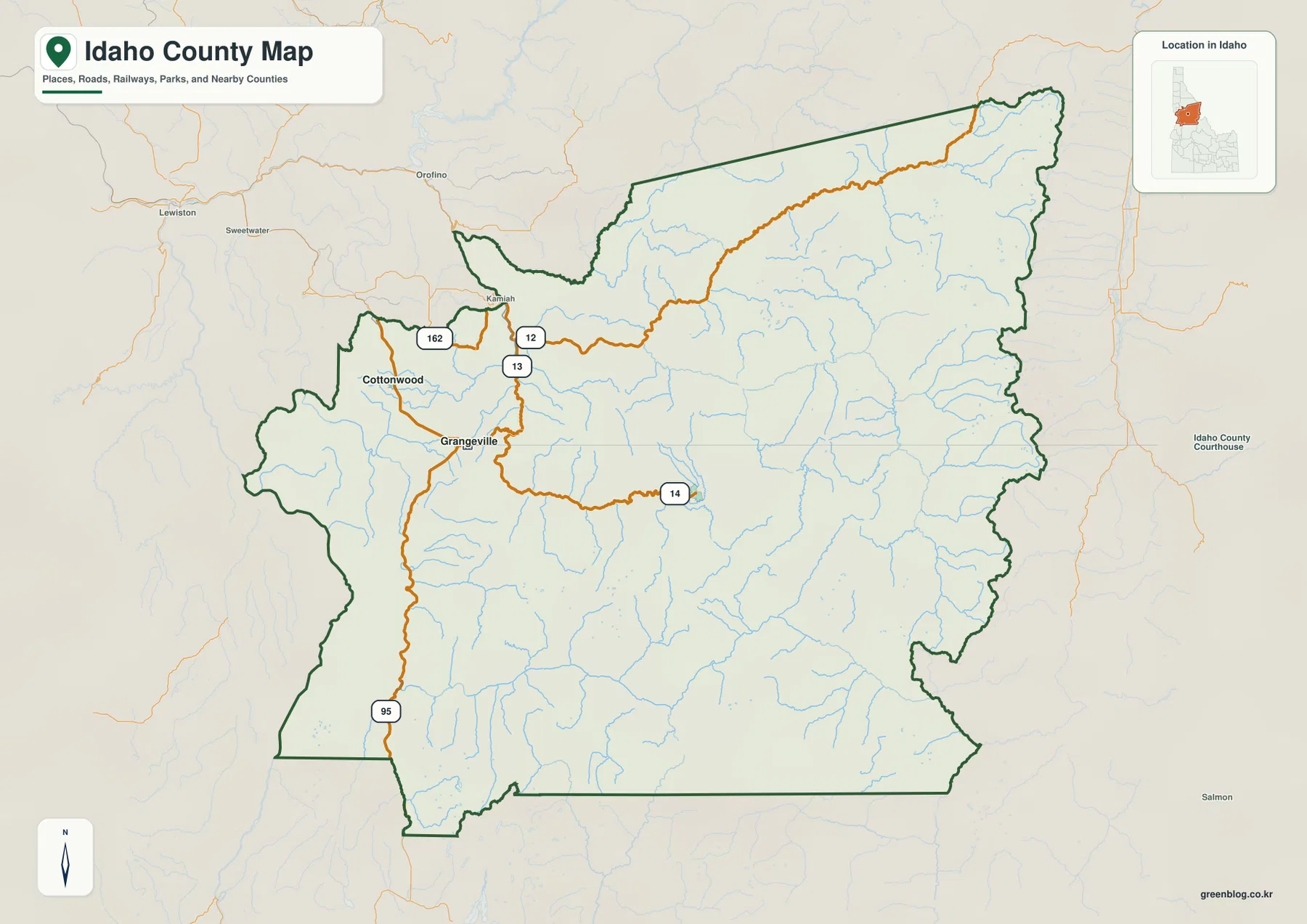
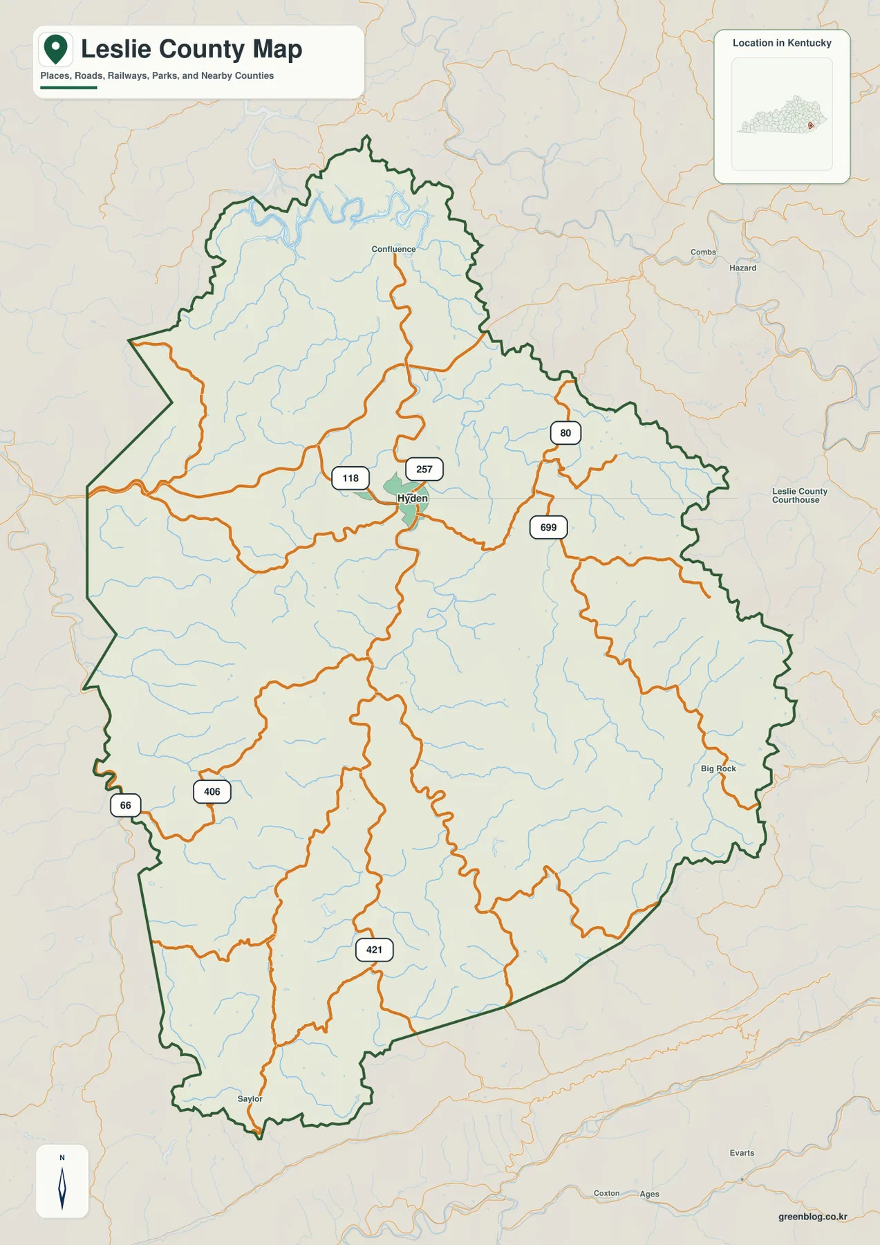
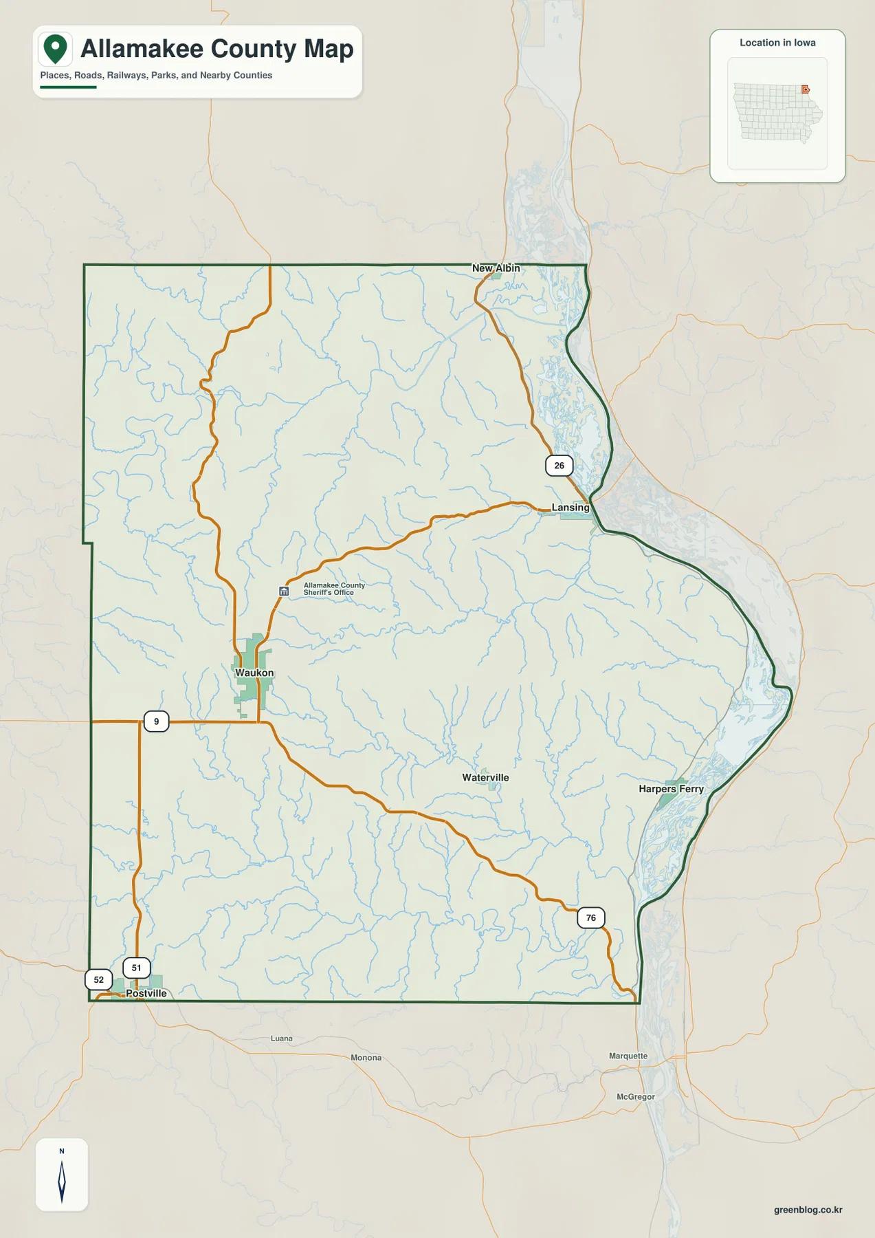
East Feliciana Parish in eastern Louisiana is organized around a handful of small towns and villages rather than one large urban center. Jackson, Clinton, Slaughter, Wilson, and Norwood are spread from south to north, while LA 10, LA 19, LA 67, and numerous parish-level routes connect them across rolling country crossed by many creeks. This page provides separate views of the parish boundary and roads, community locations, and waterways, and the original high-resolution JPG versions can be downloaded together in the ZIP box below. High-resolution map files are available for download in the section below.
Two places make useful starting points. Clinton is the parish seat according to the State of Louisiana profile, while Jackson is the hub selected for the city-connections map supplied with this article. That distinction matters: one is the administrative center, and the other is simply the reference point used to compare the mapped communities. Once those two places are located, Wilson and Norwood to the north and Slaughter near the southern boundary make the rest of the parish easier to orient.
Table of Contents
A parish spread between Jackson, Clinton, and the northern villages
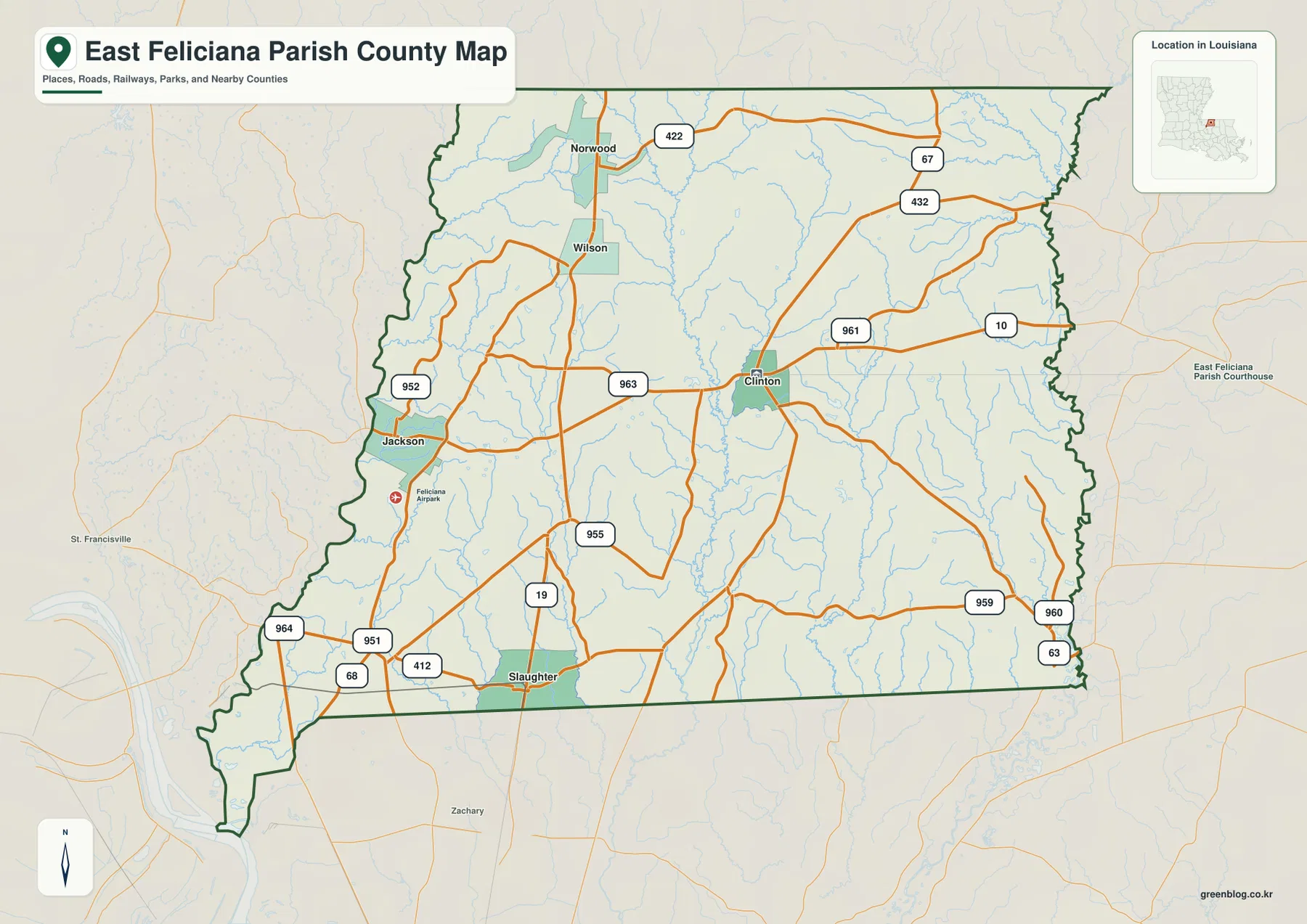
The general parish map places Jackson close to the western side of East Feliciana Parish and Clinton farther east near the middle. Slaughter sits close to the southern edge, while Wilson and Norwood form a clear northward sequence. This arrangement gives the parish a dispersed settlement pattern: the named communities are separated by long stretches of rural roads, small streams, and lightly labeled areas rather than merging into one continuous built-up corridor.
The parish outline is also worth noticing. The southern boundary contains long straight segments, but the western and eastern sides are more irregular. The eastern edge in particular follows the vicinity of the Amite River and has a noticeably uneven shape. Looking beyond the boundary, labels for West Feliciana Parish, East Baton Rouge Parish, St. Helena Parish, and other nearby areas provide a quick regional frame for where East Feliciana sits within eastern Louisiana.
LA 10 is the clearest east–west road reference
LA 10 is the easiest road to use as an east–west reference. It passes through Clinton and continues toward the eastern side of the parish, where LA 961, LA 67, and other local roads appear nearby. West of Clinton, the route connects into a denser group of numbered roads leading toward Jackson. Because so many smaller routes branch away from it, locating LA 10 first can make an otherwise busy road map much easier to understand.
LA 19 provides a different orientation. It rises northward from the Slaughter area and passes through the central-western part of the parish toward Wilson and Norwood. Roads such as LA 955 and LA 963 connect into the same general corridor, while LA 422 appears near Norwood. The map is not a live navigation product, so it should not be used to judge current closures, travel time, or road conditions, but it is well suited to learning how the communities and numbered highways are positioned relative to one another.
The road pattern changes again on the east side. LA 67 and LA 432 are prominent in the northeast, and LA 63 appears near the southeast edge. LA 959, LA 960, and LA 961 help fill the area east and southeast of Clinton. Around Jackson, a separate cluster of routes includes LA 68, LA 951, LA 952, and LA 964. These differences make the map useful for comparing the western Jackson side with the Clinton-to-Amite River side without treating the parish as one uniform road network.
Clinton is the parish seat, but Jackson is the map hub
The State of Louisiana lists Clinton as the parish seat of East Feliciana Parish. The same state profile identifies Clinton, Jackson, and Slaughter as towns, with Norwood and Wilson listed as villages. Those names match the five principal communities highlighted in the city-connections map. The map therefore provides a simplified view of the parish’s recognized municipalities and villages without the distraction of every minor road label.
Jackson is used as the hub on that map, with the other four communities positioned around it. The distance labels are direct straight-line distances, not driving distances along public roads. A route between Jackson and Clinton, for example, may curve and follow numbered highways rather than a straight segment. Treat the distance panel as a quick comparison of relative separation, and use a current routing service when actual mileage or travel time matters.
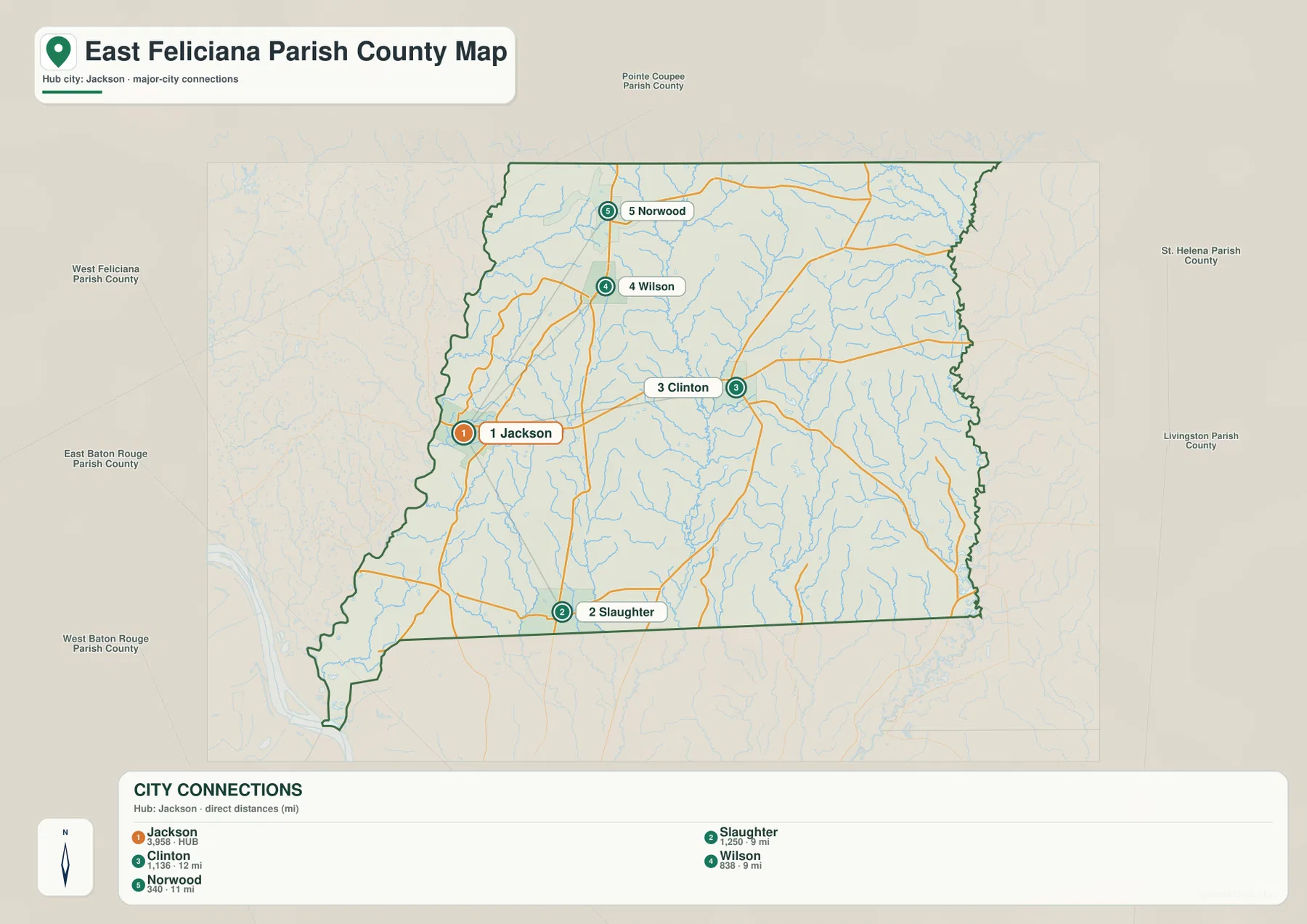
The simplified layout makes the north–south ordering especially clear. Wilson and Norwood lie north of Jackson, Slaughter lies to the south, and Clinton is east of Jackson. That arrangement is useful in classroom work, regional presentations, and trip planning because the reader can learn the basic community pattern before returning to the more detailed road map. It also helps explain why no single town occupies the geometric center of every map.
The Amite River marks the eastern side
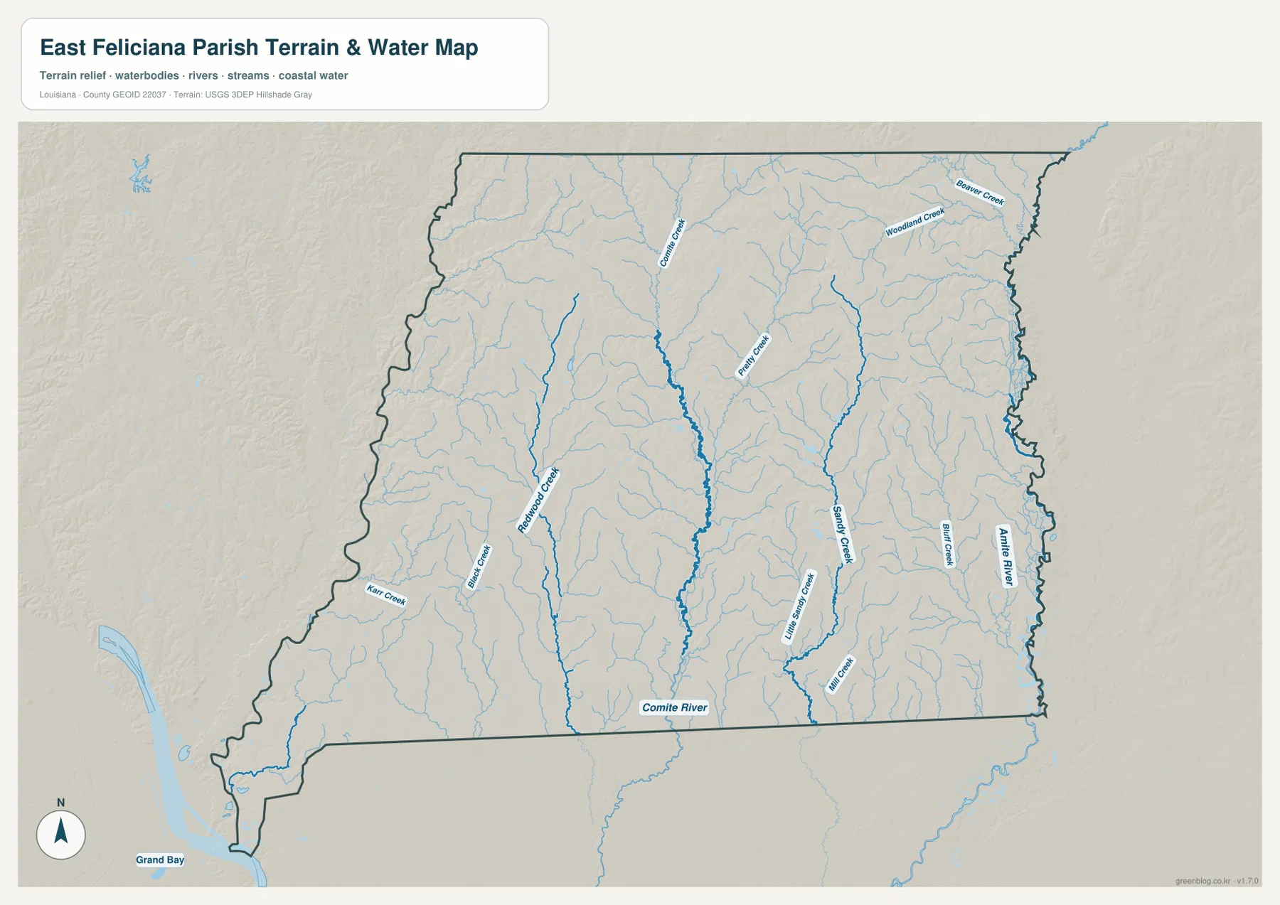
The terrain-and-water map shifts attention away from highways and toward the parish’s drainage network. The Amite River follows the eastern side, creating one of the strongest natural reference lines on the map. Several creeks approach the river from the interior, and the eastern boundary looks much more understandable when viewed alongside that watercourse than when it is seen only as a dark administrative line.
Sandy Creek is one of the most prominent interior streams, extending through the east-central portion of the parish. Piney Creek and Little Sandy Creek are also labeled nearby, while Mill Creek and Bluff Creek appear farther south and east. In the northeast, Woodland Creek and Beaver Creek provide additional named references. The repeated branching of smaller channels makes this part of the parish look much more intricate on the water map than it does on the road map.
The Comite River and western creeks define the southern half
Near the southern edge, the Comite River becomes the major named water feature. Several smaller streams descend toward the south, visually linking the interior uplands with the river corridor. This is especially useful when comparing the map with the Slaughter area on the general road map: the town is easy to find by road, while the water view reveals the network of channels occupying the surrounding countryside.
The western half has its own set of named creeks. Redwood Creek is prominent west of the center, Big Creek and Karr Creek appear toward the southwest, and additional unnamed tributaries fill the spaces between them. These streams show why East Feliciana Parish should not be understood only through its towns and highways. The rural landscape is crossed by many small waterways that are easy to miss when the road layer receives most of the visual emphasis.
Rolling terrain around Jackson adds context to the creek network
Explore Louisiana describes the Jackson area as having rolling hills, a feature that also fits the shaded relief visible behind the waterways. The terrain background is not meant to provide precise elevations, but it helps distinguish East Feliciana from the very flat Mississippi Delta landscapes farther west and north. Gentle changes in relief and the many incised creeks give the water map a textured appearance even where no large river occupies the center of the parish.
Those hills and streams also provide useful context for the road network. Around Jackson, Clinton, and the countryside between them, many routes bend rather than forming a strict rectangular grid. The map by itself cannot prove why a particular road follows a certain alignment, but comparing roads with drainage lines helps the reader see that transportation and natural features occupy the same uneven terrain. For exact elevations, engineering work, or detailed terrain modeling, a dedicated source such as the USGS 3D Elevation Program should be used instead.
Comparing the Jackson side with the Clinton–Amite side
The western Jackson side contains a compact group of numbered roads and several named creeks. LA 68, LA 951, LA 952, and LA 964 are visible around or southwest of Jackson, while Big Creek, Redwood Creek, and Karr Creek appear in the same broad part of the parish on the water map. Switching between the two maps lets the reader connect road labels with waterways without crowding both types of information into a single image.
East of Clinton, the pattern is different. LA 10, LA 961, LA 67, LA 432, and nearby routes lead toward the eastern boundary, while Piney Creek, Sandy Creek, Little Sandy Creek, Mill Creek, and the Amite River dominate the water view. This side-by-side comparison is useful for regional study because it reveals a parish with distinct western and eastern reference points rather than a single dominant corridor.
Slaughter provides a useful landmark near the southern boundary
Slaughter is positioned just above the southern parish line and is one of the easiest southern landmarks to identify. On the general map, LA 19 reaches the town area and nearby routes such as LA 412, LA 951, and LA 68 help connect it with the western side. The map also shows Zachary outside the parish to the south, which gives readers a familiar directional reference toward East Baton Rouge Parish.
On the water map, the same southern part of the parish is defined less by town names and more by small channels feeding toward the Comite River. This makes Slaughter a useful point for switching between map types: find the town and roads first, then move to the water map to see what occupies the surrounding terrain. The method is simple, but it is often more informative than trying to memorize every road and creek separately.
Which map works best for print, class, or reference use?
The general parish map is the strongest all-purpose choice when boundaries, towns, roads, and nearby areas need to appear together. It works well as the opening map in a report or presentation because Jackson, Clinton, Slaughter, Wilson, Norwood, and the major numbered routes can all be seen in one view. The city-connections map is cleaner when the goal is simply to explain where the five highlighted communities sit relative to one another.
The terrain-and-water map is better for lessons or projects focused on rivers, creeks, and the physical setting. It gives much more attention to the Amite River, Comite River, Sandy Creek, Redwood Creek, Piney Creek, and smaller tributaries. Pairing it with the road map is especially effective when a reader needs to understand both transportation and natural geography without overloading either figure.
The download archive contains three original JPG files corresponding to the maps shown on the page. Each image measures 3638 × 2572 pixels in landscape orientation, providing more detail than the lighter WebP versions used for fast page display. The larger files are a better fit for printing, classroom handouts, full-screen slides, and documents where small route shields or creek labels need to remain readable.
Important limits of these reference maps
These maps are intended for general geographic reference, learning, trip preparation, presentations, and personal map collections. They are not legal boundary surveys, parcel maps, live traffic products, flood-hazard maps, navigation charts, or engineering elevation models. The water map does not show water depth, flood probability, levee condition, or navigability, and the shaded terrain background should not be treated as a survey-grade elevation surface.
For official work, consult current agency sources such as U.S. Census Bureau TIGER/Line data for administrative boundaries and roads and USGS National Hydrography resources for water features. Within the limits of a general reference map, however, the set gives a clear introduction to East Feliciana Parish: Clinton anchors the administrative story, Jackson provides the city-map reference, LA 10 and LA 19 organize the road pattern, and the Amite and Comite rivers frame a dense network of creeks.
Frequently Asked Questions
Is Clinton or Jackson the parish seat?
Clinton is the parish seat of East Feliciana Parish. Jackson is used as the hub city on the supplied city-connections map, which is a mapping choice for comparing community locations rather than an administrative designation.
Are the city-map distances driving distances?
No. The city-connections map uses direct straight-line distances from Jackson. Actual driving routes can be longer because public roads curve, branch, and do not follow a straight line between communities.
Which map shows the Amite River and smaller creeks most clearly?
The terrain-and-water map is the best choice. It labels the Amite River, Comite River, Sandy Creek, Redwood Creek, Piney Creek, Woodland Creek, and several other tributaries with less emphasis on road shields.
Map File Information
Download the original high-resolution JPG files for the general parish map, city-connections map, and terrain-and-water map in one ZIP archive.
- Included Files: parish map JPG, city map JPG, terrain and water map JPG
Related Maps
Sources and References
- Louisiana.gov – East Feliciana Parish Profile
- Parish of East Feliciana – official parish website
- Explore Louisiana – East Feliciana Parish Tourist Commission
- U.S. Census Bureau QuickFacts – East Feliciana Parish
- U.S. Census Bureau TIGER/Line Shapefiles
- USGS National Hydrography
Green Map creates custom-edited map images using open geographic data sources such as geoBoundaries, Natural Earth, OpenStreetMap, and government open data. These maps are edited visual materials, not raw data files, and are provided for education, documents, presentations, and graphic reference.