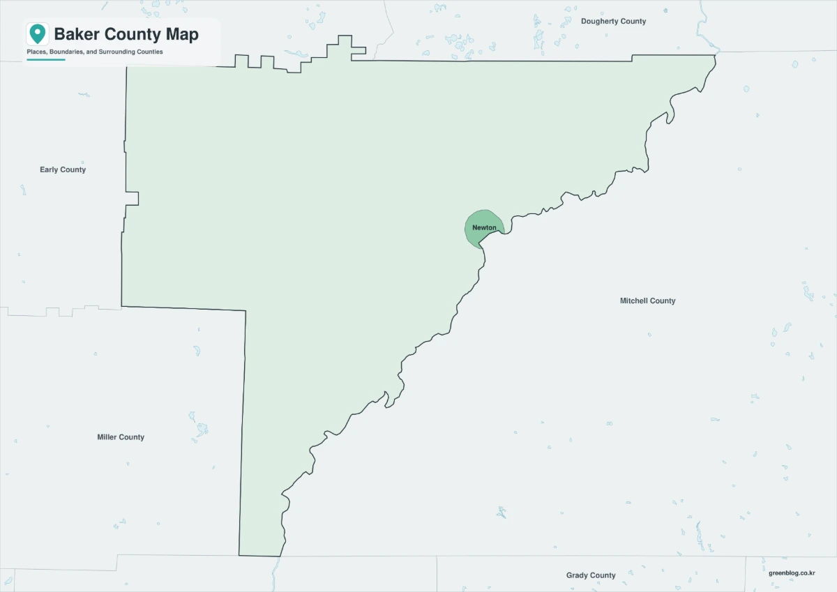
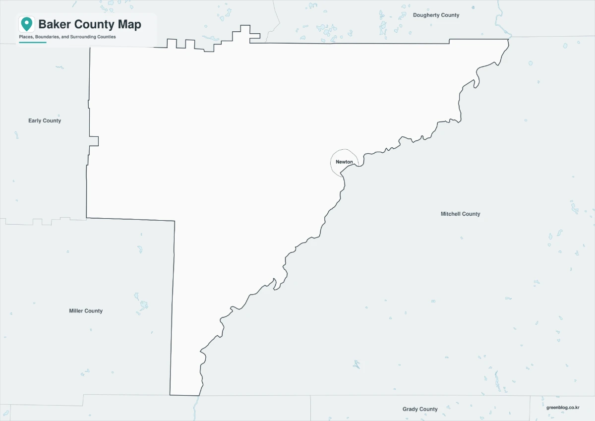
A Baker County Map needs to distinguish Georgia’s sparsely populated southwest county from other U.S. counties with the same name. The three supplied images focus on Baker County, Georgia, and use Newton as the only internal place label. They share a landscape canvas and the same county geometry, but divide the work among a pastel reference version, a monochrome version, and an unlabeled outline.
The labeled maps place Newton near the irregular eastern boundary and print five surrounding county names in the wider frame: Dougherty, Mitchell, Grady, Miller, and Early. Those are visual context labels, not a complete list of counties that touch Baker. Grady County appears southeast of the target area but is not a direct neighbor, while the true adjacent counties of Calhoun and Decatur are not named on these images.
Use this Baker County Map for county orientation and annotation, not as a street or parcel map. It does not label highways, rural communities, farms, the Flint River, Ichauway, flood zones, land ownership, or public facilities. The faint blue linework represents water features without names. Each preview measures 1,200 × 849 pixels and fits a horizontal page or presentation slide.
Table of Contents
Newton’s Role in a Very Small County
Newton is Baker County’s county seat and its only incorporated municipality. The Georgia Department of Community Affairs lists the county and the City of Newton together in local planning records. On the artwork, Newton is shown as a small bounded area rather than a point symbol, positioned beside the winding eastern edge. That treatment helps readers see how little of the county’s broad land area is occupied by the incorporated city.
This county map does not mark Elmodel, Milford, or other unincorporated communities, even though those names may be useful in local descriptions. It also does not identify a courthouse or government building. A project about services, addresses, or settlement patterns should therefore add verified point data instead of treating blank parts of the map as uninhabited.
Population Decline and an Aging Community
| 2025 Population Estimate | 2,725 |
| 2020 Census Population | 2,876 |
| Change from 2020 Base to 2025 | −5.2% |
| 2020 Land Area | 341.96 square miles |
| 2020 Population Density | 8.4 people per square mile |
| County Seat and Only Incorporated City | Newton |
The Census Bureau’s 2025 estimate is 151 residents below the 2020 census count. Combined with the county’s large land area, that scale explains why a Baker County Map can look visually open even when it accurately includes the municipal layer. Population figures should always retain their reference year; they describe a changing community and are not permanent characteristics of the map.
For service planning, a county outline alone cannot show travel time, household distribution, broadband access, emergency coverage, or healthcare proximity. Those questions require roads and current demographic data. The supplied files instead provide a clean boundary base on which such information can be added with a legend and source note.
Agriculture and Working Land
Baker County’s rural landscape supports agriculture, forestry, hunting lands, and large private holdings. Peanuts, cotton, corn, livestock, and timber are associated with the wider southwest Georgia economy. None of these land uses is encoded in the supplied artwork, so the solid county fill should not be read as cropland, forest, or a single ownership category.
Flint River, Flood Risk, and Water Resources
The strongly curved eastern edge follows the Flint River side of the county, although the river is not named on the images. Newton sits close to this boundary. The pale blue hydrographic lines and small water shapes offer visual texture inside and beyond Baker County, but they are not a complete named river network and should not be used to identify a specific stream without another source.
Flooding is central to Newton’s history. The 1994 flood connected with Tropical Storm Alberto severely affected the community and damaged the historic courthouse area. A Baker County Map can orient a hazard presentation, but it does not contain FEMA flood zones, inundation depths, gauges, evacuation roads, or current warnings. Always pair it with current emergency and flood information for operational decisions.
Ichauway as an Ecological Research Landscape
Ichauway, home to the Joseph W. Jones Ecological Research Center, gives Baker County an important role in research on longleaf pine, prescribed fire, wildlife habitat, wetlands, streams, and water resources. The center is not labeled or outlined on these maps. Its absence matters because a reader could otherwise assume that all locally important sites are represented.
Historic Formation and County Division
Baker County was created from Early County in 1825 and named for Revolutionary War figure Colonel John Baker. Newton became the county seat in 1831 after the earlier seat at Byron proved inconveniently close to the Lee County line. Later boundary changes helped form Calhoun, Dougherty, Miller, and Mitchell counties from portions of the original, larger Baker County.
This history explains why the modern outline should not be projected backward unchanged. A nineteenth-century event map needs county boundaries appropriate to the event date, not the present geometry used in this download. The current files are best suited to modern county orientation and contemporary annotation.
Creek War History
The county’s historical record includes a battle at Chickasawhatchee Creek Swamp during the 1836 Creek War. That subject belongs within the broader history of Muscogee removal, militia action, and plantation expansion in southwest Georgia. The location is not identified on the supplied map, so it should be plotted only from a reliable historical source and clearly distinguished from modern administrative features.
Five County Borders
The inherited section title corresponds to five surrounding county names printed in the labeled artwork, not to Baker County’s true number of direct neighbors. The actual adjoining counties are Calhoun, Dougherty, Mitchell, Decatur, Miller, and Early. Grady is visible in the broader southeast frame but does not share a boundary with Baker, while Calhoun and Decatur are omitted as text labels.
This distinction makes the map useful for a source-reading exercise. Ask readers to separate the highlighted target, the named municipality, direct neighbors, and nonadjacent context labels. It also shows why a cropped regional frame cannot replace a verified adjacency list when planning cross-county services or explaining jurisdiction.
Baker County Map: Color Version for County-Level Orientation
The color version fills Baker County with pale green and gives Newton a darker contrasting fill. Surrounding counties remain light, allowing the target boundary to dominate without hiding the faint water features. This is the clearest edition for an introductory slide or county profile because viewers can distinguish the county and its only incorporated city immediately.
Black and White Map for River or Farm Reports
The monochrome Baker County Map retains the target outline, Newton boundary, neighboring labels, and pale water linework without the green fills. It is suited to low-ink printing and handwritten notes. When adding agricultural or river information, use different line styles or symbols so custom marks remain distinguishable from the original boundary and hydrography.
Outline Map for Custom Ecological Data
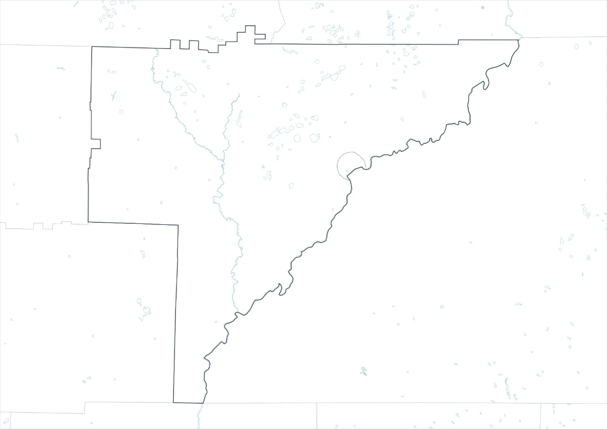
The outline Baker County Map removes titles and place names but preserves the county boundary, Newton’s small internal outline, surrounding boundary segments, and faint blue water features. It is not a completely empty silhouette. Use a duplicate as the working file, add a legend for every new layer, and preserve the original aspect ratio when resizing.
Where is Baker County located in Georgia?
It is in southwest Georgia and borders Dougherty, Mitchell, Decatur, Miller, Early, and Calhoun counties.
What is the county seat?
Newton is the county seat, while Elmodel and Milford provide additional local reference points.
Which version is best for photocopying?
The black-and-white version is usually the best choice for photocopies and routine reports.
Can the outline file be edited?
Yes. It is designed for adding custom labels, routes, notes, legends, or shaded areas.
What does this Baker County Map leave out?
It does not label roads, Elmodel, Milford, the Flint River, Ichauway, farms, parcels, elevation, flood zones, or public facilities. It also does not name every county that directly borders Baker. Add authoritative layers when a project requires those details.
Download the Baker County Map Set
The package provides matching color, black-and-white, and outline editions prepared for A3 use. Choose the labeled color image for orientation, monochrome for economical printing, or the outline when custom information will be added.
Reference Information
U.S. Census Bureau QuickFacts for Baker County, Georgia provides the dated population, land-area, and density figures used above.
Map File Information
The download contains three Baker County reference styles using the same county and Newton geometry.
- Included Versions: Color, black and white, and outline
- Intended Use: Printing, lessons, reports, presentations, and custom annotations
Related Maps
Green Map creates custom-edited map images using open geographic data sources such as geoBoundaries, Natural Earth, OpenStreetMap, and government open data. These maps are edited visual materials, not raw data files, and are provided for education, documents, presentations, and graphic reference.