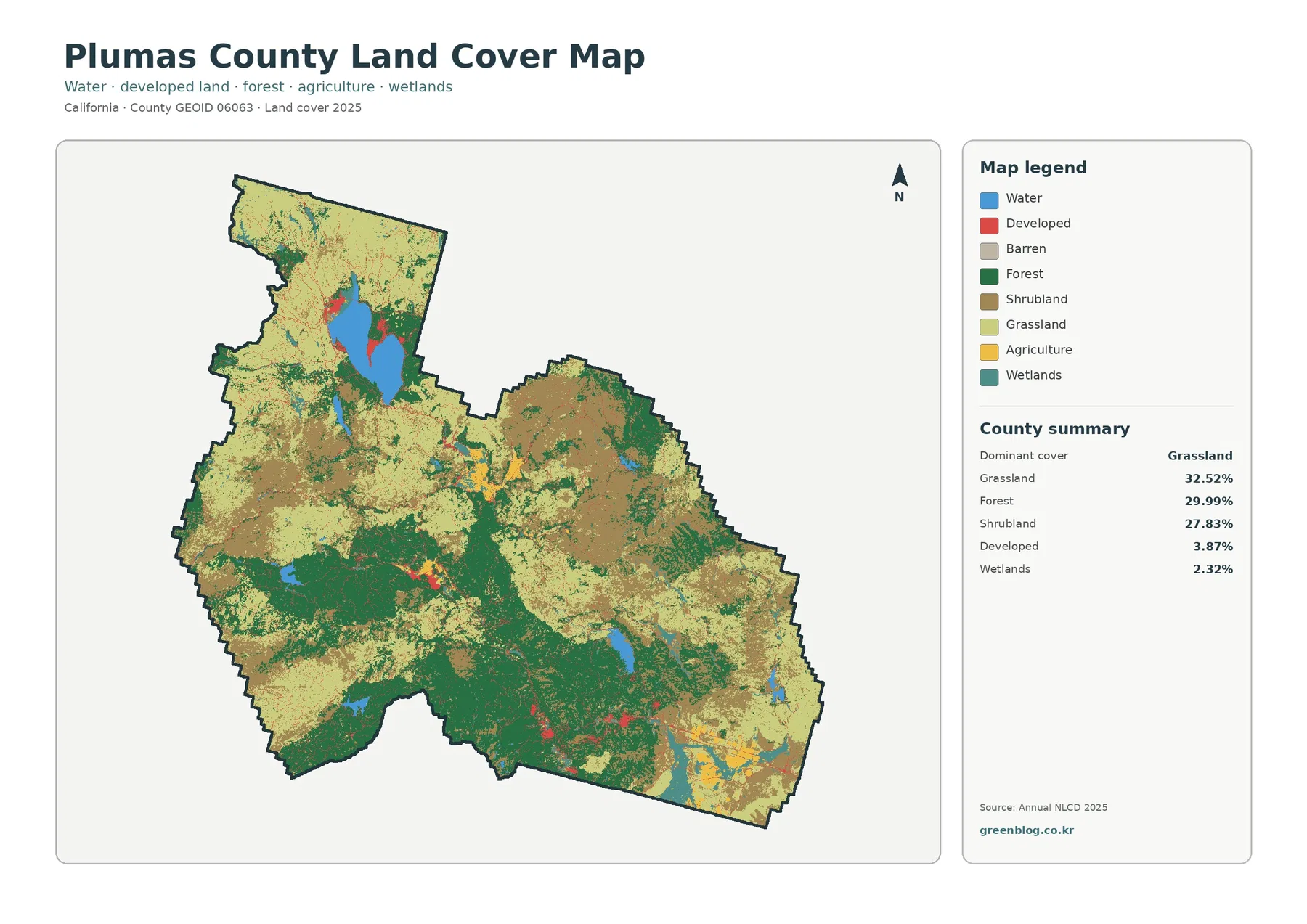
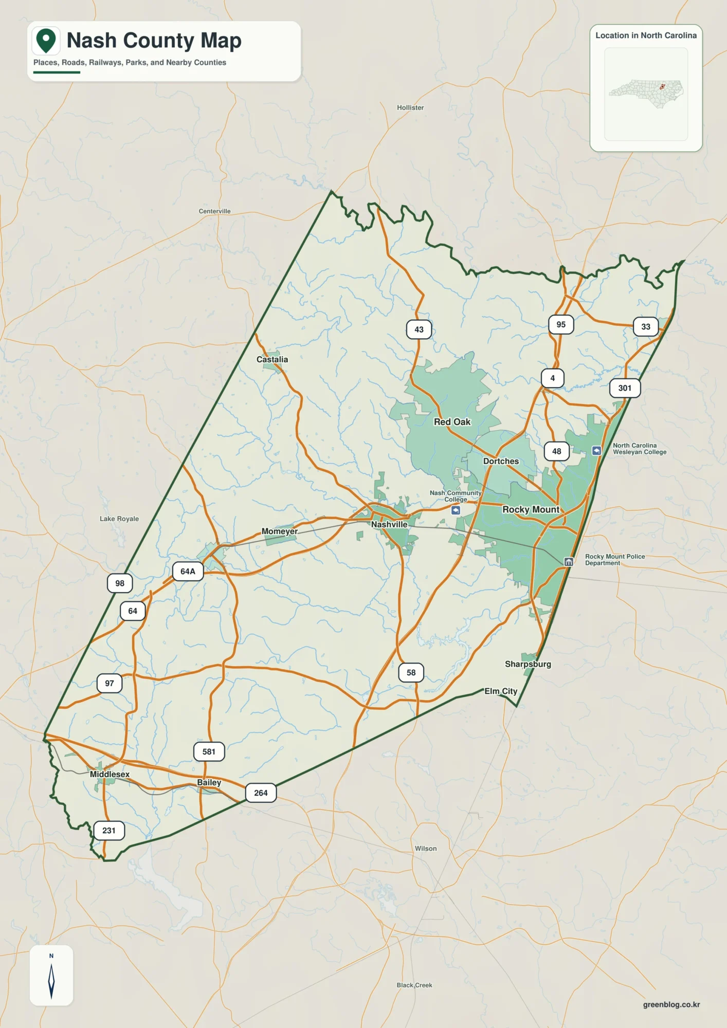
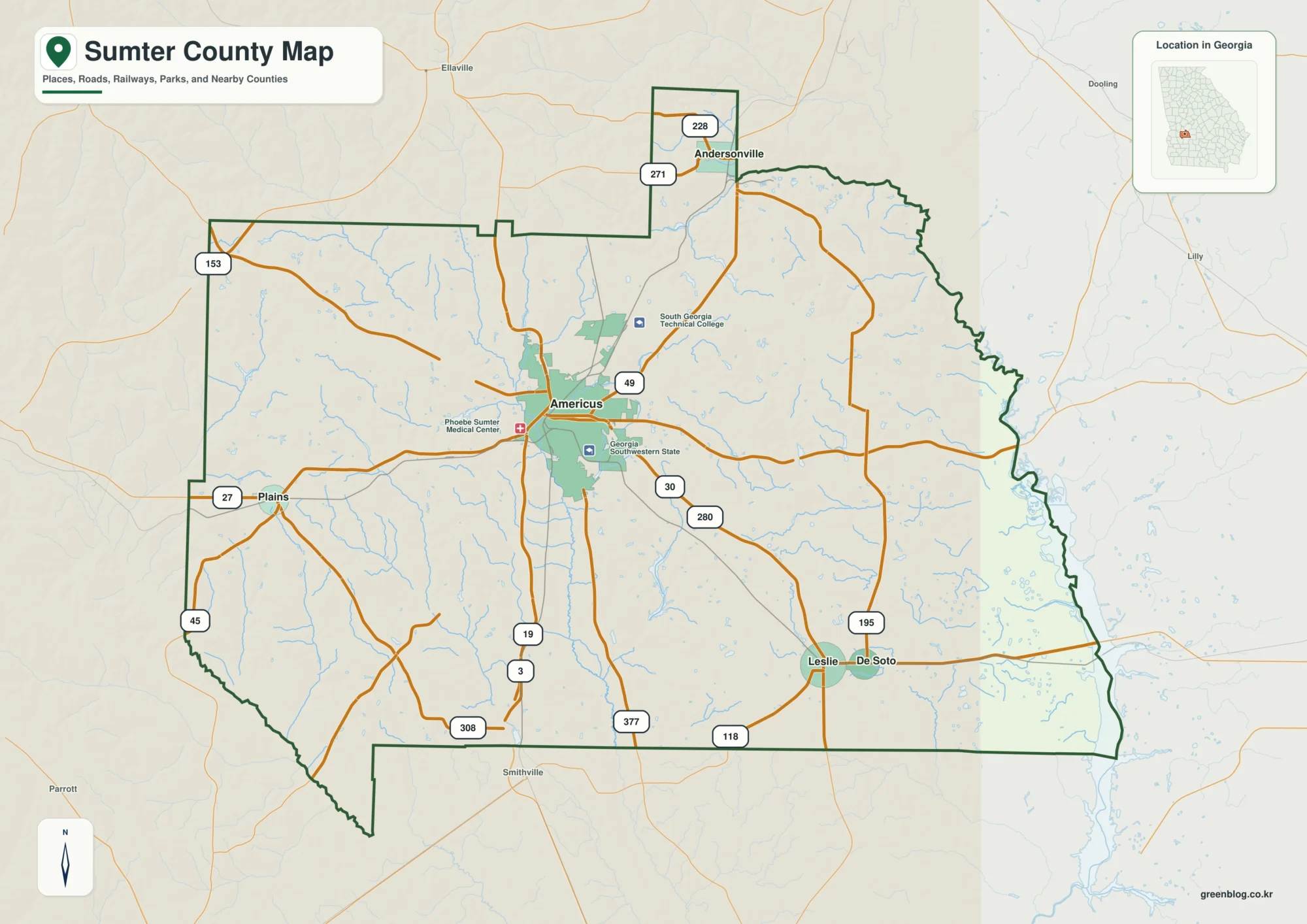
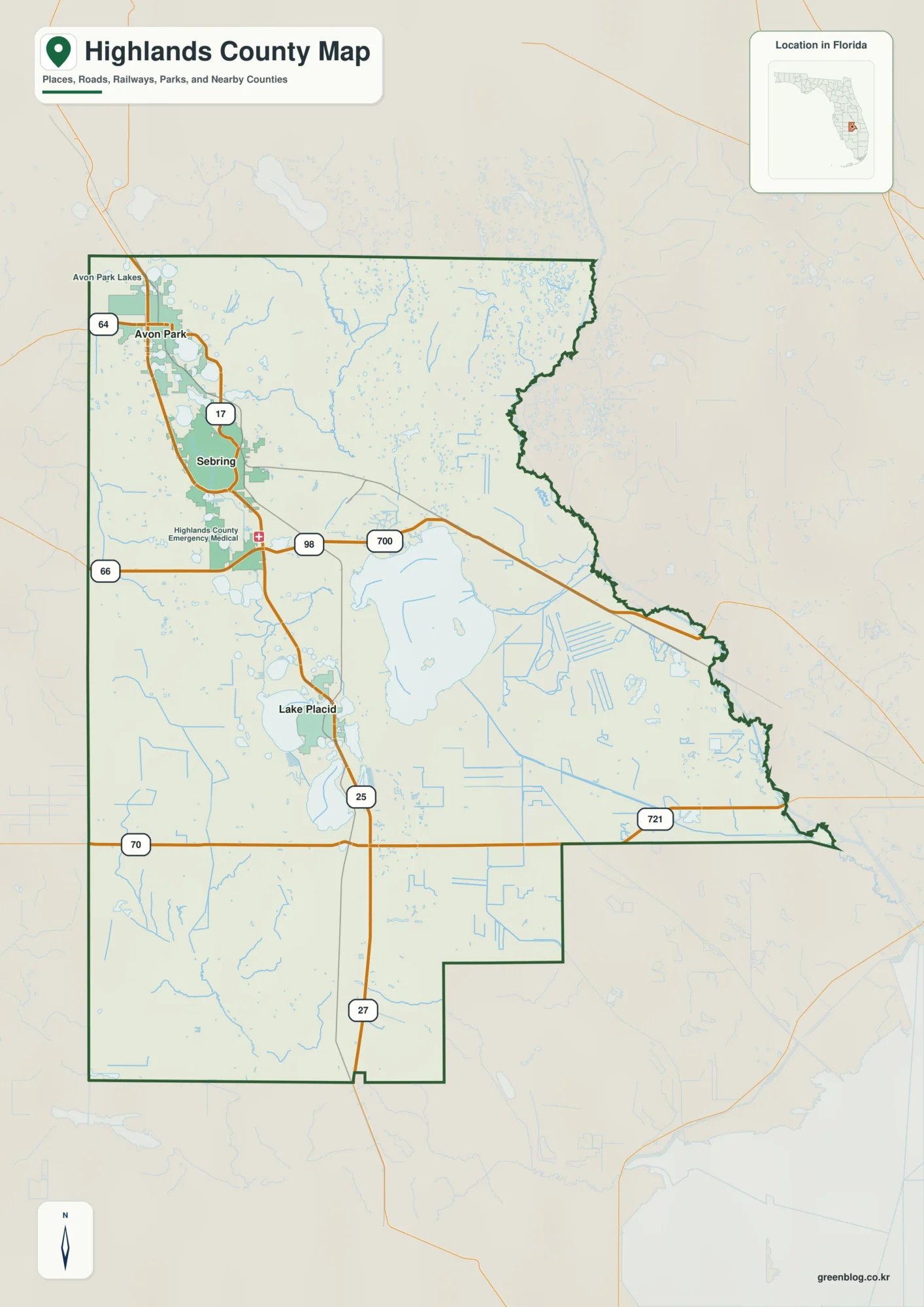
The Monroe County Alabama Map on this page can be downloaded as a ZIP containing four separate high-resolution A3 JPG files. If you need a printable county map, a city-location map, a detailed water map, or an elevation view, the full-size versions are available together near the end of the article. The web previews are useful for a quick look, while the downloadable JPGs make small labels easier to read and work better for classroom handouts, presentations, and personal map projects.
Monroe County becomes much easier to understand once Monroeville is located near the center. Frisco City and Uriah extend the settlement pattern southward, Excel lies southeast of the county seat, and Beatrice and Vredenburgh sit far to the north. On the western side, the Alabama River and its low country create a different landscape from the inland roads and ridges around Monroeville. The sections below use the supplied maps to connect those places with roads, creeks, lakes, and terrain rather than treating the county as a simple list of names.
Table of Contents
Start with Monroeville, Then Read the County Outward
Monroe County lies in inland southwestern Alabama. The current county material identifies Baldwin, Conecuh, Escambia, Butler, Wilcox, and Clarke counties around its borders, placing Monroe north of the Gulf Coast and between the Mobile region and south-central Alabama. It is a large county with small communities spread across long stretches of forest and rural land. That layout is why a county-scale map is more useful here than a city-only view: the important question is often not just where one town is, but how far it sits from the next town, the main road, or the river side of the county.
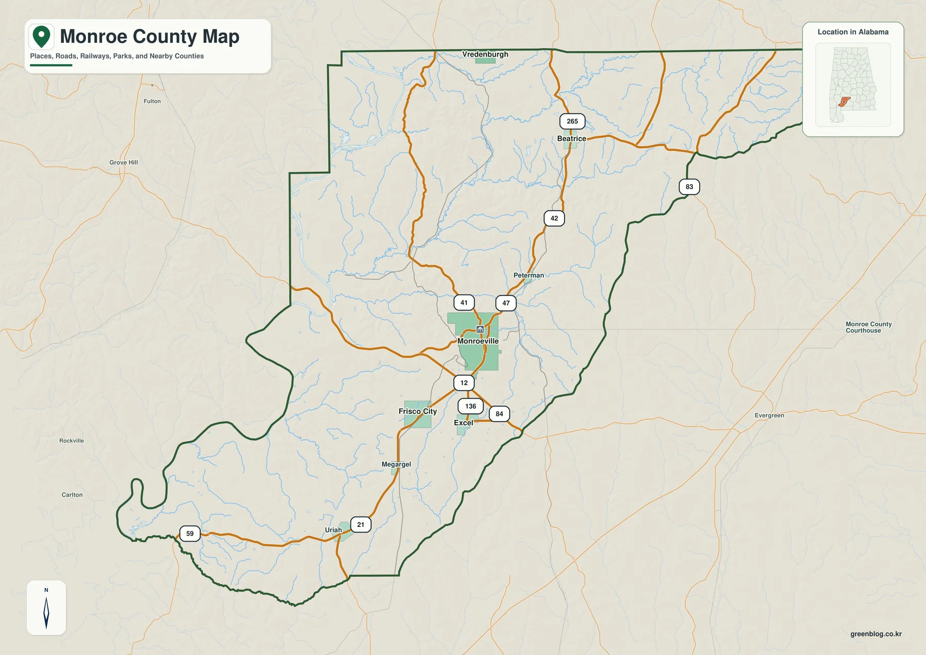
Monroeville is the clearest orientation point because several numbered routes meet around it and the surrounding communities fall into recognizable directions. Frisco City is southwest of the county seat, Uriah is farther south, and Excel sits to the southeast. Beatrice and Vredenburgh are separated from that central cluster by a much larger stretch of rural land to the north. Smaller labels such as Peterman and Megargel are useful too, because they show that the space between incorporated places is not empty; it contains smaller settlements, roads, and creek valleys that matter when reading the county as a whole.
The source material in the ZIP cites U.S. Census Bureau QuickFacts and gives a July 1, 2025 population estimate of 18,965, down from 19,772 in the 2020 census. It also lists 1,025.67 square miles of land and a 2020 population density of 19.3 people per square mile. Those figures fit the visual impression of the map: Monroe County covers a broad area without a dense chain of towns. Monroeville is the administrative and service center, but the northern communities, southern rural corridor, and western river country remain important parts of the county’s geography.
Towns Are Widely Spaced, and the Roads Explain Their Connections
Monroeville is both the county seat and the largest city, making it the practical center for reading the road network. The supplied county description identifies U.S. 84 and Alabama 21 and 41 as key routes around the city. County offices, medical services, schools, and retail activity also give Monroeville a role beyond its municipal boundary. Its literary association with Harper Lee and Truman Capote, together with the Old Monroe County Courthouse, adds a cultural landmark to the same place that already functions as the county’s road and government center.
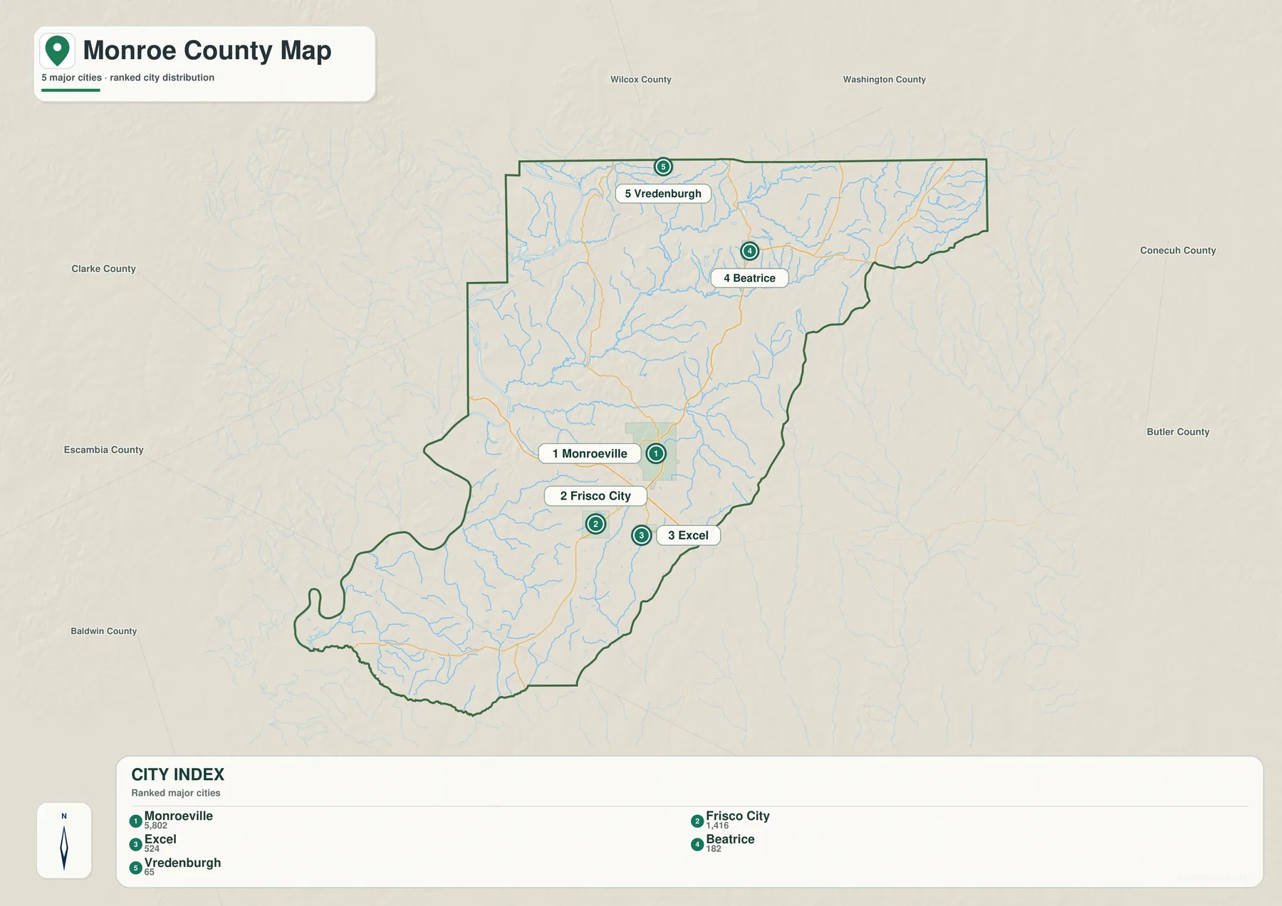
The city index printed on the supplied map lists Monroeville at 5,802, Frisco City at 1,416, Excel at 524, Beatrice at 182, and Vredenburgh at 65. The value of the map is not just the ranking. It shows how widely those places are separated. Monroeville and Frisco City form the closest pair among the larger labels in the central-southern part of the county, while Beatrice and Vredenburgh sit much farther north. Excel provides an eastern reference near the lower central area. The result is a settlement pattern made of distinct small communities rather than one continuous urban corridor.
South of Monroeville, Alabama 21 is the most useful organizing route in the current material. Frisco City lies along that direction, and Uriah is farther south near the connection with Alabama 59. The road relationship helps place the southern part of Monroe County before smaller local roads are considered. Excel and Megargel add east-west reference points within the same broad southern area, showing that the landscape is a patchwork of rural land and separate communities rather than a single strip of development.
The north has a different history. The existing county notes describe Beatrice as a town that developed with railroad construction around the turn of the twentieth century, while Vredenburgh grew around a sawmill and timber activity. Alabama 265 is identified as a route continuing from the Beatrice area toward Camden in Wilcox County. Those details help explain why the northern towns do not simply look like extensions of Monroeville. Their locations reflect older transportation and timber patterns as well as their connection to the present road network.
U.S. 84 provides the main east-west regional reference through Monroeville, connecting toward Clarke County on the west and Conecuh County on the east. Monroe County does not have an Interstate running through its interior, so U.S. highways and state routes carry much of the county’s regional movement. For map reading, a useful sequence is to establish U.S. 84 first, use Alabama 21 to organize the north-south direction, and then add the other numbered routes as local connectors. For actual driving, of course, current navigation and road-condition information should be checked separately.
The Alabama River Is Only One Part of Monroe County’s Water Network
The Alabama River dominates the western side of the county, but the supplied water map shows a much denser network once the interior is examined. Tallatchee Creek, Flat Creek, Bear Creek, Big Flat Creek, and Limestone Creek are labeled across the northern and central portions. Robinson Creek and Brushy Creek cross the eastern side, while the Little River appears toward the south. These named streams are only part of the visible drainage pattern; many thinner tributary lines fill the spaces between them.
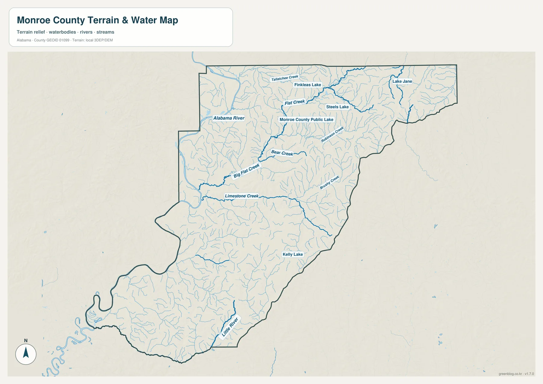
Several water bodies provide additional reference points. Finkleas Lake, Steels Lake, Lake Jane, and Monroe County Public Lake are labeled in the northern half of the map, while Kelly Lake appears farther southeast. None of these small lakes has the county-scale presence of the Alabama River, but they can be useful when matching a local road or creek to a specific area. On a map of a lightly settled county, a named lake may be a more useful locator than a street grid that does not exist.
Claiborne Lake adds a different kind of water feature to western Monroe County. The U.S. Army Corps of Engineers source included with the package describes the Alabama River Lakes system, and the existing county text identifies Claiborne Lake as a long reservoir following the Alabama River channel. That elongated shape matters because the western landscape reads as a river corridor rather than a broad, isolated lake basin. Low forested ground and historic river access areas give this side of the county a physical character that differs from the inland Monroeville area.
The water map is a geographic reference, not a flood-hazard or navigation product. It can answer questions such as where a named creek lies, which part of the county contains a concentration of tributaries, or how close a lake is to a larger stream. It should not be used to determine flood-insurance zones, legal property access, boating conditions, or parcel boundaries. Those decisions require the appropriate current official source. Here, the goal is to make the county’s river, creek, and lake pattern understandable at a glance.
Low River Ground Gives Way to Higher Ridges Inland
The elevation map adds a feature that is easy to miss when looking only at roads and town labels. Its legend reports an actual elevation range of about 1 to 175 meters and a mean of 75 meters. Lower green areas are concentrated along the western river side and in valley floors. Higher tan and brown terrain appears across parts of the east and northeast and through portions of the central-southern interior. Monroe County is not mountainous, but the repeated ridges and creek valleys give it much more relief than a plain county outline suggests.
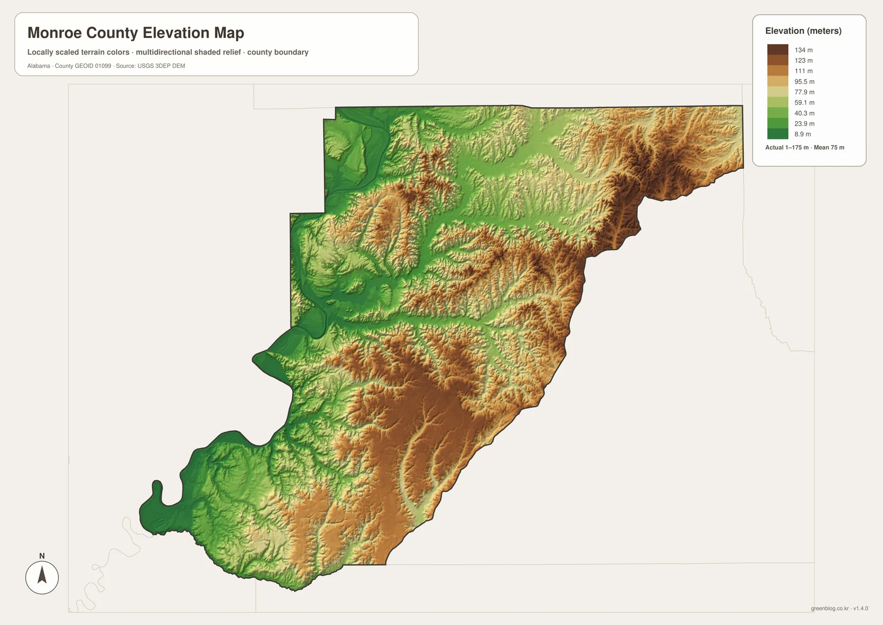
The northeastern and eastern edges show a particularly broken pattern of narrow ridges and valleys, and broader elevated areas appear through the middle and southern interior. The western side is different, with wider low zones associated with the Alabama River system. Shaded relief makes those small landforms easier to see because the direction of the ridges remains visible even where the absolute difference in height is modest. The map therefore works well for comparing parts of the county rather than for identifying one single high point.
Comparing the elevation map with the water map is especially useful. The major river and many smaller creeks occupy lower corridors, while uplands rise between the drainage lines. If Monroeville, Beatrice, or Frisco City is located on the county map first, the elevation view can then show whether the surrounding landscape is lower and smoother or more dissected by ridges and valleys. This makes the pair useful for geography lessons, local background research, and general trip preparation even when exact contour measurements are not needed.
The elevation colors should not be treated as survey measurements for construction or property work. They summarize relative terrain from elevation data at a county scale. For engineering, site planning, or any task that depends on exact ground heights, the original elevation data and a suitable professional survey are the appropriate sources. For a visitor who simply wants to understand why the river side looks different from the inland hills, however, the map provides a clear visual explanation.
Choose the Map That Matches the Question
For a first look at Monroe County, the county reference map is the best starting point because it combines the boundary, named places, roads, and visible streams. If the main question is how Monroeville compares with the other larger communities, the city map removes extra detail and makes their spacing clearer. The water map is the better choice for named creeks and lakes, while the elevation map is designed for comparing the low western river country with the higher inland terrain.
The maps can also be paired according to the project. A county map beside the city map works well for settlement and transportation, while the water and elevation maps show how streams fit into the terrain. A local-history presentation focused on river travel may benefit from the county and water maps. A classroom lesson about physical geography may be clearer with the county and elevation views. Using two focused maps often communicates more than trying to place every road, town, creek, and relief symbol on one crowded sheet.
The images embedded in the article are WebP previews for quick loading. The downloadable archive contains the four original high-resolution A3 JPG maps as separate files, so you can open one map at full size, print only the view you need, or compare all four side by side. This is also the better option when a label that is readable in the original becomes too small in the browser preview.
Frequently Asked Questions
Why is Monroeville the easiest starting point on the county map?
Monroeville is the county seat, the largest city in the supplied city index, and the place where several important roads come together. Once it is located, Frisco City and Uriah can be placed to the south, Excel to the southeast, and Beatrice and Vredenburgh to the north, giving the rest of the county an immediate directional framework.
What becomes clearer when the water and elevation maps are compared?
The water map identifies the Alabama River and smaller creeks, while the elevation map shows the lower valleys and higher ridges around them. Together they make the broad western lowland easier to distinguish from the more varied inland terrain and show why many tributaries follow narrow lower corridors between ridges.
What is included in the downloadable ZIP?
The ZIP contains four separate high-resolution A3 JPG files: the county reference map, city map, water map, and elevation map. Because they are separate files, you can print one map, compare several side by side, or open the full-size image when labels in the web preview are too small.
Why is Monroeville the best place to start when reading the county map?
Monroeville is the county seat, the largest city, and the point where several important roads come together. It also concentrates government services and many of the county’s best-known literary landmarks. Once Monroeville is located, Frisco City and Uriah can be placed to the south, Excel to the southeast, and Beatrice and Vredenburgh to the north.
Map File Information
Monroe County county, city, water, and elevation maps in one printable archive.
- Included Files: County map, city map, water map, elevation map
- File Type: 4 separate high-resolution A3 JPG files in one ZIP
- Intended Use: Printing, education, presentations, and map-based projects
Related Maps
- Abbeville, Headland, and Lake Eufaula on the Henry County Alabama Map
- Athens to Wheeler Reservoir on the Limestone County Alabama Map
- Autauga County Map
Sources and Reference Data
The following official and local sources are included in the package for checking the statistics and geographic background used on this page. The maps are designed for readable county orientation and printing; when a task depends on current official boundaries, road classification, hydrography, elevation, or local history details, the original source should be checked directly.
- U.S. Census Bureau QuickFacts – population and land-area statistics
- ALDOT Highway Functional Classification Maps – Alabama road classification and local road context
- USGS National Hydrography – rivers, streams, and water features
- USGS 3D Elevation Program – elevation data
- City of Monroeville history – local history and Monroeville background
- U.S. Army Corps of Engineers: Alabama River Lakes – Alabama River and Claiborne Lake reference
Green Map creates custom-edited map images using open geographic data sources such as geoBoundaries, Natural Earth, OpenStreetMap, and government open data. These maps are edited visual materials, not raw data files, and are provided for education, documents, presentations, and graphic reference.