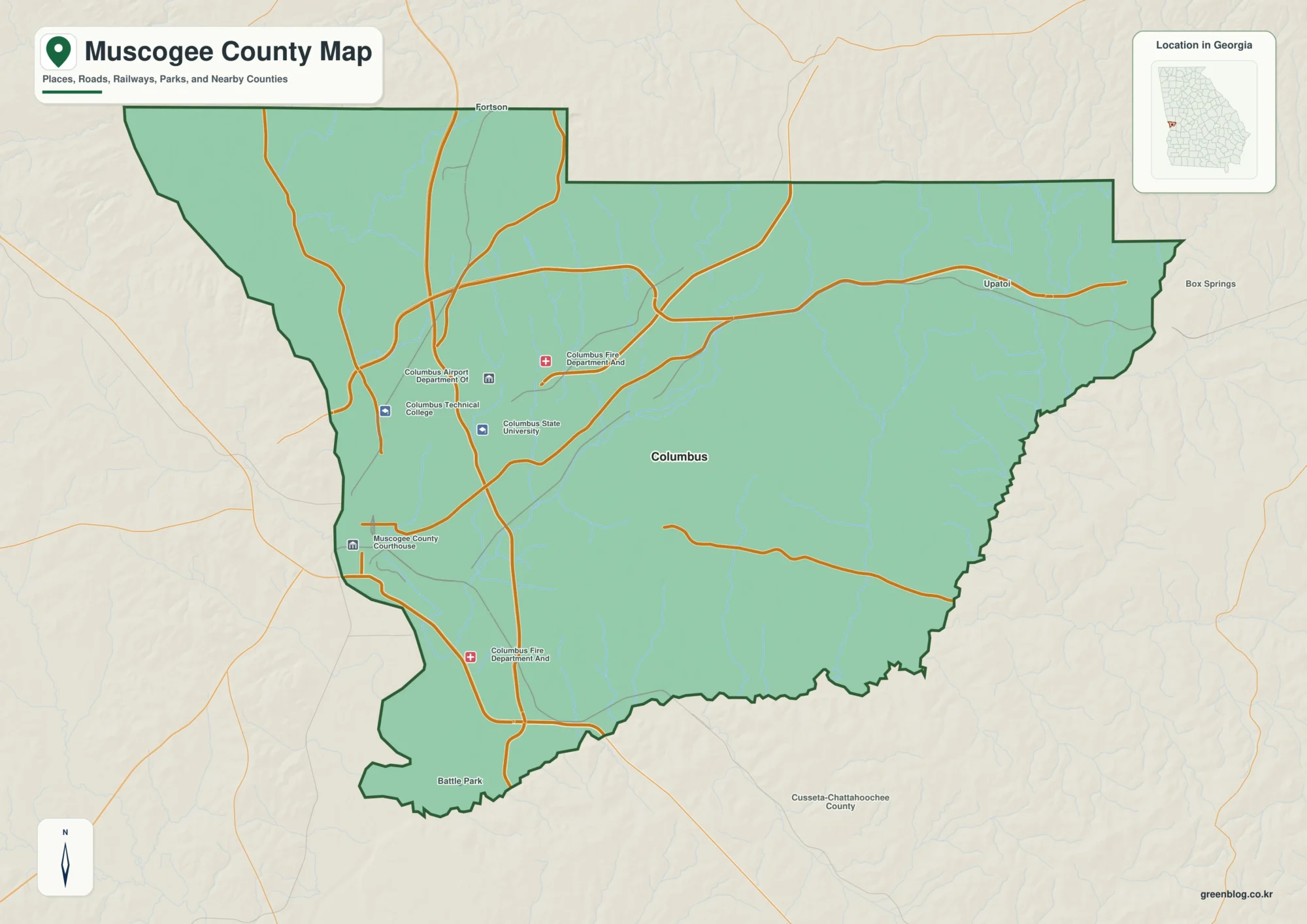
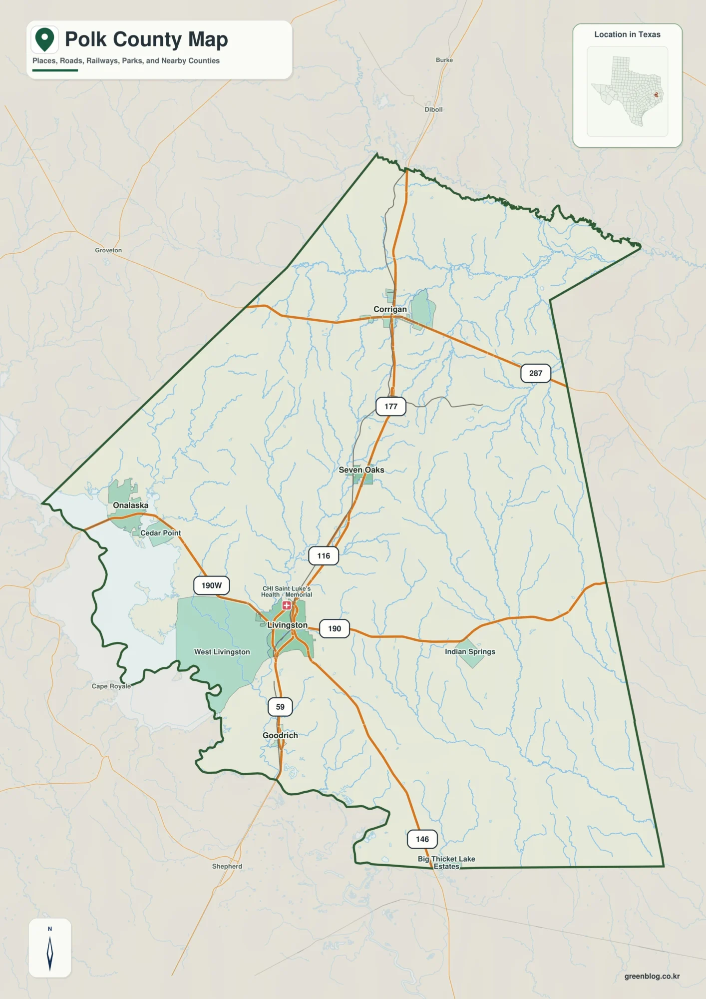
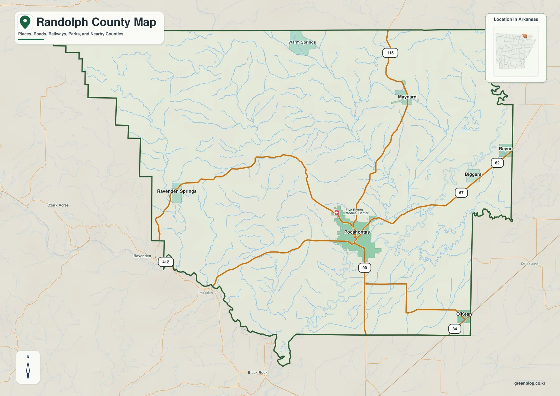
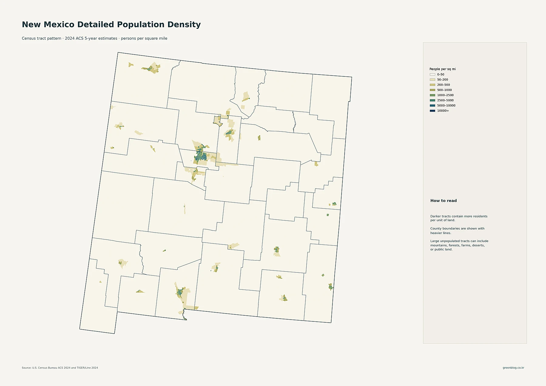
Alexander County occupies the far southern end of Illinois, and its shape makes that location obvious before any town name is read. The county bends along the Mississippi River on the west and south, while the Ohio and Cache rivers define much of the eastern side. Cairo sits at the narrow southern end. Farther north, Tamms, Thebes, East Cape Girardeau, and McClure are spread across a county that shifts from broad river lowlands to a much more rugged interior of short ridges and creek valleys.
This Alexander County Illinois Map page combines a detailed county overview, a simplified ranked-city map, a terrain-and-water map, and an elevation map. You can download high-resolution JPG copies of the supplied maps together in one ZIP file, using the same map set shown in the article for printing, classroom work, presentations, or closer viewing. The four images answer different county-scale questions without pretending to replace parcel, flood, navigation, or survey products.
Alexander County’s official website describes the county as the southern extremity of Illinois, bounded by the Mississippi River on the west and south, the Ohio and Cache rivers on the east, and Union County on the north. That description matches the visual character of the supplied maps. Cairo forms the southern anchor, Thebes and McClure sit near the western river side, Tamms lies closer to the eastern edge, and the interior between them is crossed by many small streams.
Table of Contents
Cairo makes a clear southern anchor
The county overview is easiest to enter from the bottom. Cairo is marked near the tapered southern tip, with the Alexander County Courthouse labeled inside the city. A main road continues north from Cairo past Unity toward the central part of the county. Olive Branch appears farther north, and Tamms is placed near the eastern side. On the western side, Thebes and East Cape Girardeau sit close to the river boundary, while McClure is farther north.
Road placement reinforces that split. Illinois Route 3 follows the western side through the McClure-Thebes area, while Route 127 forms a strong north-south reference near Tamms and the eastern half. Between those corridors, the overview is filled with small blue streams rather than a dense pattern of towns. The northern and central interior therefore reads as a network of creek valleys and ridges, whereas the southern end is dominated by broad low ground between major rivers.
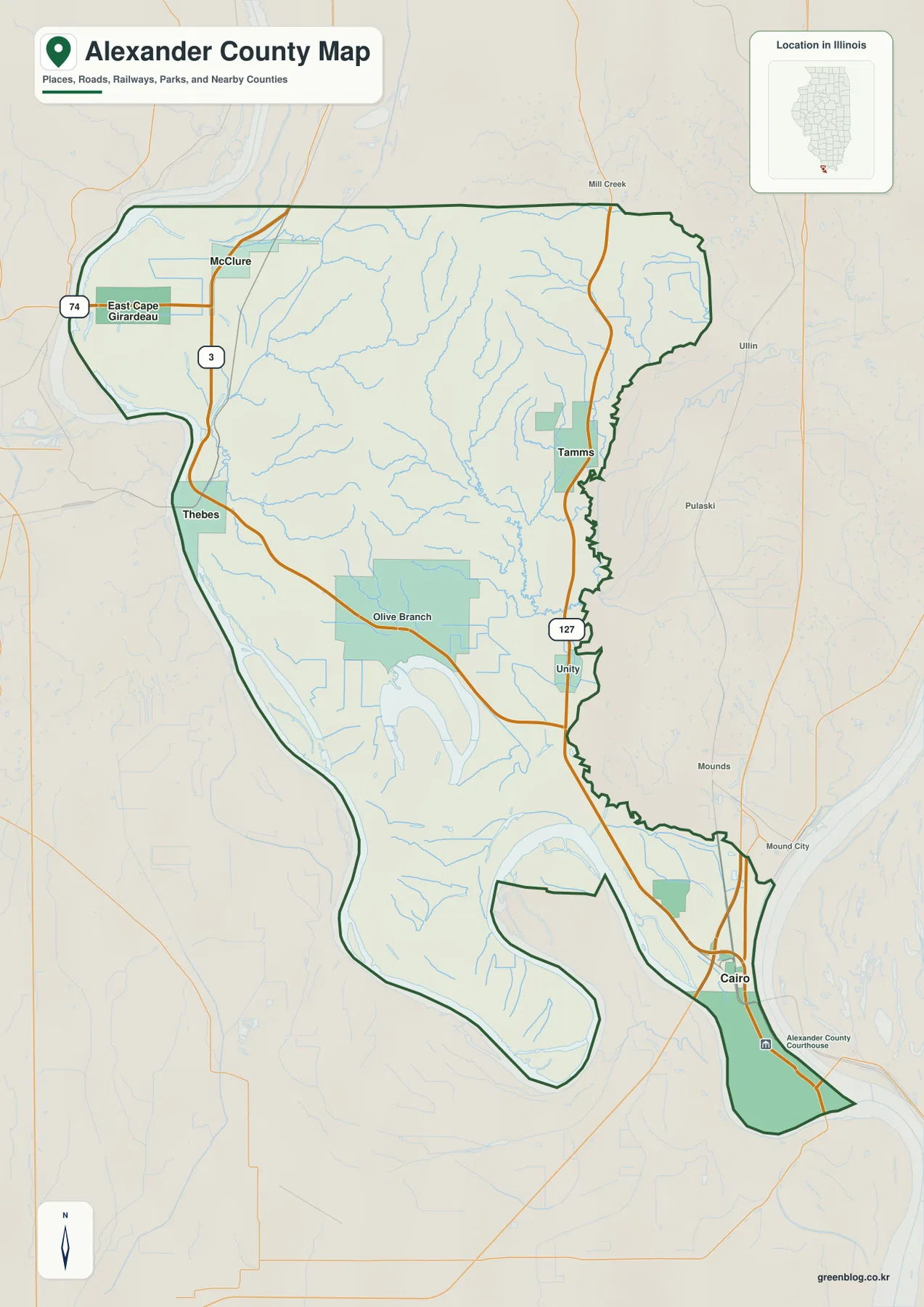
The outline is unusually useful for matching the other maps. The western and southern edges curve with large river channels, the lower county narrows into long lobes, and the eastern edge has many smaller bends. The northern boundary is comparatively simple. Once that silhouette is familiar, Horseshoe Lake, the interior ridges, and the city markers can be located much more quickly on the simplified maps.
Use Cairo, Thebes, and Tamms as three reference points
A practical way to remember the county is to place Cairo at the bottom, Thebes on the western side, and Tamms on the eastern side. McClure then falls north of Thebes, while Olive Branch sits between the western and eastern town corridors. Those anchors prevent the numerous creeks and irregular boundaries from making the map feel more complicated than it is.
The overview is a county-scale reference rather than a live travel or legal map. It does not tell a driver about current closures, determine ownership, show exact parcel lines, or certify access across levees and private land. Use current transportation, assessor, and land-management information when a decision depends on those details.
Five ranked places are split between the southern tip and the north
The city-distribution map removes most road detail and ranks five places. Cairo is number 1, Tamms number 2, Thebes number 3, East Cape Girardeau number 4, and McClure number 5. The printed CITY INDEX gives values of 1,682 for Cairo, 589 for Tamms, 353 for Thebes, 283 for East Cape Girardeau, and 239 for McClure.
The image does not print a census year or statistical date beside those values, so this article does not claim that they are current population figures. They are treated only as the index numbers supplied with the map. The geographic pattern is clear without making that assumption: Cairo is isolated at the southern tip, Tamms is east-central, Thebes is on the western side, and East Cape Girardeau and McClure occupy the northwestern part of the county.
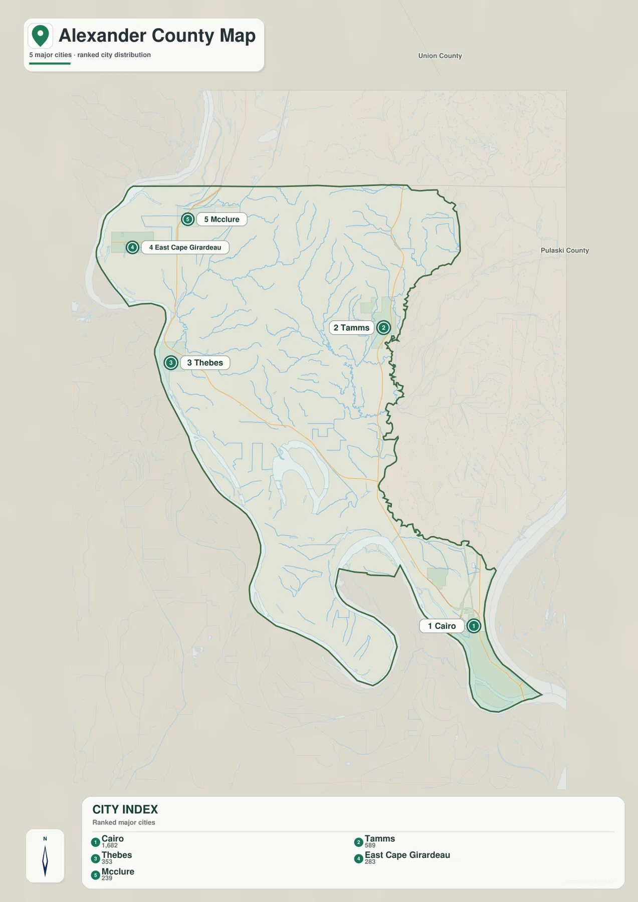
That separation is one of the map’s most useful lessons. Cairo does not sit in the middle of a compact cluster of towns. It occupies the far south, while four of the five ranked places lie much farther north. The simplified map therefore works well when the question is not which road to drive, but how settlement is distributed within Alexander County’s long north-south shape.
Treat the CITY INDEX as map data, not a current census table
If an assignment or report needs current official population, use a dated U.S. Census Bureau source rather than the values printed on this graphic. Here, the city index is useful for reading the supplied map’s ranking and for seeing how Cairo compares with the four smaller labeled places. The article keeps that interpretation separate from a claim about present-day population.
Horseshoe Lake sits inside a water-rich southern lowland
The terrain-and-water map shifts attention away from towns. Horseshoe Lake is the dominant named lake in the southern half, with Lake Cazey nearby. Grand Lake and Lake Milligan appear farther south, and the Cache River is labeled along the southeastern side. In the northern and central interior, named creeks cross a much more textured landscape before reaching the lower river country.
Sexton Creek and Hartline Creek are labeled in the north. Jackson Creek and Wolf Creek appear nearer the center, while Sandy Creek and Hogskin Creek are marked toward the east. The streams bend through narrow valleys rather than crossing a flat surface in straight lines. South of that rugged interior, Horseshoe Lake and the nearby lowlands occupy a broader, flatter setting that looks distinctly different on the shaded-relief background.
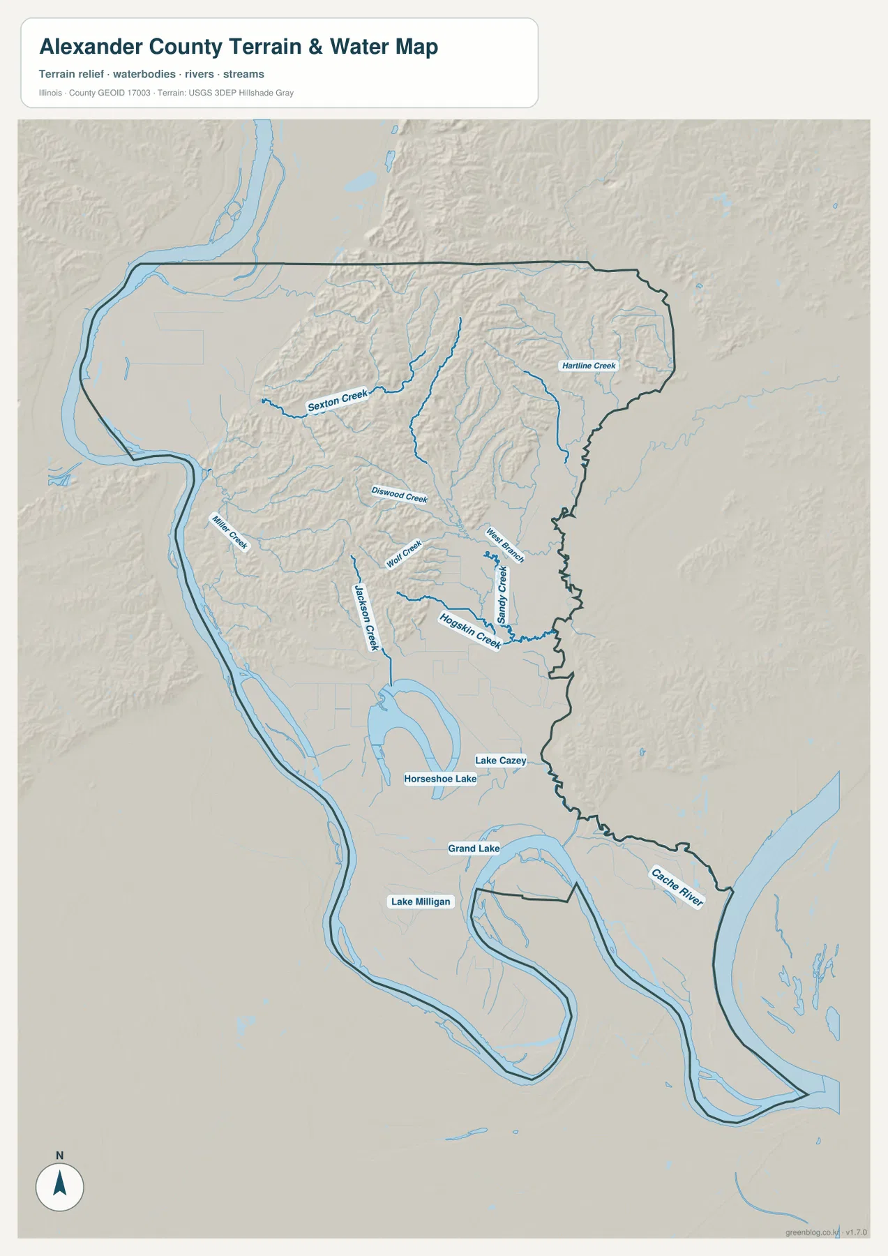
Horseshoe Lake is also supported by an official county-specific reference. The Illinois Department of Natural Resources places the Horseshoe Lake State Fish & Wildlife Area about 7 miles north of Cairo and east of Illinois Route 3. A separate IDNR nature-preserve page describes Horseshoe Lake as an ancient oxbow of the Mississippi River. Those details explain why the lake is such a strong landmark on a map otherwise dominated by river-margin lowlands and small drainage channels.
Use the water map for location, not for flood or navigation decisions
The map shows where lakes, rivers, and creeks are located relative to the county terrain. It does not contain flood-hazard zones, live river stages, water depths, levee conditions, navigable channels, or legal access information. Current USGS, Illinois DNR, and other responsible agency products should be used for safety, boating, flood, and regulatory decisions.
A high interior rises above the river margins
The elevation map makes Alexander County’s strongest physical contrast unmistakable. The southern part and much of the land beside the major rivers are dark green, showing relatively low terrain. In the central and northern interior, yellow, orange, and brown ridges rise sharply above those low areas. The most rugged belt occupies the broad zone between the McClure side of the county and the Tamms side rather than the far southern tip around Cairo.
The map reports an actual countywide elevation range of about 89 to 256 meters and a mean of about 118 meters. The legend itself is divided into colored bands from roughly 92 to 203 meters, while the separate “Actual” line records the wider minimum and maximum found in the mapped dataset. Those values summarize the county as a whole; they are not exact elevations for Cairo, Tamms, Horseshoe Lake, or a specific road.
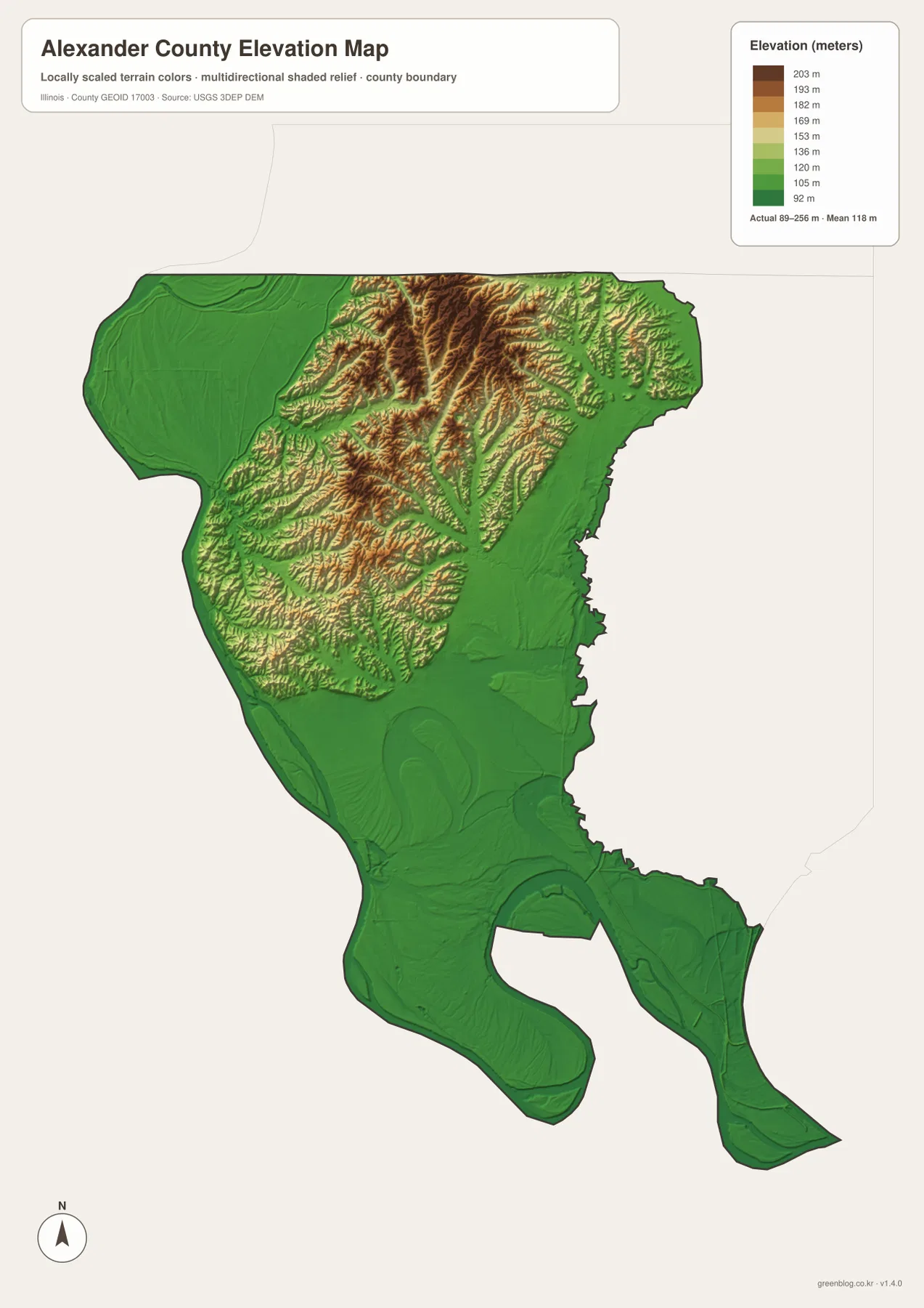
Comparing this image with the water map reveals a consistent pattern. Horseshoe Lake, Grand Lake, and much of the southern river country lie in broad low green areas. Farther north, creeks such as Sexton Creek and Jackson Creek occupy narrow valleys cut between higher ridges. The maps therefore show two very different landscapes within the same small county: low river and lake country in the south and a dissected upland interior farther north.
89 to 256 meters is a countywide range, not a town elevation
Do not assign the low or high endpoint directly to Cairo, Tamms, or another named place. An exact elevation for a parcel, levee, bridge, structure, or construction site requires location-specific elevation data or a professional survey. This map is designed for broad county comparisons rather than engineering measurement.
Choose the map by the question you have about Alexander County
Use the county overview when you want Cairo, Tamms, Thebes, McClure, major roads, streams, and the full boundary in one view. Choose the ranked-city map when the goal is simply to compare the positions of Cairo, Tamms, Thebes, East Cape Girardeau, and McClure. The water-and-terrain map is the best match for Horseshoe Lake, Cache River, nearby lakes, and named creeks, while the elevation map most clearly separates the low southern river country from the higher interior ridges.
A useful sequence is to begin with Cairo at the southern tip on the overview, then trace north toward Thebes, Tamms, and McClure. Next, use the city map to simplify that settlement pattern. Move to the water map to find Horseshoe Lake and the Cache River, and finish with elevation to see why the lake country and southern river margins look so flat while the interior becomes much more rugged.
Each map also has a clear limit. The overview is not a parcel or live-traffic product, the CITY INDEX is not presented as a dated census table, the water map does not assess flood or navigation conditions, and the elevation surface is not survey-grade. Used within those limits, the set provides a practical way to understand one of Illinois’ most distinctive county shapes and landscapes.
Frequently Asked Questions
Where is Horseshoe Lake in relation to Cairo?
On the supplied maps, Horseshoe Lake is north of Cairo in the broad southern lowland. The Illinois Department of Natural Resources describes the Horseshoe Lake State Fish & Wildlife Area as about 7 miles north of Cairo and east of Illinois Route 3. Starting at Cairo and moving north makes the lake easy to place.
Are the CITY INDEX numbers current populations?
This page does not treat them as current population figures. The map prints values such as 1,682 for Cairo and 589 for Tamms but does not display a census year or statistical date beside the index. Use a current U.S. Census Bureau source when an official present-day population figure is required.
Does 89 to 256 meters give Cairo’s elevation?
No. The elevation map identifies 89–256 m as the actual range across the Alexander County dataset and gives a mean of about 118 m. Exact elevation for Cairo or any specific road, property, levee, or structure requires point-specific elevation or survey data.
Sources and Reference Material
The article uses the supplied Alexander County maps together with the official references below. For current river conditions, legal boundaries, or exact point elevations, use the responsible agency’s current source data rather than these explanatory county maps.
- Alexander County Official About Page – county location, surrounding rivers, and local context
- Illinois DNR Horseshoe Lake Alexander County – Horseshoe Lake State Fish & Wildlife Area information
- Illinois DNR Horseshoe Lake Nature Preserve – oxbow-lake and nature-preserve context
- U.S. Census Bureau TIGER/Line Shapefiles – county boundaries and geographic reference data
- USGS 3D Elevation Program – elevation and terrain data
Map File Information
The high-resolution JPG originals for the Alexander County overview, ranked-city map, terrain-and-water map, and elevation map are bundled in one ZIP file. Each image is 2,572 × 3,638 pixels, giving you more detail for larger displays, printed reference sheets, classroom materials, and presentation graphics.
- Included Files: 4 high-resolution JPG maps
- Printable Size: 2,572 × 3,638 pixels each
Related Maps
Green Map creates custom-edited map images using open geographic data sources such as geoBoundaries, Natural Earth, OpenStreetMap, and government open data.
These maps are edited visual materials, not raw data files, and are provided for education, documents, presentations, and graphic reference.