The Stone County Mississippi map places Wiggins, the county seat, with Perkinston and McHenry to the south and Bond to the northeast along the US 49 region. De Soto National Forest pine lands and Black Creek and Red Creek organize travel and drainage in the inland Gulf Coastal Plain.
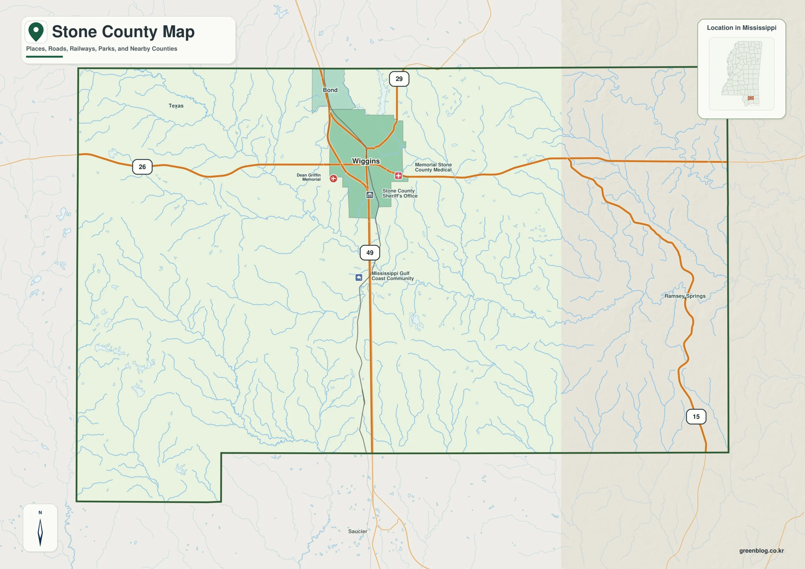
Stone County Mississippi map download
The WebP preview is optimized for the page, while the button preserves the original high-resolution JPG for printing and reuse.
- File: County reference map
- Format: JPG
- Print layout: A3
Quick Facts
- State and identifier: Mississippi, Stone County; FIPS 28131
- County seat: Wiggins
- Selected map labels: Wiggins, Perkinston, McHenry, Bond
- 2020 census population: 18,333
- July 2025 population estimate: 19,654
- 2025 Gazetteer area: 445.485 sq mi land and 2.592 sq mi water
- 2020 land-area density: 41.2 residents per sq mi
- Primary route references: US 49, MS 26, and MS 29
- Landscape references: De Soto National Forest, Black Creek, Red Creek, longleaf pine country, and Gulf Coastal Plain wetlands
The decennial count and July 2025 estimate use different reference dates. Land and water measurements come from the 2025 Gazetteer. The density of 41.2 residents per square mile divides the 2020 population by 2025 land area and does not imply an even distribution among cities, farms, forest, or wetland.
Reading the Stone County Mississippi map
US 49 links Wiggins with Forrest County to the north and Harrison County to the south. MS 26 runs west toward Pearl River County and east toward George County, while MS 29 supplies the Bond and Perry County approach. Forest tracks, canoe access lanes, and campus streets are simplified.
Boundary, Water, and Terrain
Black Creek winds through De Soto National Forest, creating white sandbars and floodplain woods, while Red Creek helps divide southeastern drainage. Relief is low and gentle, but wetlands, pine ridges, and stream bluffs repeat. Stone is inland and has no Gulf shoreline despite its close relationship with the coast.
Settlement and Regional Context
Wiggins is the courthouse, retail, and national forest office center. Perkinston contains a Mississippi Gulf Coast Community College campus, and US 49 supports commuting and freight access toward Gulfport. The July 2025 estimate is about 7.2 percent above the 2020 base, the fastest growth in this batch.
Practical Map Uses
- Sequence Wiggins, Perkinston, and McHenry on US 49
- Relate Black Creek to De Soto National Forest
- Compare east and west access along MS 26
Frequently Asked Questions
Does Stone County touch the Gulf of Mexico?
No. Harrison County lies to the south, making Stone an inland coastal-plain county. US 49 provides the main Gulf Coast approach.
How does De Soto National Forest complement Wiggins when orienting the map toward Perry?
A symbol at Wiggins fixes one named point; De Soto National Forest adds a broader frame that can be followed toward Perry without treating every local road as mapped.
Sources
- U.S. Census Bureau QuickFacts
- U.S. Census Bureau 2025 Gazetteer Files
- Mississippi Department of Transportation official highway map
- Regional landscape or institution reference
Related County Maps
Green Map creates custom-edited map images using open geographic data sources such as geoBoundaries, Natural Earth, OpenStreetMap, and government open data.
These maps are edited visual materials, not raw data files, and are provided for education, documents, presentations, and graphic reference.