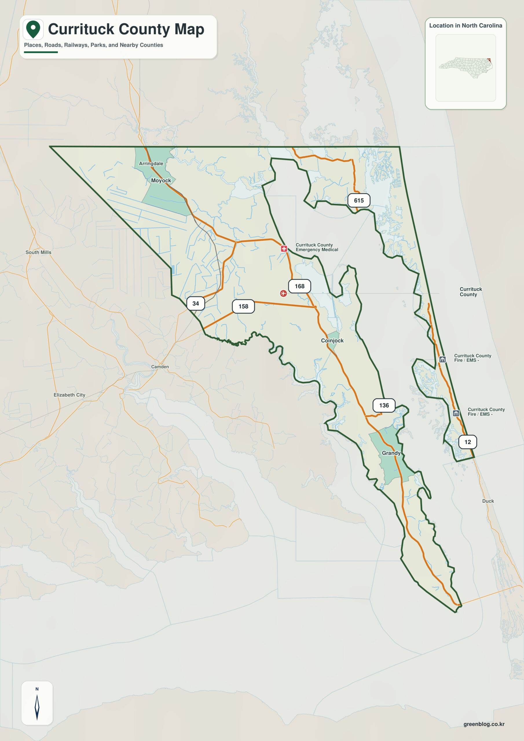
Currituck County North Carolina map needs a water-first reading because its mainland and Outer Banks sections are physically separated by Currituck Sound. Currituck and Coinjock belong to the mainland side, while Corolla sits on the Atlantic barrier island, so the county cannot be understood as one continuous road-connected land area.
Keep urban or administrative information around Currituck separate from physical information around Currituck Sound. Corolla and Coinjock then work as intermediate anchors that show how the rest of the county differs from the center.
Currituck County quick facts
- County seat: Currituck
- North Carolina setting: northeastern Outer Coastal Plain
- Place references: Currituck, Corolla, Coinjock
- Physical references: Currituck Sound, Outer Banks, Albemarle and Chesapeake Canal
- Neighboring counties for orientation: Camden, Dare
Why the boundary alone is misleading
Currituck must be read as two separated landscapes. The county seat and Coinjock are on the mainland, while Corolla occupies the northern Outer Banks across Currituck Sound, so a single continuous-land assumption immediately produces the wrong picture.
Directional clues inside the county
The Albemarle and Chesapeake Canal provides a mainland waterway reference, whereas Corolla is an Atlantic-side barrier-island reference. Their separation demonstrates why ordinary east-west distance is a poor substitute for actual access geography.
The feature that separates this county from its neighbors
Currituck dates to 1668 and has long been shaped by water. Mainland agriculture, sound waters, wildlife areas, and Outer Banks tourism now occupy visibly different parts of the county.
Placing Corolla and Coinjock beside Currituck makes the outer county visible rather than leaving the seat to represent every local condition. Currituck Sound adds the physical frame needed to interpret those settlement differences at county scale.
A practical reading sequence
- compare Currituck and Corolla using Currituck Sound as the physical reference
- orient the Camden side of the boundary before reading smaller settlement labels
- use the county image as a reference layer before switching to street, parcel, hazard, or navigation mapping
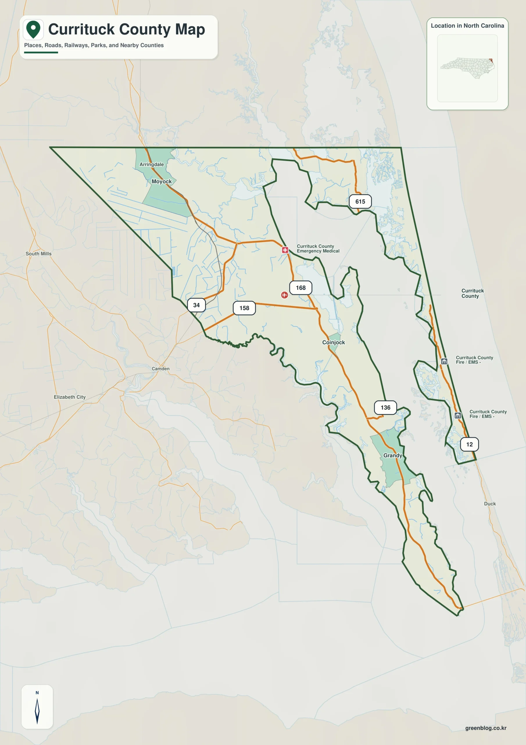
Currituck County single map file
The image above is a web preview. The button is reserved for the separate original map asset used by the publishing workflow.
Download the Currituck County map fileFrequently Asked Questions
What does Currituck Sound reveal that town labels alone do not?
Keeping Currituck Sound visible gives the map a stable non-municipal reference. With Outer Banks, it makes the outer county easier to interpret without assuming that every area behaves like Currituck.
What becomes clearer when Corolla is kept separate from Currituck?
Treating Corolla as only a minor label under Currituck would hide part of the county’s internal geography. The map keeps them separate so different local functions and directions remain visible.
Sources
Related County Maps
Green Map creates custom-edited map images using open geographic data sources such as geoBoundaries, Natural Earth, OpenStreetMap, and government open data.
These maps are edited visual materials, not raw data files, and are provided for education, documents, presentations, and graphic reference.