A Shelby County Texas map places a historic East Texas county at the point where forest country meets the Louisiana line. Center is the county seat and largest city, while Tenaha, Timpson, Joaquin, Shelbyville, and Huxley form smaller hubs across a broad rural landscape. The Sabine River defines much of the eastern edge, and the northern reaches of Toledo Bend Reservoir shape the southeastern corner.
The U.S. Census Bureau estimated 24,286 residents on July 1, 2025, compared with 24,022 counted in 2020. That relatively stable total is spread across 796 square miles of land, so the map reads less like a continuous urban area and more like a network of communities separated by timberland, farms, and water.
Table of Contents
A County Formed Before Texas Statehood
Shelby County developed from an early municipality organized during the Mexican period and became a county of the Republic of Texas in 1837. It was named for Isaac Shelby, a Revolutionary War veteran and the first governor of Kentucky. Shelbyville served as an early seat of government, but voters later moved the county seat to Center, a more central location that grew into the county’s administrative and commercial focus.
The county’s early history also includes the Regulator–Moderator conflict, a period of local violence and political disorder in the 1840s. That history, along with the surviving courthouse district and older communities, gives the county a regional identity that extends well beyond its modern boundary lines.
Transportation Links Through Tenaha and Timpson
Tenaha occupies an important northern junction where U.S. 59 and U.S. 84 meet. The two routes connect East Texas traffic with Louisiana and with communities farther north and south. Timpson lies northwest of Center along U.S. 59 and is also associated with U.S. 84, U.S. 87, and a long-standing railroad corridor, making it a useful reference point for understanding the county’s inland transportation pattern.
Joaquin serves the eastern side near the Sabine River and the Louisiana border. Center is connected to the surrounding region by U.S. 96 and state highways, while Shelbyville and Huxley lead toward the reservoir and forest areas in the southeast. The result is not a single radial road system but several corridors serving different sides of the county.
Timber, Poultry, and Reservoir Country
Shelby County is part of the East Texas timberlands, with pine, oak, cypress, and other forest types supporting a long history of logging and wood products. Agriculture and poultry production also became major parts of the local economy. Center’s East Texas Poultry Festival reflects the connection between industry, civic life, and the county’s agricultural heritage.
Outdoor activity is concentrated along the Sabine River, Toledo Bend Reservoir, and nearby portions of Sabine National Forest. The reservoir extends across the Texas–Louisiana boundary and supports fishing, boating, and shoreline recreation. On the western side, Attoyac Bayou forms portions of the boundary with Nacogdoches and San Augustine counties, giving Shelby County two distinct water-defined edges.
How to Read the County Boundary
The eastern side projects into a bend of the Sabine River, which separates the county from De Soto and Sabine parishes in Louisiana. Panola County is directly north; Rusk and Nacogdoches counties are west and southwest; San Augustine and Sabine counties lie to the south. Center provides the interior anchor, while Joaquin and the reservoir communities help identify the state-line side.
The Shelby County Texas map is most useful when those boundary relationships are read together. The long river edge, the southern county line, and the dispersed northern communities explain why straight-line distance can be misleading when comparing places across the county.
Color Map
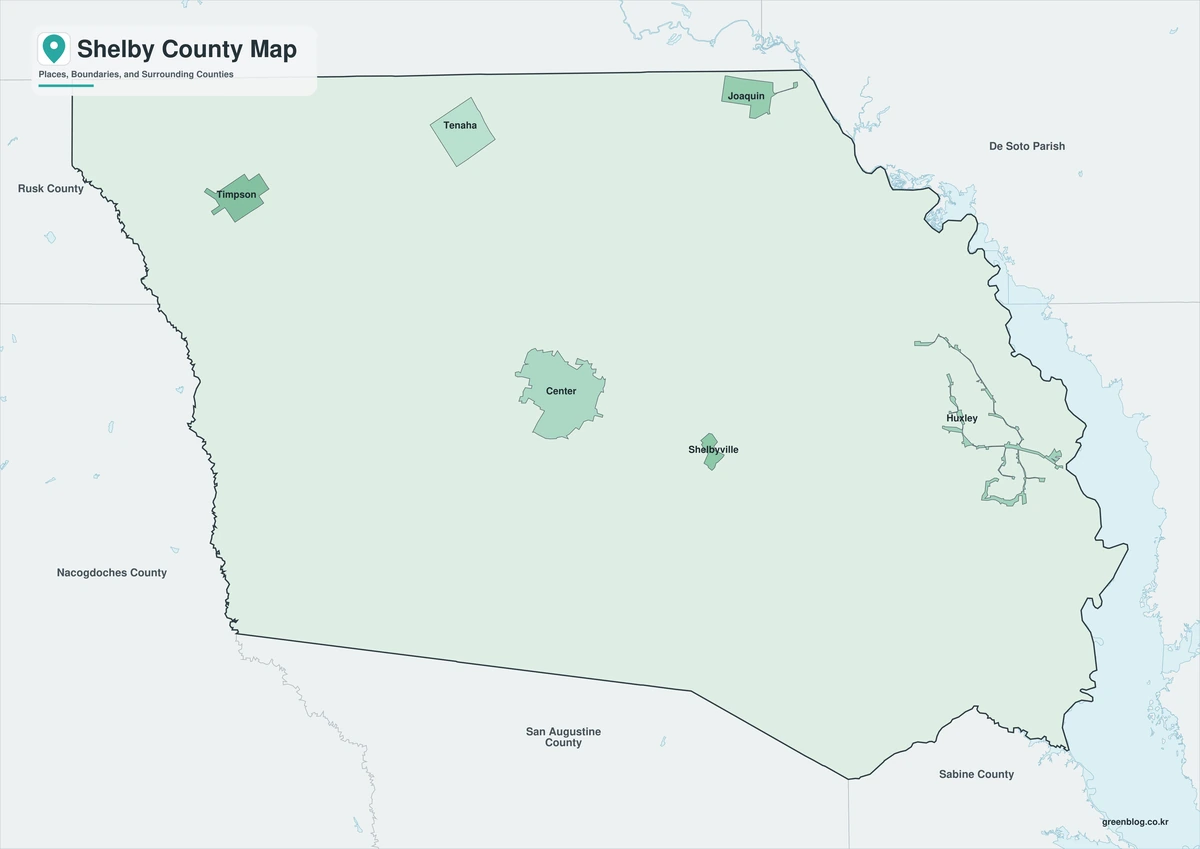
The color edition separates Shelby County from Panola, Rusk, Nacogdoches, San Augustine, and Sabine counties while also distinguishing the two Louisiana parishes across the river. Joaquin appears near the eastern state line, with Center inland and Tenaha farther north. The reservoir side near Huxley and Shelbyville can be compared with the more road-oriented Timpson–Tenaha corridor without losing the county’s overall shape.
Black-and-White Map
Timpson and Tenaha sit apart in the northern half, while Shelbyville and Huxley occupy the southeastern side near the reservoir corridor. In grayscale, the curved Sabine River edge and the spacing between those communities become the main visual guides rather than the fills. This format works well for reports that need readable place references without a large color area.
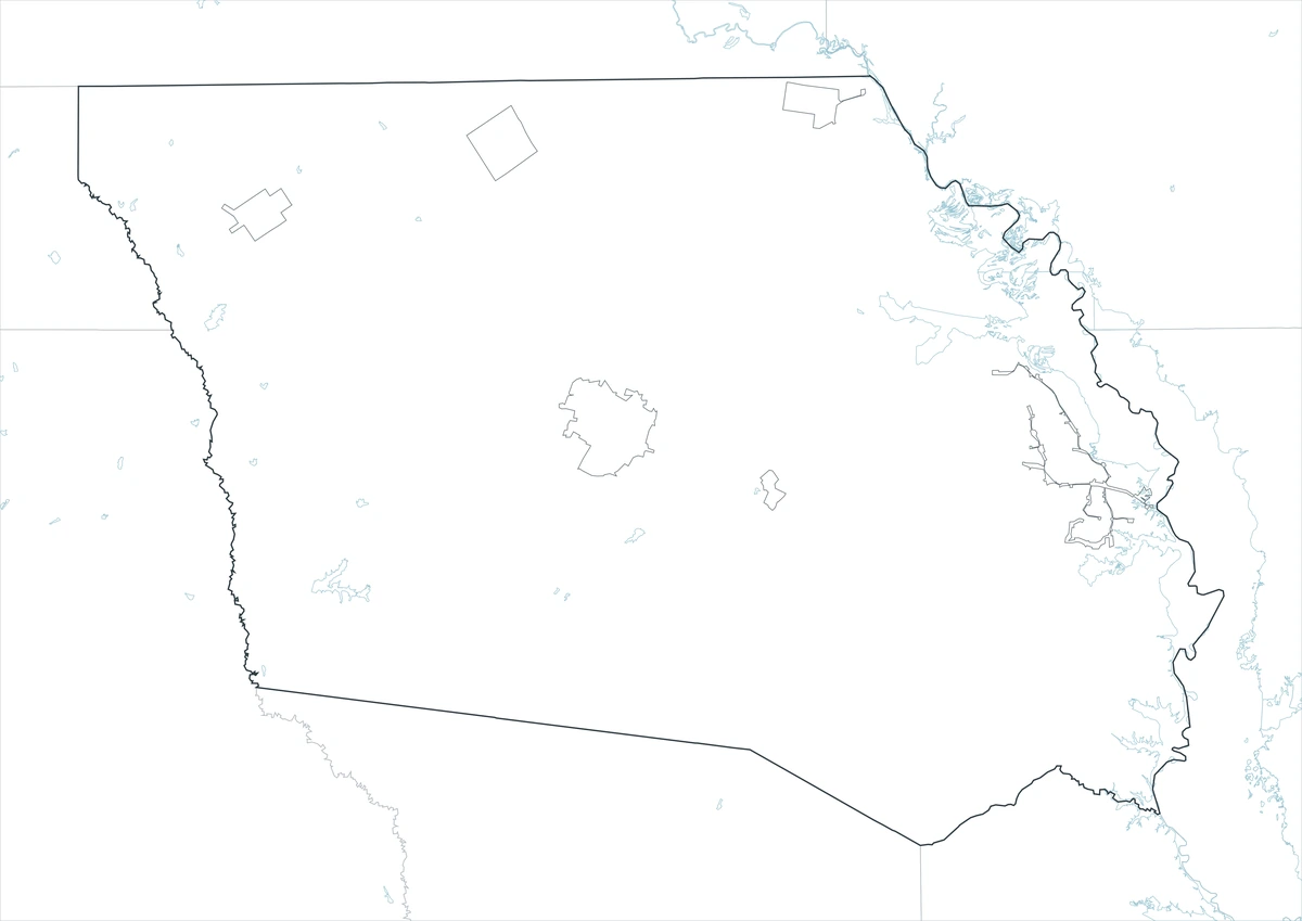
Outline Map
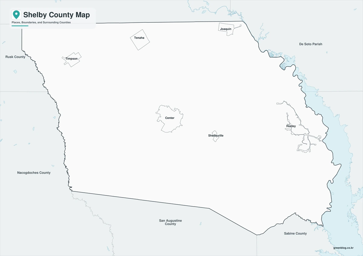
The outline edition removes color and place labels, leaving the Shelby County perimeter and surrounding reference boundaries. Users can add Center and Joaquin, trace the Sabine River and Attoyac Bayou, or mark a route from Tenaha toward Louisiana. The blank interior also supports classroom exercises about Texas counties, parishes, and interstate boundaries.
Download the County Map Files
The download provides three A3 JPG layouts for visual reference, grayscale printing, and custom annotation. These files are general geographic materials rather than legal boundary, parcel, navigation, or flood-control documents.
County Map File Information
This download includes three A3 JPG versions of the Shelby County map. The labeled maps use place names for readability, while the outline version contains boundary lines without labels or color fills.
- Included Versions: Color, Black and White, Outline
- File Type: JPG
- Printable Size: A3 high-resolution layout
- Map Detail: County boundary, mapped communities, and surrounding county or parish reference
- Intended Use: Printing, classroom materials, presentations, documents, and annotation
Frequently Asked Questions
Why does Shelby County border Louisiana parishes instead of counties?
Louisiana uses parishes as its primary county-equivalent units. Across the Sabine River, Shelby County faces De Soto Parish to the northeast and Sabine Parish to the east.
Which communities help orient the northern part of the map?
Tenaha and Timpson are the main northern reference points. Tenaha is associated with the U.S. 59 and U.S. 84 junction, while Timpson lies northwest of Center along major highway and rail corridors.
Does Toledo Bend Reservoir touch Shelby County?
Yes. The reservoir occupies part of Shelby County’s southeastern and eastern edge along the Sabine River and the Texas–Louisiana boundary.
Sources and Further Reading
- U.S. Census Bureau QuickFacts — 2020 census and 2025 population estimate
- Texas State Historical Association — county history, geography, communities, and economy
- Texas Water Development Board — Toledo Bend Reservoir and Sabine River setting
Regional Information
Continent: North America
Country: United States
State: Texas
County: Shelby County
Location in State: Eastern Texas along the Louisiana state line
Adjacent Counties: Panola County (north), De Soto Parish, Louisiana (northeast), Sabine Parish, Louisiana (east), Sabine and San Augustine counties (south), Nacogdoches County (southwest), Rusk County (northwest)
Major Places: Center, Tenaha, Timpson, Joaquin, Shelbyville, Huxley
Geographic Features: Sabine River, Toledo Bend Reservoir, Attoyac Bayou, East Texas timberlands
Related Maps
- Stonewall County Texas map|Aspermont, Double Mountain, and the Brazos Forks
- Val Verde County Texas map|Del Rio, Lake Amistad, and Devils River
- Tyler County Texas map|Woodville, the Neches River, and Big Thicket
- Wharton County Texas map|Wharton, El Campo, and the Colorado River
- Uvalde County Texas map|Uvalde, Sabinal, the Nueces River, and Frio River
Green Map creates custom-edited map images using open geographic data sources such as geoBoundaries, Natural Earth, OpenStreetMap, and government open data.
These maps are edited visual materials, not raw data files, and are provided for education, documents, presentations, and graphic reference.