Rivera map resources are useful when a simple place name is not enough to explain how this northern Uruguayan department is organized. Rivera lies along the Brazilian border and connects with Artigas and Salto to the west, Tacuarembó to the south, and Cerro Largo to the east. Its capital, Rivera, stands directly beside the Brazilian city of Santana do Livramento, creating a cross-border urban area where the international boundary passes through the built-up landscape rather than separating two distant settlements.
The department covers 9,370 square kilometers and has a projected 2024 population of 109,255. Its population density is 11.7 people per square kilometer, so the map combines one major northern border city with broad inland areas and smaller regional centers. The visible municipal areas are Tranqueras in the west, Minas de Corrales near the center, and Vichadero in the east. Their wide separation makes a labeled visual reference especially helpful for comparing direction, distance, and administrative coverage.
This downloadable collection includes a color map, a black and white map, and an outline map. All three are supplied as JPG images in an A3 layout. The files are suitable for classroom handouts, reports, presentation slides, blog graphics, regional comparisons, and annotation work. The labeled versions help readers identify the capital and municipalities quickly, while the blank outline version provides a clean base for adding custom information.
Table of Contents
A Border Department with Widely Separated Centers
The shape of Rivera stretches from the western border area toward the southeastern edge of the department. The capital appears near the northern boundary, while the three municipalities occupy separate inland sections rather than forming one continuous municipal block. Most of the remaining land is shown as non-municipal territory, which makes the contrast between named municipal areas and the wider department easy to recognize.
A Rivera map is particularly helpful for explaining why the capital does not sit near the geographic center. Rivera city developed on the frontier beside Santana do Livramento, and the two cities are separated in places by little more than streets and the shared International Square. Farther inland, Tranqueras, Minas de Corrales, and Vichadero function as distinct local centers across a much broader rural landscape.
Administrative Areas Shown on the Map
The map identifies the departmental capital and three municipalities:
- Rivera: the departmental capital near the Brazilian border
- Tranqueras: the western municipality
- Minas de Corrales: the central municipality
- Vichadero: the eastern municipality
The municipal polygons differ noticeably in shape and position. Tranqueras extends across an elongated western area, Minas de Corrales forms a more compact central section, and Vichadero occupies a southeastern section close to the Cerro Largo side of the department. This arrangement gives teachers and presentation creators a clear example of how municipal boundaries can cover only selected parts of a larger administrative region.
Rivera Map in Color
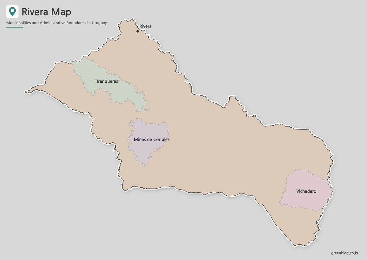
The color version separates the three municipalities from the surrounding departmental area without making the page visually crowded. Tranqueras, Minas de Corrales, and Vichadero can be compared immediately, while the capital marker remains visible near the top of the map. Color is especially useful here because the municipalities are far apart and surrounded by a large area shown in a single neutral tone.
This version works well in presentation slides, regional comparison charts, and blog posts introducing northern Uruguay. It also helps students connect municipality names with their approximate positions before moving to a blank worksheet or a more detailed geographic source.
Clean Black and White Version for Documents
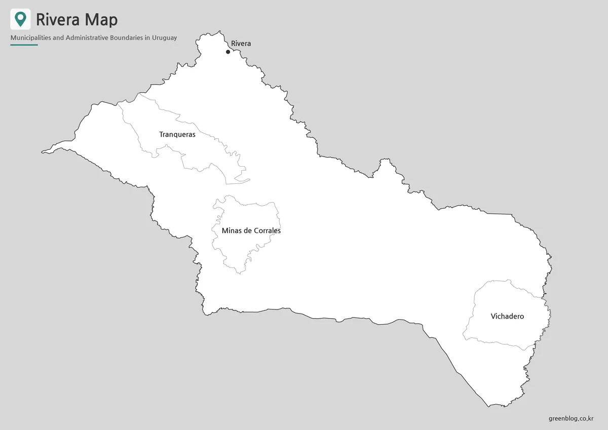
For reports, worksheets, and photocopied classroom material, the black and white layout keeps attention on names and boundary lines. The Rivera map remains easy to scan because only four labels are required: Rivera, Tranqueras, Minas de Corrales, and Vichadero. The large open spaces also leave room for notes when the image is placed in a document.
The simplified appearance is useful when color printing is unavailable or when the map needs to sit beside text, statistics, or a timeline. At A3 size, the municipality labels remain separated enough to support group lessons, printed reference sheets, and wall displays.
Blank Outline Base for Custom Projects
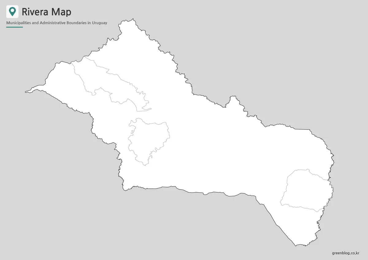
The outline image removes place names and color fills while preserving the department shape and municipal boundaries. Users can add city markers, travel routes, border notes, population values, tourism locations, or their own color scheme. Because the three municipal areas are not adjacent, the blank layout also works well for exercises that ask students to identify each municipality by position.
Designers can use this Rivera map as a base for infographics about the Uruguay–Brazil frontier or for highlighting the contrast between the capital area and the inland municipalities. It is also suitable for presentation annotations because the central and eastern open spaces provide room for labels without covering the boundary lines.
Practical Ways to Use the Files
Choose the color file when quick regional comparison matters, especially for slides or web graphics. Use the black and white file for reports, school assignments, and low-ink printing. Select the outline version when a project requires custom labels, coloring, route marking, or data overlays.
The collection is also useful for travel presentations that introduce Rivera city before showing inland destinations. In geography lessons, the three versions can be used as a sequence: first identify the named areas, then compare their positions, and finally complete an activity on the blank boundary map.
Frequently Asked Questions
What does the Rivera map include?
It includes the department outline, the capital marker, and the municipal boundaries of Tranqueras, Minas de Corrales, and Vichadero. The collection provides color, black and white, and blank outline versions.
Can the files be printed at A3 size?
Yes. The supplied images use an A3 layout, making them suitable for handouts, posters, classroom displays, and presentation boards.
Which version is best for editing?
The outline version is the most flexible choice for adding labels, routes, statistics, colors, or infographic notes.
Is Rivera city one of the three municipalities shown?
Rivera is marked as the departmental capital. The three colored municipal areas shown separately are Tranqueras, Minas de Corrales, and Vichadero.
Download Information
Map File Information
This download includes printable Rivera map versions for educational use, presentation design, document printing, and editable graphic projects.
- Included Versions: Color map, black and white map, outline map
- Printable Size: A3 layout
- File Type: JPG image files
- Intended Use: Classroom handouts, presentations, blog graphics, infographic editing, and printable reference materials
Related Maps
Additional Resources
- Rivera – Uruguay Natural : The official tourism page introduces Rivera’s cross-border relationship with Santana do Livramento, International Square, local attractions, accommodations, and visitor services.
Green Map creates custom-edited map images using open geographic data sources such as geoBoundaries, Natural Earth, OpenStreetMap, and government open data. These maps are edited visual materials, not raw data files, and are provided for education, documents, presentations, and graphic reference.