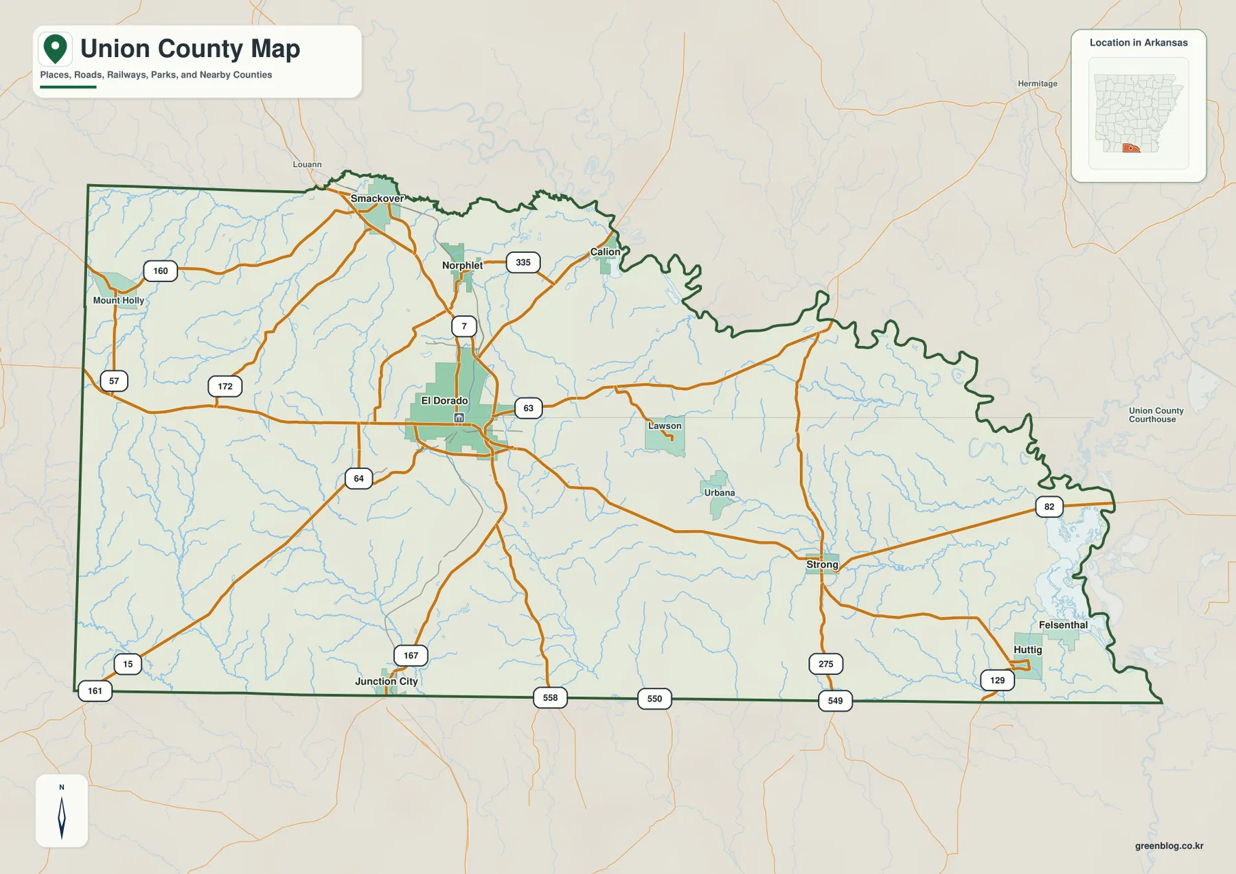
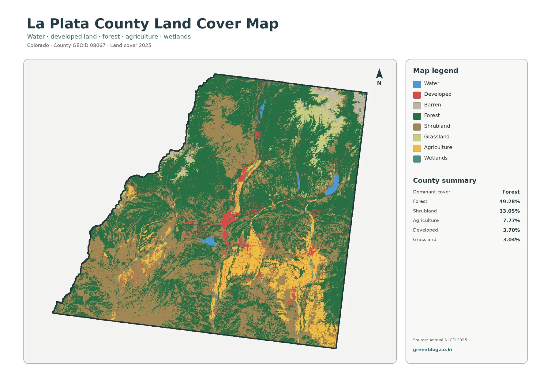
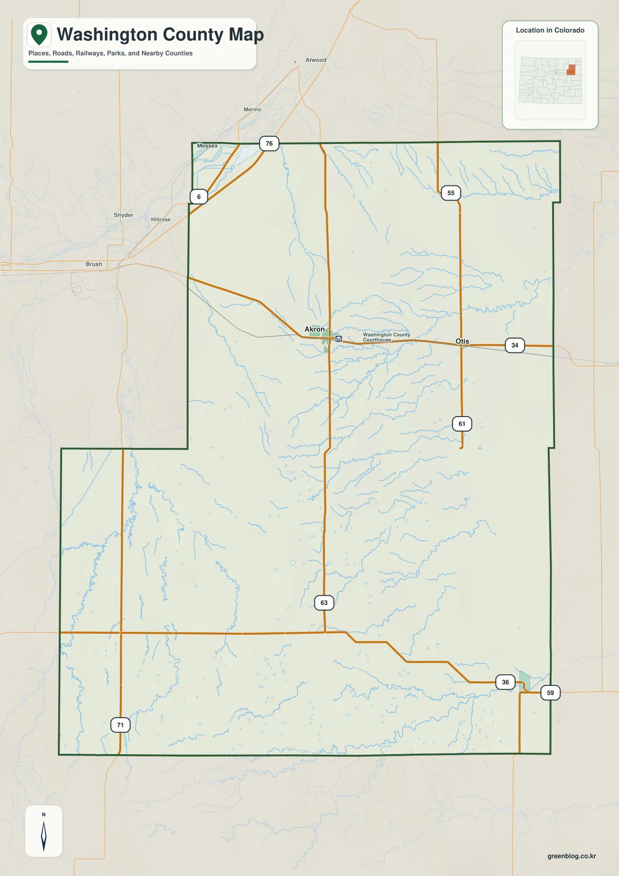
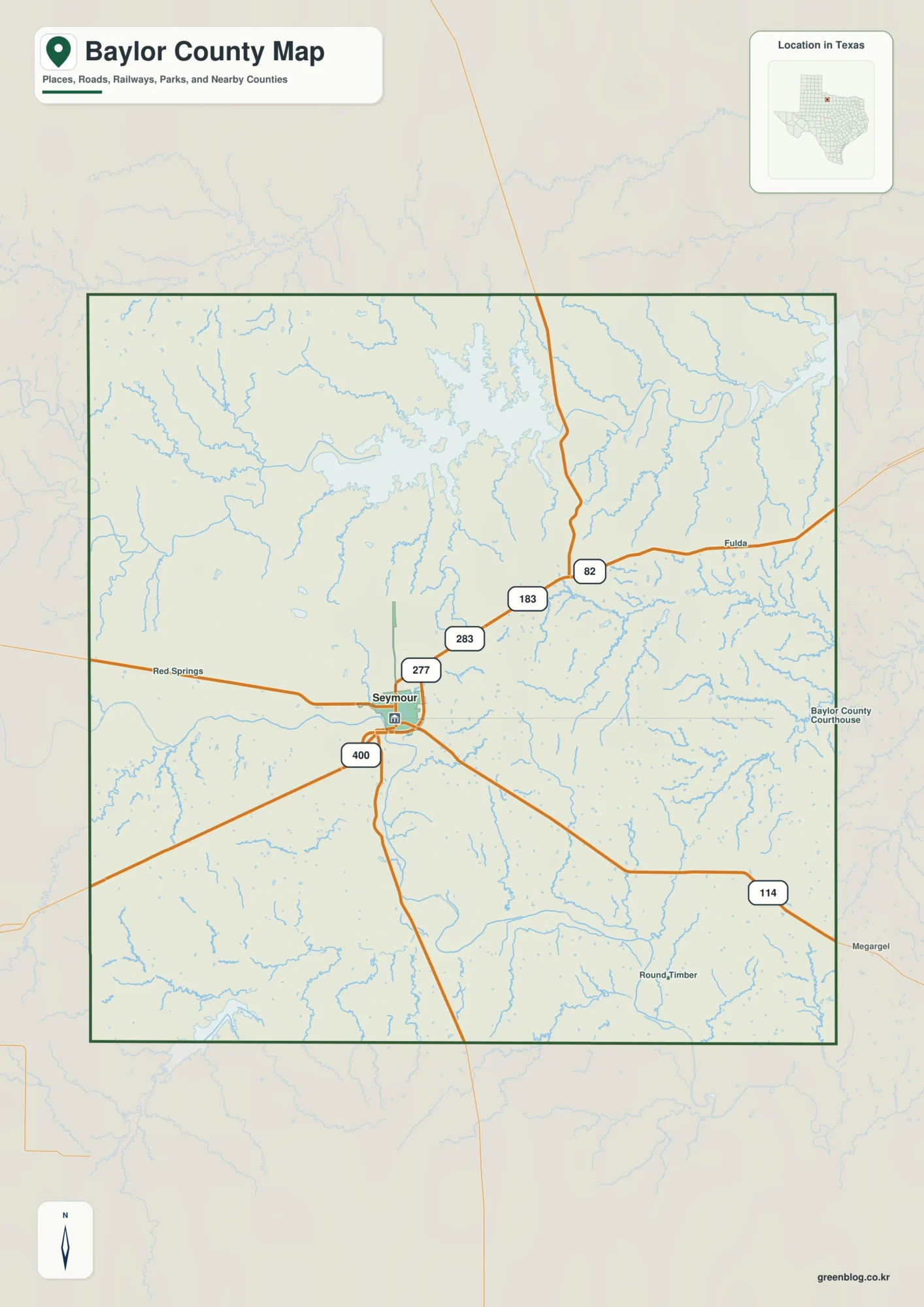
The Pickens County Alabama Map is easiest to understand when the western water landscape and the higher northern and eastern terrain are considered together. Carrollton is the county seat, Aliceville is the largest place on the ranked city map, Gordo and Reform line up with the U.S. 82 corridor, and Pickensville sits close to the Tombigbee system and Aliceville Lake. The four supplied maps separate those layers into a county-and-roads reference, a six-place ranking, a detailed water map, and an elevation map. A ZIP containing four original A3 high-resolution JPG files is available in the download box below.
Pickens County is not organized around one dominant urban center. Its communities face different directions: the eastern side connects toward Tuscaloosa, the northwest reaches the Mississippi state line, the southwest opens toward the Tennessee-Tombigbee Waterway, and the interior centers on Carrollton. The elevation surface adds another layer, showing broad low ground around the western and southwestern waterways and much more broken upland relief toward the north and east. Reading the maps in that sequence gives a clearer picture than treating every town, road, or creek as an isolated label.
Table of Contents
A west-central Alabama county shaped by a state line and major waterways
Pickens County lies in west-central Alabama along the Mississippi state line. The supplied article material places Lamar County to the north, Tuscaloosa County to the east, and Greene and Sumter counties to the south. Carrollton sits near the interior and serves as the county seat, while the western and southwestern sides are strongly influenced by the Tombigbee River, Aliceville Lake, and the larger Tennessee-Tombigbee Waterway system. That combination gives the county a more varied orientation than a simple east-west or north-south description suggests.
| State | Alabama |
|---|---|
| County | Pickens County |
| County seat | Carrollton |
| 2025 population estimate | 18,221 |
| 2020 census population | 19,123 |
| 2020 land area | 881.41 sq mi |
| 2020 population density | 21.7 per sq mi |
| Key routes shown | U.S. 82, AL 17, AL 14, AL 86 and other state routes |
| Major water references | Tombigbee River, Aliceville Lake, Sipsey River and numerous creeks |
The source package gives a July 1, 2025 population estimate of 18,221 and a 2020 census population of 19,123. With 881.41 square miles of land and a 2020 density of 21.7 people per square mile, the county has large stretches between its main communities. The same material reports a 2020-2024 mean commute of 32.6 minutes, a useful reminder that local geography includes travel between separated towns as well as trips to employment and services beyond the county boundary.
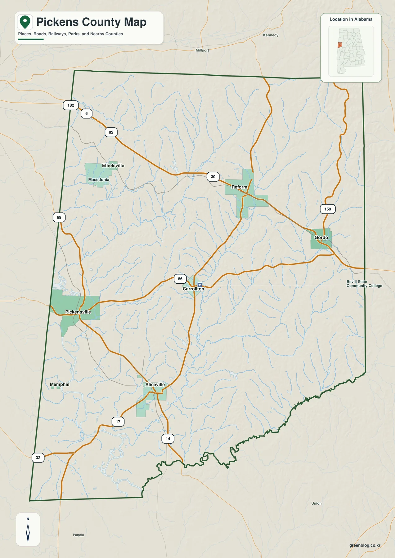
U.S. 82 is the strongest east-west reference on the general map. It crosses the northern part of the county through the Gordo-Reform corridor and continues toward Tuscaloosa on the east side. Alabama 17 provides a useful north-south line through Reform toward Carrollton and Aliceville, while Alabama 86 connects the Carrollton area toward Pickensville. Alabama 14 serves the southern Aliceville side. Because the road network is concentrated into long connecting routes rather than a dense grid, these highways are more useful for orientation than simply measuring the distance between town labels.
Six ranked places reveal separate northern, central, southern, and western centers
The city map highlights six places and prints a ranking value beside each one: Aliceville 2,211, Gordo 1,723, Reform 1,597, Pickensville 803, Carrollton 781, and Memphis 56. Those figures are the values printed in the supplied city index and are best used for comparing the map’s selected places rather than as a replacement for a separately dated population table. The visual pattern matters more than the numbers alone. Aliceville anchors the south, Gordo and Reform form a northern pair along the highway corridor, Carrollton occupies the interior, and Pickensville and Memphis mark the western side.
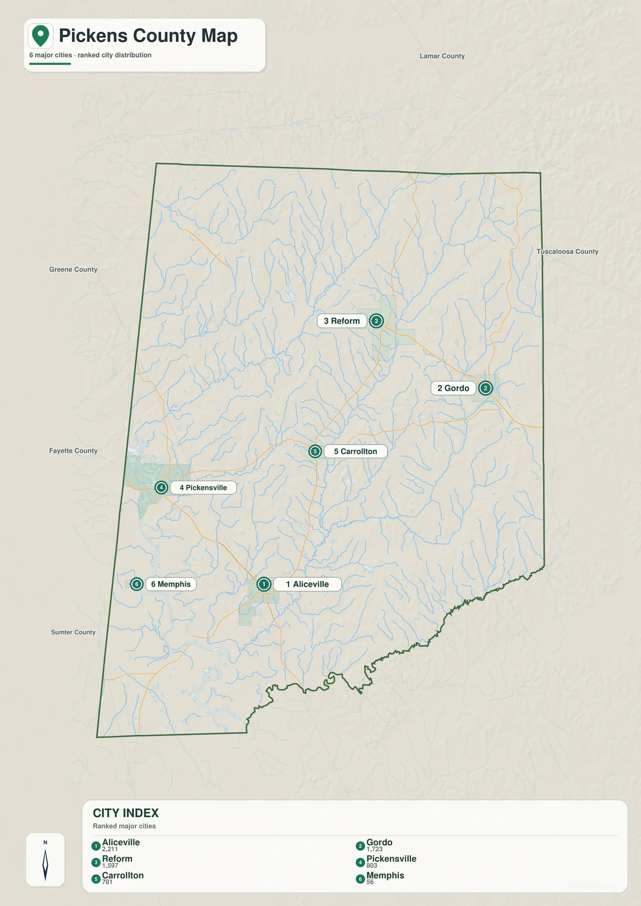
The ranked city map is not the same thing as an official municipality list. The Pickens County government material identifies Aliceville, Carrollton, Ethelsville, Gordo, Pickensville, and Reform as municipalities, while the ranking map includes Memphis and omits Ethelsville. That distinction is useful for choosing the right reference. Use the official list when legal municipal status matters; use the city map when the goal is to compare the selected places and see how they are distributed across the county.
Carrollton has an importance that its rank alone does not show. The supplied history material says county government moved there from Pickensville in 1830, shifting the administrative center inland from the Tombigbee side. Aliceville developed as a major southern center with railroad and commercial ties, while Reform grew around a northern transportation setting associated with rail, timber, U.S. 82, and Alabama 17. The map therefore contains communities that became important for different reasons rather than one repeated town pattern.
Gordo’s eastern location gives it a strong relationship with the Tuscaloosa direction. Pickensville, by contrast, belongs to the waterway side of the county and historically served as the first county seat and a river-oriented settlement. Memphis is tiny on the supplied ranking, but its southwestern location is still useful for orienting the lower western side. When these places are read by position and function, the map becomes much more informative than a simple list of town names.
Aliceville Lake and the Tombigbee system dominate the western water map
The terrain-and-water map makes the county’s western and southwestern water landscape impossible to miss. Tombigbee River and Aliceville Lake appear as broad water features rather than narrow tributary lines. The supplied article material also refers to Aliceville Lake as Pickensville Lake and describes it as an approximately 8,300-acre reservoir created by Tom Bevill Lock and Dam near Pickensville. It is part of the Tennessee-Tombigbee Waterway, which gives this side of the county a regional navigation and recreation context that a road-only map does not show.
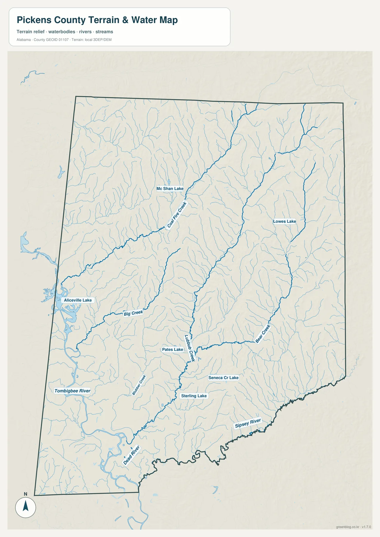
Beyond the large western water bodies, the map shows a dense network of smaller creeks. Big Creek stands out in the southwest, Lubbub Creek runs through the central and southern interior, Coal Fire Creek is visible farther northwest, and Bear Creek appears on the eastern side. Named lakes such as Mc Shan Lake, Lowes Lake, Pates Lake, and Sterling Lake add local reference points that are largely lost on the general county map.
The Sipsey River is particularly important on the southeastern edge. The existing county material explains that part of the lower Sipsey forms the Pickens-Greene county boundary, which helps make sense of the irregular line along the southeast. Comparing that boundary with the Tombigbee side shows two different water relationships: one broad reservoir-and-river landscape in the west and another river boundary at the southeast edge.
This map should be used as a geographic water reference, not as a flood-risk, legal-boundary, or navigation product. It is well suited to classroom work, local-history context, map design, or any project that needs named waterways placed inside the county boundary. It is not a substitute for current flood maps, parcel surveys, boating charts, or site-specific hydrologic analysis.
Elevation rises from the southwestern lowlands into northern and eastern ridges
The elevation map gives the clearest visual explanation for Pickens County’s physical contrast. Its printed summary shows an actual elevation range of 33 to 187 meters and a mean of 83 meters. The lowest green terrain spreads across much of the western and southwestern side near the Tombigbee system and Aliceville Lake. Moving north and east, the surface becomes much more textured, with brighter and brown ridges appearing repeatedly across the uplands.
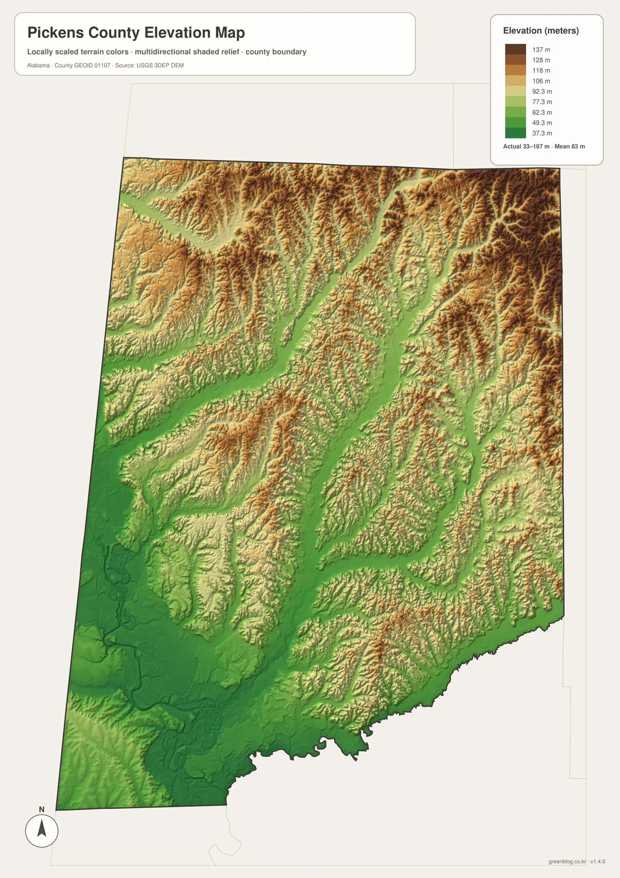
That difference helps explain why the county map looks more open around parts of Aliceville and Pickensville but more broken farther north and east. Gordo and Reform sit within a landscape where ridges and valleys are more frequent, while Carrollton occupies the interior between the two broad terrain patterns. Roads in the more rugged sections often bend through lower passages rather than cutting across every ridge in a straight line, so the elevation layer adds context that cannot be read from highway symbols alone.
The supplied background places Pickens County within the East Gulf Coastal Plain and describes timbered northern uplands grading toward rolling plains and lower river environments. The elevation map supports that broad contrast without requiring technical terrain analysis. It is useful for comparing the county’s higher and lower sections, creating educational material, or adding relief to a local map project. It should not be treated as survey-grade elevation for a parcel, engineering design, construction, or drainage calculation.
U.S. 82 and Alabama 17 organize travel between otherwise separated communities
For practical orientation, start with U.S. 82 across the north. Gordo and Reform sit along this route, and the east side continues toward the Tuscaloosa direction. The road therefore functions as the clearest reference for the county’s northern communities and its strongest eastward connection. Its position also explains why the northern towns feel distinct from Aliceville and Pickensville even though all are in the same county.
Alabama 17 provides the contrasting north-south link. It connects the Reform area toward Carrollton and Aliceville, making it one of the most useful routes for relating the county seat to the southern population center. Alabama 86 supports the Carrollton-Pickensville direction, while Alabama 14 is important around Aliceville and the southwestern side. Together these roads form a simple framework for moving between the county’s main settlement zones.
The west side adds another complication because Mississippi, the Tombigbee system, and local water crossings all influence movement. Ethelsville serves as a useful northwest border reference, while Pickensville belongs to the waterway side. On the east, Gordo has a more direct relationship with Tuscaloosa County. Two places can therefore be similar distances from Carrollton but have very different travel connections depending on the highway, state line, or water feature between them.
The county’s history reinforces the same pattern. Reform and Aliceville both developed with important railroad influences, Pickensville grew from the river and later waterway setting, and Carrollton reflects the deliberate choice of an inland government center. Those differences are still visible in the modern map because the communities remain positioned along different transportation and physical corridors.
Choose the map according to the detail you actually need
Use the general county map when you need boundaries, towns, numbered roads, waterways, and nearby context together. It is the best all-purpose reference for finding Carrollton, Aliceville, Gordo, Reform, Pickensville, and Ethelsville while keeping U.S. 82 and the main state highways visible. The ranked city map is better when the main question is how the six selected places compare in size and where they sit relative to one another.
Use the water map when Tombigbee River, Aliceville Lake, Sipsey River, or named creeks are the focus. Its smaller tributaries and lakes are far easier to see than on the general map. Choose the elevation map when the question is terrain rather than labels: the strongest pattern is the transition from low western and southwestern water country to increasingly rugged uplands toward the north and east.
For teaching, printing, local research, or a personal map project, the four maps work best as complementary references. The general map explains position and travel, the city map simplifies the settlement pattern, the water map isolates rivers and lakes, and the elevation map explains why the land itself changes across the county. Keeping those functions separate avoids the clutter that would result from forcing every layer into one image.
Frequently Asked Questions
Why is Carrollton the county seat when Aliceville is larger on the city map?
The supplied history material says Pickensville was the first county seat and that county government moved to more centrally located Carrollton in 1830. Aliceville later developed into the larger southern center, so administrative importance and population rank are not the same thing. The general map is useful for the county-seat role, while the city map makes the present settlement hierarchy easier to compare.
Does the ranked city map show every official municipality?
No. The ranking shows Aliceville, Gordo, Reform, Pickensville, Carrollton, and Memphis. The official Pickens County municipality list includes Ethelsville instead of Memphis. Use the ranked map for relative position and the official county source when formal municipal status matters.
What becomes clearer when the water and elevation maps are compared?
The broad Tombigbee and Aliceville Lake side aligns with some of the county’s lowest terrain, while higher and more closely spaced ridges become common toward the north and east. Comparing the two maps makes it easier to see how major waterways occupy lower ground and how the county’s uplands differ from the western water landscape.
Map File Information
Pickens County map files
- Included Versions: county, city, water, elevation
Related Maps
- Abbeville, Headland, and Lake Eufaula on the Henry County Alabama Map
- Athens to Wheeler Reservoir on the Limestone County Alabama Map
- Autauga County Map
Sources and references
- U.S. Census Bureau QuickFacts — Pickens County population, area, and commute background
- Pickens County official community and transportation information — county communities and transportation context
- Pickens County official municipality list — incorporated place reference
- U.S. Army Corps of Engineers Tennessee-Tombigbee Waterway — waterway and Aliceville Lake context
- Encyclopedia of Alabama: Pickens County — county history and physical background
Green Map creates custom-edited map images using open geographic data sources such as geoBoundaries, Natural Earth, OpenStreetMap, and government open data. These maps are edited visual materials, not raw data files, and are provided for education, documents, presentations, and graphic reference.