A Taitung County map brings together one of Taiwan’s most geographically dispersed local areas: a long Pacific-facing mainland corridor, mountain-side townships to the west, and the offshore islands of Green Island and Lanyu. The county’s shape is not easily understood from a city-centered reference alone. A single page that shows the coast, interior boundaries, neighboring counties, and island insets makes the administrative pattern much easier to read.
This printable set provides three views of the same boundary layout: a color administrative map, a labeled black-and-white map, and an unlabeled outline map. Each serves a different task. The color edition separates adjoining townships at a glance; the monochrome edition gives reports and handouts a quieter reference image; and the outline edition leaves room for personal labels, route notes, or classroom activities.
The maps are arranged for A3 printing and use image files. They are practical for learners comparing Taiwan’s local divisions, presenters explaining the east coast, writers adding geographic context to a page, and designers building a simple county-level graphic. Rather than treating Taitung City as the entire area, the collection helps readers see its relationship with rural townships, the coastline, and the island townships administered as part of Taitung County.
Table of Contents
Taitung County Map Overview
Located on southeastern Taiwan, Taitung County faces the Philippine Sea along its eastern side. Hualien lies to the north, Pingtung is shown toward the south, and Kaohsiung occupies the broad western side of the map. The mainland portion follows a notably narrow north-to-south coastal route in places, while the county also extends inland toward much larger mountain areas. This contrast is a central reason why a Taitung County map is more informative than a simple point marker on a map of Taiwan.
The labeled view shows Taitung near the central coast, with Beinan immediately inland and northward connections through Luye, Donghe, Chenggong, and Changbin. On the western side, Haiduan and Yanping occupy large interior areas, while Guanshan and Chishang appear as smaller adjoining townships within the northern inland pattern. Farther south, Jinfeng, Taimali, Dawu, and Daren continue the county’s coastal-and-mountain sequence toward Pingtung.
Two island insets are especially important when reading the county as an administrative unit. Green Island appears east of the mainland, while Lanyu is placed much farther southeast. Their separate placement explains why the county cannot be represented accurately as one continuous land shape. The map also labels the surrounding sea and neighboring areas, giving readers a clear sense of distance and direction without turning the page into a road or tourism map.
Printable Map Collection
The three supplied designs retain the same recognizable county outline and township boundaries, so they can be compared without relearning the layout. Labels are included on the color and black-and-white versions, while the outline design removes place names and filled areas. That progression is useful when a project needs to move from reference reading to annotation.
The vertical A3 arrangement gives the long mainland coastline room to remain legible while preserving separate space for Green Island and Lanyu. This layout choice matters here: reducing the map too aggressively would make the narrow coastal townships and the offshore insets difficult to distinguish. The neighboring labels for Hualien, Kaohsiung, and Pingtung also help orient readers who are comparing Taitung with other parts of Taiwan.
Color-Coded Administrative Map
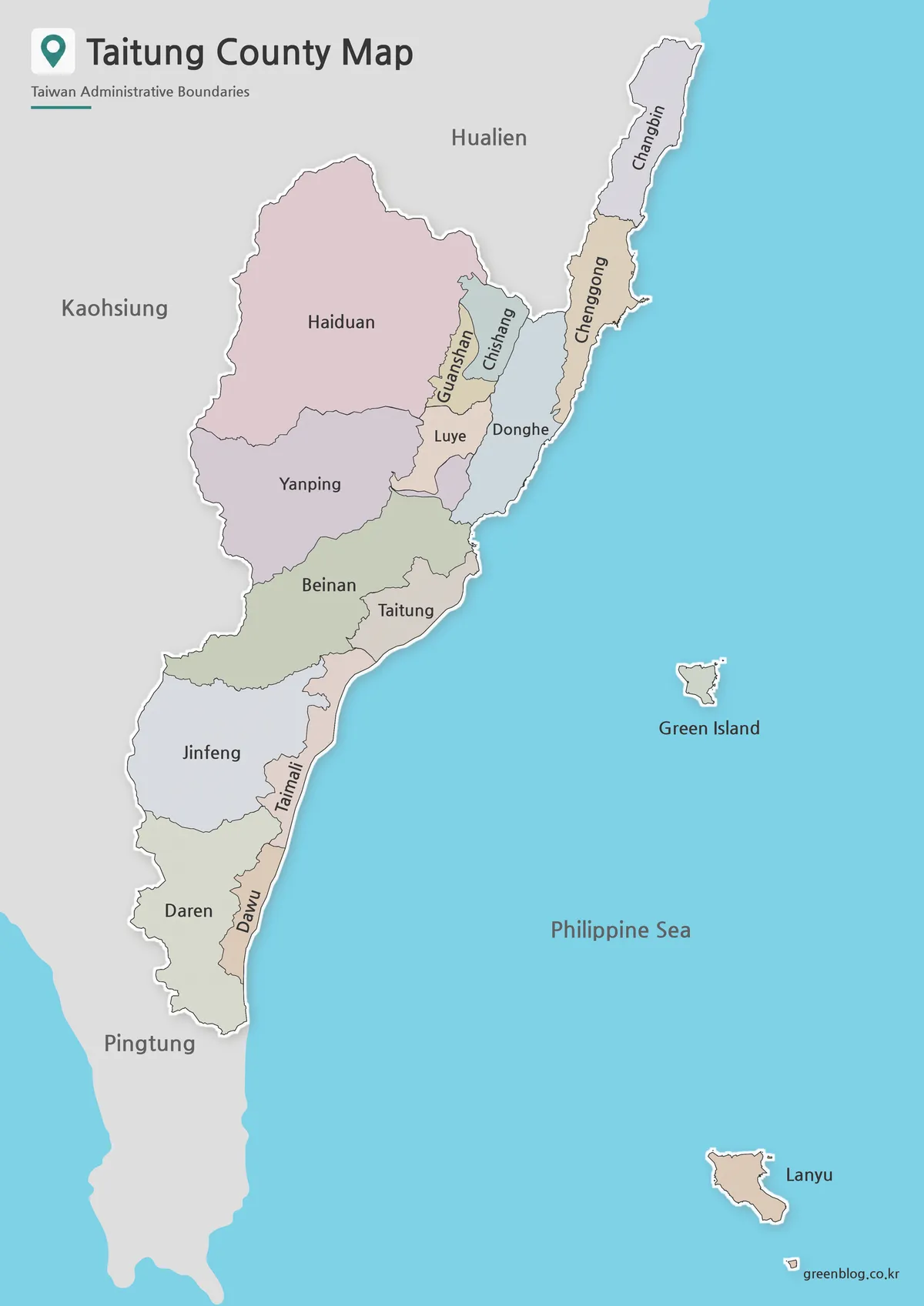
Color is most helpful when the goal is to compare adjacent jurisdictions quickly. On this Taitung County map, the broad inland areas of Haiduan, Yanping, and Beinan are visually separated from the slim coastal sequence that includes Donghe, Chenggong, Taimali, and Dawu. The differing fills also make compact areas such as Guanshan and Chishang easier to locate within the northern interior.
For a slide, poster, or regional comparison graphic, this version makes the county’s changing width easy to explain: substantial mountain-side townships on the west, a Pacific edge on the east, and island districts set apart in the sea. It is particularly useful when a viewer needs to identify individual township areas before discussing a route, local topic, or administrative comparison.
Black and White Printable Version
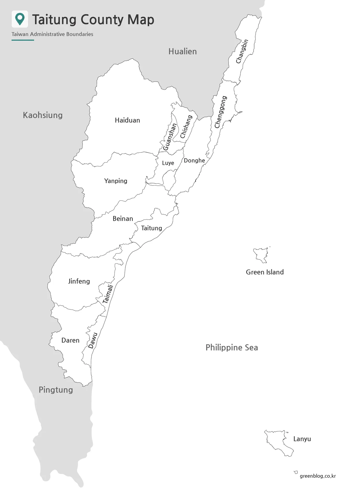
The monochrome version is intended for situations where labels, outlines, and page balance matter more than color differentiation. Its restrained presentation fits a worksheet, briefing paper, research appendix, or presentation page that already contains charts and text. Readers can trace the coastal line from Changbin to Daren while still seeing where Taitung, Beinan, and the inland townships sit in relation to one another.
Because Green Island and Lanyu remain labeled as separate insets, the map still communicates the county’s full extent without relying on colored fills. Choose this edition when the map needs to reproduce consistently alongside written material or when a clean reference image is preferable to a more decorative visual treatment.
Blank Outline Map for Editing
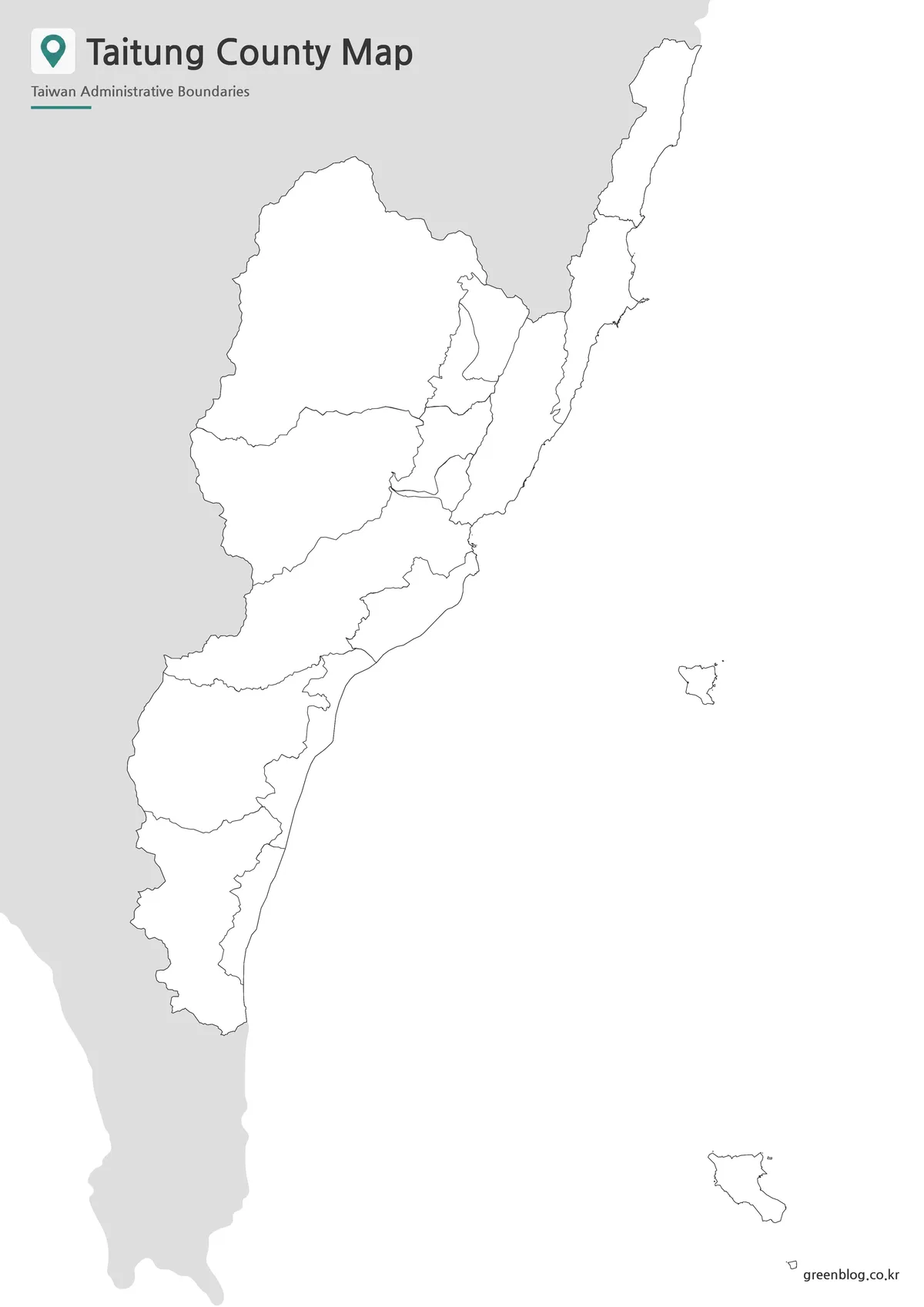
The outline edition preserves the county boundary framework but removes the labels and color fills. That makes it a flexible starting point for a lesson in which students identify townships, a presentation that highlights only selected areas, or an infographic that overlays original symbols and statistics. A reader can mark the Pacific coast, distinguish the interior from the shoreline, or add separate callouts for Green Island and Lanyu without competing with existing text.
For travel-oriented planning, annotations can be kept geographic rather than promotional: mark Taitung City as a mainland reference point, draw a coastal sequence through the southern townships, or use arrows to show the island insets’ offshore position. For classroom work, the blank boundaries support exercises on recognizing how a single county can include both extensive upland territory and islands far from the main administrative center.
Practical Uses for This Map
Select the version according to what the reader must do next. Use the color map when comparing township positions visually is the priority, particularly in a presentation or a regional overview. Use the black-and-white map when labels need to sit comfortably beside written notes, tables, or printed questions. Use the blank outline when the project requires custom information rather than a finished labeled reference.
In a Taiwan geography lesson, the Taitung County map can support a discussion of why coastal, inland, and offshore areas may belong to the same county. A teacher might ask students to identify the north-to-south mainland pattern, locate the neighboring Hualien and Pingtung directions, then add their own labels to the outline page. This is more place-specific than a generic boundary exercise because Green Island and Lanyu must be read as part of the same county despite their distance from the mainland.
For editorial or design work, keep the map within its actual scope. It is an administrative reference image, not a detailed transport, terrain, or attraction guide. Its strengths are the township outlines, visible place labels on the two labeled versions, the contextual neighboring areas, and the distinct island insets. Those features make it suitable for a county introduction, a regional comparison, or a clean supporting graphic where geographic orientation matters.
FAQ
Where is Taitung County located?
Taitung County is located in southeastern Taiwan. It stretches along the Pacific coast and connects with Hualien County to the north and the Pingtung direction to the south.
What is included in this Taitung County map collection?
The collection includes color, black and white, and outline versions. These versions are designed for printing, classroom use, presentation design, and simple editing projects.
Is Taitung City the same as Taitung County?
No. Taitung County refers to the full county, while Taitung City is the county seat and one administrative area within the county.
Is Ludao the same as Green Island?
Yes. Ludao is commonly known in English as Green Island. On administrative maps, it may appear as Ludao Township or Green Island Township.
Which version is best for editing?
The outline map is the best choice for editing. It provides boundary lines without filled colors, making it easier to add labels, routes, icons, or regional highlights.
Map File Information
This download provides three printable Taitung County administrative map styles for reference, annotation, classroom activities, and page layouts.
- Included Versions: Color map, black and white map, outline map
- Printable Size: A3 layout
- File Type: Image files
- Intended Use: Reference handouts, presentations, worksheets, annotations, and simple map graphics
Additional Resources
- Taitung Travel – Official Tourism Website: Visit this official county resource for visitor information and location context across Taitung’s mainland and island areas.
Related Maps
Green Map creates custom-edited map images using open geographic data sources such as geoBoundaries, Natural Earth, OpenStreetMap, and government open data.
These maps are edited visual materials, not raw data files, and are provided for education, documents, presentations, and graphic reference.