A Mactan Island Map is especially useful when planning a trip to Cebu because many first-time visitors do not realize that the airport, beach resorts, island hopping departure points, and Cebu City are not all in the same place. Mactan Island sits just east of Cebu City in the central Philippines and is home to Mactan-Cebu International Airport, making it one of the first areas most travelers pass through after arrival. Although the island is not very large, its resorts, coastal roads, memorial sites, shopping areas, and nearby island destinations are spread across different parts of the island.
This printable Mactan Island Map collection includes three versions: a color travel map, a black and white printable map, and a blank outline map. The original map size is 4463×2753, which makes it suitable for travel planning sheets, blog graphics, presentation images, and editable map projects. The map was created with a travel-focused layout rather than a full administrative style, so the main goal is to help users understand where key attractions and island areas are located.
Mactan Island is part of Cebu Province and is mainly associated with Lapu-Lapu City and Cordova. The island is often used as a base for beach resorts, snorkeling, diving, island hopping, and short trips to nearby coastal destinations. Because Cebu City is located across the water from Mactan, a simple city map of Cebu is not always enough for planning a practical itinerary. A separate Mactan Island travel map makes it easier to compare the airport area, resort zones, tourist spots, and island tour locations at a glance.
While preparing this map collection, the layout was kept cleaner than a general road map. Spa listings and minor facilities were not included because they can make the map too crowded for travel use. Instead, the focus was placed on recognizable landmarks, coastal points, and places that travelers are more likely to search for when planning a Cebu trip.
Table of Contents
What This Mactan Island Map Includes
This Mactan Island Map highlights major points around Mactan Island rather than trying to show every road, shop, or local facility. It includes tourist-oriented locations such as the Magellan Monument, Lapu-Lapu Shrine, Island Central Mactan, Virgen de la Regla National Shrine, and nearby island destinations such as Caohagan Island. This makes the map more useful for itinerary planning, travel blog content, and visual explanations than a dense administrative reference map.
English place names are used throughout the map because they are easier to match with online booking platforms, navigation apps, hotel listings, and travel guides. For travelers moving between the airport, resort areas, and island tour departure points, the English labeling also helps reduce confusion when comparing the map with local search results.
Color Travel Map for Tourist Spots and Island Layout
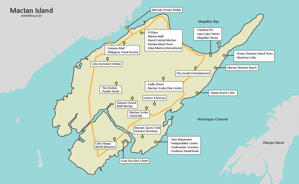
Designed around travel readability, the color Mactan Island Map helps separate land, sea, coastal areas, and nearby island locations more clearly. This matters for Mactan because many activities are connected to beaches, resorts, and boat trips rather than only inland roads. The color layout makes it easier to see how the island sits between Cebu City and the surrounding waters.
The color version works well for travel blog images, itinerary guides, presentation slides, and quick visual references. If someone is trying to explain where Mactan-Cebu International Airport is located in relation to beach resorts or island hopping areas, this version gives the clearest first impression. It is also the best choice when the map will be viewed on a screen rather than printed in black and white.
During the map preparation process, tourist locations were selected with readability in mind. Adding too many labels would make the island look cluttered, especially around coastal and resort areas. The final Mactan Island Map layout keeps the most useful travel points visible while leaving enough space for the island shape and nearby water areas to remain easy to read.
Black and White Printable Version
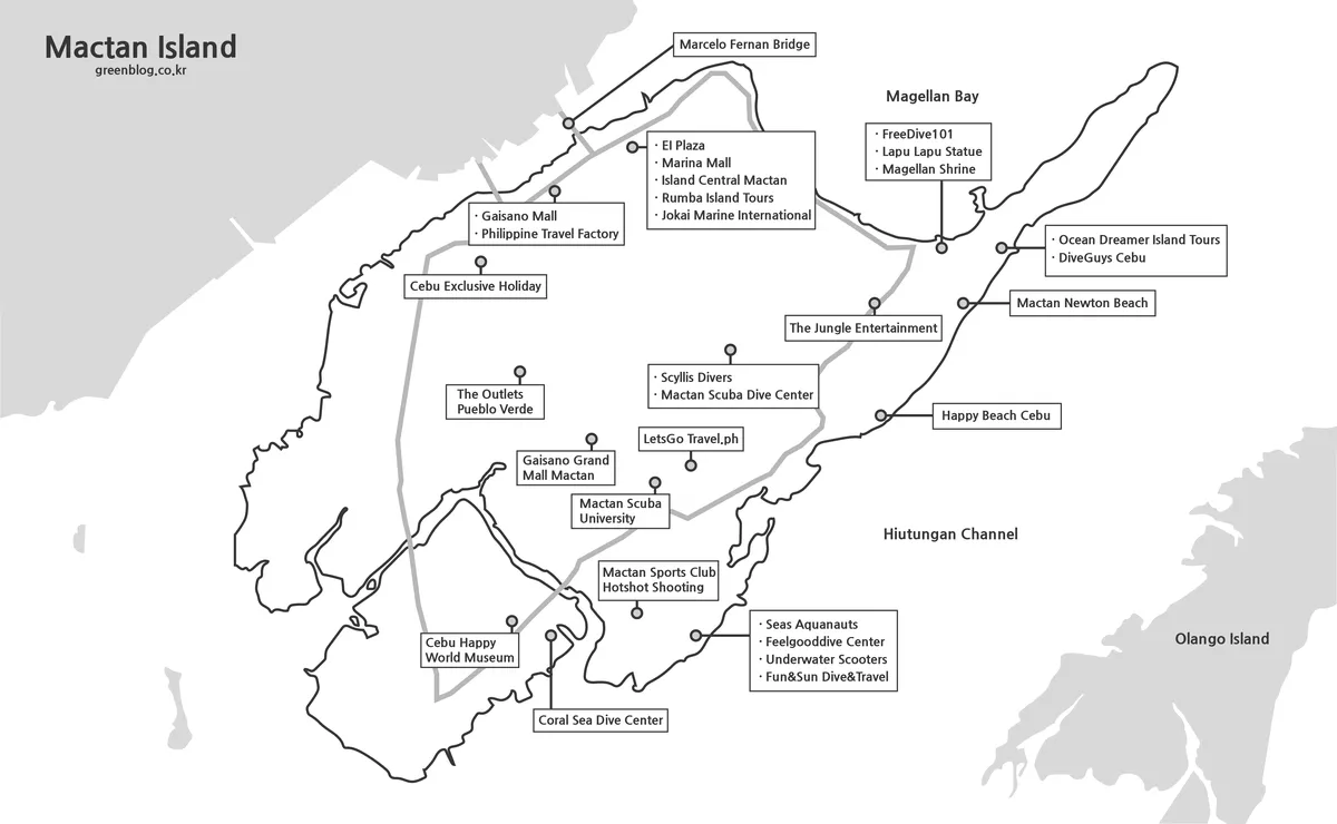
For printed materials, the black and white Mactan Island Map provides a cleaner layout for notes, itinerary planning, and handouts. Since Mactan has tourist spots spread across several directions, a simplified printable version is helpful when users want to mark hotels, airport transfers, island hopping routes, or places to visit during a short Cebu trip.
The black and white style also works well for travel worksheets, personal planning pages, and printed reference sheets. Instead of relying on color contrast, the map uses a simpler visual structure so labels and coastline shapes remain clear after printing. This is useful when preparing a travel folder, group trip plan, or document that needs to be printed without using much ink.
The original file was prepared in a large size, so users who need sharper labels should use the downloadable version rather than the preview image shown on the page. The preview is fine for quick viewing, but the full-size file is better for printing and enlarged viewing.
Blank Outline Map for Editing and Route Marking
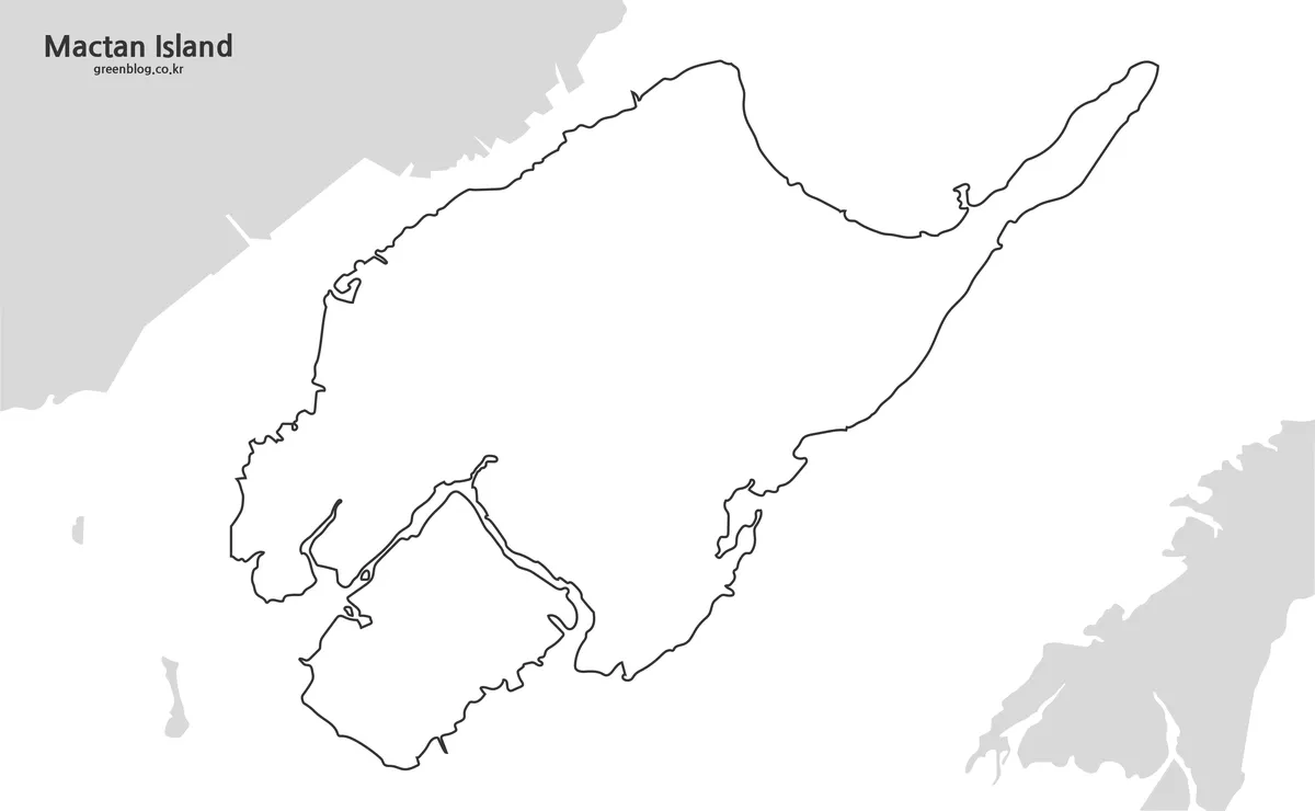
The outline version removes most visual details and leaves a clean base map of Mactan Island. This blank Mactan Island outline map is useful when users want to add their own information, such as resort markers, boat routes, snorkeling locations, airport transfer paths, or custom travel notes.
For designers and bloggers, the outline version can be used as a background for infographics, card news images, YouTube travel visuals, or Pinterest graphics. Because the map is not crowded with labels, it is easier to add icons, arrows, highlights, or color overlays without fighting against existing map details.
This version is also useful for comparing travel areas. For example, users can mark the airport zone, beach resort side, Cordova area, or island hopping routes separately. Instead of using a finished map as-is, the outline map gives creators a flexible working base.
Practical Ways to Use the Mactan Island Map
Travelers can use the map before arriving in Cebu to understand whether their hotel is closer to the airport, beach resorts, or bridge connections to Cebu City. This is helpful because staying on Mactan Island feels very different from staying in Cebu City. Mactan is better known for resorts, coastal activities, and airport access, while Cebu City is more urban and often used for shopping, city tours, and transportation connections.
The map is also useful for bloggers and travel writers who want to explain Cebu itineraries visually. A written itinerary may say “stay near Mactan” or “take an island hopping tour,” but a map helps readers understand where those activities actually take place. For presentation creators, the map can be used in travel slides, tourism materials, or regional comparison graphics.
Teachers and students may also use the outline version for geography activities or island-based map projects. Since Mactan Island is connected to Cebu travel, tourism, aviation, and coastal geography, the map can support visual lessons or simple location-based assignments.
Frequently Asked Questions
What is included in this Mactan Island Map collection?
The collection includes a color travel map, a black and white printable map, and a blank outline map. Each version is designed for a different purpose, from travel planning to graphic editing.
Is this Mactan Island Map suitable for printing?
Yes. The original map size is 4463×2753, which gives users more detail than a small preview image. For printing, the black and white version is usually the easiest to use.
Why are the labels written in English?
English labels make it easier to match places with hotel booking sites, navigation apps, travel guides, and local search results used by international travelers.
Can I use the outline map for travel route marking?
Yes. The blank outline version works well for marking airport transfers, resort locations, island hopping routes, and custom travel notes.
Download Information
The preview images on the page are reduced for faster loading. For printing, enlarged viewing, or editing work, use the original downloadable map files.
Mactan Island Map Download
Download the printable Mactan Island map collection, including color, black and white, and outline versions for travel planning, printing, and graphic editing.
- Image size: 4463×2753
- Created with: Illustrator
- Included versions: Color travel map / Black and white map / Outline map
- Intended use: Cebu travel planning, tourist spot reference, printable handouts, blog graphics, and editable map projects
Related Maps
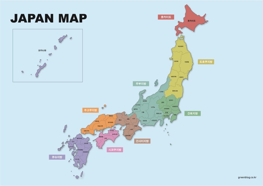
- 4 Japan Maps Download Collection for Print and Design
- South Korea Maps Download: 6-Map Collection
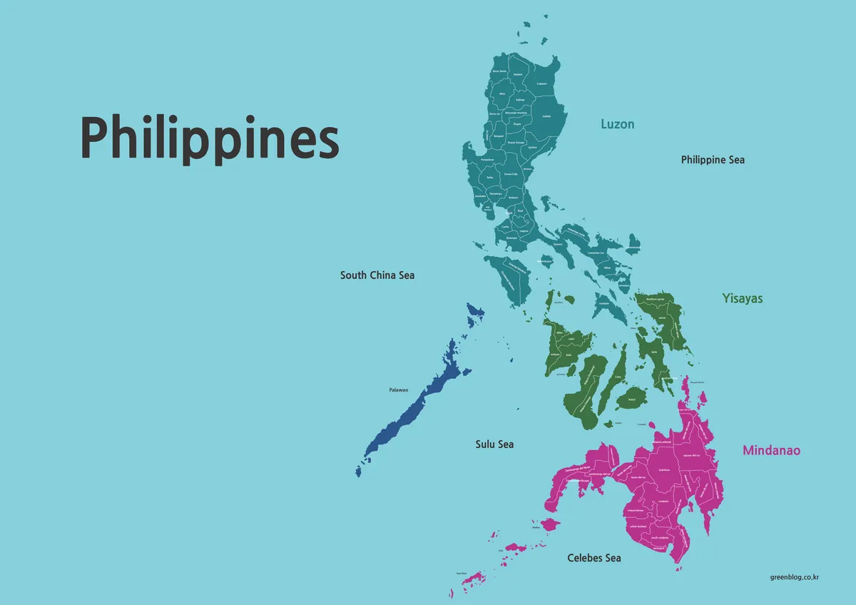
- Philippines Maps Collection Download (3 Printable Maps)
- China Maps Download Collection – 4 Regional Map Types
Additional Resources
- Google Maps : Useful for comparing Mactan Island tourist spots, resort areas, airport access, and nearby island locations with live map data.