A Democratic Republic of the Congo Map is especially useful when explaining one of Africa’s largest countries by area. The Democratic Republic of the Congo, often shortened to DRC, is located in Central Africa and shares borders with many countries, including Angola, Zambia, Tanzania, Uganda, South Sudan, the Central African Republic, the Republic of the Congo, Rwanda, and Burundi. Because of this wide border network, a clear printable map helps readers understand the country’s position much faster than a written description alone.
This printable Democratic Republic of the Congo Map collection includes three practical versions: a color province map, a black and white labeled map, and a blank outline map. The files were prepared for A3-size use and are suitable for classroom handouts, educational worksheets, presentation slides, blog graphics, regional comparison materials, and editable infographic projects. The focus is not street navigation, but a clean visual structure that shows the country’s large shape, provincial divisions, and surrounding geographic context.
The DRC covers a very large area in Central Africa, so spacing, label placement, and boundary clarity matter more than they would on a small country map. While preparing this map collection, the layout was organized to keep the province structure readable without adding unnecessary detail. The original shape was built in Illustrator, then color work was completed in Photoshop to make the map easier to use in both printed and digital formats.
Another important part of the preparation was the administrative structure. The map was organized around the current 25-province system plus Kinshasa, rather than the older 10-province structure. That makes the Democratic Republic of the Congo Map more practical for users who need a modern province-level reference for education, research visuals, resource-related explanations, or Central Africa comparison graphics.
Table of Contents
Democratic Republic of the Congo Map Overview
The Democratic Republic of the Congo is a large inland country with a small Atlantic outlet in western Central Africa. Its scale makes it a useful map subject for lessons about African geography, natural resources, regional boundaries, and country size comparisons. Kinshasa, the capital, is located in the western part of the country near the Republic of the Congo, while many other provinces extend deep into central and eastern Africa.
Because the country shares borders with numerous neighbors, a labeled Democratic Republic of the Congo Map can help readers quickly understand regional relationships. It is useful for comparing Angola and Zambia to the south, Tanzania and Uganda to the east, and the Central African Republic to the north.
Map Styles Included
This collection includes three map styles for different types of work:
- Color province map
- Black and white labeled map
- Blank outline map
Each format has a different purpose. The color map works best for province comparison, the black and white map is easier to print in documents, and the outline version gives users a clean base for custom editing or data visualization.
Color Province Map for Regional Structure
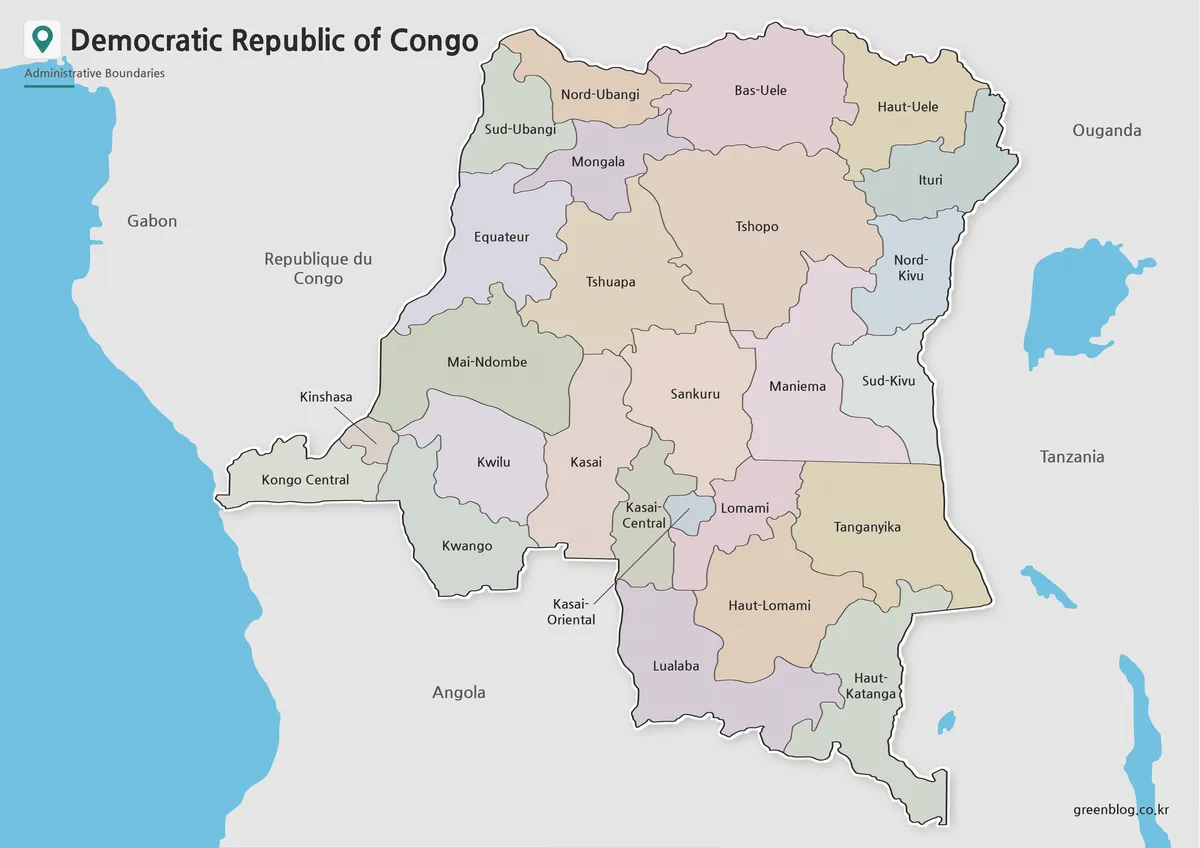
Designed with color-coded provinces, this version makes the DRC’s large administrative layout easier to read. Since the country covers a broad area and has many provincial divisions, color separation helps users compare regions without losing the overall shape of the country.
The map also includes surrounding country names in a simplified way. This gives enough geographic context without making the layout feel crowded. For classroom slides, blog articles, or African country comparison materials, the color Democratic Republic of the Congo Map works well as a main visual reference.
The map reflects the 25-province structure plus Kinshasa, which is important because older references may still show the former province system. The color layout helps distinguish these modern divisions more clearly when explaining administrative geography, regional resources, or national-scale topics.
Black and White Map for Printing and Reports
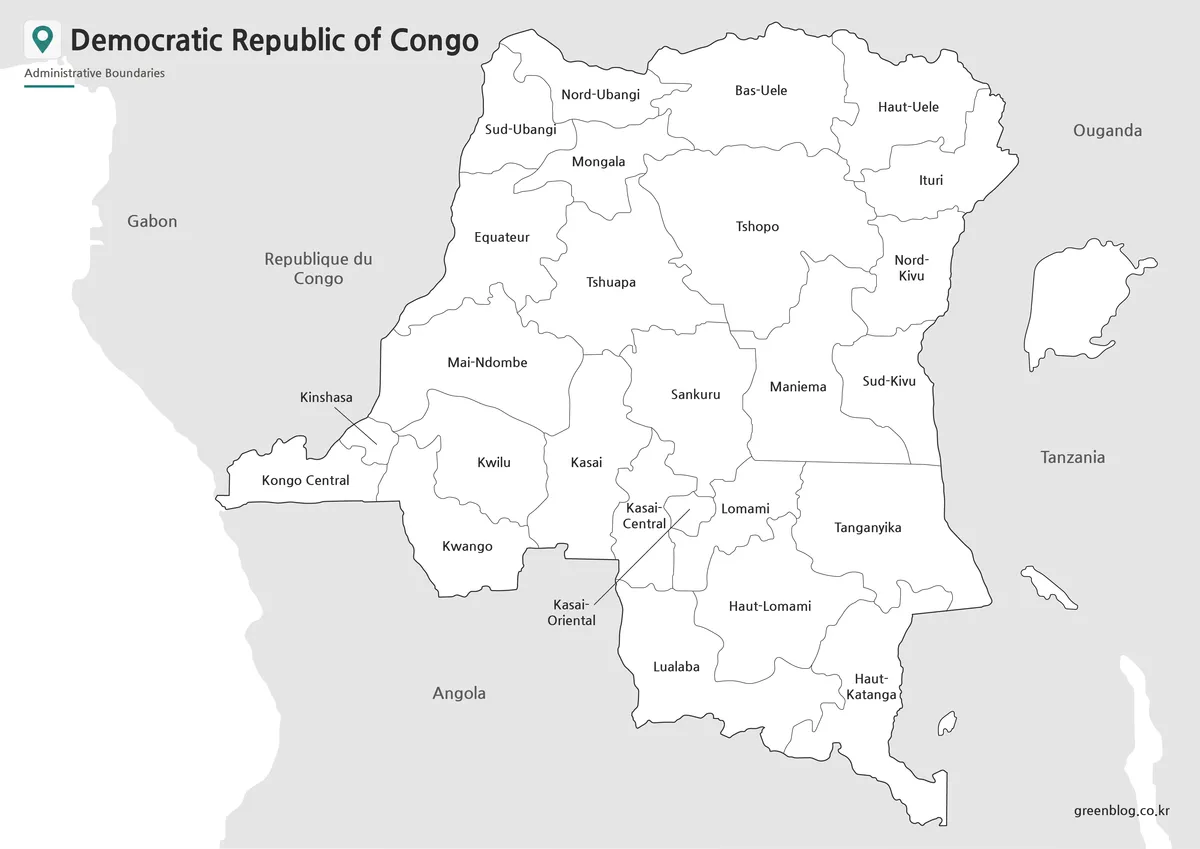
For printed handouts and written documents, the black and white version keeps the focus on labels and boundary lines. Removing color reduces visual weight, which can be helpful when the map is placed inside a report, worksheet, or presentation document.
The DRC is a large country, so label spacing must remain readable even when the map is reduced to fit a page. This version was arranged with print clarity in mind, making it suitable for classroom reference sheets, geography assignments, and educational PDF materials.
A black and white Democratic Republic of the Congo Map is also useful when users want to add their own marks. Teachers can circle provinces, students can write notes, and bloggers can place arrows or simple highlights without fighting against background colors.
Blank Outline Map for Editing and Data Projects
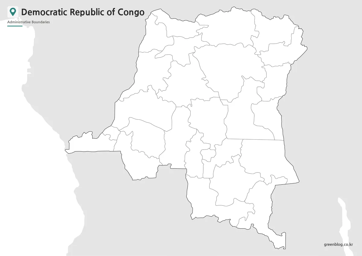
The outline version removes both color and labels, leaving province boundary lines as a clean working base. This is the most flexible format for users who want to create their own map-based content.
A blank Democratic Republic of the Congo Map can be used to add resource locations, population notes, conflict timeline markers, travel routes, city labels, or regional comparison data. It also works well for classroom coloring activities and map quizzes because students can identify or label the provinces themselves.
For designers, the outline version is useful in Illustrator, Photoshop, presentation software, or infographic layouts. Since unnecessary visual elements are removed, it is easier to apply custom colors, add icons, or highlight selected regions without having to erase existing labels first.
Flag Image
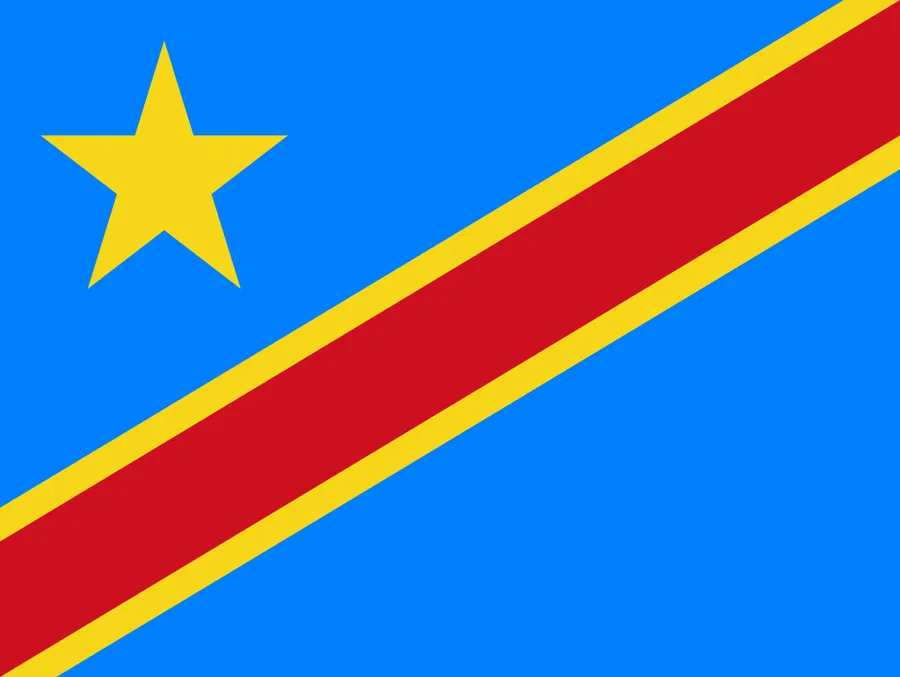
The flag of the Democratic Republic of the Congo includes a blue field, a yellow star, and a diagonal red stripe with yellow borders. When used together with the map, the flag can help complete a country profile page, classroom slide, or travel and geography resource.
For educational materials, pairing the flag with the Democratic Republic of the Congo Map gives readers both national identity and geographic context in one visual section.
Practical Ways to Use This Map Collection
This map collection can support many types of projects, including:
- classroom geography lessons
- African country comparison worksheets
- resource distribution graphics
- presentation slides about Central Africa
- printable study materials
- blog posts and educational articles
- infographic layouts
- editable province-based visuals
The color map is best when you need to explain provincial structure. The black and white map is better for printing and note-taking. The outline map is ideal when you want to build your own visual layer on top of the province boundaries.
Frequently Asked Questions
Does this Democratic Republic of the Congo Map reflect the newer province system?
Yes. The map is organized around the 25-province structure plus Kinshasa, rather than the older 10-province layout.
Is Kinshasa shown separately?
Yes. Kinshasa is treated as a distinct area so readers can identify the capital more easily within the western part of the country.
Are neighboring countries included?
Yes. Surrounding countries are included as simplified labels to help show the DRC’s position in Central Africa without overcrowding the design.
Which version is best for printing?
The black and white version is usually the best choice for printing because labels and boundaries remain clear while using less ink.
Democratic Republic of the Congo Map Download
Choose the Democratic Republic of the Congo map version that fits your project. Printable and editable styles are included for education, presentations, and graphic design work.
- Included Maps: Color province map, black and white map, outline map
- Printable Size: A3
- Administrative Layout: 25 provinces plus Kinshasa
- File Format: Downloadable image files
- Intended Usage: Printing, classroom resources, presentations, infographic design, and editing
- Color Mode: Not specified
Related Maps
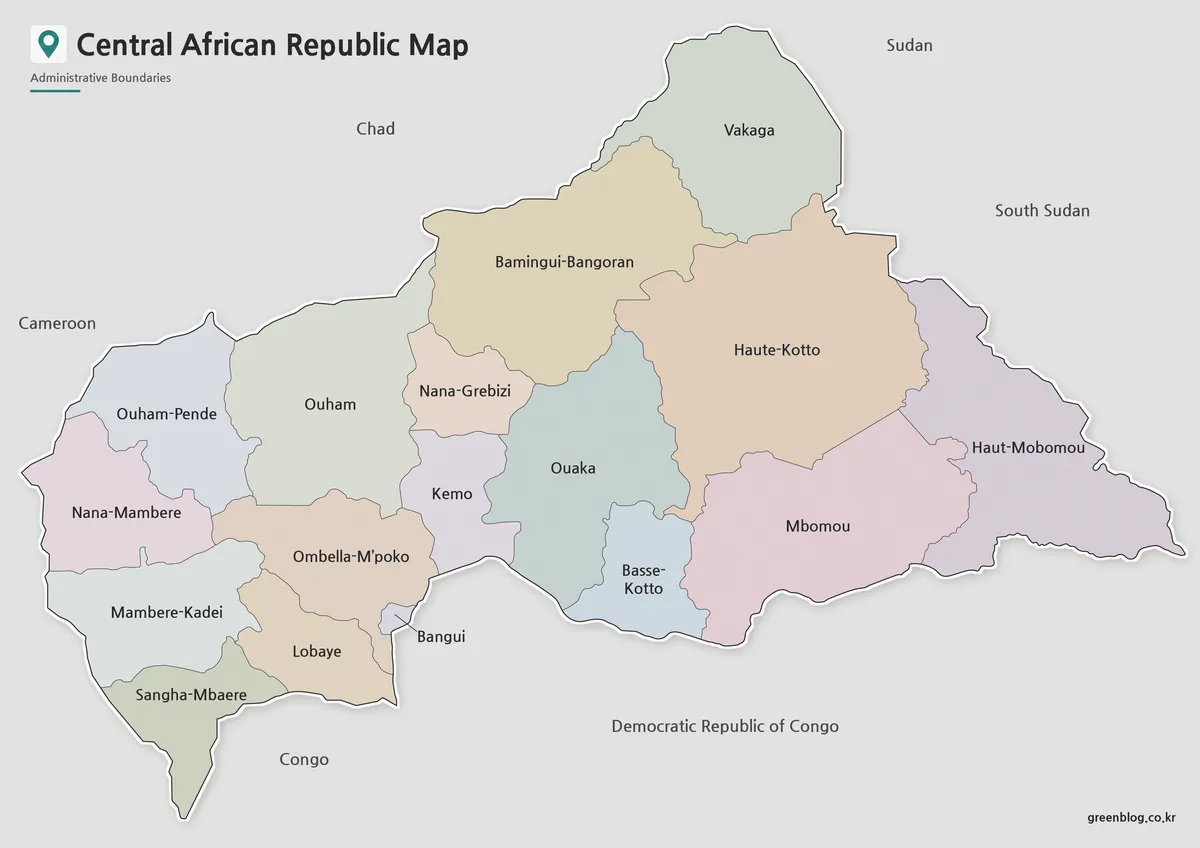
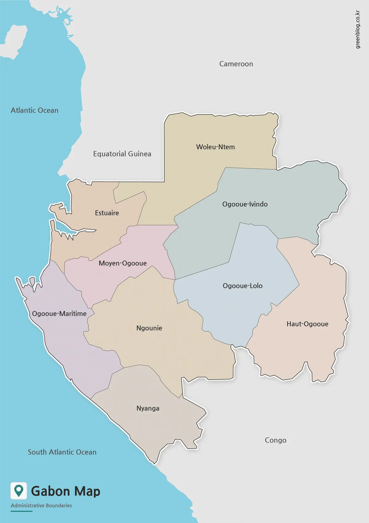
- Gabon Map for Classroom, Presentation and Design Projects
- Central African Republic Map Download | Printable Administrative Map Collection
- Cameroon Map Download | Printable Administrative Map Collection
- Printable Burkina Faso Map for Education, Design and Presentations
Additional Resources
- GRID3 – Geospatial Data DRC – Provides updated geospatial data for the Democratic Republic of the Congo, including subnational boundaries, settlements, population estimates, and infrastructure data.