A Gabon Map is useful when you need a clear visual reference for one of the smaller countries on the Atlantic coast of Central Africa. Gabon is bordered by Cameroon to the north, the Republic of the Congo to the south and east, and Equatorial Guinea near the northwest, while its western side faces the Atlantic Ocean. Because the country has a compact shape, a clean map can quickly show how its regions are arranged without overwhelming the viewer with too much detail.
This printable Gabon Map collection includes color, black and white, and outline versions designed for classroom materials, presentation slides, blog graphics, infographic projects, and editable design work. The files were prepared in high resolution and arranged with practical use in mind, so they can be used for both screen-based content and printed resources. The labeled versions help readers recognize regional names, while the blank outline version gives more freedom for custom editing.
Gabon has a relatively small population compared with its land area, and large forested regions cover much of the country. For map users, this makes regional boundaries and neighboring-country placement more important than dense city labeling. Instead of turning the image into a complex road map, this version focuses on a clean administrative layout that can work well in educational posts, geography worksheets, country profile pages, and presentation graphics.
During the map preparation process, extra attention was given to keeping the regional layout simple and readable. The country’s outline is not overly complicated, but the map still needed enough spacing for labels to remain clear when enlarged or printed. The surrounding countries are shown in a simple way so that users can understand Gabon’s location without making the page look crowded.
Table of Contents
Printable Gabon Map Collection
The collection was prepared as a practical map resource rather than a general country article. Each version serves a different purpose, so users can choose the most suitable map depending on how the image will be used.
The color version works best when visual separation between regions is important. The black and white version is better for printing, handouts, and documents. The outline version is the most flexible option for editing because it removes labels and color, leaving only the boundary structure.
These maps are suitable for A3-style printable layouts, educational worksheets, blog posts, regional comparison materials, and presentation-ready graphics. They can also be used as a base image when creating custom country cards or simple infographic layouts.
Color Gabon Map
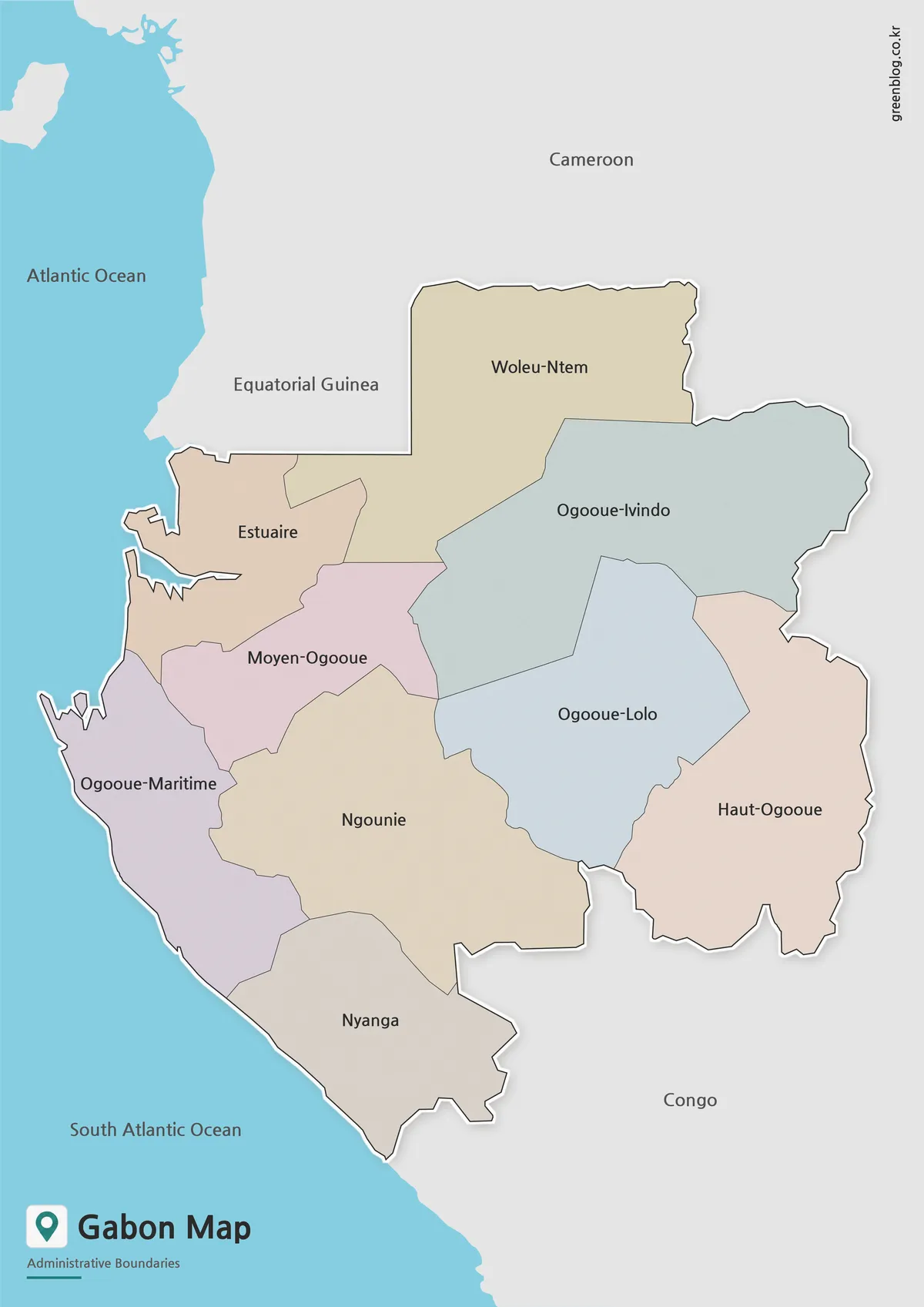
The color Gabon Map separates the administrative regions with soft colors, making it easier to compare areas at a glance. This version is especially useful for web pages, classroom slides, geography introductions, and visual country profiles where readers need to understand the overall layout quickly.
Labels are included in both Korean and English in the original map set, which helps when checking regional names or preparing bilingual materials. The use of color also makes the map easier to scan on screens, especially when it appears alongside text explaining Gabon’s location, neighboring countries, or regional structure.
The color layout was adjusted so that neighboring regions do not blend together too much. This helps the map remain readable when inserted into a blog post, presentation slide, or downloadable study resource.
Black and White Gabon Map for Printing
The black and white Gabon Map removes the color fill while keeping the regional boundaries and labels. This version works well when the map needs to be printed, marked by hand, or inserted into a document with a cleaner visual style.
Teachers can use it for classroom handouts, students can use it for country reports, and bloggers can place it inside articles without strong colors competing with the surrounding layout. Because the background is kept simple, it is also easier to add notes, arrows, or highlighted areas after printing.
The boundary lines were checked so that the map can still be read clearly without color. This is important for worksheets, monochrome printing, and reports where color printing may not be available.
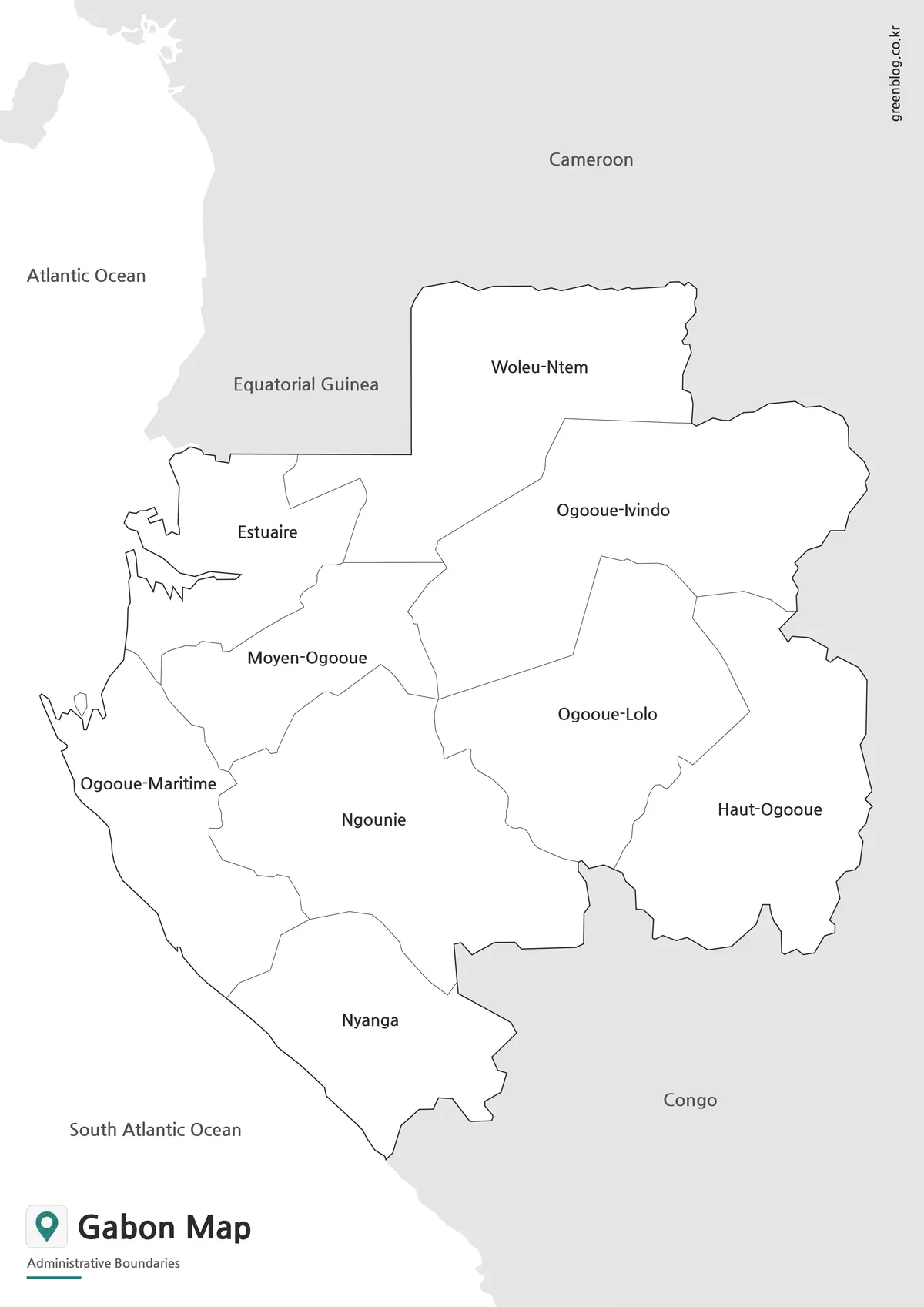
Blank Gabon Outline Map for Editing
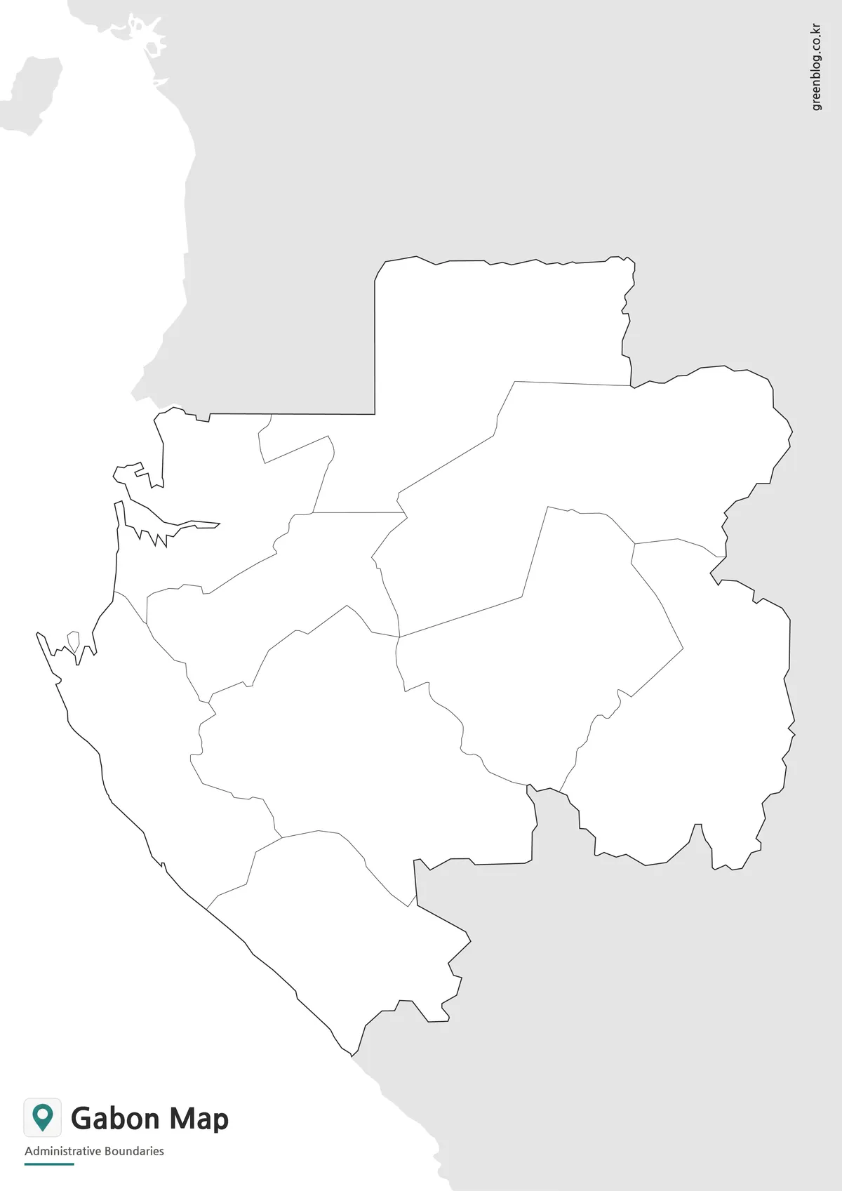
The outline version is designed for users who want to add their own information. It removes both color and text, leaving a clean Gabon Map outline with administrative boundary lines.
This version is useful for infographic creators, presentation designers, and anyone who needs a simple base map for custom work. You can add your own colors, mark important regions, show travel routes, compare neighboring countries, or create a visual explanation of natural resources, forests, ports, or regional data.
A blank map also saves time during editing. Instead of removing existing labels or color blocks from a completed map, users can start with a clean version and build the design around their own purpose.
Practical Uses for This Gabon Map
This Gabon Map set can be used in many visual projects where a simple country map is enough. It works well for classroom geography lessons, printable worksheets, country introduction pages, travel-related graphics, regional comparison materials, and Africa map collections.
For educational use, the labeled map helps students identify Gabon’s regional structure and neighboring countries. For design use, the outline version gives more flexibility because it can be recolored or annotated. For presentation use, the color version is often the easiest to understand at a glance.
The maps can also be paired with the Gabon flag when creating country profile images, card-style graphics, or blog thumbnails. A map explains location, while the flag adds quick national recognition.
Frequently Asked Questions
What is included in this Gabon Map collection?
The collection includes a color map, a black and white labeled map, and a blank outline map. Each version is designed for a different use, from printing to editing.
Can I use the Gabon Map for classroom materials?
Yes. The printable Gabon Map versions are suitable for handouts, geography lessons, student reports, and educational worksheets.
Which version is best for editing?
The blank outline map is the best choice for editing. It has only boundary lines, so you can add colors, labels, routes, or custom information.
Is the black and white version good for printing?
Yes. The black and white Gabon Map was prepared for cleaner printing and works well when color output is not needed.
Gabon Map Download
Download the printable Gabon Map collection with color, black and white, and outline versions for classroom use, presentations, blog graphics, and editable map projects.
- File Format: Image files included in a ZIP archive
- Map Versions: Color map, black and white map, outline map
- Intended Usage: Printing, education, presentations, infographic design, editing
Related Maps
- Central African Republic Map Download | Printable Administrative Map Collection
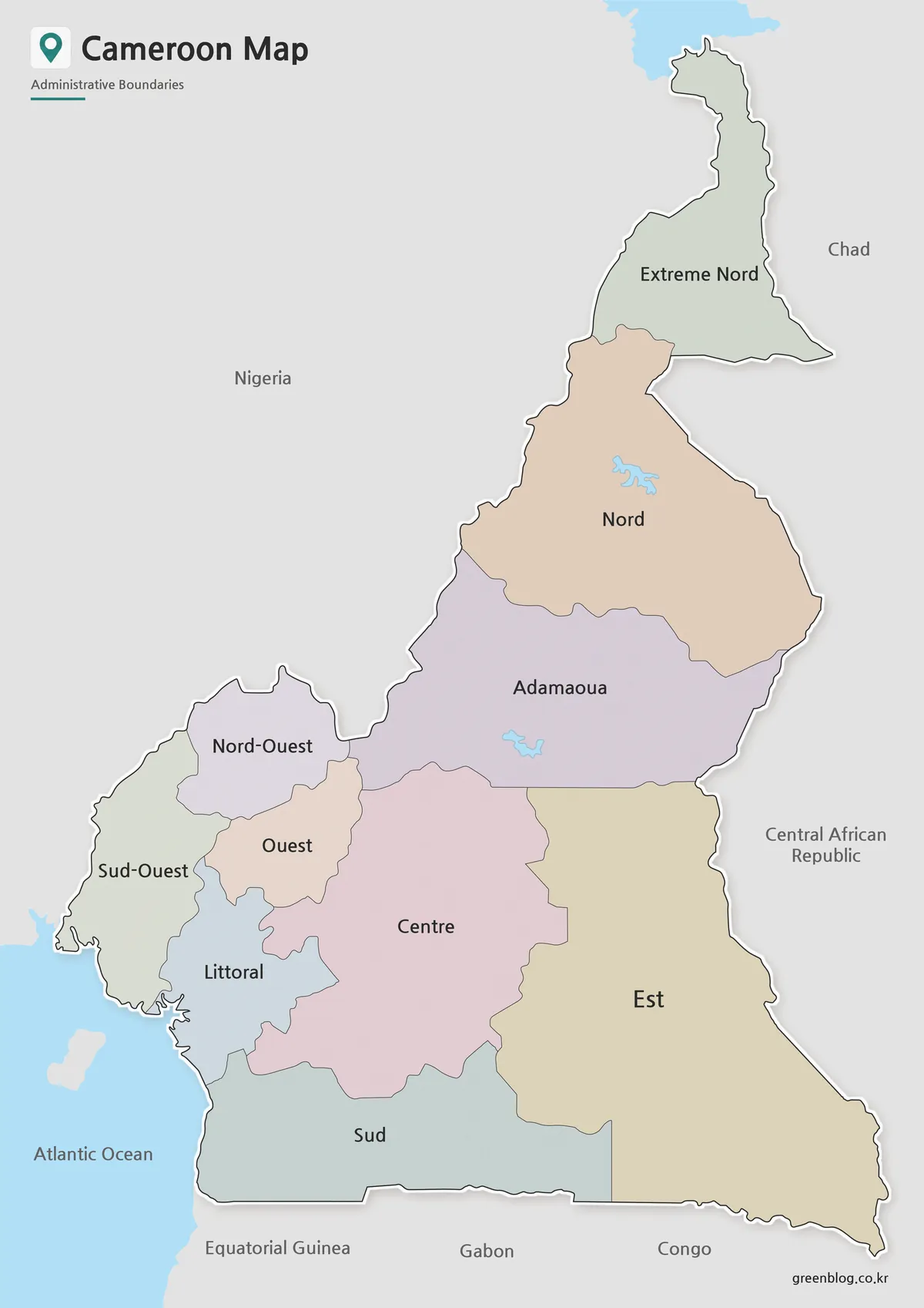
- Cameroon Map Download | Printable Administrative Map Collection
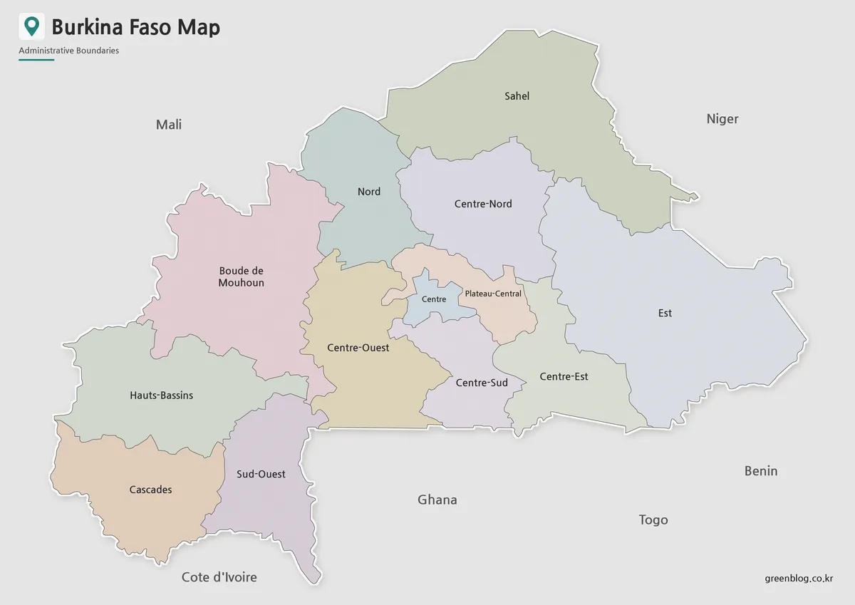
- Printable Burkina Faso Map for Education, Design and Presentations
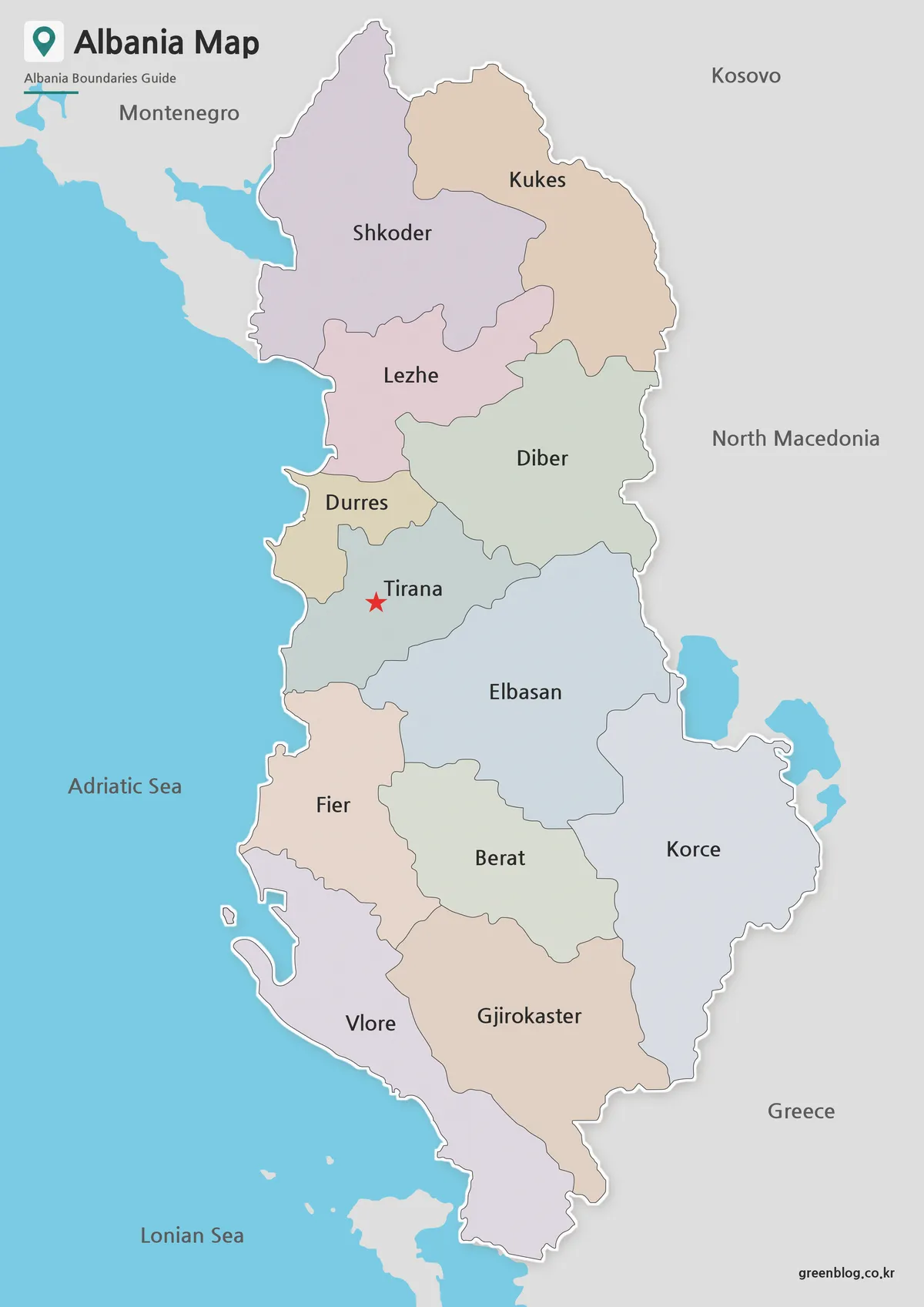
- Free Albania Map Download – Color, Black and White, and Outline Versions
Additional Resources
- UN Geospatial – Gabon Reference Map – Official reference map provided by the United Nations Geospatial program for geographic orientation and administrative boundary reference.