An Arizona State Map is useful for much more than simply locating Phoenix or identifying where Arizona sits within the southwestern United States. Teachers preparing classroom materials, bloggers creating regional content, students working on geography projects, and designers building presentations often need a map that can be printed, edited, or incorporated into visual materials.
Arizona covers a large geographic area and shares borders with Utah, Nevada, California, New Mexico, and Mexico. Because of its size and varied landscape, understanding regional relationships can be difficult without a clear map reference. Major population centers such as Phoenix and Tucson are separated by large stretches of desert, plateau, and mountain terrain, making visual reference especially helpful when explaining the state’s layout.
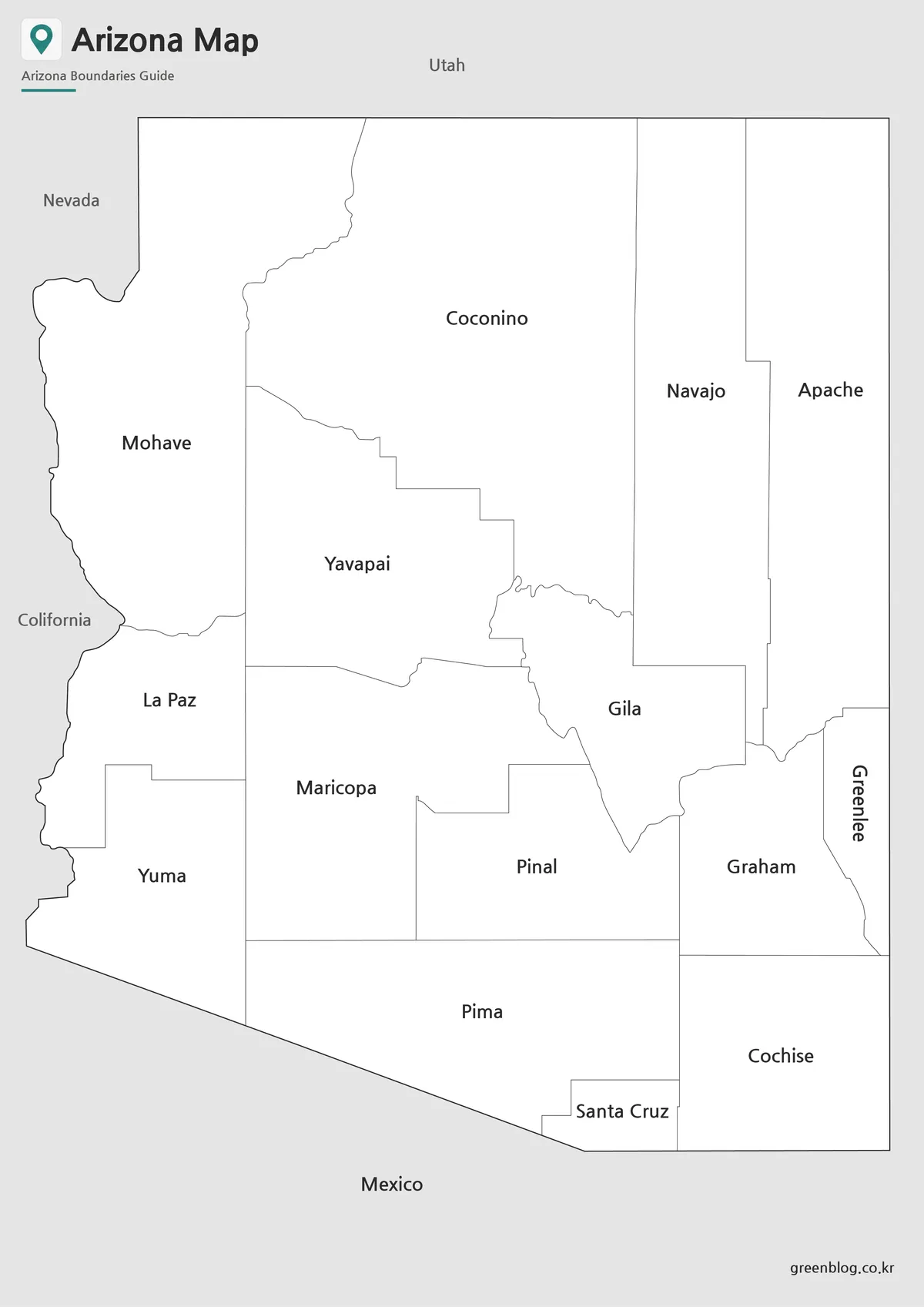
This printable Arizona State Map collection includes three different versions designed for practical use. Users can choose a color county map for presentations, a black and white version for worksheets and printing, or an outline map for graphic editing and custom projects. All versions were prepared in high resolution and organized for both digital viewing and large-format printing.
While preparing the collection, special attention was given to county boundaries, label readability, and print visibility. The layouts were reviewed at larger print sizes to ensure important details remain easy to read in educational handouts, presentation slides, and infographic projects.
Table of Contents
Map Collection Overview
Included in this Arizona map package:
- Color county map
- Black and white labeled map
- Outline county map
- High-resolution image files
- Printable A3 format
- Suitable for editing and presentation use
The collection was created to support educational, visual, and professional projects that require a clean and easy-to-read regional reference.
Regional Color Map
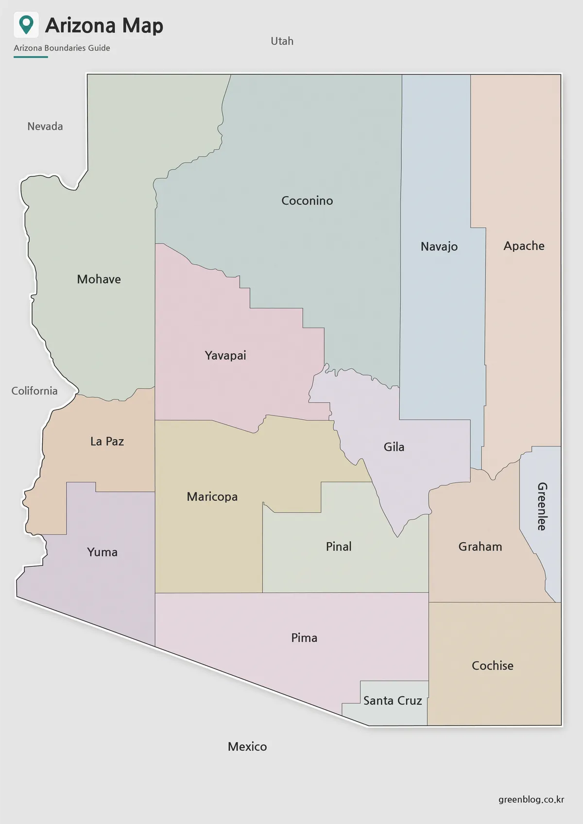
The first version features a color-coded county layout designed to improve visual distinction between neighboring regions.
Large states can become difficult to interpret when all boundaries are displayed using a single color. Different county colors make regional comparisons much easier, especially when discussing population distribution, tourism areas, transportation corridors, or administrative divisions.
The color scheme was adjusted to remain readable when printed while avoiding excessive contrast that can distract from labels and boundary lines.
Best Uses
- Geography lessons
- Classroom presentations
- Tourism reference materials
- Regional comparison graphics
- Blog illustrations
Black and White Printable Version
The black and white version focuses on readability and printing efficiency.
Removing color allows users to write notes directly on the map, highlight selected counties, or create customized study materials. It is also useful when large quantities of printed handouts are required since it reduces ink usage while maintaining clear county boundaries.
During testing, label sizes and line thicknesses were adjusted to remain visible even after printing and photocopying.
Ideal For
- Educational worksheets
- Printed handouts
- Study materials
- Meeting presentations
- Regional planning documents
Arizona State Map Outline Version for Editing
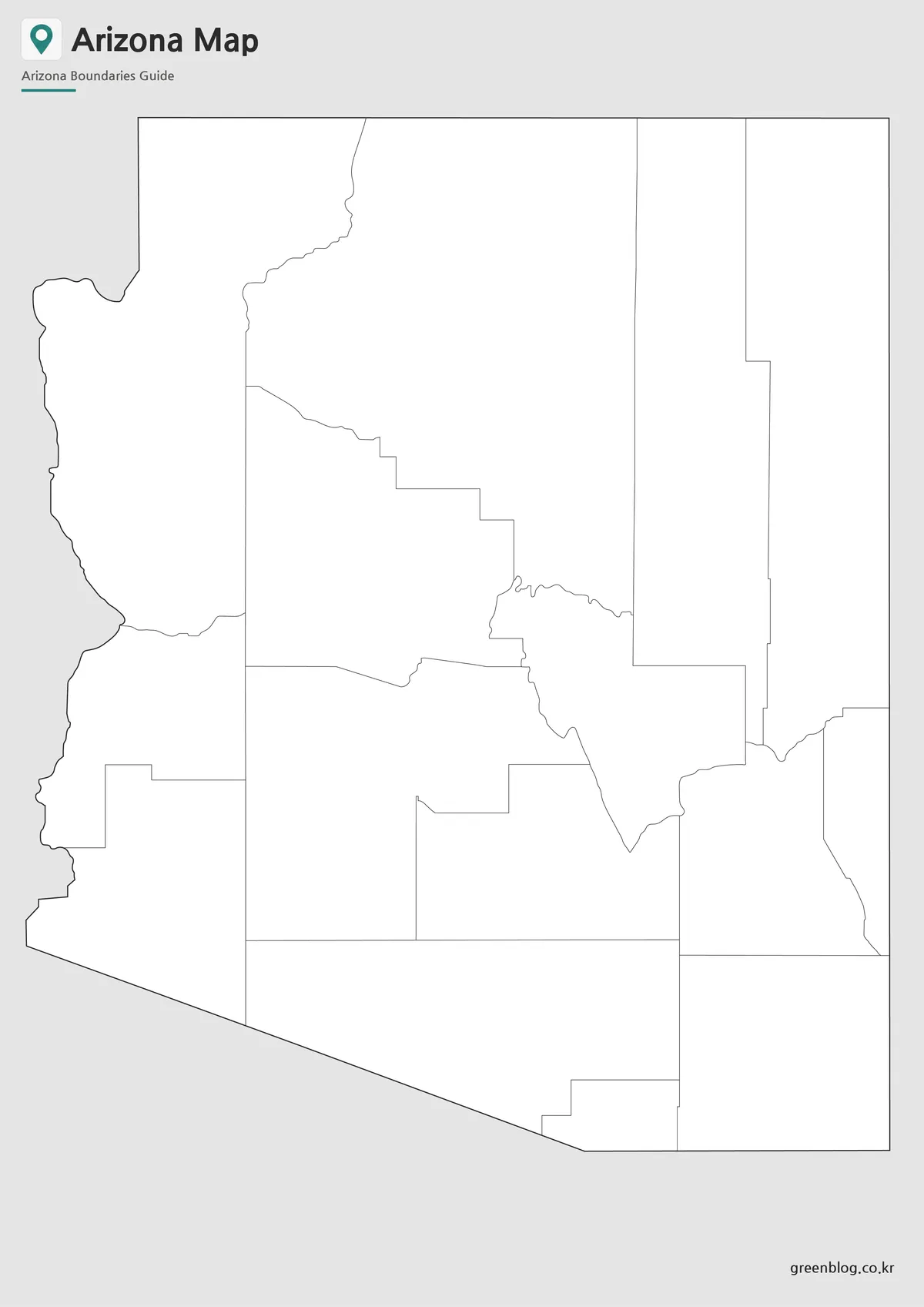
For users working with graphic design software, an outline map is often the most flexible option.
This version removes color and unnecessary visual elements, leaving only county boundaries. The simplified layout works well for infographic creation, data visualization, presentation graphics, and custom labeling projects.
Rather than spending time removing labels and colors manually, designers can begin editing immediately.
Common Uses
- Infographics
- Adobe Illustrator projects
- Photoshop editing
- Custom county highlighting
- Data visualization maps
- Video production graphics
Designed for Printing and Presentation Use
Arizona’s large geographic footprint makes it a frequent choice for educational and regional comparison projects. The map collection works well when explaining relationships between Arizona and neighboring states such as Utah, Nevada, California, and New Mexico.
Because the state contains major urban centers, extensive desert regions, and internationally recognized landmarks such as the Grand Canyon, visual references often provide a clearer understanding than text descriptions alone.
The collection was organized to support:
- Printable study resources
- Classroom instruction
- Travel presentations
- Blog graphics
- Educational posters
- Regional analysis materials
Frequently Asked Questions
Can I print the Arizona State Map in A3 size?
Yes. The files were prepared for high-resolution A3 printing.
Which version is best for classroom use?
The black and white version is usually the easiest for students to annotate and study.
Is the outline version editable?
Yes. The outline map is intended for graphic editing, annotations, and custom design work.
Which version works best for presentations?
The color map provides the clearest visual distinction between counties and regions.
Arizona State Map Download
Choose the map version that best fits your project. Color, black and white, and outline maps are included for printing, education, presentations, and editing.
- File Format: JPG / PNG / ZIP
- Image Size: A3 High Resolution
- Intended Usage: Printing, Education, Presentation, Editing
Files are packaged in a ZIP archive for convenient download and storage.
Additional Resources
- USGS National Map — Official mapping platform providing geographic and administrative reference data for the United States.
Related Maps
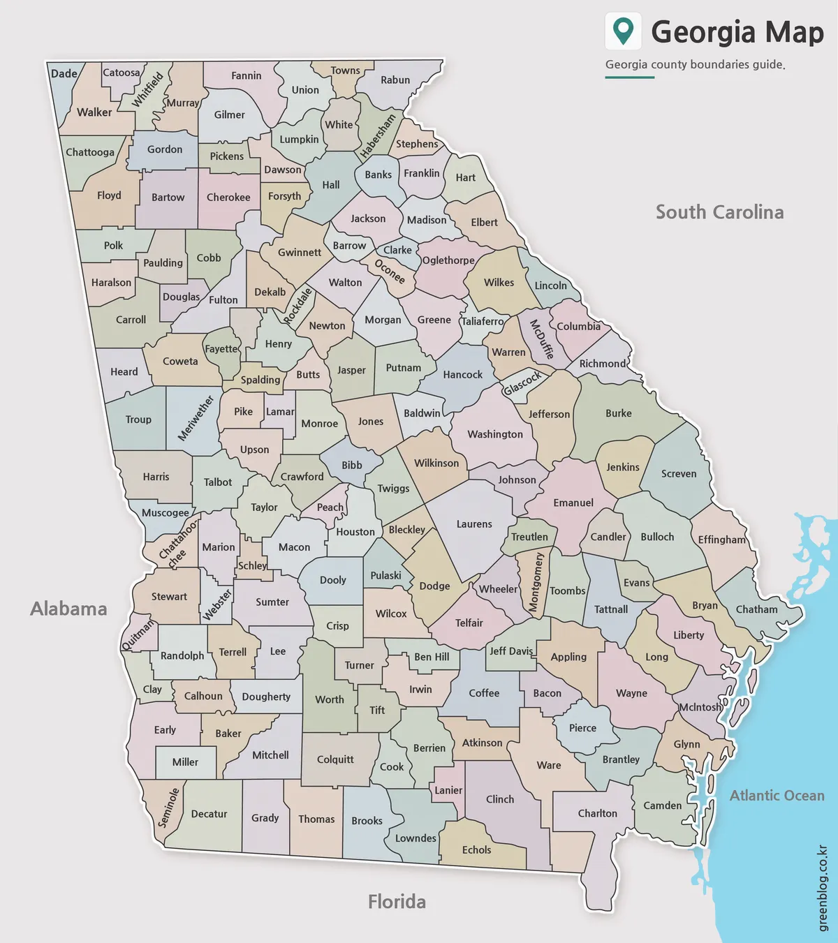
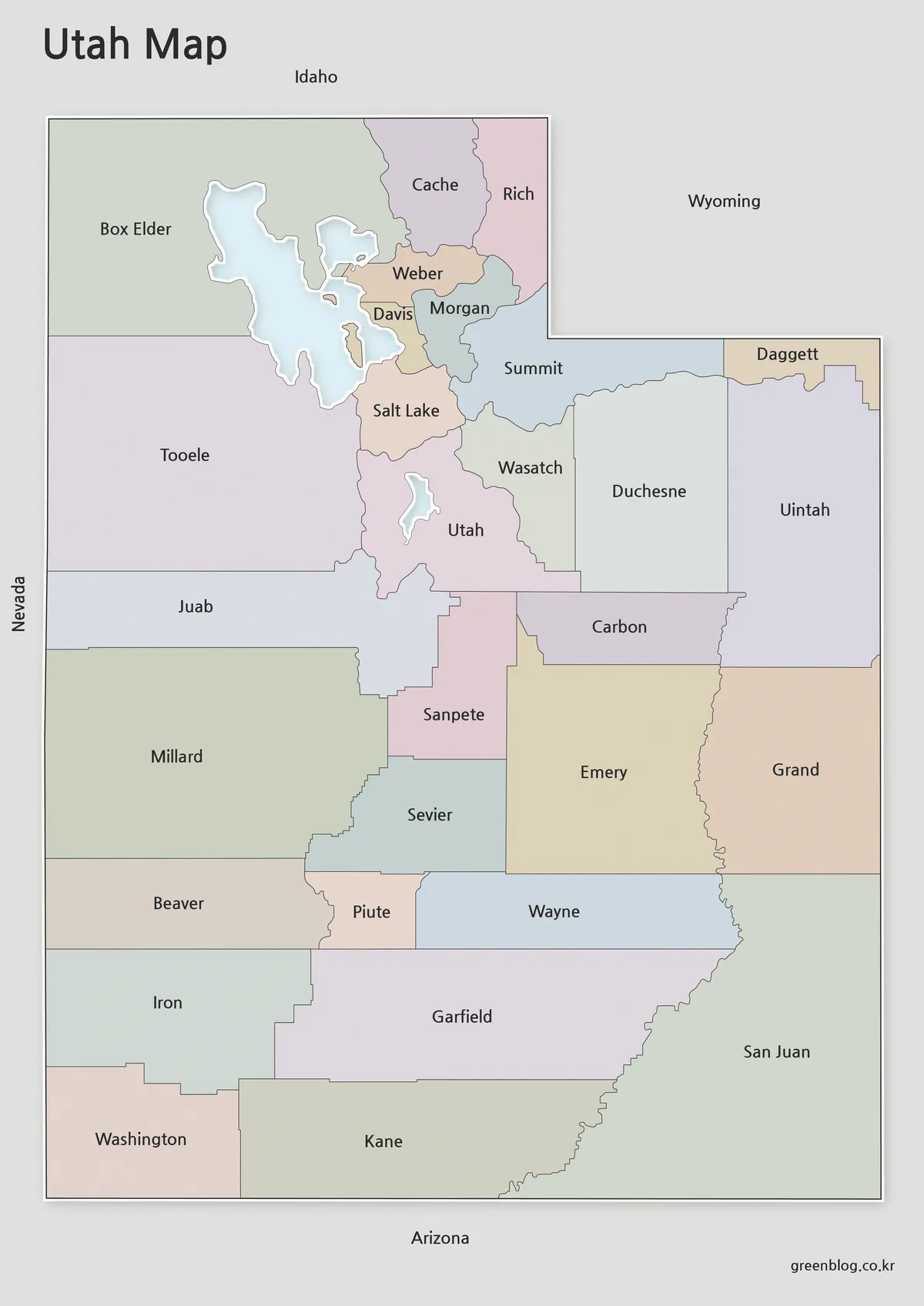
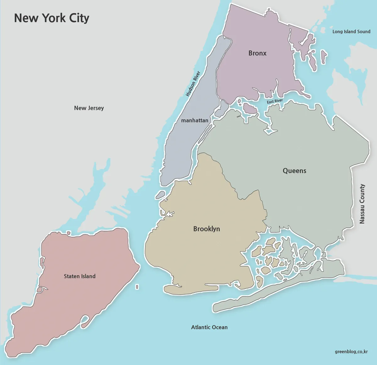
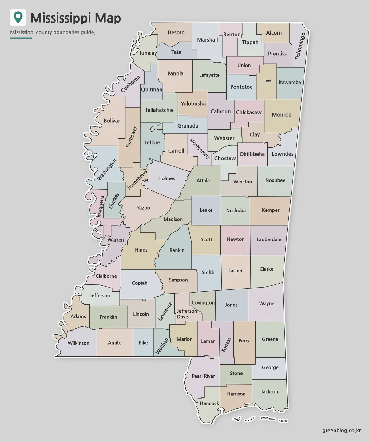
- Virginia Map Collection | Printable County and Independent City Maps
- Maine Map Collection | Printable County Maps in High Resolution
- West Virginia Map Download – Printable County Map Collection
- Massachusetts Map Collection | Printable County Maps in High Resolution